24-26.5.14
Walking with; Ed (assessor) and Ads (other candidate)
I'VE DONE IT !! Eighteen months ago I undertook my Mountain Leader training and realised that I had a lot to learn to take me from being a competent, experienced walker to a true Mountain Leader . The last year and a half have been a real journey in terms of personal and professional development, the refinement of old skills and the learning of new ones and there were times when the attainment of the qualification seemed a long way away. However, over the two May bank holidays I have taken my assessment with Thornbridge Outdoors, and having spent an incredibly sunny three days in the Dark Peak and an incredibly soggy three days in Snowdonia I am now incredibly proud to say I am a BMC accredited Mountain Leader!
The three days in the Peaks saw us undertake micro-navigation on Bleaklow, saw one of our group drop out after day one, saw us undertake a navigation and leadership day on the Snake Pass side of Kinder and a rope work and navigation day above Grindsbrook Clough. The Snowdonian part of the assessment was a 2 night expedition leg which saw us micro navigate by day and night the areas around Cnicht, Llyn Yr Adar and Llyn Edno. We shared legs, navigated on different scaled maps and described the flora and fauna around us. We were given different scenarios to deal with and presented with different situations that we might face in the mountains whilst leading a group.....and, at the end of it all, the wet tent and soaked kit were forgotten when I heard the magic words "You've passed......". So now, onwards and upwards and hopefully this will be a genuinely life changing moment! There are almost no photos as I was far too busy concentrating on where I was, what I was looking at and where I was going!
Come walk with me aims to help you enjoy, and be inspired by, the magnificent British countryside
Total Pageviews
Showing posts with label Bleaklow. Show all posts
Tuesday, May 27, 2014
Monday, April 21, 2014
A week's worth of walks
14-21.4.14
Walking with; Ruthy, Paul and Stephen
In the week that the Peak District National Park was celebrating it's 63rd birthday, it seemed appropriate to stay local and enjoy the beautiful weather in the oldest National Park in the UK and the second most visited in the world (behind Mt Fuji apparently). It was the kind of week where no great expeditions were planned but pleasant walks showing the diversity of the area were undertaken and enjoyed.
The moorland around "The Cat and Fiddle" is an excellent expanse for practicing the art of fine navigation. I traced the route of groughs, located dew ponds and avoided disused mine workings. I skirted quarries, startled Grouse and ended up at Three Shires Head, all whilst basking in the rays of a glorious Spring sun. In the Dark Peak, Lantern Pike was a pleasant jaunt from Hayfield and Bleaklow proved to be a grim and forboding place both by day and by night. Following a navigation challenge undertaken by the Edale Mountain Rescue team led me to be convinced that they could locate a needle in a haystack, I didn't fare badly, but returned the next day to review the area under a somewhat dark and gloomy sky. Mountain Hares were everywhere, their coats changing from Arctic white to a duller brown more associated with the dun coloured moors of the Snake Pass. The Roaches too looked great under sunny skies even if the wind was whipping around the tops. The Bank Holiday weekend had crowds everywhere so I retreated to my urban hideaway to sit it out with little more than a brief jaunt to Marbury Country Park to admire the bluebells and the Great Crested Grebes.
I suspect I may decide to wander further afield this week, but if I don't it's satisfying to appreciate the fact I have so much here on my doorstep!
To view the full album please click on the link below;
https://www.facebook.com/media/set/?set=a.868562373159718.1073741861.597048676977757&type=3&uploaded=26
Walking with; Ruthy, Paul and Stephen
In the week that the Peak District National Park was celebrating it's 63rd birthday, it seemed appropriate to stay local and enjoy the beautiful weather in the oldest National Park in the UK and the second most visited in the world (behind Mt Fuji apparently). It was the kind of week where no great expeditions were planned but pleasant walks showing the diversity of the area were undertaken and enjoyed.
The moorland around "The Cat and Fiddle" is an excellent expanse for practicing the art of fine navigation. I traced the route of groughs, located dew ponds and avoided disused mine workings. I skirted quarries, startled Grouse and ended up at Three Shires Head, all whilst basking in the rays of a glorious Spring sun. In the Dark Peak, Lantern Pike was a pleasant jaunt from Hayfield and Bleaklow proved to be a grim and forboding place both by day and by night. Following a navigation challenge undertaken by the Edale Mountain Rescue team led me to be convinced that they could locate a needle in a haystack, I didn't fare badly, but returned the next day to review the area under a somewhat dark and gloomy sky. Mountain Hares were everywhere, their coats changing from Arctic white to a duller brown more associated with the dun coloured moors of the Snake Pass. The Roaches too looked great under sunny skies even if the wind was whipping around the tops. The Bank Holiday weekend had crowds everywhere so I retreated to my urban hideaway to sit it out with little more than a brief jaunt to Marbury Country Park to admire the bluebells and the Great Crested Grebes.
I suspect I may decide to wander further afield this week, but if I don't it's satisfying to appreciate the fact I have so much here on my doorstep!
To view the full album please click on the link below;
https://www.facebook.com/media/set/?set=a.868562373159718.1073741861.597048676977757&type=3&uploaded=26
Friday, November 29, 2013
Walking on Bleaklow
28.11.13
Walking with; Nobody
Bleaklow can be an intimidating hill, a vast expanse of peat, groughs, bogs and moorland often enveloped in low cloud, it's the kind of place where an overactive imagination could conjure up all manner of ghostly encounters. There are rumoured to be spirits of Roman legionnaires haunting the Pennine Way and the very real wreckage of many planes in the area can give a walk on this Peak District classic a sombre air. There are also, however, Mountain Hares, Grouse, a selection of intriguing stone formations and a sense of wilderness that can be hard to find in Britain's most visited National Park. Navigation can be a challenge especially in bad weather, but this just adds to the sense of remoteness which can be found on this bog trotters paradise!
I set off from Old Glossop along Doctor's Gate, a bridleway that follows the route of an old Roman road (possibly the one taken by the ghostly legionnaires....?) before cutting off above Shelf Benches and following the rough route of Wigan Clough up onto the tops. At this stage visibility was pretty good and as I wandered along the edge towards the Shelf Stones there were great views over the Dark Peak, plenty of Mountain Hares and very little in the way of human company. I made the Trig point and then bog trotted my way, compass in hand, in and out of groughs, across boot sucking patches of moor and into increasingly thick and low cloud until I located the weirdly sculpted formations of the Hern Stones where I stopped for a well deserved Chicken and coleslaw roll! The cloud was very low now and I moved onto the Wain Stones where another figure loomed out of the mist, proving to be a flesh and blood type of walker rather than a ghostly Roman. It was satisfying to gain the flagstones of The Pennine Way which led me along the beautiful Wildboar Grain and around Torside Castle. There is considerable conjecture about this site, for many years it was thought to be a Bronze Age hill fort or Prehistoric earthworks, although more recently the consensus has been towards it being a natural formation. I must confess that to my eye it looked as if it might be man made, but it's a striking feature none-the-less. There are tales of mysterious, ghostly lights dancing on the summit at certain times of the year, but I passed it in the clag with no supernatural experiences.
I left the Way somewhere above Torside Clough and cut in land, heather bashing and startling the odd Grouse. I eventually located the deep grough of Small Clough and handrailed it all the way down to the scatologically named Shittern Clough which was full of stunning Autumnal woodland and dense stands of Rhododendron. Popping back onto Doctor's Gate the path menadered back to Old Glossop and my car. Bleaklow will never be my favourite hill, it is rough and scruffy and not the prettiest, but it has a genuine feeling of wilderness and is certainly not a hill to be underestimated.
To view the full album please click on the link below;
https://www.facebook.com/media/set/?set=a.777797895569500.1073741839.597048676977757&type=1
Walking with; Nobody
Bleaklow can be an intimidating hill, a vast expanse of peat, groughs, bogs and moorland often enveloped in low cloud, it's the kind of place where an overactive imagination could conjure up all manner of ghostly encounters. There are rumoured to be spirits of Roman legionnaires haunting the Pennine Way and the very real wreckage of many planes in the area can give a walk on this Peak District classic a sombre air. There are also, however, Mountain Hares, Grouse, a selection of intriguing stone formations and a sense of wilderness that can be hard to find in Britain's most visited National Park. Navigation can be a challenge especially in bad weather, but this just adds to the sense of remoteness which can be found on this bog trotters paradise!
I set off from Old Glossop along Doctor's Gate, a bridleway that follows the route of an old Roman road (possibly the one taken by the ghostly legionnaires....?) before cutting off above Shelf Benches and following the rough route of Wigan Clough up onto the tops. At this stage visibility was pretty good and as I wandered along the edge towards the Shelf Stones there were great views over the Dark Peak, plenty of Mountain Hares and very little in the way of human company. I made the Trig point and then bog trotted my way, compass in hand, in and out of groughs, across boot sucking patches of moor and into increasingly thick and low cloud until I located the weirdly sculpted formations of the Hern Stones where I stopped for a well deserved Chicken and coleslaw roll! The cloud was very low now and I moved onto the Wain Stones where another figure loomed out of the mist, proving to be a flesh and blood type of walker rather than a ghostly Roman. It was satisfying to gain the flagstones of The Pennine Way which led me along the beautiful Wildboar Grain and around Torside Castle. There is considerable conjecture about this site, for many years it was thought to be a Bronze Age hill fort or Prehistoric earthworks, although more recently the consensus has been towards it being a natural formation. I must confess that to my eye it looked as if it might be man made, but it's a striking feature none-the-less. There are tales of mysterious, ghostly lights dancing on the summit at certain times of the year, but I passed it in the clag with no supernatural experiences.
I left the Way somewhere above Torside Clough and cut in land, heather bashing and startling the odd Grouse. I eventually located the deep grough of Small Clough and handrailed it all the way down to the scatologically named Shittern Clough which was full of stunning Autumnal woodland and dense stands of Rhododendron. Popping back onto Doctor's Gate the path menadered back to Old Glossop and my car. Bleaklow will never be my favourite hill, it is rough and scruffy and not the prettiest, but it has a genuine feeling of wilderness and is certainly not a hill to be underestimated.
To view the full album please click on the link below;
https://www.facebook.com/media/set/?set=a.777797895569500.1073741839.597048676977757&type=1
Labels:
Bleaklow,
bleaklow walk,
Come walk with me,
Dark Peak,
Doctor's Gate,
Hern stones,
Mountain Hares,
Peak District,
peat bogs,
Pennine Way,
Shittern Clough,
Torside castle,
Wain stones,
Wildboar grain
Sunday, September 22, 2013
Come walk with me UK's 100th post!
Wow! 100 posts, who'd have thought I would have got this far :-) Having reached this landmark I thought it might be appropriate to look back on the blog thus far and pick out a few highlights!
Pool between Moel Hebog and Moel Yr Ogof- July 2013
Sprinkling Tarn- August 2013
Langdale Pikes- June 2013
Harter Fell- June 2013
The Cantilever Stone- November 2012
Frosted trees near Fernilee Reservoir- January 2013
Cloud inversion from the Pike O'Stickle- October 2012
Ruthy at Llyn Idwal- August 2012
With Ros and Emily on South Head- February 2013
Parkhouse Hill- February 2013
Al on Y Garn- November 2012
Cream Tea- January 2012
Long-tailed Tit- January 2012
Kinder Downfall- March 2012
Mud- March 2012
Bleaklow- March 2012
On Pendle Hill- May 2012
With Ruthy on Pen-Y-Ghent- June 2012
CWWMUK highlights........Wild camping in Snowdonia in the Moel range, Tryfan, the Pike O' Stickle, Kinder in the snow, the many faces of Wasdale, Blencathra, Helvellyn, Malham Cove, 2 of the 3 Yorkshire Peaks, starting ML training, Bristly Ridge and many, many more.....
Thanks due to Ruthy, Al, Greg, Emily, Ros, the Peak District Rangers, Nathan, Rob and Helen, Rich, the good folks of the Pendle and Peak District walking festivals and all the others who have helped me to enjoy the fantastic walks we have done together, here's to the next 100 and the continuing success of Come walk with me!
Labels:
Bleaklow,
Cantilever Stone,
Come walk with me,
Fernilee,
Harter Fell,
Kinder,
Langdale Pikes,
Llyn Idwal,
Moel Hebog,
Parkhouse Hill,
Pen-y-ghent,
Pendle Hill,
Pike of Stickle,
South Head,
Sprinkling Tarn
Thursday, March 29, 2012
Back of Bleaklow in the sunshine
28.03.12
Walking with; Nobody
A tough but beautiful day climbing up from the Woodhead Pass and with the sun beating down and tremendous views. As soon as I got out of the car and crossed the bridge over the River Etherow I saw a Dipper bobbing up and down on a small rock by the far bank and the wildlife was a constant over the whole walk. This is Grouse shooting country and the moorland in this area has been very much shaped by the demands of the shoot. The path up Far Black Clough is a cracker, it winds it's way up the very narrow clough, dipping in and out of the sunshine and ascending steadily, eventually it becomes a little too narrow and steep and a tiring scramble up the bank to the rough Landrover track used by the shooters is necessary. I followed a narrow path along the clough edge before following a large, sandy grough Eastward onto the path from Howden Edge. I followed this path for about half a mile putting up quite a few Red Grouse and a number of Mountain Hares in various shades of colour from pure white to dirty brown. Visibility was excellent so I could see my goal, Barrow Stones, and struck off across the moors to reach them, negotiating a few deep groughs and peat bogs before arriving at the stones for an early lunch and a bit of shade from the strong sun. I'd not seen another soul and the only sign of human activity thus far had been a helicopter which looked like it was distributing fertiliser or feed over the moors.
Refreshed by a chicken sandwich I headed across to the Grinah stones where I met a landscape photographer who was taking advantage of the fantastic weather and spectacular views over Ridgewalk Moor and over the River Westend. The rocks are eroded into fantastic shapes and the vista was amazing. I spotted a Common Lizard catching a few rays as well before leaving the stones and heading through some waist high heather South East towards Round Hill. In spite of the weather it was still pretty boggy underfoot and at one stage I found myself thigh deep in peat bog, this is not a walk I'd fancy in mid-January! After a while I met a deep landrover track linking the Ronksley Moor bothy with the Grouse butts. I wandered down to a viewpoint over the River Westend before returning along the path and down to the beautifully sighted bothy at the top of Lower Small Clough. It's pretty basic and is, I think, mainly used for shooters, but there is a poem tacked to the wall singing the praises of the shelter provided on a wild, snowy afternoon!
Lower Small Clough runs down across the heather (including a patch very recently burned) and past many well established Grouse butts to a beautiful spot where the clough meets the River Derwent, where I cooled down by sticking my head into the running waters! (Bliss!)
The path along the Derwent is beautiful and the landscape a little more lush than on the tops, but I soon had to leave the river and ascend the steep, brackeny slopes of Hoar Clough to the Shepherds Meeting Stones. Featherbed Moss is a pretty featureless expanse and it took me a while to locate the path that led back to the Howden Edge path, but locate it I eventually did and followed it due West until cutting off back to Far Black Clough where I followed the path all the way back to my car, sweaty, peaty but thoroughly satisfied by a great day.
One of the real highlights of today was the solitude. The number of other walkers I saw today can eb counted on the fingers of one hand, once I'd got away from the A628, there were no roads, houses, pylons etc and the tracks and butts were well hidden. It is remarkable to get a feeling of such wilderness and isolation so close to Manchester, Barnsley and Sheffield, and there is something magnificent about the utter bleakness of the expanses of moorland!
To see the full album for this walk please click on the link below;
Thursday, March 15, 2012
Ashton Clough and the Shelf Stones on Bleaklow
14.03.12
Walking with; Nobody
I fancied something a little more challenging today and a spot of navigation practice, so where better than Bleaklow and the peat bogs atop it? Bleaklow is a classic example of peat covered gritstone moorland riven with Groughs and in poor visibility very hard to find your way around. It has two peaks above 2000 feet and today I was aiming for the Trig Point at Higher Shelf Stones which sits at 2037 feet.
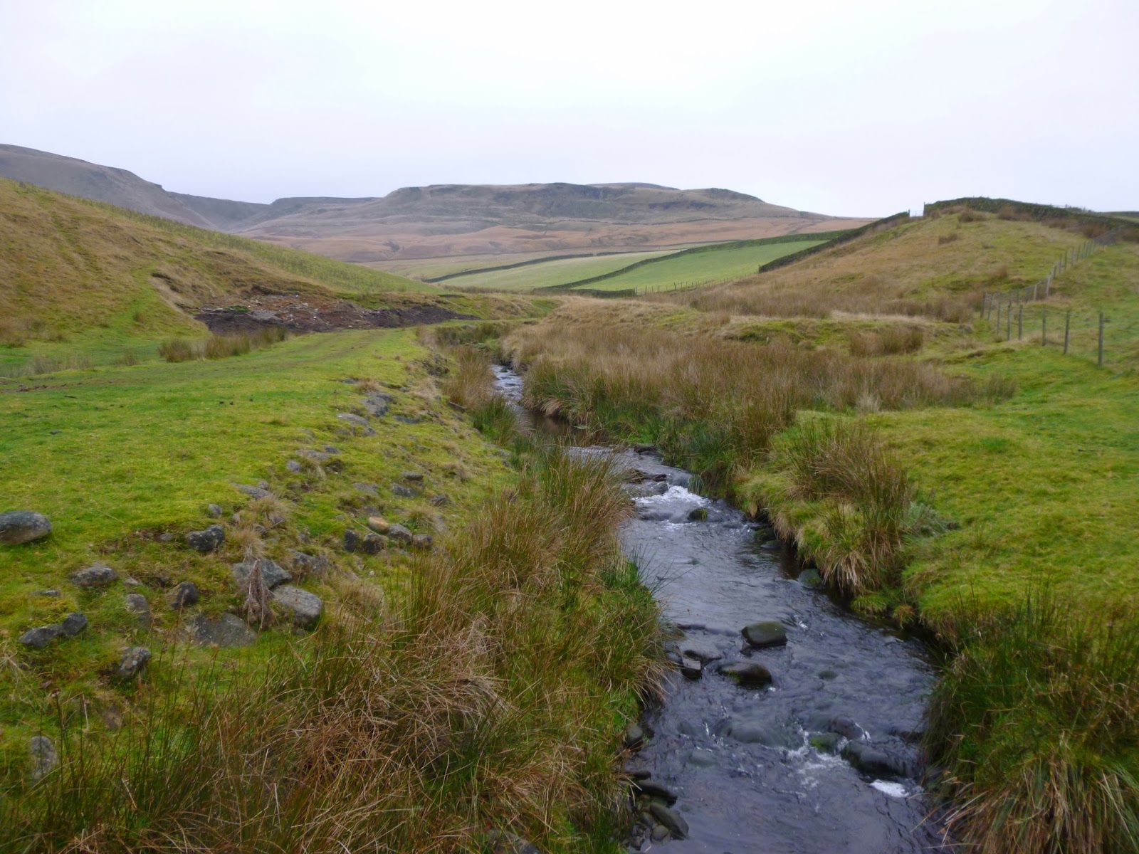
The initial route along Shelf Brook was a pleasant meander along the valley floor with Pheasant and Curlew plentiful and good views towards Bleaklow and James's Thorn. The path is known as Doctor's Gate and is reputed to be a Roman route linking the forts of Ardotalia in Glossop and Navio in the Hope Valley. The track is supposed to be named after Doctor John Talbot who had a family seat in Sheffield and needed to link it to his parish in Glossop, either way it is a pleasant introduction ahead of the tougher work required to ascend Bleaklow. Shortly after the Edwin Ambler memorial footbridge I left the path and followed the Brook along to the foot of Ashton Clough, a perfect spot for a coffee before tackling the climb. One of the great advantages of Open Access Land is how easy it makes it to find yourself some real solitude. Sat down by the water with Grouse scudding by and Curlews calling I felt as if I could have been the only person in the hills......
The climb up Ashton Clough involved a little scrambling and the stream bed made footing a little uncertain from time to time but it was exhilarating stuff and as I climbed the views back down towards the valley were worth the effort. I passed some wreckage from a June 1945 plane crash and when I sent a hail of stones tumbling behind me I disturbed a Mountain Hare, still in his Winter coat which now made him stand out starkly against the non-snowy background. By the time I'd reached the top the clouds had dropped pretty low and visibility was not fantastic so I skirted the edge and headed across to Lower Shelf Stones where I thought I might sit it out with a tuna sarnie and a book until the cloud lifted. It didn't take long and refreshed I headed over to the high point of the walk at Higher Shelf Stones Trig point. This whole area is crisscrossed with deep groughs and peat bogs and has a real rugged beauty to it, it also has the most spectacular plane wreck on the moors. In November 1948 , a Boeing RB-29A American Airforce reconaissance plane with 13 crew members on board crashed in heavy cloud killing all crew members and the wreckage is still strewn across a wide area (for more information on this visit http://www.peakdistrictaircrashes.co.uk/pages/peakdistrict/peakdistrict44-61999.htm). The whole site still has a very eerie air to it which was exacerbated today by cloud blowing across it.
I headed East towards the Pennine Way but decided to take the path running parallel to the edge of the beautiful and spectacular Crooked Clough. Another Hare broke cover up here and I put up numerous Grouse en route as I followed the Clough back down to Doctor's Gate which led me gently back down to Shelf Brook and my starting point on the outskirts of Glossop.
To see the full photo album please click on the link below;
Subscribe to:
Posts (Atom)