Total Pageviews

Showing posts with label YHA. Show all posts

Monday, November 25, 2013

A night walk and a day walk from Borrowdale YHA

23/24.11.13
Walking with; Rob


I only ever seem to visit Borrowdale in the cold. Last year I had one of my best, if snowiest walks, there http://www.comewalkwithmeuk.co.uk/2012/12/borrowdaleand-snow.html and when I arrived this weekend, full of fish and chips from "The Old Keswickian" I could see a dusting of snow across some of the higher tops. I had decided that the time had come to bite the bullet and set out on some night navs on my own, it is hard to finding people who are brave/daft/amenable enough to come out stumbling around the Peaks or the Lakes in the dark, and yet, it is one of the key challenges I will face on my ML assessment, so I gave it a go! I left the hostel and meandered through the Autumnal woodland following the crystal clear waters of the river I'd decided to make my way up to the fells, wait for darkness to fall and then micro-nav my way down from point to point. It seemed a little counter intuitive to be heading out as most people were heading back to the twinkling lights of Borrowdale, but it also seemed adventurous. As darkness fell I took a deep breath and reminded myself that I didn't believe in "ghosties or ghoulies or long legged beasties or things that go bump in the night" and set off using as many different techniques as I could usefully remember.
I'd given myself the fairly unmissable "handrail" of the stream so bumped up and down the slope from point to point, trying to identify ring contours and near invisible re-entrants, seeing the beam of my Petzl reflected in the eyes of the local Herdwicks and, at one stage, seeing another fellow night wanderer somewhere on the slopes of Thorneythwaite Crag! It wasn't the toughest route, but it was a start and as I wandered back along the abandoned lanes to Longthwaite I felt a, probably disproportionate, sense of pride and felt the three pints of "Cumberland" at the hostel bar, better earned than on many previous occasions.
I was joined by Rob the next morning. Once a colleague at Lose Hill YHA, the lucky sod has moved to the Lakes and now lives down in Levens. We set off along the river bank before aiming up and steadily ascending the Honister pass until we reached the slate mines and Honister Hause hostel. Circumventing my "Face of Fatigue" hell http://www.comewalkwithmeuk.co.uk/2012/12/borrowdaleand-snow.html , we headed up the steady ascent along the side of the fell which opened up some spectacular views over Buttermere and Crummock Water. It was chilly on the tops and as we made our way up the slopes of Green Gable I found myself walking in snow for the first time this Winter. The cloud dropped lower and lower and by the time we reached the summit we were restricted to a view of little more than one another! We headed down to Windy Gap and then slipped and scree slithered our way down to Styhead Tarn, one of my favourite spots in the whole Lake District. The path from here was a straightforward descent and then a stroll along the valley floor to Seathwaite and eventually back to Borrowdale. It was great to catch up with Rob again and, as a fell runner, he enjoyed the more sedate pace that I explore the fells at. Looking forward to some more snowy days out in the Lakes in the not too distant future!

To view the full album, please click on the link below;
https://www.facebook.com/media/set/?set=a.775527165796573.1073741838.597048676977757&type=1 

Saturday, August 10, 2013

Honister, Great Langdale and points in between

6-8/8/13
Walking with; Nobody/Nathan 


Not being in possession of either children or gainful employment I'd kind of forgotten how the Summer holidays affect the Lake District. There are hills best avoided under these conditions and yet I'd already planned a roughish selection of wanderings to occupy me over three days and I was loathe to stray too far from my prescribed ideas. Whilst it was considerably busier than usual I was fortunate that a little judicious route selection and some reasonably timed starts minimised the amount of contact I was required to have with the many hundreds thronging the fells!
Day one started at the prohibitively priced NT car park in Seatoller. I'd been a member once and when they tried to strong arm us into renewing the subscription they wanted £92 for a couple, the exorbitant fees are clearly the latest example of strong arming people into membership...Heading off up Thorneythwaite Fell (try saying that after a pint or three of Snecklifter) I was soon being treated to views of Derwentwater and the crags above Comb Gill. I was heading for Glaramara, a previous attempt had had to be aborted due to the depth of snow http://www.comewalkwithmeuk.co.uk/2012/12/borrowdaleand-snow.html, so I was keen to get it under my belt. The final gentle scramble onto the summit proved very rewarding, two hours in to my Lakeland August odyssey and still not a soul to be seen! I was experimenting with a 1:50000 scale OS in order to sharpen my identification of contours but my brain hadn't quite computed the full repercussions so the wander over to Allen Crags took me twice as long as I had convinced myself it would. Arriving at the Crags and with Great End and Esk Hause in clear view I discovered where all the Summer visitors had been, it was akin to Oxford Street in December, people (and dogs) here, there and everywhere! The path most being trodden appeared to be the one towards Scafell Pike but I dropped off it and headed over to Great End for magnificent views and some close inspection by a rescue chopper which circled the summit for some time. Leaving the tops I followed Ruddy Gill down to Seathwaite and then tramped along The Allerdale Ramble back to Seatoller from where I headed up to the YHA at Honister. Whilst it may be that the hostel could do with a lick of paint and a wee bit of TLC, the staff were friendly, the beer cold and the views spectacular all for the price of a good bottle of wine!
The next morning started with the steep haul up Grey Knotts where I snapped a sure fire winner for the "Trail magazine-Face of Fatigue". The top was reached and the vistas opened out in all directions, Borrowdale, Buttermere, Ennerdale, the heart of the Lakes. The walking over Brandreth and upto Green Gable was gentle and I slipped and slid my way down the Aaron Slack for a bite to eat at Styhead Tarn. Last time I'd been here the snow was knee deep and I'd had the place pretty much to myself, but by lunchtime on a Thursday in August there were already two tents pitched and a plethora of walkers milling about. I headed on up and before too long was escaping the bulk of the crowds once more and slowly ascending Esk Pike for more views back towards England's highest peak. I had one more peak in mind for the day, Bowfell, which I duly meandered up before the descent to the Three Tarns and then down the knee crunching The Band to arrive in Great Langdale with the sun shining and the lure of a good pint foremost in my mind. Tent pitched and chilli cooked it was time to head off to "The Old Dungeon Ghyll" and then "The Stickleback" to refresh myself with a couple of pints of Esthwaite Ale and Loweswater Gold!
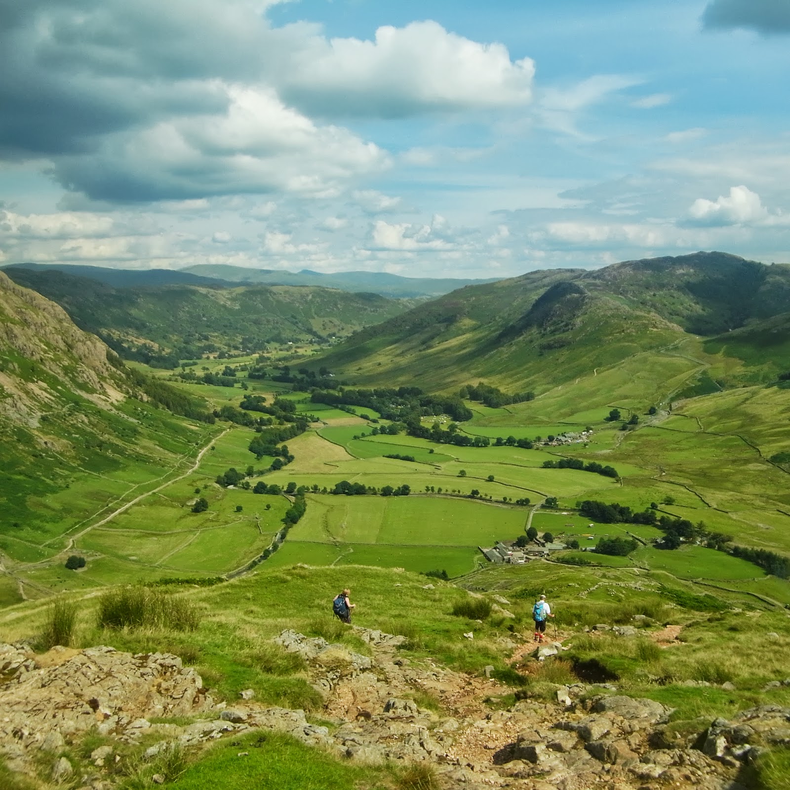
Nathan had come across to join me for the Thursday. We headed off into Mickleden and began the brutal climb up Rossett Pike, this was made slightly less arduous for us by the sight of eight gents hefting their mountain bikes up and over the summit, respect due. We carried on to Angle Tarn and gradually ascended to Esk Hause where perched upon one of the shelter walls I found the Guinness cap that I had inadvertently left there the afternoon before! Honest bunch walkers? Or perhaps the sweat stained soiled and grubby cap hadn't proved enough of a prize for anyone to covet, who knows? We'd decided to do a traverse around Great Gable and stopped opposite Lingmell for a bit of rope work practice, still one of my bete noirs! The traverse was spectacular, crossing the screes with stunning views down Wasdale and we eventually ended up at Beck Head from where we made our way back towards Honister with some truly awesome views back down Ennerdale and towards Buttermere and Crummock Water.
Even in the height of Summer there are still plenty of spots where it's possible to find a little Lakeland solitude and the sunshine and the views made this three of my favourite days out so far this year! All that being said, roll on September and the hills to myself once more!

Monday, June 24, 2013

A Snowdonian overnighter

19/20.6.13
Walking with; Nobody


In my recent desire to get to know the Lake District better I have somewhat neglected Snowdonia but after a cracking two days in North Wales I am anxious to rectify this once more. The hostels in Snowdon were busy but I eventually found a bed at the Pen-Y-Pass YHA http://www.yha.org.uk/hostel/pen-y-pass  and so planned a couple of days around my base.
I arrived in Beddgelert in blazing sunshine (a sentence not often written I suspect) and after a brief refreshment stop headed out along the pretty banks of the River Glaslyn to Gelert's grave. Gelert, a hunting hound, was the pet of Prince Llewelyn, one day the Prince went hunting without Gelert and on his return found his son's crib overturned and the room in disarray, there was blood on Gelert's muzzle and the Prince, jumping to conclusions slew him. As he did this a baby cried and the Prince found his son alive under the crib and a huge Wolf, killed by the faithful hound, lay dead next to him. The Prince was heartbroken and supposedly never smiled again! Leaving the grave I followed "The Fisherman's Path" which became ever rockier as the river became wilder, before emerging on the Aberglaslyn bridge. The path then zigzagged up through woodland before emerging onto boggy moorland near the ruins of the farm at Oerddwr-uchaf. Even in the sunshine the ruins had a slightly "The Hills have eyes" feel to them and I was glad to be past them and tramping through the Cotton grass towards my first target for the day Moel Ddu. I watched a Red Kite playing on the thermals, soaring gracefully up and up before dropping down again, and then repeating the process, and as I started up the painfully steep lower slopes of Moel Ddu my grunts of exertion were accompanied by the familiar "cronk" of a number of the local Ravens.It was a short, very steep slog, but the summit views were possibly some of the finest in Wales. As I sat sandwich in hand, whichever direction I looked it was magnificent. The Moel range loomed large, Snowdon herself sat proud and cloudless in the distance, the Llyn Peninsula stretched out into the sea and Porthmadog sat perched on the estuary offering the promise of fish and chips and ice cream....I'd have killed for an ice cream at this stage. Apart from the occasional "cronk" and the whistle of the steam train from down in the valley, it was blissfully peaceful and still.
Ahead of me I could see Moel Hebog and Banog, two more sharp climbs still lay ahead so, refuelled, I moved on. The climb up Banog was another where frequent "view" stops broke up the gradient and from there it was a last slog up the scree onto the summit of Moel Hebog where I met a squirrel hanging around the cairn on the scrounge and saw the only other walkers I met all day, seven hours close to one of Snowdonia's tourist honeypots and barely a soul to be seen. The path zig zagged back down to the valley where I saw a couple of Wheatears before coming to rest in the Tanronnen Inn for a restorative pint and a perusal of the photos of local history adorning the walls.
Snowdon is not just a mountain, it is a tourist attraction, a destination in it's own right, and my second ascent of it was a very different experience from the day before. I'd been up it once before, in a hurry, in the cloud at the end of a Three Peaks challenge, so this time I wanted to take my time and enjoy it. I left the friendly staff at the hostel behind and they agreed I could save myself a tenner by leaving my car in their layby rather than in the exorbitantly priced car park across the road. I'd previously followed the Miner's Track so this time I set off up the Pyg, a far more scenic path that climbs up to the foot of Crib Goch. It was still sunny at this stage but the forecast was poor so I'd decided to skip the ridge and concentrate on getting to the top in one piece. The paths were all busy but by varying my pace I managed to not get caught up in any traffic jams and the views remained pretty impressive until about ten minutes from the top when the cloud dropped a little further and things became a bit hazy. None-the-less I did have views from the summit, even if they had to be shared with a train load of 50 odd European tourists who timed their arrival to perfectly coincide with mine! Snowdon is not a mountain for peace and solitude! I dropped back down the Miner's enjoying the relatively flat return and almost making it back to Pen-Y-Pass before the rain started!
On the return leg I came across a number of groups of people who were very clearly (to my mind) under prepared and/or inappropriately equipped. I am the first to accept that I sometimes overdo it, but a full pack gives me a feeling of security and a better workout, and if the worst comes to the worst I am confident in my ability to deal with most things a mountain can throw at me. I am sure all regular walkers have come across this on occasions, once on the Half Dome Trail in Yosemite I came across a (for want of a better description) "stoner dude" in cut off denims and no shirt who had attempted the 15 odd mile round trek with a 350ml bottle of water and by the time we found him was suffering from heat stroke......an extreme example but it raises the question, what responsibility do we, as experienced and able hill walkers, have to people we see heading out into potentially perilous situations? My natural reserve makes me inclined to say little, but last month after I'd descended in full waterproof kit from Wetherlam due to the ferocity of the conditions on the top I felt compelled to say to three teenage Americans who were about to try and ascend the Old Man of Coniston in shorts and t-shirt that I didn't think it would be sensible for them to continue.....they ignored me, but at least I felt I done the right thing.....What do other people think?

To view the full album, plase click on the link below;
 https://www.facebook.com/media/set/?set=oa.403018443150400&type=1

Friday, May 17, 2013

Four seasons in one trip

13-15.5.13
Walking with; Nobody


Off to the Lakes again for comprehensive proof that in spite of last week's Bank Holiday sunshine in Wales, Britain seems reluctant to shake off Winter just yet. I spent the morning in Ambleside touring the gear shops in search of a new jacket, I eventually settled on the Montane Superfly which will be getting it's first outing next week as I am somewhat superstitious about throwing a new garment directly into the fray. Lunch done, I decided to drive up to Kirkstone Pass and have a go at Red Screes which I'd seen from the other side on my Fairfield Horseshoe route http://www.comewalkwithmeuk.co.uk/2012/10/the-fairfield-horseshoe.html. The ascent from the Kirkstone Pass Inn took on some of the eponymous screes and there was a fair amount of judicious route picking and minor scrambling all of which made the sudden appearance of the summit very satisfying. Wainwright claims that the cairn atop Red Screes is the largest of the Eastern Fells and it provided a degree of shelter from the wind which had started whipping hailstones across the tops somewhat lessening my enjoyment of the spectacular views back towards Windermere, across to Fairfield and down to Brothers Water. I decided that discretion might well be the better part of valour at this stage and headed (with the wind battering at my back) down the broad ridge of Middle Dodd before slipsliding my way down to Kirkstone Beck and with the hail now turned to a wet sleet I was very happy to see the ancient inn ahead of me as I crested the final slope. The pub is reckoned to date back to the Fifteenth Century and is listed as the third highest inn in England, it's certainly an attractive building and the fire was burning as I supped a restorative pint, very welcome. I spent the night at the Ambleside Backpackers which I can heartily recommend http://www.englishlakesbackpackers.co.uk/ after a few pints at The Gilded Lily!
   I have a few dirty little secrets; I like JLS and Bombay Bad Boy Pot Noodles, but, perhaps the worst of them was, that for someone describing themselves as a passionate hillwalker I had never climbed Helvellyn....well, that has at least been rectified! I decided to take the easy way up and parked at the exorbitantly expensive Wythburn car park next to the beautiful little church that served the community of Wythburn before it was drowned under the waters of Thirlmere. Coleridge and Wordsworth both mention the building and I found it a lovely, poignant spot. I followed the path running parallel to Comb Gill and then skirting below the peak of Nethermost Pike which afforded excellent views of Thirlmere and the Western Fells and then as the path levelled out there was Striding Edge with a couple of brave souls picking their way along it. There was fresh snow on the top and a bitter wind and the cross shaped shelter was well populated, the sky was clear though and the views to Ullswater and beyond were worth every ounce of effort. I followed the edge of the busy summit and headed down past Lower Man and along the ridge to White Side (for lunch) and then onto Raise. It was at this stage the sun came out and ......stayed out. I took off my jacket, smiled for a little while and then meandered onto Stybarrow Dodd for a wee spot of rest looking out of miles and miles of beautifully scenic countryside that yesterday would have been completely invisible! Time was ticking on so I headed down the increasingly sheer and stunningly beautiful Stanah Gill until reaching the path that ran parallel to the lakeside road, flitting in and out of the pine forest (spotting my first Chiffchaff of the year) until I reached the welcome sanctuary of my car! I spent the night at the YHA in Hawkshead http://www.yha.org.uk/hostel/hawkshead catching up with my friend Rob, whom I'd worked with at Castleton last year. He introduced me to the joys of Loweswater Gold at The King's Arms in the picturesque village for which I am very thankful!
   Wednesday morning started grey and very quickly progressed to wet and by the time I was on my way up the Coniston Fells, Wetherlam my quarry for the day, wet and windy. The cloud got lower, the wind got higher and I got wetter.....and wetter....and (you guessed it) wetter......Summiting was satisfying, not pleasurable, so I abandoned plans to carry on to Swirl How, and with the wind doing it's very level best to lift me off my feet, I headed down Low Wether Crag, past Levers Water and back towards the Coppermines and a cup of something hot.
Three days, three different walks, and just about every kind of weather chucked at me......roll on next week!

To view the full album, please click on the link below;

https://www.facebook.com/#!/media/set/?set=oa.384532758332302&type=1

Tuesday, February 19, 2013

A Grasmere overnighter

14/15.2.13
Walking with; Nobody


Last time I stopped in Grasmere was a couple of years ago on my Coast to Coast walk and my impression of the village was of a shrine to Wordsworth that lacked a decent Lakeland pub. I'd stayed in the Thorney How Hostel which at that time was owned by the YHA but is now operating on an independent basis. I stayed on this visit at the Butharlyp Howe hostel (pronounced Butterlip) and have nothing but praise for it, a beautiful building in an excellent location with Goldcrests in the garden. I arrived later than intended after too much wine the night before and fish and chips in Ambleside, so decided on something gentle to stretch the legs and stimulate the mind with thoughts of "lonesome wandering".
Leaving Grasmere I headed out past Dove Cottage (Wordsworth's home from 1799-1808 when he sold it to Thomas de Quincy) and started ascending on the old coffin route across to Rydal and Rydal Mount where Wordsworth lived later in his life. The coffin route is so named as before Rydal and Ambleside had churches of their own, bodies used to be carried (in coffins) to St Oswald's church in Grasmere for burial. As I climbed out of the village I passed one of the coffin stones that was used to  rest coffins on in order to provide the bearers with a break. The path was very slushy underfoot, the dump of snow on Wednesday was already thawing and there was water everywhere, but the views across to Rydal Water were beautiful with the water reflecting Loughrigg Terrace. Passing Rydal Mount I continued through the village and after crossing the River Rothay meandered out onto the slopes of Loughrigg and the impressive caves caused by quarrying on the fell.  The walk along Loughrigg Terrace back towards Redbank Wood was breathtaking with views across Grasmere, Helm Crag and back to Nab Scar. Bags dropped off at the YHA I decided to try "Tweedies" bar and am very glad I did, there's not much better after an afternoon on the fells than a log fire, some locally brewed real ale and a steak and kidney pudding!
Day two, I headed off from the hostel and took the path away from the village and onto the lower slopes of Helm Crag. Whilst I couldn't really see any sign of the lion or the lamb, it's a handsome hill and from the summit there was some fantastic views back to the lakes I'd trawled round the previous day. Wainwright wrote of it, ""The virtues of Helm Crag have not been lauded enough. It gives an exhilarating little climb, a brief essay in real mountaineering, and, in a region where all is beautiful, it makes a notable contribution to the natural charms and attractions of Grasmere" and I'd be hard pressed to disagree. Leaving the summit, I followed the ridge along to Gibson Knott and continued over the Pike of Carr and Calf Crag. It was warm work even with the snow still lying thick on some parts of the path. Reaching the head of Far Easdale I began the descent into the valley stopping for a beautiful sunlit lunch at the foot of one of the many waterfalls where the sun shining through the spray created some beautiful rainbows. Following Far Easdale Gill back towards the village I took the permissive path through the grounds of the Lancrigg where I was lucky enough to come face to face with a beautiful Roe Deer standing in the woodland at the hotel entrance......a perfect end to a very good day of walking.

To view the full album please click on the link below;
https://www.facebook.com/#!/media/set/?set=oa.342759652509613&type=1


Thursday, December 6, 2012

Borrowdale......and snow!

4/5.12.12
Walking with; Nobody


Wainwright is allegedly described Borrowdale as "the loveliest square mile in the Lake District", it is also the wettest in terms of annual rainfall with the hamlet of Seathwaite taking the honours and receiving around 3.15 metres of rain a year! So, I couldn't really be surprised as I pulled into the carpark at Rosthwaite that the cloud was low and the rain starting to fall. I took the path across the fields towards the Youth Hostel where I was staying for the night before following the banks of the fast flowing Derwent towards the ominously named "Jaws of Borrowdale". It got wetter. By the time I started the ascent of Castle Crag,(the smallest Wainwright and the only one under 1000 feet), picking my way through the leafless skeletons of the trees the rain was bouncing off my hood, off the branches and even the Robins were looking for shelter in the Holly. Small it maybe, but Castle Crags is steep and by the time I had made my way through the slate workings and up the wiggles to the War Memorial on the summit I was breathing hard. There was still enough of a view to make the effort worthwhile. Ahead through the cloud lay the village of Grange and Derwentwater and below me Borrowdale lay bisected by the Derwent.
I descended onto a section of the Allerdale Ramble, a 54 mile route running from Seathwaite to the coast at Grune Point and followed it's gentle route until I reached the tumbling waters of Tongue Gill where I headed uphill through the ruins of Rigghead Quarry, atmospherically spooky as the light levels dropped, and onto the plateau of High Scawdell. In front of me Dale Head was blanketed in snow and looked magnificent. High Scawdell was covered in a scruffy layer of light snow which crunched underfoot as I made my way across to the partially frozen Launchy Tarn before the vertiginous descent down Scaleclose Gill back to the Allerdale Ramble which I followed down into Seatoller before retracing my steps back to Rosthwaite and The Scafell Hotel http://www.scafell.co.uk/ where a pint in front of an open fire helped to dry out my gear! Bed for the night was at the Borrowdale Youth Hostel, http://www.yha.org.uk/hostel/borrowdale where I made the most ofanother fire and another pint or two!
   It was minus three when I left the hostel full of porridge and a full English, but the sky was blue and there was not a cloud in sight. Wasdale Head always feels remote, but although Seathwaite has many nearer geographical neighbours it really feels extremely remote and must be a rough place to Winter.The path leads away from the hamlet with Base Brown and Glaramara towering on either side and both tops were well dusted with snow. Crossing Grains Gill at Stockley Bridge which afforded excellent views of Taylorgill Force, the icy path looped round Greenhow Knott before following Styhead Gill up to the eponymous tarn. The snow on Green and Great Gables looked beautiful in the sunshine but until the tarn was reached there wasn't much underfoot and with almost nobody else around and the sun warm if weak, it was a grand spot for a coffee and flapjack! Leaving Styhead I continued on through deepening snow up to Sprinkling Tarn and then onwards to the foot of Allen Crags. I'd considered heading over to Glaramara but the snow was getting ever deeper (I was passed by a couple pushing on further up complete with skis) and so after snapping a few more Scott of the Antarctic style photos of footprints in virgin snow, I dropped back down to the summit of Seathwaite Fell for lunch and to drink in the views.
Snow makes everything seem more adventurous, turns a walk into a trek, makes you feel as if you are pushing the boundaries and makes an amazing landscape, yet more amazing. It envelops the countryside in silence and yesterday there was nowhere else I'd rather have been!


To view the full album please click on the link below;

Wednesday, August 8, 2012

Ennerdale

6/7.8.12
Walking with; Nobody


The Lake District in Summer can be a pretty horrendous place, Bowness can be akin to Blackpool and on my drive up both Ambleside and Keswick were too hectic to even consider stopping. I eventually found a spot of lunch in Cockermouth and can heartily recommend "Main Street Fisheries" for an excellent portion of fish and chips. Ennerdale however remains a relatively tranquil oasis, it's remoteness means it gets considerably less visitors than many of the other lakes and apart from a trickle of Coast to Coasters I had the place to myself for the majority of the walking.
   I arrived on the Monday afternoon and parked my car outside the picturesque YHA http://www.yha.org.uk/hostel/ennerdale which is housed in an old foresters cottage a couple of miles along a dirt track and has it's own hydro-electric power supply, an excellent selection of cakes and scones and no mobile phone, reception, internet or television....all adding to the tranquility. It also has a superb view of Pillar from the breakfast room. On Day one, I contented myself with a gentle stroll along the forestry track taking in the views of Pillar, Crag Fell, Anglers Crag and Ennerdale Water. I watched a couple of Peregrines playing above the forest, snacked on billberries in the woods and listened to the distinctive "cronk" of a Raven. I found a bench to sit on and watched the shadows of the clouds flit across the hills and generally revelled in doing nothing, hearing nothing and seeing nobody........Back to the hostel for a few pints of "Snecklifter" and a good nights sleep ahead of a slightly tougher Tuesday.
  Fuelled by a cooked breakfast I set off on Tuesday morning and was soon climbing out above Ennerdale following the path of Gillflinter Beck onto the slopes of Red Pike. It was wet underfoot and there had been a number of landslides across the path so I ended up scrambling through the scree to reach White Pike before heading across the tops to Red Pike and some spectacular views over Crummock Water and a good twenty miles of visibility in all directions. The ridge stretched out ahead of me and I was soon continuing high above Bleaberry Tarn to the next peak, High Stile, where I sat and looked out over Buttermere and away in the distance to the Derwent Fells. I watched another Raven circling and chatted to a couple of girls backpacking their way over to Scafell Pike. Reluctantly leaving the view behind I struck out East along the well defined ridge to High Crag where I stopped for a sarnie with beautiful views down the valley to Ennerdale Water and watched as the clouds started to swirl around Pillar and minutes later the rain started to fall. Descending the steep flank of  High Crag I was aware, for the first time today, of multi-coloured dots ascending the slopes ahead of me, it was Haystacks, beloved by Wainwright and, if Tuesday is anything to go by, large numbers of others. Wainwright wrote of Haystacks, "for beauty, variety and interesting detail, for sheer fascination and unique individuality, the summit area of Haystacks is supreme. This is in fact the best fell-top of all..", high praise indeed and whilst I might not find myself in total agreement, it is certainly a pretty spot and accessible at only 597 metres. Having made it this far I decided to carry on to Innominate Tarn where Wainwright had his ashes scattered, a site of proper pilgrimage for fans of Lakeland walking. I skirted the tarn and then made my way down a steep sheep track on Haystack's flank to Scarth Gap sandwiched between Seat and Haystacks where I followed the path down to the valley floor and watched a group of walkers working their way up to the Black Sail Hut, sitting remote at the head of the valley. The last four miles were a military yomp along the forestry track back to the YHA. The Ennerdale re-wilding project is working http://www.wildennerdale.co.uk/ and the valley floor reminds me of wild Scotland or even the South island of New Zealand with the Liza running down the middle and the lack of farming until Gillerthwaite is reached. Ennerdale is still home to Red Squirrels and Pine Martens and is a fantastic spot to get away from the hubbub of the Southern Lakes and enjoy some real solitude.

To view the full album, please click on the link below;
https://www.facebook.com/#!/media/set/?set=oa.257203821065197&type=1