Total Pageviews

Showing posts with label scramble. Show all posts

Thursday, November 8, 2012

Tryfan and the Glyders

29.10.12
Walking with; Al


A last warm up walk before heading off on my Mountain Leader Training course and what a cracking day it proved to be. Tryfan is one of those iconic mountains that really look the part, the Matterhornesque summit of the type that kids sketch when asked to draw a mountain. Tryfan is the fifteenth highest mountain in Wales at 915 metres and is topped by the twin rocks of Adam and Eve, neither Al nor I nor any of the other sumiteers whilst we were there attempted the leap between these two biblically named pillars and I tip my hat in salute to those of you brave enough to have done this.
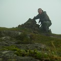
We set off from Llyn Idwal and soon began the climb/scramble up the North face. Whilst there is theoretically a path it wasn't long before we had given up following it and as we picked our way through the rocks and gulleys it was easy to see how in poor visibility it could prove to be tricky. We found the Cannon Stone and posed for an obligatory photo although the rock is now worn smooth and there isn't a lot of grip left, so instead of noble "yonder, the Ogwen valley" shots, mine looks like a drowning man clinging to a life raft! We continued to pick our way through gullies, scree slopes and up the odd body contorting scramble until we reached the top, Adam and Eve and some spectacular 360 degree views to enjoy with a coffee and flapjack!
Looking across to Glyder Fach the unpromising scree slopes threatened an arduous, strength sapping ascent, but as we dropped into Bwlch Tryfan a fellow walker suggested Bristly Ridge as a more interesting route. Wow!! One of the highlights of this busy year in the hills and mountains. Www.ukscrambles.co.uk describes Bristly Ridge as "an absolute classic scramble, the best Grade 1 in Wales without any doubt", and who am I to disagree........It was a truly exhilirating half hour or so, nerve racking, exciting, challenging and fun and I emerged onto the wind blasted summit of Glyder Fach grinning like an overdosed adrenalin addict. The name Glyder is believed to be derived from the Welsh word gludair meaning heap of stones and the exposed summit is strewn with rocks not least the Cantilever Stone (another essential photo stop) and the spectacular formation of Castell Y Gwynt or the Castle of the Winds, both these features were used in the Disney film "Dragonslayer" and certainly the place has a fantastical feel to it. Circumventing the Castle we headed onto Glyder Fawr, our highest peak of the day which our map told us was an agonising 999 metres, however in late 2010 it was resurveyed and is now believed to top out at 1000.8 metres! http://www.bbc.co.uk/news/uk-wales-north-west-wales-11375937. Either way it is the fifth highest peak in Wales and whilst not as pretty as it's sister still affords incredible views across to Angelsey.
Our descent from here was hard on the knees, skidding down the scree towards Llyn Y Cwn and then taking The Devil's Kitchen path down towards Llyn Idwal. By the time we got to the bottom the clouds were scudding across the top of Tryfan and it was fantastic to be able to trace our whole route behind us. Definitely one of the best days our of the year so far!!!!

To view the full album please click on the link below;
https://www.facebook.com/#!/media/set/?set=oa.292351124217133&type=1

Tuesday, September 18, 2012

Wasdale in the Wet

13/14.9.12
Walking with; Nobody


I am developing another worrying addiction. Since quitting cigarettes, I have had a number of these ranging from Pork scratchings to Charlie Sheen's version of "Two and a Half Men", however, my latest, Wasdale, is healthier than any that have gone before it. I love this valley containing the deepest lake in England surrounded by forboding, scree slopes and peaks with the intimidating look of proper hills. It has become my Lake District go to this year, in spite of (or perhaps because of) the difficulty in reaching it by road, and even in horrendous conditions it hasn't let me down. I left Manchester in sunshine and arrived in Wasdale with cloud blanketing the tops and rain coming down, undeterred I donned every item of waterproof clothing I possessed and set off up Yewbarrow. At 628m it is not one of the higher peaks in the area but it sits above the lake and has a satisfyingly mountainous profile. It is reckoned to be named for the Yew trees that once thrived in the area and it's shape which resembles (with a little imagination) the bottom, or barrow, of an upturned boat. I took the route up through the Great Door, an entertaining little scramble traversing plenty of water and involving an amount of effort that made achieving the cloudbound summit very satisfying in spite of the lack of view! It was cold on the top so I hurried on along to Stirrup Crag from where I dropped down towards Over Beck where I squelched my way back along the valley following the path above Bowderdale with nobody but a few bedraggled sheep for company.
The drying room, pint of Snecklifter and library of the Wastwater YHA provided welcome respite from the weather and a warm and comfortable bed for the night.The hostel is a half-timbered house dating from 1829 and owned by the National Trust and the grounds at the front run right down onto the lake with great views of the forbidding scree slopes of Illgill Head.
I set off early next morning in sunshine, but by the time I'd driven the three miles to Wasdale Head it was raining and the wind was so strong that the car was rocking in the carpark, undeterred I headed off past the Inn (famed as one of the birthplaces of contemporary British climbing) and into the beautiful Mosedale. One of the benefits of inclement weather is that it greatly reduces the number of other people you meet in the hills and I had this fantastic dale to myself. Gatherstone Beck was in full spate so I spared myself the crossing and followed it's Eastern bank up to Black Sail Pass where the views down to Ennerdale and lonely Black Sail were impressive and where the wind funnelled through with such force it was all I could do to stay upright. Wet weather and scree do not make for the most comfortable scrambling companions and the ascent of Kirk Fell was (probably) just the wrong side of scary........it certainly got the adrenalin pumping and made the reward of popping up onto the top at the same time as a rainbow appeared behind me doubly satisfying. Kirk Fell is, however, not the most secnic of tops and with nothing to subdue the force of the wind was not a place to stop and I soon found myself nestling down behind some stones at Beck Head Tarn and watching another adventurerer trying not to be blown off the ascent of Great Gable.
 
 
 The power of a good cheese roll to inspire is not to be underestimated and I had Great Gable under my belt in less than an hour. Standing at 899m it is a truly impressive peak and worth the buffeting and battering the wind had given me on the way up. The lure of the Wadale Head Inn was growing ever stronger and I decided on the direct path down via Little Hell Gate and Gavel Neese, sure the contours were closely grouped on the map and the name sounded a little intimidating, but it was the "crow flies" route.......An hour of scree surfing, slipping, sliding and taking lots of deep breaths my feet hit solid ground once more with my thighs screaming and knees protesting and the odd hole or two in the bottom of my waterproof trousers. It is not a route I'll be taking again.....Lingmell Beck led me back to a pint in the pub and a wander round England's smallest church, St Olaf's. The gravestones bear testament to the dangers of the surrounding hills and also house members of famous fell runner and Wadale resident, Joss Naylor's, family. It's a peaceful little spot to contemplate both an ever growing addiction the splendour that surrounds even when you're soaking wet through!

To view the full album, please click on the link below;
https://www.facebook.com/#!/media/set/?set=oa.272379392880973&type=1

Monday, January 16, 2012

Nantlle Ridge


12.1.12
Walking with; Al
A beautiful, wild, windy day out in Snowdonia without another walker in sight. We parked up at the very picturesque Rhyd Ddu railway station, scenically set with Snowdon (hidden by cloud) as a spectacular backdrop.
We set out across very swampy land, before passing Drwyscoed Uchaf farm and starting the lengthy ascent towards the summit of Y Garn. Slippery conditions underfoot made it hard going, but the "view stops" looking back over the valley towards Snowdon provided welcome respite. The summit was blowy, but the vistas opening up with spectacular views towards the coast and Caernarfon Harbour made the initial ascent worthwhile. Looking West from the hilltop, the ridge lay before us, the clouds were scudding across the pass, but the wind kept them moving and we pressed on.
Following an excellent stone wall along the ridge with an exposed edge on one side, the wind hit us hard and with the rocks slippery from the frost and dew, the scramble up to the second peak of Mynydd Drws Y Coed was hair raising, but just the right side of exciting. The cloud was getting lower now in spite of the wind and after a third short ascent we hit the grassy plateau of Trum Y Ddysgl and assessed our onward/downward options. We'd initially planned to descend along the ridge to Bwlch-Y-ddwy-elor, a pass on the ancient route between Rhyd Ddu and Cwm Pennat, but in the distance the obelisk atop Mynydd-Tal-Y-Mignedd just proved too intruiging. The obelisk was reached via a narrow ridge with drop off views on both sides and a short, steep climb, sheltering in it's lee, we had lunch with magnificent views back to the coast and across the Snowdon range.
With frozen fingers and wind bitten cheeks we headed away from the obelisk and descended a very steep sheep path into the Afon Dwyfor valley (Valley of the Big Holy River) where we made our way through the abandoned, and by know quite ruined, copper mine workings before the steep ascent following sheep tracks up the marshy slopes with only circling ravens and the spectacular, sunlit views down the valley as distractions. Finally reaching the Bwlch-Y-ddwy-elor pass we headed down into the dense pine of the Beddgelert Forest where a sole mountain biker proved we were moving back towards civilisation. The path wound through the forest and spat us out back on the A4085 where we followed the railway line back to our parking spot enjoying magnificent views of the Llyn y Gader lake nestled in the shadows of Y Garn.
To view the full photo album please visit the link below