14-21.4.14
Walking with; Ruthy, Paul and Stephen
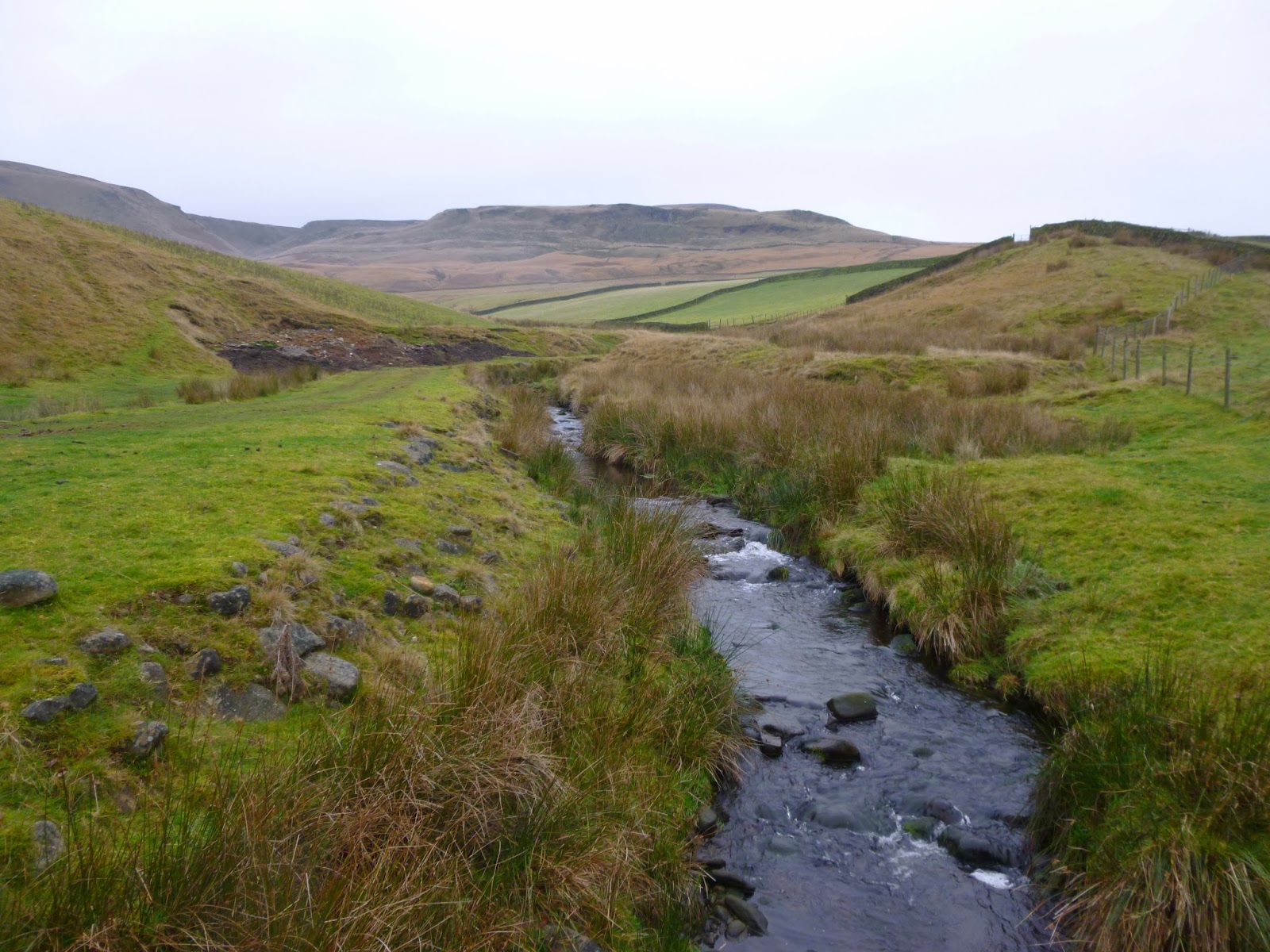
In the week that the Peak District National Park was celebrating it's 63rd birthday, it seemed appropriate to stay local and enjoy the beautiful weather in the oldest National Park in the UK and the second most visited in the world (behind Mt Fuji apparently). It was the kind of week where no great expeditions were planned but pleasant walks showing the diversity of the area were undertaken and enjoyed.
The moorland around "The Cat and Fiddle" is an excellent expanse for practicing the art of fine navigation. I traced the route of groughs, located dew ponds and avoided disused mine workings. I skirted quarries, startled Grouse and ended up at Three Shires Head, all whilst basking in the rays of a glorious Spring sun. In the Dark Peak, Lantern Pike was a pleasant jaunt from Hayfield and Bleaklow proved to be a grim and forboding place both by day and by night. Following a navigation challenge undertaken by the Edale Mountain Rescue team led me to be convinced that they could locate a needle in a haystack, I didn't fare badly, but returned the next day to review the area under a somewhat dark and gloomy sky. Mountain Hares were everywhere, their coats changing from Arctic white to a duller brown more associated with the dun coloured moors of the Snake Pass. The Roaches too looked great under sunny skies even if the wind was whipping around the tops. The Bank Holiday weekend had crowds everywhere so I retreated to my urban hideaway to sit it out with little more than a brief jaunt to Marbury Country Park to admire the bluebells and the Great Crested Grebes.
I suspect I may decide to wander further afield this week, but if I don't it's satisfying to appreciate the fact I have so much here on my doorstep!
To view the full album please click on the link below;
https://www.facebook.com/media/set/?set=a.868562373159718.1073741861.597048676977757&type=3&uploaded=26
Come walk with me aims to help you enjoy, and be inspired by, the magnificent British countryside
Total Pageviews
Showing posts with label Peak District. Show all posts
Monday, April 21, 2014
Thursday, April 17, 2014
Thursday, February 20, 2014
A walk round Wessenden Moor
19.2.14
Walking with; Nobody
Saddleworth Moor and the area around will, unfortunately, be forever connected with the Moors murders. The deeds of Ian Brady and Myra Hindley have cast a dark shadow over this area and the impression lingers that these are wild places where bad things happen and bodies and dark secrets are buried. The moorland in this area does have a dark and sometimes forboding feel to it, but as a place to find solitude and feel far removed from the urban jungle of Greater Manchester it represents an excellent option.
I parked in the layby at the site of what was once "The Isle of Sky Inn", Black Hill lay shrouded in low cloud and the car park at Featherbed Moss had been almost invisible beneath the thick blanket of fog. I set off onto The Pennine Way making my way between enormous bags of Heather Brash which was being helicoptered onto the moors and spread by hand to help prevent the worst excesses of erosion. I carried on down past Wessenden Head reservoir to Wessenden Reservoir and Lodge. The Lodge used to serve "rich repasts" in Victorian times, even in Wainwright's day food was provided, but apparently the last tenant farmer moved out some years ago and the place is now being run as a small scale deer farm. It is certainly a picturesque spot to be situated.
I followed the Pennine Way up Blakely Clough before striking off onto Black Moss and locating an overgrown Grouse butt to lunch in with views of the Butterly Hills and beyond. The helicopters had started ferrying the huge bags of brash out on to Broadhead Moss and the whirring of their rotors accompanied for the remainder of the day. There were plenty of Grouse around as I tramped through the peaty bog making my way up to the tiny pool sitting atop Birk Moss. The cloud had lifted by this point and there were grand views across to the Black Hill and the transmitter mast. I cut down to Shiny Brook in the sunshine thoughts of ghosts and bad deeds far from my mind and followed the line of the stream down to the reservoir where The Pennine Way led me back towards my car. As I reached the gates at the entrance a small sign caught my eye and gave me a sombre reminder of why this area is best known, it provided a website link to a campaign set up to try and ascertain the whereabouts of the body of Keith Bennett who is presumed to still be buried out on the wild moors.
To view the full album please click on the link below; https://www.facebook.com/media/set/?set=a.828687837147172.1073741851.597048676977757&type=1
Walking with; Nobody
Saddleworth Moor and the area around will, unfortunately, be forever connected with the Moors murders. The deeds of Ian Brady and Myra Hindley have cast a dark shadow over this area and the impression lingers that these are wild places where bad things happen and bodies and dark secrets are buried. The moorland in this area does have a dark and sometimes forboding feel to it, but as a place to find solitude and feel far removed from the urban jungle of Greater Manchester it represents an excellent option.
I parked in the layby at the site of what was once "The Isle of Sky Inn", Black Hill lay shrouded in low cloud and the car park at Featherbed Moss had been almost invisible beneath the thick blanket of fog. I set off onto The Pennine Way making my way between enormous bags of Heather Brash which was being helicoptered onto the moors and spread by hand to help prevent the worst excesses of erosion. I carried on down past Wessenden Head reservoir to Wessenden Reservoir and Lodge. The Lodge used to serve "rich repasts" in Victorian times, even in Wainwright's day food was provided, but apparently the last tenant farmer moved out some years ago and the place is now being run as a small scale deer farm. It is certainly a picturesque spot to be situated.
I followed the Pennine Way up Blakely Clough before striking off onto Black Moss and locating an overgrown Grouse butt to lunch in with views of the Butterly Hills and beyond. The helicopters had started ferrying the huge bags of brash out on to Broadhead Moss and the whirring of their rotors accompanied for the remainder of the day. There were plenty of Grouse around as I tramped through the peaty bog making my way up to the tiny pool sitting atop Birk Moss. The cloud had lifted by this point and there were grand views across to the Black Hill and the transmitter mast. I cut down to Shiny Brook in the sunshine thoughts of ghosts and bad deeds far from my mind and followed the line of the stream down to the reservoir where The Pennine Way led me back towards my car. As I reached the gates at the entrance a small sign caught my eye and gave me a sombre reminder of why this area is best known, it provided a website link to a campaign set up to try and ascertain the whereabouts of the body of Keith Bennett who is presumed to still be buried out on the wild moors.
To view the full album please click on the link below; https://www.facebook.com/media/set/?set=a.828687837147172.1073741851.597048676977757&type=1
Monday, February 3, 2014
Peak Mountaineering
Just a short note to say that I can wholeheartedly recommend Paul Lewis of Peak Mountaineering for anyone looking to improve their mountain skills. As I continue to edge towards my ML assessment I'd decided that a day out with an assessor would be a valuable way of measuring my progress. I booked a day with Paul and despite everything the weather could throw at us I came away with loads of valuable information, some new skills and strategies and an increased belief in my own ability. Onwards and upwards now, but the least I can do is offer a wholehearted endorsement!
Monday, January 6, 2014
Last walk of 2013
30/12/13
Walking with; Ruthy
Ever since I abandoned my South coast roots and left the chalk cliffs and churning muddy waters of the English Channel for the rain, peat bogs and dark Satanic mills of the North West, Kinder has been my "go to" hill. It can be approached by such a variety of routes that even though it is never quiet on Kinder it can often feel as if you are the only person on the top, especially if there is some weather coming in. Whilst I think my favourite approach is via Grindsbrook on a Sunny day, the day before New Year's Eve saw me re-introducing Ruthy to the joys of walking into horizontal rain as we meandered our way up from Hayfield! Nothing like a gale driving the rain directly into your face to blow away the Christmas cobwebs and make you appreciate the extra few pounds of turkey and brandy butter reinforcing the insulation around my middle.
We left the car at Bowden Bridge and ignoring the warnings of some "fair weather" walkers were soon sidestepping sheep, passing the seemingly abandoned but maintained magnificence of "The Ashes" and climbing towards the cloud from Coldwell Clough. The views over Mount Famine and South Head soon disappeared and it wasn't long before Kinder too had sunk beneath the clouds.....and then the rain started. We made the Edale Cross which is reckoned to be a 12th century carving erected by the Cistercian monks at Basingwerk Abbey and graffitied by local farmers who rediscovered it buried in a peat bog in 1810! The alcove it is set in provided us with a little shelter and it was here we decided that going over the tops was not a particularly appealing option. We decided instead to angle over towards South Head and from there head down to Dimpus Clough and South Head Farm.
We followed the flagstones across the boggy moorland suffering a battering from the ferocious wind and with the rain being whipped into our faces but as we neared the bulk of South Head the wind seemed to push the front past us and by the time we reached the footpath leading down to Dimpus Clough there were even the odd glimpses of blue sky! The path to South Head farm had been roundly trashed by cows and rain and we slipped, slithered and skidded our way back towards Coldwell Clough and from there onto Bowden Bridge and home to a well deserved brandy coffee.
To view the full album please click on the link below;
https://www.facebook.com/media/set/?set=a.801685729847383.1073741844.597048676977757&type=1
Walking with; Ruthy
Ever since I abandoned my South coast roots and left the chalk cliffs and churning muddy waters of the English Channel for the rain, peat bogs and dark Satanic mills of the North West, Kinder has been my "go to" hill. It can be approached by such a variety of routes that even though it is never quiet on Kinder it can often feel as if you are the only person on the top, especially if there is some weather coming in. Whilst I think my favourite approach is via Grindsbrook on a Sunny day, the day before New Year's Eve saw me re-introducing Ruthy to the joys of walking into horizontal rain as we meandered our way up from Hayfield! Nothing like a gale driving the rain directly into your face to blow away the Christmas cobwebs and make you appreciate the extra few pounds of turkey and brandy butter reinforcing the insulation around my middle.
We left the car at Bowden Bridge and ignoring the warnings of some "fair weather" walkers were soon sidestepping sheep, passing the seemingly abandoned but maintained magnificence of "The Ashes" and climbing towards the cloud from Coldwell Clough. The views over Mount Famine and South Head soon disappeared and it wasn't long before Kinder too had sunk beneath the clouds.....and then the rain started. We made the Edale Cross which is reckoned to be a 12th century carving erected by the Cistercian monks at Basingwerk Abbey and graffitied by local farmers who rediscovered it buried in a peat bog in 1810! The alcove it is set in provided us with a little shelter and it was here we decided that going over the tops was not a particularly appealing option. We decided instead to angle over towards South Head and from there head down to Dimpus Clough and South Head Farm.
We followed the flagstones across the boggy moorland suffering a battering from the ferocious wind and with the rain being whipped into our faces but as we neared the bulk of South Head the wind seemed to push the front past us and by the time we reached the footpath leading down to Dimpus Clough there were even the odd glimpses of blue sky! The path to South Head farm had been roundly trashed by cows and rain and we slipped, slithered and skidded our way back towards Coldwell Clough and from there onto Bowden Bridge and home to a well deserved brandy coffee.
To view the full album please click on the link below;
https://www.facebook.com/media/set/?set=a.801685729847383.1073741844.597048676977757&type=1
Friday, November 29, 2013
Walking on Bleaklow
28.11.13
Walking with; Nobody
Bleaklow can be an intimidating hill, a vast expanse of peat, groughs, bogs and moorland often enveloped in low cloud, it's the kind of place where an overactive imagination could conjure up all manner of ghostly encounters. There are rumoured to be spirits of Roman legionnaires haunting the Pennine Way and the very real wreckage of many planes in the area can give a walk on this Peak District classic a sombre air. There are also, however, Mountain Hares, Grouse, a selection of intriguing stone formations and a sense of wilderness that can be hard to find in Britain's most visited National Park. Navigation can be a challenge especially in bad weather, but this just adds to the sense of remoteness which can be found on this bog trotters paradise!
I set off from Old Glossop along Doctor's Gate, a bridleway that follows the route of an old Roman road (possibly the one taken by the ghostly legionnaires....?) before cutting off above Shelf Benches and following the rough route of Wigan Clough up onto the tops. At this stage visibility was pretty good and as I wandered along the edge towards the Shelf Stones there were great views over the Dark Peak, plenty of Mountain Hares and very little in the way of human company. I made the Trig point and then bog trotted my way, compass in hand, in and out of groughs, across boot sucking patches of moor and into increasingly thick and low cloud until I located the weirdly sculpted formations of the Hern Stones where I stopped for a well deserved Chicken and coleslaw roll! The cloud was very low now and I moved onto the Wain Stones where another figure loomed out of the mist, proving to be a flesh and blood type of walker rather than a ghostly Roman. It was satisfying to gain the flagstones of The Pennine Way which led me along the beautiful Wildboar Grain and around Torside Castle. There is considerable conjecture about this site, for many years it was thought to be a Bronze Age hill fort or Prehistoric earthworks, although more recently the consensus has been towards it being a natural formation. I must confess that to my eye it looked as if it might be man made, but it's a striking feature none-the-less. There are tales of mysterious, ghostly lights dancing on the summit at certain times of the year, but I passed it in the clag with no supernatural experiences.
I left the Way somewhere above Torside Clough and cut in land, heather bashing and startling the odd Grouse. I eventually located the deep grough of Small Clough and handrailed it all the way down to the scatologically named Shittern Clough which was full of stunning Autumnal woodland and dense stands of Rhododendron. Popping back onto Doctor's Gate the path menadered back to Old Glossop and my car. Bleaklow will never be my favourite hill, it is rough and scruffy and not the prettiest, but it has a genuine feeling of wilderness and is certainly not a hill to be underestimated.
To view the full album please click on the link below;
https://www.facebook.com/media/set/?set=a.777797895569500.1073741839.597048676977757&type=1
Walking with; Nobody
Bleaklow can be an intimidating hill, a vast expanse of peat, groughs, bogs and moorland often enveloped in low cloud, it's the kind of place where an overactive imagination could conjure up all manner of ghostly encounters. There are rumoured to be spirits of Roman legionnaires haunting the Pennine Way and the very real wreckage of many planes in the area can give a walk on this Peak District classic a sombre air. There are also, however, Mountain Hares, Grouse, a selection of intriguing stone formations and a sense of wilderness that can be hard to find in Britain's most visited National Park. Navigation can be a challenge especially in bad weather, but this just adds to the sense of remoteness which can be found on this bog trotters paradise!
I set off from Old Glossop along Doctor's Gate, a bridleway that follows the route of an old Roman road (possibly the one taken by the ghostly legionnaires....?) before cutting off above Shelf Benches and following the rough route of Wigan Clough up onto the tops. At this stage visibility was pretty good and as I wandered along the edge towards the Shelf Stones there were great views over the Dark Peak, plenty of Mountain Hares and very little in the way of human company. I made the Trig point and then bog trotted my way, compass in hand, in and out of groughs, across boot sucking patches of moor and into increasingly thick and low cloud until I located the weirdly sculpted formations of the Hern Stones where I stopped for a well deserved Chicken and coleslaw roll! The cloud was very low now and I moved onto the Wain Stones where another figure loomed out of the mist, proving to be a flesh and blood type of walker rather than a ghostly Roman. It was satisfying to gain the flagstones of The Pennine Way which led me along the beautiful Wildboar Grain and around Torside Castle. There is considerable conjecture about this site, for many years it was thought to be a Bronze Age hill fort or Prehistoric earthworks, although more recently the consensus has been towards it being a natural formation. I must confess that to my eye it looked as if it might be man made, but it's a striking feature none-the-less. There are tales of mysterious, ghostly lights dancing on the summit at certain times of the year, but I passed it in the clag with no supernatural experiences.
I left the Way somewhere above Torside Clough and cut in land, heather bashing and startling the odd Grouse. I eventually located the deep grough of Small Clough and handrailed it all the way down to the scatologically named Shittern Clough which was full of stunning Autumnal woodland and dense stands of Rhododendron. Popping back onto Doctor's Gate the path menadered back to Old Glossop and my car. Bleaklow will never be my favourite hill, it is rough and scruffy and not the prettiest, but it has a genuine feeling of wilderness and is certainly not a hill to be underestimated.
To view the full album please click on the link below;
https://www.facebook.com/media/set/?set=a.777797895569500.1073741839.597048676977757&type=1
Labels:
Bleaklow,
bleaklow walk,
Come walk with me,
Dark Peak,
Doctor's Gate,
Hern stones,
Mountain Hares,
Peak District,
peat bogs,
Pennine Way,
Shittern Clough,
Torside castle,
Wain stones,
Wildboar grain
Sunday, October 20, 2013
The Snake Path, Hayfield and Win Hill, Hope
10 and 16.10.13
Walking with; Nobody
Well after the highs and lows and mizzle and drizzle of Galloway I decided a couple of gentler routes with some more micro-nav thrown in was just what the Doctor ordered. The Snake Path runs out of Hayfield and was created in 1897 by the newly formed Peak and Northern Footpath Society, it leads away from the village and climbs up to the grouse shooting moorland of Middle Moor where the bright white shooting hut is an easily identifiable landmark. There were great views across to the Kinder Plateau but I decided to head in the opposite direction circumnavigating the low, bulky hillock of The Knott. The Grouse that had survived thus far were out in force and whilst the wind had teeth it was pleasant to be out and about.
I cut up Hollingworth Clough, a pretty path that involved much crossing and recrossing of the stream and a not inconsiderable amount of Bracken bashing. As the Clough opens out numerous tributaries stream down the hillsides and I picked one and followed it up onto The Knott where the wind buffeted me about as I admired Kinder once more and the views down to Hayfield and beyond. I followed the line of newly spruced up, and obviously recently used, Grouse buttes back down to the shooting hut before retracing my steps down into Hayfield. It was not by any stretch of the imagination a great adventure, but my day was infinitely better for having stirred my bones and headed out onto the moors. It also raised the thorny question of how I feel about Grouse shooting. I am a dedicated carnivore, I happily eat game and have tried all manner of exotic varieties over the years and yet I still feel somewhat uncomfortable about the whole process. I acknowledge that our moorland often looks the way it does because of the shoots and that they provide employment for local people and have close associations with tradition, and yet........it still doesn't sit quite right with me.
A week later and I was climbing slowly out of Hope, into the fog and onto Win Hill which remains one of my all time favourite peaks in the Peaks! The weather was pretty grim and the valley floor disappeared beneath me as I watched a Kestrel soaring on the currents, no need to hover today. I followed the ridgeline from Win Hill along the route of the old Roman Road to the Hope Cross, and then onwards to Blackley Clough. Another spot of bracken bashing took me out onto yet another Grouse moor, buttes, feeding stations and what I took to be numbered "beating" stations littered the top of Crookstone Out Moor. I'd planned to carry on up to Madwoman's Stones but by now the cloud had dropped even lower, the wind was blowing and the rain teeming down. Defeated, I trudged back towards Hope eventually dropping out of the cloud as I descended. A welcome cup of coffee at The Old Hall Hotel revived my flagging spirits but it definitely felt very Autumnal!
To view the full album please click on the link below;
https://www.facebook.com/photo.php?fbid=750280728321217&set=a.750279658321324.1073741836.597048676977757&type=3&theater
Walking with; Nobody
Well after the highs and lows and mizzle and drizzle of Galloway I decided a couple of gentler routes with some more micro-nav thrown in was just what the Doctor ordered. The Snake Path runs out of Hayfield and was created in 1897 by the newly formed Peak and Northern Footpath Society, it leads away from the village and climbs up to the grouse shooting moorland of Middle Moor where the bright white shooting hut is an easily identifiable landmark. There were great views across to the Kinder Plateau but I decided to head in the opposite direction circumnavigating the low, bulky hillock of The Knott. The Grouse that had survived thus far were out in force and whilst the wind had teeth it was pleasant to be out and about.
I cut up Hollingworth Clough, a pretty path that involved much crossing and recrossing of the stream and a not inconsiderable amount of Bracken bashing. As the Clough opens out numerous tributaries stream down the hillsides and I picked one and followed it up onto The Knott where the wind buffeted me about as I admired Kinder once more and the views down to Hayfield and beyond. I followed the line of newly spruced up, and obviously recently used, Grouse buttes back down to the shooting hut before retracing my steps down into Hayfield. It was not by any stretch of the imagination a great adventure, but my day was infinitely better for having stirred my bones and headed out onto the moors. It also raised the thorny question of how I feel about Grouse shooting. I am a dedicated carnivore, I happily eat game and have tried all manner of exotic varieties over the years and yet I still feel somewhat uncomfortable about the whole process. I acknowledge that our moorland often looks the way it does because of the shoots and that they provide employment for local people and have close associations with tradition, and yet........it still doesn't sit quite right with me.
A week later and I was climbing slowly out of Hope, into the fog and onto Win Hill which remains one of my all time favourite peaks in the Peaks! The weather was pretty grim and the valley floor disappeared beneath me as I watched a Kestrel soaring on the currents, no need to hover today. I followed the ridgeline from Win Hill along the route of the old Roman Road to the Hope Cross, and then onwards to Blackley Clough. Another spot of bracken bashing took me out onto yet another Grouse moor, buttes, feeding stations and what I took to be numbered "beating" stations littered the top of Crookstone Out Moor. I'd planned to carry on up to Madwoman's Stones but by now the cloud had dropped even lower, the wind was blowing and the rain teeming down. Defeated, I trudged back towards Hope eventually dropping out of the cloud as I descended. A welcome cup of coffee at The Old Hall Hotel revived my flagging spirits but it definitely felt very Autumnal!
To view the full album please click on the link below;
https://www.facebook.com/photo.php?fbid=750280728321217&set=a.750279658321324.1073741836.597048676977757&type=3&theater
Wednesday, August 28, 2013
Hill Skills On Kinder
22.8.13
Walking with; Nobody
Another chance to get out onto the Peak District's finest hill to work on my rope and navigation skills. Kinder is undoubtedly my favourite hill in the area, dramatic, historic and accessible and I decided to access it on this occasion from the lay by at the foot of Chapel Gate. This particular track has been the scene of much controversy over the past 18 months with banning orders for trail bikes and 4x4 and then orders being rescinded. However, early on a Thursday morning it was pretty tranquil and as I struck off towards Brown Knoll, with only a couple of other walkers in sight! The walk to Brown Knoll afforded great views to the Edale valley and the Great Ridge and in the distance were the various rock formations running along the flank of Kinder, Noe's Stool, Pym's Chair and the Crowden Towers.
On reaching the Swine's Back I found a few likely looking crags and spent a productive hour abseiling myself and lowering and retrieving my rucksack up and down the slope, rope work has definitely improved over the last couple of months. Nathan and Manchester Climbing Centre have undoubtedly aided in this, but my poor long suffering wife, Ruthy, has been a willing volunteer to be belayed up and down the stairs in our flat! After a bite of lunch I left Swine's Back and navigated my way through the groughs and peat hags towards the actual peak of Kinder Scout, marked on the map at 636m and a fair distance away from the trig point on Kinder Low. I came up slightly to one side but decided that the cairn to my left was likely to be the spot. Resting at the cairn I watched a couple of Curlew and then, even better, a Golden Plover. I picked my way back to Pym's Chair pausing to eat a couple of bilberries before heading back to Edale Rocks and from there following the path that led me to South Head.
South Head looked tempting, the short, very steep haul up to the summit was an option, but I was in a rush at this stage, needing to pick Ruthy up from Stockport station and time had ticked on. I followed the Bridleway back to my car, being passed only by one mountain biker and finishing in the sunshine feeling pleased to have had a great day further refining my skills! It's a slow process, but my accuracy and ability are definitely improving and my confidence is following with it!
Walking with; Nobody
Another chance to get out onto the Peak District's finest hill to work on my rope and navigation skills. Kinder is undoubtedly my favourite hill in the area, dramatic, historic and accessible and I decided to access it on this occasion from the lay by at the foot of Chapel Gate. This particular track has been the scene of much controversy over the past 18 months with banning orders for trail bikes and 4x4 and then orders being rescinded. However, early on a Thursday morning it was pretty tranquil and as I struck off towards Brown Knoll, with only a couple of other walkers in sight! The walk to Brown Knoll afforded great views to the Edale valley and the Great Ridge and in the distance were the various rock formations running along the flank of Kinder, Noe's Stool, Pym's Chair and the Crowden Towers.
On reaching the Swine's Back I found a few likely looking crags and spent a productive hour abseiling myself and lowering and retrieving my rucksack up and down the slope, rope work has definitely improved over the last couple of months. Nathan and Manchester Climbing Centre have undoubtedly aided in this, but my poor long suffering wife, Ruthy, has been a willing volunteer to be belayed up and down the stairs in our flat! After a bite of lunch I left Swine's Back and navigated my way through the groughs and peat hags towards the actual peak of Kinder Scout, marked on the map at 636m and a fair distance away from the trig point on Kinder Low. I came up slightly to one side but decided that the cairn to my left was likely to be the spot. Resting at the cairn I watched a couple of Curlew and then, even better, a Golden Plover. I picked my way back to Pym's Chair pausing to eat a couple of bilberries before heading back to Edale Rocks and from there following the path that led me to South Head.
South Head looked tempting, the short, very steep haul up to the summit was an option, but I was in a rush at this stage, needing to pick Ruthy up from Stockport station and time had ticked on. I followed the Bridleway back to my car, being passed only by one mountain biker and finishing in the sunshine feeling pleased to have had a great day further refining my skills! It's a slow process, but my accuracy and ability are definitely improving and my confidence is following with it!
Thursday, July 25, 2013
The Peak Forest canal and navigation lessons near Strines
24/25.7.13
Walking with (and being taught by); Neil
Two very varied days, one a very gentle meander from Disley to Furness Vale along the Peak Forest canal followed by a fascinating and informative day of navigation training with Neil from Peak Mountaineering on the moors above Strines.
I left the attractive centre of Disley and was soon picking my way through the thick undergrowth swamping an obviously little used right of way leading to the Golf course. I was surprised to find Heather coming into bloom and Bilberries fruiting already and grabbed a quick snack before making my way across the manicured fairways and then via another very overgrown path skirting Stanley Hall woods to the canal. There were Jays on patrol and Jackdaws in the fields and the sun even started to put in the odd appearance.
The canal was fully opened in 1800 and was mainly used to transport lime from the Bugsworth Basin, nowadays it is the domain of narrow boats and families of ducks with adorable fluffy ducklings in tow! I passed fishing herons, narrowboaters drinking cups of tea and touching up their paintwork, fishermen and at New Mills, the Swizzels sweet factory. This is not a walk of wilderness and solitude but it is pleasant and undemanding and the kind of walk where just putting one foot in front of the other with no real agenda seems to be a commendable end in itself. Tempted as I was by the Furness Vale chippy I stayed strong and climbed out onto the ridge above the valley and followed the path through hay meadows with views to New Mills before a gentle descent took me back into the desirable fringes of Disley village. This was a walk containing no challenges, little navigation and no discernible elements of danger or excitement and it was all the better for it!
Thursday was a very different experience. In order to improve my chances of eventually passing my Mountain Leader training I was aware I needed to further develop my navigation skills and pick up hints and tips from those already amongst the hallowed ranks, Neil from Peak Mountaineering is such a hilltop God! We spent a fascinating and enlightening day on the hills above Ladybower taking in the delights of Strines Moor, Derwent Edge, Dovestone Tor, the Gusset, Back Tor and Broggig Moss. I searched for boulders hidden amidst the heather, located Springs, identified re-entrants, startled Grouse and Curlews and finally, perhaps, began to understand how contours on the land are accurately depicted on a map. I learned about slope aspect, resections, collecting features and relocating myself when we got (deliberately) lost. The difference between reading a book and then trying out exercises and having a real, live expert to consult and learn from is inestimable and I can say without a shadow of a doubt that the experience was of real benefit and my confidence has grown. Now I just have to get back out on the hill and put it in to practice without having somebody to hold my hand!! No photos from Day 2, too busy concentrating!
Walking with (and being taught by); Neil
Two very varied days, one a very gentle meander from Disley to Furness Vale along the Peak Forest canal followed by a fascinating and informative day of navigation training with Neil from Peak Mountaineering on the moors above Strines.
I left the attractive centre of Disley and was soon picking my way through the thick undergrowth swamping an obviously little used right of way leading to the Golf course. I was surprised to find Heather coming into bloom and Bilberries fruiting already and grabbed a quick snack before making my way across the manicured fairways and then via another very overgrown path skirting Stanley Hall woods to the canal. There were Jays on patrol and Jackdaws in the fields and the sun even started to put in the odd appearance.
The canal was fully opened in 1800 and was mainly used to transport lime from the Bugsworth Basin, nowadays it is the domain of narrow boats and families of ducks with adorable fluffy ducklings in tow! I passed fishing herons, narrowboaters drinking cups of tea and touching up their paintwork, fishermen and at New Mills, the Swizzels sweet factory. This is not a walk of wilderness and solitude but it is pleasant and undemanding and the kind of walk where just putting one foot in front of the other with no real agenda seems to be a commendable end in itself. Tempted as I was by the Furness Vale chippy I stayed strong and climbed out onto the ridge above the valley and followed the path through hay meadows with views to New Mills before a gentle descent took me back into the desirable fringes of Disley village. This was a walk containing no challenges, little navigation and no discernible elements of danger or excitement and it was all the better for it!
Thursday was a very different experience. In order to improve my chances of eventually passing my Mountain Leader training I was aware I needed to further develop my navigation skills and pick up hints and tips from those already amongst the hallowed ranks, Neil from Peak Mountaineering is such a hilltop God! We spent a fascinating and enlightening day on the hills above Ladybower taking in the delights of Strines Moor, Derwent Edge, Dovestone Tor, the Gusset, Back Tor and Broggig Moss. I searched for boulders hidden amidst the heather, located Springs, identified re-entrants, startled Grouse and Curlews and finally, perhaps, began to understand how contours on the land are accurately depicted on a map. I learned about slope aspect, resections, collecting features and relocating myself when we got (deliberately) lost. The difference between reading a book and then trying out exercises and having a real, live expert to consult and learn from is inestimable and I can say without a shadow of a doubt that the experience was of real benefit and my confidence has grown. Now I just have to get back out on the hill and put it in to practice without having somebody to hold my hand!! No photos from Day 2, too busy concentrating!
Labels:
Broggig Moor,
Come walk with me,
Dark Peak,
Derwent Edge,
Disley,
Dovestone Tor,
Furness Vale,
grouse,
navigation,
New Mills,
Peak District,
Peak Forest canal,
Peak Mountaineering,
Strines
Wednesday, May 29, 2013
Another weekly wander or two..........
21/23.5.13
Walking with; Nobody
I love having the Peak District on my doorstep, it means when time is short or inclination is in lowish supply I can still get out and experience some of the finest countryside Britain has to offer without it really feeling like an effort....and so it was last week, two very different Peak District rambles, neither more than half an hour from home.
Tuesday morning, feeling a bit flat, I decided a gentle amble might lift the mood and headed to the undemanding territory of the Middlewood Way. A previous walk on this multi-use track, which follows the route of an old rail line from Marple to Macclesfield, had proved fruitful in terms of the profusion and variety of wild flowers http://www.comewalkwithmeuk.co.uk/2012/06/stroll-on-middlewood-way.html and this one was equally rewarding. Bluebells were starting to decorate the fringes of the path, as well as Forget-me-nots, Cow Parsley and Cranesbill. Bumble bees were dancing around the flowers and Orange Tip and Peacock butterflies were making the most of the patches of dappled sunlight cutting through the canopy. After twenty minutes or so I left the path and ascended to the Macclesfield Canal. I have a longing for the life of a narrow boat man and every time I see the immaculate barges, wood smoke curling from the chimneys and kettle on the hob I'm filled with an overwhelming urge to travel.....Dreaming, I pressed on deeper into the Cheshire countryside, there were male Pheasants in the fields, resplendent amongst the sheep and cows and a Kestrel hovered over head as I continued on to Lyme Park where I had lunch and watched a flock of Jackdaws tormenting one another. The Bluebells were out in force in Elmerhurst Wood and on emerging from the trees I regained the Ladybrook Valley Interest Trail before pottering back to my car refreshed in mind, body and spirit!
A couple of days later and I decided I was in the mood for some map work and a few more demanding miles. I parked at the Arnfield reservoir, on the outskirts of Tintwistle, and headed out across the Grouse moors towards Tintwistle Knarr. There were plenty of Grouse about, not to mention Curlews, and later on I saw a Peregrine, but very few people and progress was pretty quick up on to the edges above the chain of Longdendale reservoirs. As I left the edge the clouds which had been sitting on Bleaklow dropped and the short cross moor path to Lad's Leap was done in poor visibility. After a restorative cuppa I followed Hollins Clough North before making the Trig Point on Rakes Moss and continuing on to Chew Reservoir which I had only previously reached from Dove Stones http://www.comewalkwithmeuk.co.uk/2012/08/black-hill-via-holme-clough.html. Leaving the reservoir to the Canada Geese I followed the cliff top path above Chew Brook before striking off across Ormes Moor and eventually (after a few relocations) managed to make my way to the top of Ogden Clough. At this stage the sun came out!! Buoyed by the novelty factor I decided to lunch at Higher Swineshaw reservoir and after half an hour with the sun on my face ended up contouring round Lees Hill before enjoying more Bluebells in the Hollingworth Nature Reserve and eventually making it back to my starting point at Arnfield.
These two walks were very different in terms of scope, landscape and effort required, but I feel very lucky to have them both on my doorstep!
To view the full album, please click on the link below;
https://www.facebook.com/media/set/?set=oa.390206104431634&type=1
Walking with; Nobody
I love having the Peak District on my doorstep, it means when time is short or inclination is in lowish supply I can still get out and experience some of the finest countryside Britain has to offer without it really feeling like an effort....and so it was last week, two very different Peak District rambles, neither more than half an hour from home.
Tuesday morning, feeling a bit flat, I decided a gentle amble might lift the mood and headed to the undemanding territory of the Middlewood Way. A previous walk on this multi-use track, which follows the route of an old rail line from Marple to Macclesfield, had proved fruitful in terms of the profusion and variety of wild flowers http://www.comewalkwithmeuk.co.uk/2012/06/stroll-on-middlewood-way.html and this one was equally rewarding. Bluebells were starting to decorate the fringes of the path, as well as Forget-me-nots, Cow Parsley and Cranesbill. Bumble bees were dancing around the flowers and Orange Tip and Peacock butterflies were making the most of the patches of dappled sunlight cutting through the canopy. After twenty minutes or so I left the path and ascended to the Macclesfield Canal. I have a longing for the life of a narrow boat man and every time I see the immaculate barges, wood smoke curling from the chimneys and kettle on the hob I'm filled with an overwhelming urge to travel.....Dreaming, I pressed on deeper into the Cheshire countryside, there were male Pheasants in the fields, resplendent amongst the sheep and cows and a Kestrel hovered over head as I continued on to Lyme Park where I had lunch and watched a flock of Jackdaws tormenting one another. The Bluebells were out in force in Elmerhurst Wood and on emerging from the trees I regained the Ladybrook Valley Interest Trail before pottering back to my car refreshed in mind, body and spirit!
A couple of days later and I decided I was in the mood for some map work and a few more demanding miles. I parked at the Arnfield reservoir, on the outskirts of Tintwistle, and headed out across the Grouse moors towards Tintwistle Knarr. There were plenty of Grouse about, not to mention Curlews, and later on I saw a Peregrine, but very few people and progress was pretty quick up on to the edges above the chain of Longdendale reservoirs. As I left the edge the clouds which had been sitting on Bleaklow dropped and the short cross moor path to Lad's Leap was done in poor visibility. After a restorative cuppa I followed Hollins Clough North before making the Trig Point on Rakes Moss and continuing on to Chew Reservoir which I had only previously reached from Dove Stones http://www.comewalkwithmeuk.co.uk/2012/08/black-hill-via-holme-clough.html. Leaving the reservoir to the Canada Geese I followed the cliff top path above Chew Brook before striking off across Ormes Moor and eventually (after a few relocations) managed to make my way to the top of Ogden Clough. At this stage the sun came out!! Buoyed by the novelty factor I decided to lunch at Higher Swineshaw reservoir and after half an hour with the sun on my face ended up contouring round Lees Hill before enjoying more Bluebells in the Hollingworth Nature Reserve and eventually making it back to my starting point at Arnfield.
These two walks were very different in terms of scope, landscape and effort required, but I feel very lucky to have them both on my doorstep!
To view the full album, please click on the link below;
https://www.facebook.com/media/set/?set=oa.390206104431634&type=1
Wednesday, April 24, 2013
Kinder in Spring
23.4.13
Walking with; Nobody
After the trials and tribulations of a windswept Lake District last week it felt good to be back on familiar ground and to, maybe, just maybe, see Spring finally beginning to stir. Kinder is my "go to" hill, close enough to have a long day out and sleep in my own bed, and yet, wild enough to feel like a proper adventure and different every time I visit.
I set off from Barber Booth, one of a string of hamlets that make up Edale, and followed the River Noe, enjoying the daffodils and budding trees, until I reached Upper Booth Farm. The path follows Crowden Brook through a wooded vale before bringing you out at the foot of Crowden Clough with Crowden Towers and the Kinder edge towering over head. It was a pleasant climb, the gradient rises (for the most part) gently and there was a cooling breeze, none-the-less by the time I'd scrambled up to the foot of the Towers I'd worked up a sweat and an appetite! As I sat and ate the first half of my lunch, I saw my first Swallow of the year, a harbinger of Spring if ever there was one. The good weather had bought out quite a few walkers so I decided to leave the edge and head into the peaty heartland of the massif intent on doing a little "nav work". It was hard work, in and out of groughs and bashing through the heather, but as well as reaching my eventual goal of Crowden Head, I put up a few Grouse, spied a solitary Curlew and managed to come to the aid of a compass-less father and son who'd strayed a little off route......all part of the service!
Another session of cross-Kinder yomping bought me out at Kinder Low and then onto Edale Rocks for the second half of my lunch and some truly superb views down the valley and across to the Great Ridge. My knees didn't fancy Jacob's Ladder so after a brief consultation with my map I continued on to Brown Knoll, detouring to examine the sparse remains of another WW2 plane crash that lay on the Eastern side of the hill. The tops of Brown Knoll reminded me of Black Hill, peat and vast expanses of pale grass waving in the breeze. I located the memorial cairn of John Charles Gilligan complete with the classic biblically inspired walker's epitaph, "I will lift up mine eyes unto the hills........." before contouring round Horsehill Tor and dropping back into the valley. The last quarter mile or so had plenty of Spring lambs and that, as well as the Swallow and budding Hawthorns made me optimistic that Spring may finally have made it as far as the Peak District, fingers crossed!
To view the full album please click on the link below;
https://www.facebook.com/media/set/?set=oa.373717109413867&type=1
Walking with; Nobody
After the trials and tribulations of a windswept Lake District last week it felt good to be back on familiar ground and to, maybe, just maybe, see Spring finally beginning to stir. Kinder is my "go to" hill, close enough to have a long day out and sleep in my own bed, and yet, wild enough to feel like a proper adventure and different every time I visit.
I set off from Barber Booth, one of a string of hamlets that make up Edale, and followed the River Noe, enjoying the daffodils and budding trees, until I reached Upper Booth Farm. The path follows Crowden Brook through a wooded vale before bringing you out at the foot of Crowden Clough with Crowden Towers and the Kinder edge towering over head. It was a pleasant climb, the gradient rises (for the most part) gently and there was a cooling breeze, none-the-less by the time I'd scrambled up to the foot of the Towers I'd worked up a sweat and an appetite! As I sat and ate the first half of my lunch, I saw my first Swallow of the year, a harbinger of Spring if ever there was one. The good weather had bought out quite a few walkers so I decided to leave the edge and head into the peaty heartland of the massif intent on doing a little "nav work". It was hard work, in and out of groughs and bashing through the heather, but as well as reaching my eventual goal of Crowden Head, I put up a few Grouse, spied a solitary Curlew and managed to come to the aid of a compass-less father and son who'd strayed a little off route......all part of the service!
Another session of cross-Kinder yomping bought me out at Kinder Low and then onto Edale Rocks for the second half of my lunch and some truly superb views down the valley and across to the Great Ridge. My knees didn't fancy Jacob's Ladder so after a brief consultation with my map I continued on to Brown Knoll, detouring to examine the sparse remains of another WW2 plane crash that lay on the Eastern side of the hill. The tops of Brown Knoll reminded me of Black Hill, peat and vast expanses of pale grass waving in the breeze. I located the memorial cairn of John Charles Gilligan complete with the classic biblically inspired walker's epitaph, "I will lift up mine eyes unto the hills........." before contouring round Horsehill Tor and dropping back into the valley. The last quarter mile or so had plenty of Spring lambs and that, as well as the Swallow and budding Hawthorns made me optimistic that Spring may finally have made it as far as the Peak District, fingers crossed!
To view the full album please click on the link below;
https://www.facebook.com/media/set/?set=oa.373717109413867&type=1
Labels:
Aircraft wreck,
Brown Knoll,
Come walk with me,
Crowden Brook,
Crowden Towers,
Dark Peak,
Edale,
edale rocks,
groughs,
grouse,
hike,
John Charles Gilligan,
Kinder,
moorland,
Peak District,
Spring walks
Wednesday, March 13, 2013
Higger Tor and Carl Wark
12.3.13
Walking with; Nobody
The skies were blue and the air crisp and I decided that such a day was not to be wasted in Manchester so, amidst the flurries of snow, headed off to do this walk which had been on my list for the past couple of weeks. As I headed towards Sheffield the skies grew darker and the snow a little more insistent, but there were plenty of hardy souls out and about and whilst this is not, in any sense, a wilderness walk there was still enough weather and heather to make it feel pretty wild at times.
I parked near "The Grouse Inn", above Froggatt village, when I arrived it wasn't open and by the time I'd returned it had shut......have to learn to time my walks better........From there I headed up to White Edge and out onto the exposed moorland where the wind whipped plenty of snow into my face and forced me into digging out the hat and gloves. I carried on entering the grounds of the National Trust owned Longshaw Estate. The Estate was once owned by the Duke of Rutland who used it for shooting parties, however it was purchased from the Duke by public subscription in 1927 and presented to the Trust the following year. Eschewing the undoubted delights of the NT tearoom I carried on following the high path above the quarries onto Burbage Moor. The views from the edge took in my eventual objectives of Higger Tor and Carl Wark as well as the forestry plantation planted in the shape of Great Britain and which Sheffield Council are now talking of removing. The edge is normally a very popular spot for climbers but there was nobody brave, or foolhardy, enough to risk it today and I made it to Upper Burbage Bridge (for lunch) without meeting another soul.
Higger Tor itself, is a classic Dark Peak gritstone hill and whilst only attaining a height of 434m affirds some excellent views to Stannage Edge and Mam Tor and the Hope Valley. I descended and headed over to Carl Wark, a site I'd been meaning to visit for a long time on account of the (what are thought to be) Iron Age fortress remains situated atop it. Much mystery still remains as to the actual useage of the area and no remains of settlement have been found but the remaining wall is none-the-less a very impressive piece of work and has weathered over 3000 years of inclement Peak District weather admirably. The path back to the estate was boggy underfoot and I was glad to get off it and head down to Padley Gorge, a beautiful wooded valley just waiting for Spring to have sprung! The path follows the stream as it cuts it's way towards Grindleford, but what goes down must come up meaning that after bypassing the village, it was a short, sharp shock that led me puffing and panting back towards "The Grouse", just too late to console myself with a well earned pint!
To view the full album, please click on the link below;
https://www.facebook.com/#!/media/set/?set=oa.353890711396507&type=1
Walking with; Nobody
The skies were blue and the air crisp and I decided that such a day was not to be wasted in Manchester so, amidst the flurries of snow, headed off to do this walk which had been on my list for the past couple of weeks. As I headed towards Sheffield the skies grew darker and the snow a little more insistent, but there were plenty of hardy souls out and about and whilst this is not, in any sense, a wilderness walk there was still enough weather and heather to make it feel pretty wild at times.
I parked near "The Grouse Inn", above Froggatt village, when I arrived it wasn't open and by the time I'd returned it had shut......have to learn to time my walks better........From there I headed up to White Edge and out onto the exposed moorland where the wind whipped plenty of snow into my face and forced me into digging out the hat and gloves. I carried on entering the grounds of the National Trust owned Longshaw Estate. The Estate was once owned by the Duke of Rutland who used it for shooting parties, however it was purchased from the Duke by public subscription in 1927 and presented to the Trust the following year. Eschewing the undoubted delights of the NT tearoom I carried on following the high path above the quarries onto Burbage Moor. The views from the edge took in my eventual objectives of Higger Tor and Carl Wark as well as the forestry plantation planted in the shape of Great Britain and which Sheffield Council are now talking of removing. The edge is normally a very popular spot for climbers but there was nobody brave, or foolhardy, enough to risk it today and I made it to Upper Burbage Bridge (for lunch) without meeting another soul.
Higger Tor itself, is a classic Dark Peak gritstone hill and whilst only attaining a height of 434m affirds some excellent views to Stannage Edge and Mam Tor and the Hope Valley. I descended and headed over to Carl Wark, a site I'd been meaning to visit for a long time on account of the (what are thought to be) Iron Age fortress remains situated atop it. Much mystery still remains as to the actual useage of the area and no remains of settlement have been found but the remaining wall is none-the-less a very impressive piece of work and has weathered over 3000 years of inclement Peak District weather admirably. The path back to the estate was boggy underfoot and I was glad to get off it and head down to Padley Gorge, a beautiful wooded valley just waiting for Spring to have sprung! The path follows the stream as it cuts it's way towards Grindleford, but what goes down must come up meaning that after bypassing the village, it was a short, sharp shock that led me puffing and panting back towards "The Grouse", just too late to console myself with a well earned pint!
To view the full album, please click on the link below;
https://www.facebook.com/#!/media/set/?set=oa.353890711396507&type=1
Labels:
Burbage,
Carl Wark,
Come walk with me,
Dark Peak,
Froggatt,
Grindleford,
Higger Tor,
hike,
Iron Age fort,
Longshaw Estate,
moorland,
Padley Gorge,
Peak District,
Snow,
The Grouse Inn,
White Edge
Monday, February 4, 2013
Rushup Edge to Hayfield
3.2.13
Walking with; Ruth, Emily and Roz
Some of the more observant amongst you may have noticed that whilst the blog is called Come walk with me, for many of my wanderings, I tend to wander alone! This is partially as a result of me generally walking during the week when other people are working and partially because I enjoy walking on my own. However, I am in the process of trying to become a Mountain Leader and that, of course, requires leading people, so many thanks to Ruthy, Emily and Roz for being willing guinea pigs in this experiment!
We set off, in pretty miserable conditions from Rushup Edge and after slipping and sliding on the first iced up half mile of the Pennine Bridleway we disappeared into thick mist. It was muddy going underfoot and the Bridleway provides the additional hazard of avoiding hurtling hordes of mountain bikers, but early progress was predominantly "head down, hoods up and aim into the wind!". After crossing the wooded stream at Bolehill Clough we descended to Roych Clough where the cloud thinned and we paused for a sandwich ahead of the climb up to South Head. The slope up to South Head is brutal and the wind on the top was gale force, but the lure of getting to the top of the highest point on the main route was too good a chance to miss and with Roz leading the way we ascended to the summit for a good view of the clouds and all cobwebs to be very decisively blown away!
We slid (literally in Ruthy's case) back down to the Bridleway and continued a gradual descent out of the clouds circumventing Mount Famine (try as I might I have been unable to find out where this name comes from) and following the paths down towards Bowden Bridge where we found a magnificent herd of Highland Cattle grazing contentedly. From there we followed the River Sett down into Hayfield for a well deserved drink at The Pack Horse. I managed not to lose or kill anyone, hopefully even imparted a little bit of knowledge and the girls all seemed to have a good time, so everyone is a winner! First of many I hope.
To view the full album, please click on the link below;
https://www.facebook.com/media/set/?set=oa.335118956607016&type=1
Walking with; Ruth, Emily and Roz
Some of the more observant amongst you may have noticed that whilst the blog is called Come walk with me, for many of my wanderings, I tend to wander alone! This is partially as a result of me generally walking during the week when other people are working and partially because I enjoy walking on my own. However, I am in the process of trying to become a Mountain Leader and that, of course, requires leading people, so many thanks to Ruthy, Emily and Roz for being willing guinea pigs in this experiment!
We set off, in pretty miserable conditions from Rushup Edge and after slipping and sliding on the first iced up half mile of the Pennine Bridleway we disappeared into thick mist. It was muddy going underfoot and the Bridleway provides the additional hazard of avoiding hurtling hordes of mountain bikers, but early progress was predominantly "head down, hoods up and aim into the wind!". After crossing the wooded stream at Bolehill Clough we descended to Roych Clough where the cloud thinned and we paused for a sandwich ahead of the climb up to South Head. The slope up to South Head is brutal and the wind on the top was gale force, but the lure of getting to the top of the highest point on the main route was too good a chance to miss and with Roz leading the way we ascended to the summit for a good view of the clouds and all cobwebs to be very decisively blown away!
We slid (literally in Ruthy's case) back down to the Bridleway and continued a gradual descent out of the clouds circumventing Mount Famine (try as I might I have been unable to find out where this name comes from) and following the paths down towards Bowden Bridge where we found a magnificent herd of Highland Cattle grazing contentedly. From there we followed the River Sett down into Hayfield for a well deserved drink at The Pack Horse. I managed not to lose or kill anyone, hopefully even imparted a little bit of knowledge and the girls all seemed to have a good time, so everyone is a winner! First of many I hope.
To view the full album, please click on the link below;
https://www.facebook.com/media/set/?set=oa.335118956607016&type=1
3 Staffordshire Hills
1.2.13
Walking with; Nobody
Sometimes in the hill walking community we naturally assume bigger is better, but that isn't always the case. As the husband of a wife who measures in at a less than towering 5 ft 2 and as a fan of the brand of wing wizadry Shane Williams bought to the Welsh rugby team, I am more than aware that the best things often come in small packages.......which leads me neatly to a three hour walk with no peak above 425m which was one of the best I've done in a while!
I parked in the tiny hamlet of Hollinsclough. The 1851 census listed 400 residents living there, but I'd be surprised if there were more than a tenth of that now and apart from the school there were few signs of life. I followed the path leading towards Glutton Grange before striking off up the steep slopes of Parkhouse Hill from where I was able to watch a Buzzard circling ever higher on the thermals. Shutlingsloe is nicknamed the "Cheshire Matterhorn" and I would argue Parkhouse Hill should definitely be in line for the Staffordshire version of that title. Both Parkhouse and Chrome Hill are part of a Carboniferous reef and from the valley floor you can clearly see how the reef must once have run. The views from the top were stunning in all directions and well worth the ten minutes of steep scrambling it took to reach the top. I descended down the rocky spine which involved lots of hands on the ground and the occasional quickening heartbeat, but reached the valley floor in one piece and continued on to Chrome Hill.
The summit of Chrome Hill was a great spot for lunch with views across to the village of Earl Sterndale and down to Dowall Hall and again, for a short ascent, the views were breathtaking. The path follows the craggy spine of the hill before descending onto a permissive path that leads round to Booth Farm where I left it and headed up the muddy slopes of Hollins Hill to follow another path running along the spine of the hill adjacent to farmland before dropping back towards the village. Just before crossing the Dove, a sign warned me of a weak bridge and a notice from the Parish Council informed me that the bridge and path would be closed from February 4th until further notice and that there is no alternative route which would necessitate a very long reverse journey.So, as of today I don't think I'd be able to replicate this walk for some time.....shame!
To view the full album, please click on the link below;
https://www.facebook.com/#!/media/set/?set=oa.333819363403642&type=1
Walking with; Nobody
Sometimes in the hill walking community we naturally assume bigger is better, but that isn't always the case. As the husband of a wife who measures in at a less than towering 5 ft 2 and as a fan of the brand of wing wizadry Shane Williams bought to the Welsh rugby team, I am more than aware that the best things often come in small packages.......which leads me neatly to a three hour walk with no peak above 425m which was one of the best I've done in a while!
I parked in the tiny hamlet of Hollinsclough. The 1851 census listed 400 residents living there, but I'd be surprised if there were more than a tenth of that now and apart from the school there were few signs of life. I followed the path leading towards Glutton Grange before striking off up the steep slopes of Parkhouse Hill from where I was able to watch a Buzzard circling ever higher on the thermals. Shutlingsloe is nicknamed the "Cheshire Matterhorn" and I would argue Parkhouse Hill should definitely be in line for the Staffordshire version of that title. Both Parkhouse and Chrome Hill are part of a Carboniferous reef and from the valley floor you can clearly see how the reef must once have run. The views from the top were stunning in all directions and well worth the ten minutes of steep scrambling it took to reach the top. I descended down the rocky spine which involved lots of hands on the ground and the occasional quickening heartbeat, but reached the valley floor in one piece and continued on to Chrome Hill.
The summit of Chrome Hill was a great spot for lunch with views across to the village of Earl Sterndale and down to Dowall Hall and again, for a short ascent, the views were breathtaking. The path follows the craggy spine of the hill before descending onto a permissive path that leads round to Booth Farm where I left it and headed up the muddy slopes of Hollins Hill to follow another path running along the spine of the hill adjacent to farmland before dropping back towards the village. Just before crossing the Dove, a sign warned me of a weak bridge and a notice from the Parish Council informed me that the bridge and path would be closed from February 4th until further notice and that there is no alternative route which would necessitate a very long reverse journey.So, as of today I don't think I'd be able to replicate this walk for some time.....shame!
To view the full album, please click on the link below;
https://www.facebook.com/#!/media/set/?set=oa.333819363403642&type=1
Friday, February 1, 2013
Crowden
Walking with; Nobody
28.01.13
When I think of the Dark Peak, I tend to think about the "Big three", Kinder, Bleaklow and Crowden/Black Hill, but I do seem to neglect the latter. It doesn't have the mystery of Bleaklow with it's low hanging fog and aircraft wrecks (although it does have a few up there) or the history of Kinder and the tresspass, but it does have the Great and Little Brooks, Laddow Rocks (where the original members of The Rucksack club climbed and put in place the foundations of the modern Mountain rescue service) and miles of barren moorland. I wanted a bit more navigation work and figured miles of barren moorland met that criteria so away I went, passing the YHA before crossing Crowden Brook and making my way up to The Pennine Way. There were Pheasant and Grouse about and I heard Ravens at least twice on my walk. I ascended slowly until I reached Oakenclough Brook tumbling down off Rakes Moss,then instead of re-treading the next section of the Way, I decided to follow a narrow track contouring along the valley and below Laddow Rocks before emerging back onto the Way opposite the magnificent rock formations known as Castles.
The path crisscrossed the brook before the distinctive paving slabs showed me the way towards the distant Black Hill. I'm always struck at how vast the expanse of moorland is up there, miles of nothingness giving the lone walker the occasional chill down the spine especially when the mist starts to drift in.......Visibility remianed pretty good though so I struck off in an easterly direction, locating the pond at Sliddens Moss before continuing on the rough, broken up, tussocky ground in the direction of the ever visible Holme Moss Transmitting Station. The groughs were still full of snow and I set off a Mountain Hare in it's beautiful white coat, he made my progress across the moor look decidedly clumsy and he bounced and bounded away from me. I eventually made my way up on to Tooleyshaw Moss and searched for the remains of the original route that the Pennine Way took. The wind had gotten up by this point and the dark clouds that had hovered over Bleaklow began to scud in my general direction incentivising me to pick up my pace as I slip slid through the peaty bogs and mossy marshes from White Low and across Westend Moss. The squall when it hit did so with the kind of malevolence a disgruntled Nordic God might have used to show his power over mere humans and I was soaked before I'd even got my waterproofs out of my rucksack......luckily it was over as quickly as it started and I wandered the remaining path back to the hamlet of Crowden (the most Northerly settlement in Derbyshire) without further downpour.
To visit the full photo album for this walk please click on the link below;
https://www.facebook.com/#!/media/set/?set=oa.332787893506789&type=1
28.01.13
When I think of the Dark Peak, I tend to think about the "Big three", Kinder, Bleaklow and Crowden/Black Hill, but I do seem to neglect the latter. It doesn't have the mystery of Bleaklow with it's low hanging fog and aircraft wrecks (although it does have a few up there) or the history of Kinder and the tresspass, but it does have the Great and Little Brooks, Laddow Rocks (where the original members of The Rucksack club climbed and put in place the foundations of the modern Mountain rescue service) and miles of barren moorland. I wanted a bit more navigation work and figured miles of barren moorland met that criteria so away I went, passing the YHA before crossing Crowden Brook and making my way up to The Pennine Way. There were Pheasant and Grouse about and I heard Ravens at least twice on my walk. I ascended slowly until I reached Oakenclough Brook tumbling down off Rakes Moss,then instead of re-treading the next section of the Way, I decided to follow a narrow track contouring along the valley and below Laddow Rocks before emerging back onto the Way opposite the magnificent rock formations known as Castles.
The path crisscrossed the brook before the distinctive paving slabs showed me the way towards the distant Black Hill. I'm always struck at how vast the expanse of moorland is up there, miles of nothingness giving the lone walker the occasional chill down the spine especially when the mist starts to drift in.......Visibility remianed pretty good though so I struck off in an easterly direction, locating the pond at Sliddens Moss before continuing on the rough, broken up, tussocky ground in the direction of the ever visible Holme Moss Transmitting Station. The groughs were still full of snow and I set off a Mountain Hare in it's beautiful white coat, he made my progress across the moor look decidedly clumsy and he bounced and bounded away from me. I eventually made my way up on to Tooleyshaw Moss and searched for the remains of the original route that the Pennine Way took. The wind had gotten up by this point and the dark clouds that had hovered over Bleaklow began to scud in my general direction incentivising me to pick up my pace as I slip slid through the peaty bogs and mossy marshes from White Low and across Westend Moss. The squall when it hit did so with the kind of malevolence a disgruntled Nordic God might have used to show his power over mere humans and I was soaked before I'd even got my waterproofs out of my rucksack......luckily it was over as quickly as it started and I wandered the remaining path back to the hamlet of Crowden (the most Northerly settlement in Derbyshire) without further downpour.
To visit the full photo album for this walk please click on the link below;
https://www.facebook.com/#!/media/set/?set=oa.332787893506789&type=1
Labels:
birds,
Come walk with me,
Crowden,
Dark Peak,
Derbyshire walks,
groughs,
grouse,
hike,
Laddow Rocks,
moorland,
Mountain Hares,
Oakenclough Brook,
Peak District,
Pennine Way,
Sliddens Moss
Wednesday, January 23, 2013
Fernilee Reservoir
22.01.13
Walking with; Nobody
Snow seems to divide the nation, one half turning into big kids and the other into whingers and moaners, perhaps the divide is based on whether you have to go to work in it, because spending a day wandering through the Peak District in the snow is, quite frankly, one of the best things I can think of doing! It's a while since I have found a completely new walk in the Peaks so I pulled my well thumbed "Pub Walks in the Peak District" out of the bookcase and on John Morrison's advice decided to try a variant on his stroll around Fernilee.
Fernilee is a hamlet, a mile or so South of Whalley Bridge and consists of "The Shady Oak" pub, a few farms and not a lot more. However a short stroll down the Goyt Valley there are the twin reservoirs of Fernilee and Errwood built in 1938 by the Stockport Water Corporation. I followed the footpath through Folds Lane Farm and down the pristine slopes to the River Goyt itself which I crossed before following a path that seemed better suited to cross country skiing than walking to the head of the Fernilee Reservoir. Walking with the crunch of snow under boot, the sky blue and cloudless and a chill wind reddening your cheeks is hard to beat and my meander was further cheered by a friendly Robin accompanying me en route......no bird looks better against a backdrop of snow and holly. The next section took me through a fir plantation giving the walk a distinctly Scandanavian flavour before a path dropped down to the shore and I followed this to the dam separating the two reservoirs. It was being utilised by some kamikaze sledders who I watched in awe before lunching on top of the dam and spending ten minutes chatting to a gent who'd come down from the Cat and Fiddle.
I circumvented Bunsal Cob before taking the Midshires Way and heading through some seriously deep, drifted snow to the roadside viewpoint of Long Hill with views back towards the reservoir and across to Ladbitch Wood and Taxal Moor. The slog across the thigh deep drifts made me feel like Titus Oates, except with a little less immediate peril. Crossing the access land North of the A5004 I headed through more deep snow up to the Old Road which led me past the very lonely and remote farm at Wythen Lache and back through a true Winter wonderland to the lane down to the pub which sadly had just closed thus depriving me of a well needed pint and opportunity to thaw out in front of a fire......ah well, there's always next time!
All this snow has seriously whetted my appetite for our ski trip, one month from today, so fingers crossed it continues in this vein!
To view the full album, please click on the link below;
https://www.facebook.com/#!/media/set/?set=oa.325422667576645&type=1
Walking with; Nobody
Snow seems to divide the nation, one half turning into big kids and the other into whingers and moaners, perhaps the divide is based on whether you have to go to work in it, because spending a day wandering through the Peak District in the snow is, quite frankly, one of the best things I can think of doing! It's a while since I have found a completely new walk in the Peaks so I pulled my well thumbed "Pub Walks in the Peak District" out of the bookcase and on John Morrison's advice decided to try a variant on his stroll around Fernilee.
Fernilee is a hamlet, a mile or so South of Whalley Bridge and consists of "The Shady Oak" pub, a few farms and not a lot more. However a short stroll down the Goyt Valley there are the twin reservoirs of Fernilee and Errwood built in 1938 by the Stockport Water Corporation. I followed the footpath through Folds Lane Farm and down the pristine slopes to the River Goyt itself which I crossed before following a path that seemed better suited to cross country skiing than walking to the head of the Fernilee Reservoir. Walking with the crunch of snow under boot, the sky blue and cloudless and a chill wind reddening your cheeks is hard to beat and my meander was further cheered by a friendly Robin accompanying me en route......no bird looks better against a backdrop of snow and holly. The next section took me through a fir plantation giving the walk a distinctly Scandanavian flavour before a path dropped down to the shore and I followed this to the dam separating the two reservoirs. It was being utilised by some kamikaze sledders who I watched in awe before lunching on top of the dam and spending ten minutes chatting to a gent who'd come down from the Cat and Fiddle.
I circumvented Bunsal Cob before taking the Midshires Way and heading through some seriously deep, drifted snow to the roadside viewpoint of Long Hill with views back towards the reservoir and across to Ladbitch Wood and Taxal Moor. The slog across the thigh deep drifts made me feel like Titus Oates, except with a little less immediate peril. Crossing the access land North of the A5004 I headed through more deep snow up to the Old Road which led me past the very lonely and remote farm at Wythen Lache and back through a true Winter wonderland to the lane down to the pub which sadly had just closed thus depriving me of a well needed pint and opportunity to thaw out in front of a fire......ah well, there's always next time!
All this snow has seriously whetted my appetite for our ski trip, one month from today, so fingers crossed it continues in this vein!
To view the full album, please click on the link below;
https://www.facebook.com/#!/media/set/?set=oa.325422667576645&type=1
Labels:
Bunsal Cob,
Come walk with me,
Derbyshire walks,
Errwood,
Fernilee,
forest walks,
hike,
John Morrison,
Midshires way,
Peak District,
Pub walks,
reservoir walk,
robin,
Snow,
The Shady Oak,
Trek,
winter walks
Subscribe to:
Posts (Atom)