Total Pageviews

Wednesday, July 30, 2014

EXTREME RAMBLING BY MARK THOMAS


 The act of walking has over the years been not only a balm to the troubled soul but also an act of political defiance. The very fact that protestors the world over go on protest marches puts the act of pedestrianism in the realm of politics, not to mention events such as the Kinder Trespass which became the catalyst for the free access movement which has won us so many freedoms today. However, for the majority of us, I don't think we consider the act of walking to be anything overtly political. When I find myself tucked under the Wain Stones sheltering from a gale or dipping my feet in Angle Tarn on a hot Summer's day, I feel a million miles away from the concerns of my normal life and, usually, all the better for it.
   Mark Thomas however is not a man to shy away from expressing his views and his idea to walk the length of the Israeli West Bank barrier cannot really be seen as anything other than overtly political. The route the barrier takes is over 400 miles long, so the walk is a not insignificant undertaking, and it is an undertaking that is made considerably harder by the political situation and inevitable tensions the walkers encounter on both sides of the barrier. Thomas walks with his friend and cameraman, Phil, and an assortment of translators, fixers, guides and oddballs. He interviews Israeli settlers, Palestinian farmers, NGO workers, scrap metal dealers and those striving for peace from both sides of the divide. He is pelted with stones, rained upon, hailed upon, sunburned, tear gassed and arrested, but continues stoically on. He meets members of the Palestinian Ramblers Association and goes for a walk with the British consul general and he experiences a harsh, scarred landscape but one that is still regularly capable of taking his breath away.
   Regardless of your views on the situation, and Thomas's views are clear from the first paragraph, one of the very real things that comes out of this book is how by walking you are forced into contact with the land and the people on it. On a linear walk such as this it is impossible not to meet people, not be confronted with the reality of what we as humans do to the land and each other, and to ponder the notion that travel that is not undertaken on foot often removes us from the very essence of the place we are there to see.

Wednesday, July 23, 2014

Guided walking on Scafell Pike with SINCIL sports college

17.7.14
Walking with; Kallum, Josh, Jordan, Brad, George, Michelle and Mr Z!IMG_1207
IMG_1221


As part of their challenge week five students and two members of staff from Sincil Sports College in Lincoln decided they would like to attempt an ascent of Scafell Pike, England’s highest mountain, and Come walk with me UK were more than happy to help them achieve this fantastic goal! The weather the day before had been horrendous and when I’d ventured on to the fells to do a bit of a reccy, visibility had been little more than five metres and the rain torrential, so it was with some trepidation I crawled out of my tent on Thursday morning to see the tops of the big peaks covered in cloud.
I met the guys at the NT campsite where they were busy dismantling their camp and after a quick kit check we set off along the banks of Longmell Gill and were soon climbing towards the now fully visible Scafell Pike, stopping for fantastic views of Wastwater, Yewbarrow, Ill Gill Head, Great Gable and Kirk Fell. After our stream crossing we carried on up the steep steps on Brown Tongue and onto the Hollow Stones. It was a popular day for walking and the same faces ebbed and flowed as we walked, admired the views and took the odd breather, but the peak continued to grow ever closer. We finally made the summit and the whole team were really proud of the effort it had taken to get to the top of England.
The descent was a bit easier and the views down to Styhead Tarn were fantastic. It was hot work and hard on the legs as we made our way back down to Wastwater, stopping for a cooling dip in the Gill en route. Although all the team would agree that it had been hard work, I think we would all agree it was well worth the effort and a true challenge! So, Congratulations to Team Sincil and I hope to see you again for another challenge soon!

Monday, July 7, 2014

First paid work as a Mountain Leader!

30.6-2.7.14
Walking with; More House School


   Well, it has finally paid off! This was my first gig as a professionally qualified ML. I picked up the job with Class Adventure at the last minute and headed down to Crickhowell in South Wales for a couple of days walking and working with a group of 55 kids from More House School in Surrey. I was in charge of 11 kids and assisted by one of the teachers from the school. We were based at a semi-permanent campsite in the beautiful Glanusk Estate and spent one night at a more remote camp still on the estate but with a slightly wilder feel.
   The sun shone and I led the group along the Brecon and Monmouthshire canal before cutting off the towpath and dropping down to the gorgeous River Usk. We paused by the waterfalls and watched Buzzards wheel overhead before continuing on to Llangynidir and then cutting through the countryside to our campground. The next morning we followed the Usk down to Crickhowell before crossing into Llangattock and heading back along the canal. The kids also got the chance to try their hands at climbing, abseiling and canoeing and really seemed to enjoy their time in the Welsh countryside. Whilst I might not have spent any actual time in the mountains it was good experience working with groups and getting used to the different dynamic and also being able to educate some of the kids about the fantastic countryside around Crickhowell. My next gig is on Scafell Pike, can't wait, especially if the sun keeps shining!

Saturday, July 5, 2014

Changes a foot

As part of the progression from being a general "man about the hills" to being a Mountain Leader I am having a new website built and am going to integrate my blog into it. This means that the blog is likely to be off line for a few days! Hope to see you on the other side at www.comewalkwithmeuk.co.uk !

Thursday, June 26, 2014

Baslow-Chatsworth House-Edensor-Hassop and Bank Wood

25.6.14
Walking with; Nobody


   Over the years I have acquired a fair number of different walking books describing routes for many different parts of the country. In recent times I have mostly devised my own routes and derived great pleasure from it, but once in a while I find myself thinking "Why bother inventing the wheel" and dig one of the dusty guide books out form the shelf on which they languish. The one I laid hands on this week was by Mark Reid, author of "The Inn Way" series who hit on the genius idea of producing books combining excellent walks with excellent pubs....sounds like a decent job to me! After a perusal of his "Walking weekends Peak District" I decided that I'd head over to Baslow and do his 10.5 miler taking in the Chatsworth estate and some of the Peak District's most picturesque villages.
   Leaving the village green at Nether End I crossed Bar Brook and followed a resplendent male Pheasant along the path towards the Chatsworth estate. The estate is a fine example of an English stately home, vast swathes of grassland populated by magnificent mature trees and grazing herds. The landscaping was done by "Capability" Brown and the house itself was built in the late 17th Century and is still the home of the Duke and Duchess of Devonshire today. Passing Queen Mary's bower, one of the oldest buildings on the estate named after Mary, Queen of Scots who was imprisoned at Chatsworth I crossed the Derwent and headed towards the hamlet of Edensor. If an American tourist were to describe a picture perfect English village they'd be hard pressed to describe something other than Edensor. It's a collection of beautiful stone built cottages clustered around a parish church and village green. The gardens are immaculate, vegetables and flowers adding colour to the picture and in the June sunshine it was the quintessence of Englishness. I reluctantly climbed out of the village passing a couple of dry stone wallers and dropped down Handley Lane towards Pilsley.
   A little further on I came to Hassop and the 17th century pub "The Eyre Arms" http://www.eyrearms.com/ where a pint of "Palerider" in front of the hanging baskets seemed like too good an opportunity to miss. The path leading through Bank Woods South and North was very overgrown but I picked my way through the grass led by Red Admirals and Wrens and enjoying views of Longstone Edge before dropping down to Calver. Negotiating a herd of slightly frisky cattle I made it back to the banks of the Derwent and from there cut through St Mary's Wood before dropping through Bubnell and emerging back by the old bridge in Baslow and returning along the road from there. This was a beautiful route through the kind of English countryside long dreamed off by visitors to the UK. Beautiful villages, wild flower meadows, dry stone wallers and birds and butterflies, a decent pub and the sun even managed to shine! Good work Mark Reid.

To view the full album please click on the link below;
https://www.facebook.com/media/set/?set=a.916405638375391.1073741869.597048676977757&type=3&uploaded=17 
  

Monday, June 23, 2014

Peregrine and Puffins at South Stack

22/06/14
Walking with; Ruthy


  Ever since I completed my ML things have been very busy and I've not had much of an opportunity to actually get out into the countryside, slightly ironic. Sunday, it was too nice a day not to get out and do something though and what with it being Puffin season and Ruthy never having seen one I decided South Stack might be the place to go!
   In truth there isn't a great deal of walking necessary to get a look at the seabird cities, a gentle stroll down from the visitor's centre takes you to the frighteningly sheer cliff edge and spectacular views of the nesting birds, rafts of Auks and the famous lighthouse (which was actually closed on Sunday as a feature film was being made). We spotted a beautiful Peregrine Falcon perched on the cliff face and the noise and smell of huge Guillemot and Razorbill colonies was overwhelming. As we traced our way along the narrow cliff edge passing patches of Thrift and Tormentil, we spied a couple of Choughs lifting off from the grass and drifting by overhead. The Puffins proved elusive and we were about to pack up and go home when a final scan of the floating flocks revealed a couple of this most distinctive and iconic of birds bobbing on the fringe of a large group of Razorbills. Mission accomplished!! It wasn't in truth much of a walk, a mile or two at best, but it was an extremely rewarding way to spend a sunny Sunday afternoon. Sadly the birds were out of camera range so I had to make do with a few of the lighthouse!

Monday, June 16, 2014

Sentier des Toblerones or The Toblerone Trail

13.6.14
Walking with; Nobody


  The days since my ML assessment have been filled with the mundane duties of trying to arrange professional insurance, build a new website, get a DBS check and generally doing all sorts of things that involved sitting in my living room and not being out in the countryside, so it was with some relief that I managed to inveigle myself onto Mrs H work trip to Switzerland. I knew I wasn't going to have the time to get up into the big mountains but a bit of research on the internet bought up this interesting sounding historical wander just outside Geneva and easily accessible by the excellent Swiss rail network.
   The Toblerone Line was a defensive fortification built during the Second World War by the Swiss and with each of the concrete pieces being shaped like the distinctive pieces of Switzerland's best known chocolate bar! There are over 2500 of these blocks lined up along the route and with each weighing around 9 tons, the construction of the defensive line was clearly a considerable undertaking. The trail starts in the Jura mountains and leads all the way down to the shores of Lake Geneva and then on into the town of Nyon. I had decided to walk the last section from Gland to Nyon and after hopping off the train the route made a distinctly unpromising start as it led me through an industrial estate. Soon afterwards though the pathway cut across a poppy spotted field and I was up alongside the first of the toblerones on a lovely forest path that traced the line of the defence all the way down to the famous Villa Rose. The Villa Rose was a Swiss fortification disguised to appear as an ordinary farmhouse but in reality it was a military base and the ground floor hid a number of gun emplacements. After the Villa Rose the path led me through the immaculately manicured Gland golf course. I am slightly ambivalent about golf courses, they are beautifully maintained pieces of land but strangely soulless and, more often than not, the preserve of the wealthy, elite few. This one at least seemed to have plenty of wild areas left full of wild fowers and butterflies, but it was a strangely sterile environment. Eventually I left the golf course behind me and emerged on the shores of the magnificent Lake Geneva.
   The lake is one of the largest in Western Europe and affords some magnificent mountain views and I paused for a while to watch the Grebes, Swans and Ducks on the water and the Black Kites soaring overhead. The path led away from the defensive line and up into the town of Prangins where the National Museum of Switzerland is housed in the Chateau Prangins and fronted by an impressive kitchen garden. I continued through the town passing fields of vines running down towards the lake before emerging at Nyon station. Nyon is a pleasant town with another chateau looking out over the lake and a number of pleasant places to eat and drink. The train back to Geneva was waiting and I was able to reflect on a very pleasant wander along an historic monument in Mediterranean conditions. Now, when can I head back and have a go at some of those big mountains!

To view the full album please click on the link below;
https://www.facebook.com/media/set/?set=a.906823099333645.1073741868.597048676977757&type=1 

Monday, June 9, 2014

Looking for work as a Mountain Leader !


Hi there folks, as you may be aware I recently qualified as a Mountain Leader after a long and demanding process and am hoping that this might be a life changing experience which might take my career in a new direction. I am currently now looking for work in this field and am open to suggestions and offers, so if anyone has any ideas or work on offer I'd really appreciate them dropping me a line! Many thanks.

Tuesday, June 3, 2014

FIVA-An Adventure That Went Wrong by Gordon Stainforth


  If you were to go on the reviews that adorn the cover pages of this book alone, you would expect this to be one of the finest mountaineering books ever written. Luminaries such as Stephen Venables, Chris Bonnington, Joe Simpson and Andy Kirkpatrick are amongst the many big names singing the praises of Gordon Stainforth's account of, to quote the title, "an adventure that went wrong", and boy, oh boy, did it go wrong.......
  The story is a compelling account of Stainforth and his brother John's attempt to climb the Fiva (pronounced Fever) route up Store Trolltind in Norway. With only three years of mountaineering experience, a sketched map and a four sentence route description, this is a classic example of what not to do.....couple it with the fact that rations consisted of a couple of sandwiches and two chocolate bars and you could argue the book should have been sub-titled "An accident waiting to happen". Of course, an accident is exactly what happens, when the climbers lose their planned route and are forced into ever more dangerous situations, an ice axe belay fails and Gordon is catapulted down the mountain severely injuring his knee in the process. The rest of the story explores Gordon and John's fight for survival as the weather turns against them, their rations run low and they are pushed to their ultimate limits in an attempt to survive and get off the mountain.
  Stainforth has chosen to narrate in the first person which has a profound influence on the way the book reads. The internal monologues and recreated discussions represent a superb recall of events and certainly speed the story along at a rollicking pace, but, to me, sometimes they can become a bit relentless and I longed on occasion for some dispassionate, detached observation. The "conversations" with the mountain seemed particularly affected to me. However, this is not to denigrate a fine "Boy's Own" tale of adventure and survival which had me racing through the pages and rooting for the protagonists even as they seemed intent on digging ever deeper holes for themselves. In these days where every expedition is planned to within an inch of it's life, where kit is designed for the worst conditions Mother Nature can throw at us and where ration packs are manufactured to provide maximum calories, minimum weight and balanced nutrition, there is something distinctly appealing and "Famous Five-ish" about this most British of adventures gone wrong.

Friday, May 30, 2014

Foel Fras ridge walk from Llanfairfechan

28.5.14
Walking with; Al & Tristan


  I'd planned my first walk after assessment a couple of weeks ago not knowing whether it would be a celebratory or commiseratory outing. The forecast and my experience of the Snowdonian weather over the weekend meant I'd figured a coastal route might be the best bet in terms of delivering views......turned out I was wrong.
   We parked at the Nant-Y-Coed Nature Reserve after the drive down the Welsh coast and set off in reasonable conditions. As we climbed up the Afon Ddu valley there were some fine views back towards the coast and Anglesey and we came across a couple of families of Mountain Ponies with some very young foals. The gradient was quite pleasant as we climbed up on to Carnedd Y Ddelw which sits at the end of Carnedd Llewelyn's Northern spur, but the cloud started to come in as we reached the top and paused for a sandwich stop in the shelter which has been hollowed out from a Bronze Age burial cairn and where a gold funeral decoration was apparently discovered in the 18th Century. It was very atmospheric and slightly sinister in nature.
   As the clouds lowered and thickened we continued along the ridge handrailing the wall and fence line until we hit the top of Drum, also known as Carnedd Penyborth-Goch where another fine ancient cairn is sited. By now visibility had dropped to about 20 metres but we carried on through the cloud until we reached Foel-Fras at a height of 942 metres and the eleventh highest peak in Wales. Al and Tristan had been part of an aborted attempt at the Welsh 3000s last year so it was a bittersweet moment to summit what would have been their last 3000-er! We had another food stop huddled in the shelter as the cloud drifted by and the wind whipped around us and then continued, leaving the security of our handrail, onto Carnedd Gwenllian, another over 900m. This peak which was formerly known as Carnedd Uchaf was officially renamed in September 2009 after a 13th Century Welsh princess. We had one last peak in mind and ploughed on through the soupy clag until we reached Llwytmor with it's broad barren plateau which swam in and out of visibility.
   Leaving the peak we cut down the slopes for views of the Afon Anafon valley before contouring back round on very marshy ground and attaining the ridgeline once more just South of Drum. The cloud stayed with us the whole way and it wasn't until we dropped down below 400 metres that we were finally able to see anything of significance once more. Overall it was a good day for bagging a few peaks but I'd like to return on a day when the views of the Menai Straits could be better appreciated!

To view the full album please click on the link below;
https://www.facebook.com/media/set/?set=a.892908750725080.1073741867.597048676977757&type=1 

Tuesday, May 27, 2014

I have PASSED my Mountain Leader Assessment !!

24-26.5.14
Walking with; Ed (assessor) and Ads (other candidate)


  I'VE DONE IT !! Eighteen months ago I undertook my Mountain Leader training and realised that I had a lot to learn to take me from being a competent, experienced walker to a true Mountain Leader . The last year and a half have been a real journey in terms of personal and professional development, the refinement of old skills and the learning of new ones and there were times when the attainment of the qualification seemed a long way away. However, over the two May bank holidays I have taken my assessment with Thornbridge Outdoors, and having spent an incredibly sunny three days in the Dark Peak and an incredibly soggy three days in Snowdonia I am now incredibly proud to say I am a BMC accredited Mountain Leader!
   The three days in the Peaks saw us undertake micro-navigation on Bleaklow, saw one of our group drop out after day one, saw us undertake a navigation and leadership day on the Snake Pass side of Kinder and a rope work and navigation day above Grindsbrook Clough. The Snowdonian part of the assessment was a 2 night expedition leg which saw us micro navigate by day and night the areas around Cnicht, Llyn Yr Adar and Llyn Edno. We shared legs, navigated on different scaled maps and described the flora and fauna around us. We were given different scenarios to deal with and presented with different situations that we might face in the mountains whilst leading a group.....and, at the end of it all, the wet tent and soaked kit were forgotten when I heard the magic words "You've passed......". So now, onwards and upwards and hopefully this will be a genuinely life changing moment! There are almost no photos as I was far too busy concentrating on where I was, what I was looking at and where I was going!

Day and night navigation on Loughrigg and a wander up Caudale Moor

21.5.14
Walking with; Graham


  I've mentioned before that Loughrigg Fell is particularly well suited to practicing navigation on. It attains no great height, but it is easily accessible and covered in lumps, bumps, gullies, tarns, streams and wiggly contours of the most perplexing type. So ideal really as I make my last push towards ML readiness! The sun had bought out the masses and Ambleside (where I stayed at the excellent YHA) was heaving with people, but once I got out of the car and wandered down the back road to Under Loughrigg it wasn't long before the masses melted away and I found myself climbing up onto the fell in contemplative silence. I spent a couple of hours around Lanty Scar and Fox Hill. I was using the 1:50000 scale which I still find tricker for fine nav, but it was a reasonably successful outing enhanced by the bluebells, which I think have been better this year than in a long while. There were views to Grasmere, Rydal Water and Windermere and the cotton wool Cumulus drifted by as I sat drinking it all in. After a pleasant evening sitting in the sun outside the hostel, I wandered down to Rothay Park to meet Graham http://www.beardedmountainman.com/ who despite a full schedule of D of E work had been kind enough to spend a good few nights wandering round the fells with me in order to try and prepare me for assessment. It was a beautiful, clear night and another couple of hours passed as we navigated our way around the fell under a spectacularly starry sky.
   The next morning that spectacular sky had been buried under heavy, bruised clouds and as I chugged up "The Struggle"(which I still think is one of the best named roads in the world...."Where do you live?", "No 4 The Struggle....") the rain began to fall. Mine was the only car in the carpark opposite "The Kirkstone Pass Inn" and the inn itself soon disappeared in the clag below me as I ascended to Raven Crag. In the poor visibility I worked my way from point to point before reaching the Mark Atkinson monument. The monument remembers a landlord of the inn who died in 1930 and wished to be remembered in site of his life's work. His son is also remembered on a plaque. From there I attained the two tops named as Caudale Moor and Stony Cove Pike and then made my way down in deteriorating conditions back to the car. This was my last outing before my final ML assessment and the conditions were ideal for practicing navigation, now it is crunch time, but I feel as well prepared as I can be!

To view the full album please click on the link below;
https://www.facebook.com/media/set/?set=a.891122890903666.1073741866.597048676977757&type=1 

Monday, May 19, 2014

Catching up!

12 and 14.5.14
Walking with; Graham


  In spite of the beautiful weather we have been having of late I've not managed to get out as much as I would have liked, it's been a combination of factors ranging from a general ennui through to family get togethers, none-the-less I managed a couple of outings last week.
   I headed off to Stalybridge Country Park on the Monday morning, a new area for me although I am reasonably familiar with the town. I parked at the foot of the Walkerwood Reservoir and before long was cutting through the Rhododendrons of Cock Wood. I carried onto Brushes Reservoir and then cut through the flower studded woodland and onto the main track. I climbed slowly but surely in the shadows of the men working on the new electricity pylons, this is a serious bit of engineering and (unfortunately) I suspect this area will be blighted by this project for some time to come. Having reached the twin Swineside Reservoirs (which I had previously visited from Tintwistle http://www.comewalkwithmeuk.co.uk/2013/05/another-weekly-wander-or-two.html) I then cut off into the peaty moorland for a bit of navigation practice. I gradually made my way up on to Harridge Pike where there were some excellent views towards Manchester. The rain clouds started to roll in at this point and I aimed off towards The Pennine Bridleway which I followed back round to the reservoirs after a short detour bought about by the work on the powerlines.
  A couple of days later it was up to the Lake District. I pitched my tent at the fantastic Baysbrown campsite with wonderful views of the Langdale Pikes before heading into Ambleside where I met Graham for another night navigation. Great as it is to have the long Summer evenings it does make for late starts when night navving. We set off up onto Wansfell Pike at about 10pm and after nearly four hours of picking our way round the Troutbeck side of the hill finally headed back down about 2am. There is a lot of satisfaction in night navigation tiring as it is and mine was greatly enhanced this time by my new Black Diamond head torch which performed fantastically and has an amazing range. Breakfast the next morning at Bilbo's cafe in Ambleside comes very highly recommended. Two very different experiences, two enjoyable rambles and more navigation practice under my belt!

To view the full album please click on the link below;
https://www.facebook.com/media/set/?set=a.886120598070562.1073741864.597048676977757&type=1

Monday, May 12, 2014

A Canalside walk from Marple Bridge

10.5.14
Walking with; Ruthy and Rach


  Sometimes in this world of highest, longest, fastest and furthest where the walking blogosphere is filled with tales of derring-do as packs are hefted across the wilds of Scotland, one forgets about the simple pleasures afforded by a gentle stroll amongst the plants and birdlife of Spring. Sometimes, simply putting one foot in front of another and meandering aimlessly along a towpath or two can bring a kind of quiet satisfaction unburdened by superlatives. Any walk that contains encounters with a Kingfisher, Grey Wagtail, numerous families of Mallards and Canada Geese and the odd Moorhen can't fail to please and this canalside ramble certainly did just that.
  We left Marple Bridge and cut onto the Peak Forest Canal in the midst of the Marple Locks. The walking was easy, the weather was short, sharp showers interspersed with brighter intervals and in the first mile we already had a Kingfisher and Grey and Pied Wagtails to our name. This innocuous patch of path is actually part of the E2 route, a trans-European path running from Galway to Nice, a distance of over 3000 miles, it's also part of The Cheshire Ring Canal walk which comes in at a more manageable 98 miles and might make a good project for a long weekend! We followed the path towards Strines before crossing beneath the canal at Stanleyhall Woods and following the lane towards Ridge Fold where we cut cross country and hit the Macclesfield Canal which is also part of the Cheshire Ring. We mooched and meandered back to the confluence of the two waterways and from there onto The Midland http://www.midlandmarplebridge.co.uk/, where the beer, the chips and the welcome were enough to gladden the heart and remind one of the joys of such simple pleasures as a canalside stroll followed by a pint.

Sunday, May 11, 2014

A wet wild camp in the Brecon Beacons

7/8.5.14
Walking with; Nathan


  Although my Granny has lived in the area for over twenty years my experience of walking in this area is pretty limited, although I enjoyed my trip there this time last year http://www.comewalkwithmeuk.co.uk/2013/05/south-wales-wanderings.html. We were well aware that the forecast was pretty poor so were pleasantly surprised to arrive at the remote parking spot on Gospel Pass (the highest road pass in Wales) with hints of blue sky still peeking out from the cloud. The Pass is apparently named after the 12th Century crusaders who preached and raised funds on the pass. It's a desolate spot but an iconic one within the park.
  We set off onto Twmpa or Lord Hereford's Knob and tramped across the marshy land watching the Wild Ponies and foals and crossing our fingers that the weather would continue to hold. We were looking for a protected spot to camp given the forecast and eventually came to the conclusion that although it meant some more mileage if we could cross the valley and make our way up to the Mynydd Du forest we'd be liely to be able to find a sheltered and protected spot. We passed the Capel-Y-Ffin monastery, now a riding centre, and after a short, steep switchbacked scramble made our way over to the forest where after some searching we found a patch of pine needles flat and wide enough to accommodate my tent and Nathan's bivvi! After tea we had a quick night nav before the conditions started to move towards inclemency and we retreated to our respective shelters!
   Breakfast done, tent packed and then the rain started! It stayed with us for most of the day as we made our way along the forest edge before dropping down to the valley floor and coming across the beautiful ruined abbey at Llanthony. The abbey is an abandoned Augustinian Priory founded in 1100 on the site of the ruined chapel of Wales's patron saint, St David. It's a beautiful spot and well worth a wander around. Leaving the abbey we headed up on to the Hatterall Hill ridge and followed the six odd km ridge back to Hay Bluff and eventually the car! The conditions were grim. The rain was persistent, the wind gusted brutally and continually threatened to knock us off our feet and the path was mired in bog and water. It was reminiscent of The Pennine Way, miles of boggy marsh with the real feeling of something potentially nasty, but the flagged path providing a degree of security. The Beacons weren't shown at their best in these conditions, but I've seen more than enough to justify a return visit in the not too distant future!

To view the full album, please click on the link below;
https://www.facebook.com/media/set/?set=a.880841658598456.1073741863.597048676977757&type=1 

Friday, May 9, 2014

A week of walking in the Lake District

26.4-2.5/2014
Walking with; Ruthy, Jay and Iona


It's not often that one is afforded the luxury of a whole week in Cumbria and the Lakes, but a cottage had been booked, time off taken and a week of hill related fun was planned. As a prospective ML it was a good challenge organising a schedule of walks that would fit the diverse needs and abilities of the group and it meant a chance to try out a few new fells as well as returning to a couple of old favourites.
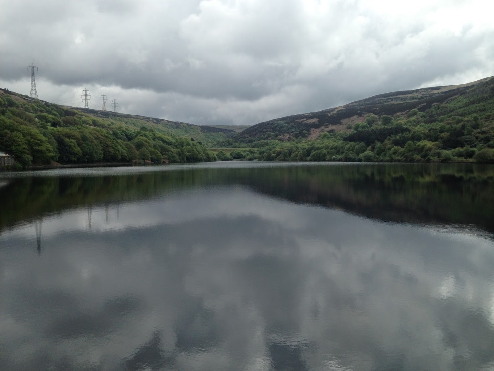
   Our cottage was in the hamlet of Dean about five miles from Cockermouth and just outside the boundaries of the National Park so we decided to focus on walks in this particular corner. Our first outing saw us setting off from Maggie's Bridge just outside Loweswater and making our way past High Nook Farm to the tarn where we encountered a very garrulous flock of Greylag Geese. Leaving them to their squabbles we followed the steep line of ascent of the Gill before popping out at the head of the stream and tramping across the marshy, tussocky ground to Gavel Fell itself. Gavel Fell proved a great spot for lunch with views West towards the coast and inland looking over to Mellbreak and Grasmoor not to mention Fleetwith Pike. We continued on to Blake Fell where we caught brief glimpses of the views to Cogra Moss before we were enveloped in cloud. With the view disappearing we meandered our way back down the grassy slopes towards High Nook Farm accompanied by an ever changing cast of Wheatears and Meadow Pippits.
  On the Tuesday we spent the morning on the Via Ferrata at Honister. I'd been on it shortly after it opened but the "extreme" version has added a little more exposure and the Burma Bridge which stretches across a canyon 2000 feet above the valley floor. After a morning of adrenalin pumping we chose a slightly more sedate afternoon and under beautifully blue skies we slowly ascended Rannerdale Knotts. Whilst it is only a comparative tiddler at 355 metres the views over Crummock Water and across to Whiteless Pike were superb. Rannerdale was immortalised in the book "The Secret Valley" written by Nicholas Size in 1930, according to the author, the valley held out for over 50 years after the Norman invasion of England in 1066. It is generally accepted there is little historical evidence to support this thesis but the valley is certainly a prime spot for an ambush. Unfortunately the Bluebells seem to be late this year and whilst there were plenty they hadn't quite reached their full magnificence.
  For our last group walk Ruthy had decided she wanted to revisit Catbells one of her favourite hills and the first Lakeland peak we did together. It's a cracking wee hill and even though it was hazy the views over Derwentwater were worth the initial grunt up the slopes. Amongst it's many claims to fame, the hill is supposed to be where Beatrix Potter's Hedgehog heroine Mrs Tiggywinkle had a burrow, but we saw no sign of the spiky washerwoman on our travels. We carried on up to Bull Crag and then across Maiden and Narrow Moor before making the hair raising descent down the screes of Nitting Haw. It's a tough descent but the girls and I all felt exhilarated to have scrambled, slipped and slid our way down the intimidating slopes.
  I spent my last morning doing some extended navigation practice on the rough ground between Muncaster and Devoke Water. It's a world away from the tweeness of the central lakes, this is rough marsh and tussock grass where you can find yourself up to your knee in gloop even on a dry day. It must be a hell of a place to make a living on  wind blasted, snowy December and I had the feeling that the Hound of the Baskervilles was just biding his time and waiting for me to step into one of the infernal bogs where upon he'd come for me!
  In addition to the walking I feel I can heartily recommend the following; "The Royal Yew" in Dean http://www.royalyew.co.uk/ for excellent food and a warm welcome from the lovely staff. "The Castle Bar" in Cockermouth http://www.cockermouth.org.uk/castlebar/ for a wide range of locally brewed real ales. The incredibly cute aquarium in Maryport http://www.coastaquarium.co.uk/ which whilst being small is perfectly formed and staffed by enthusiastic and passionate staff. The Via Ferrata at Honister http://www.honister-slate-mine.co.uk/via_ferrata_at_honister.asp which is great fun. Finally, Muncaster Castle http://www.muncaster.co.uk/ where we spent a fantastic afternoon admiring the castle and the beautiful grounds, not to mention the amazing World Owl Centre where we viewed everything from Little Owls to monsters from the Kazakh steppes who would probably have little difficulty polishing off a small child! Highly recommended.

To view the full album please click on the link below;
https://www.facebook.com/media/set/?set=a.879559215393367.1073741862.597048676977757&type=1