Total Pageviews

Friday, March 28, 2014

Lingmoor Fell, Tilberthwaite and Wetherlam

26/27.03.14
Walking with; Graham


As I continue to work towards my ML I find myself spending a lot of time on lumpy, bumpy fells where micro-navigation can be practiced. Whilst they may not always have the height of some of the more well known Lakeland peaks they often afford great views of their loftier neighbours as well as providing a challengin training ground for me to practice my skills.
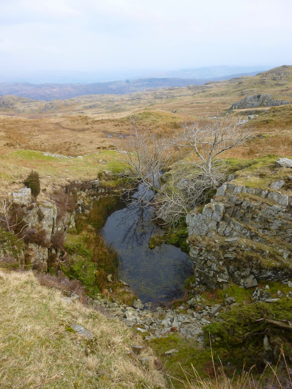
Lingmoor Fell is an excellent example of such a hill and sits prettily between Great and Little Langdale. I arrived just before 12 and set off from Elterwater which I think maybe my favourite village in the whole of the lakes, it certainly has one of the best pubs in The Britannia Inn! I followed the rough track that skirts Sawrey's Wood and then climbed gradually up on to Lingmoor admiring the views of Little Langdale Tarn and the snow capped peaks beyond. Little Langdale has a timeless feel, I imagine the basics of it have changed little over the centuries and it has a pleasingly timeless feel. Lingmoor is dotted with the remains of quarries and I picked my way through them to the summit at Brown How. The views over Lingmoor Tarn to the snow capped Langdale Pikes were truly spectacular. I spent an enjoyable afternoon wandering from tarn to abandoned hut, taking in contour features and random rocks and eventually worked my round to the crags above Fell Foot Farm where I practiced my rope work for half an hour or so making the most of the late afternoon sunshine. I dropped on to the path that contours round the bottom of the fell and made my way slowly back to Elterwater.
  Having pitched my tent on the flat, accommodating front lawn of Coniston Holly How YHA,I grabbed a bit of tea and headed off to Tilberthwaite where I was to meet Graham (http://www.beardedmountainman.com/) for another night nav. Navigating in the dark brings a fresh set of challenges, bearings and distance become of great importance and trusting them over instinct can be a struggle but invariably pays dividends. We headed up through the quarry workings and spent three hours navving around the Great Intake area, being hit by the odd snow flurry and admiring the distant lights of Ambleside and the coast. I got back to my tent just after 11pm and crawled into my sleeping bag falling asleep to the gentle patter of rain.
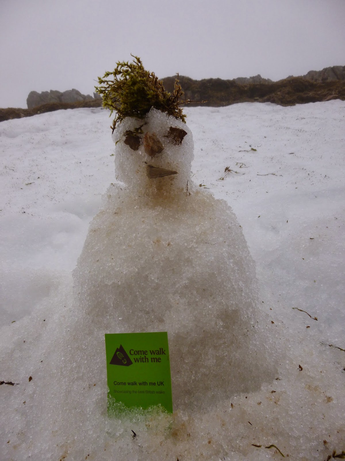
  It had cleared by the morning and I headed back to Tilberthwaite to have a go at Wetherlam. My last time on this hill had been fairly unpleasant http://www.comewalkwithmeuk.co.uk/2013/05/four-seasons-in-one-trip.html and I was hoping for better on this occasion. I climbed away from Tilberthwaite following the steep sided gill and made my way round Birk Fell before hitting the foot of Wetherlam Edge. There was a lot of snow and ice on the ascent and it was slow, careful work but the summit was well worth it. I've never had much of a view from the Coniston Fells before but this time it was breathtaking, snow, rock and sunshine, a perfect combination. I followed the edge South to Hole Rake and from there it was a gentle stroll back down to Tilberthwaite passing some old quarries en route. So,another night in the tent, more time in the hills, more navigation practice, the odd error but plenty of good stuff too! What will next week bring?

To view the full album please click on the link below; https://www.facebook.com/media/set/?set=a.853968714619084.1073741857.597048676977757&type=1

Tuesday, March 25, 2014

Outdoor First Aid course


As part of my progress towards the Mountain Leader (Summer) qualification I am required to undertake a 16 hour First Aid course with a bias specifically towards the types of injuries and illnesses that may be encountered when exploring the mountains and moorlands of Britain.
I (along with 11 other friendly folk) did mine with Peak Mountaineering at The Hollowford Centre in Castleton over the Saturday and Sunday of last weekend. The course was very thorough, highly professional and used a good mixture of theory and practice. We covered a wide range of subjects including CPR, dealing with fractures and wounds, hypothermia, hyperthermia, stings and bites, protecting the casualty from the elements, improvised slings and splints and what a First Aid kit could/should contain. In order to cement our learning, we spent the last afternoon dealing with a variety of scenarios which required us to put into practice the skills we had been learning over the previous sessions.
First Aid is one of those rare skills where once you have learned it, you never ant to have to use it....none-the-less after this weekend of instruction I feel much better prepared should the occasion arise at some stage in the future!

Friday, March 21, 2014

Scrambling and climbing around Crib Goch

18/19.3.14
Walking with; Nathan


Crib Goch is one of those evocative peaks that either have walkers/climbers grinning inanely and nodding wildly or shaking their heads and pursing their lips. It is an iconic route and with the feel of enough real danger to ensure that completing it produces the kind of buzz more normally associated with more extreme pastimes! The fact that the ridge line leads onto Wales's highest peak is an additional incentive for testing your head for heights and giving it a go. Snowdon can be climbed on a train, up the gentle "motorway" of the Llanberis pass, by the Pyg, by the Pyg and then Crib Goch or you can do what Nathan persuaded me to do and scramble your way from the bottom of the Pen-Y-Pass road onto Crib Goch and then battle your way through the cloud and wind to emerge wind reddened and grinning at the highest point in Wales!
   I am still relatively new to scrambling and found our route up towards our goal the perfect blend of challenge and fun. At one stage we ascended a slippery gully only to find our escape route blocked by a chock stone, after a little exploration a hole was discovered between the stone and valley wall and I managed to squeeze through feeling grateful I'd restricted myself to only one bacon sandwich for breakfast. By the time we'd reached the ridge itself the clouds were low and the wind high, but we picked our way along the craggy route, climbing up, dropping down, ducking out of the wind and glancing at the sheer drop offs with a mixture of awe and trepidation! There were still plenty of slabby, wind blasted snow fields on the slopes on both sides and we were aware that a slip would be unlikely to end well! We could hear voices drifting up from the Pyg track and saw one other group of three on the ridge in the distance but for the majority of our route we had what "Trail" magazine recently called "the most climbed mountain in the world" (Snowdon) to ourselves. We eventually, and somewhat regretfully, reached the trig on Carnedd Ugain and after dropping off the very windy summit we suddenly entered a traffic jam of varyingly equipped walkers moving towards the Snowdon summit. There was still snow on the railway line but that hadn't prevented the summit from being littered with beer cans, crisp packets and other detritus left by inconsiderate scum too idle to carry their own crap off the hill. We descended via The Pyg Track before dropping off back down the slope and eventually reaching our car in driving rain.
   Wednesday dawned and Nathan was keen to have a climb. I nervously assented. Whilst I have been climbing indoors for a year or so I'd never climbed outside before and had only my walking boots, but felt confident that I was with an experienced climber. We parked up in the same spot and made our way towards the crags of Dinas Mot. Nathan led the climb with me seconding and we made our way up four pitches and around sixty metres of ascent. I wasn't sure how much I would enjoy it but aside from the occasional burst of debilitating adrenalin I found my confidence growing and by the time I was hauling myself ungracefully onto the grassy plateau at the top of the climb I think it's fair to say I was hooked. The route we took wasn't a pure rock face climb, we included traverses and grassy gullies, but it was a great experience for me getting me used to climbing roped up, removing gear from crags and dealing with exposure on small ledges. I can't wait for the next time :-)

To view the full album (and it's a good one!) please click on the link below;
https://www.facebook.com/media/set/?set=a.849622378387051.1073741856.597048676977757&type=1 

Monday, March 17, 2014

Bremex Mountaineering Nav weekend

15/16.3.14
Walking with; Bremex Mountaineering Club


In 1963 Hugh Freeman set up the Brent Mountain Expedition training scheme with the purpose of providing low cost training for adventurous activities. The club ran continuously educating generations of outdoors folk until 1994 when it became an independent charity and began to run peer-to-peer skills sessions covering a variety of subject areas across a wide range of the mountainous areas of Britain http://www.bremex.org.uk/. Non-members can attend a weekend for a very reasonable £10 taster fee and it was on this basis that I'd decided to join the group for a weekend of navigation practice on and around the Kinder Plateau.
  The activities were all small group based and peer led and tried to cover as many different bases as possible. We used different scales, led legs in pairs and as individuals, worked on relocation strategies, navved "blind" trying to improve our "map memories" and micro-navved from insignificant boulder to barely existent stream junction. The facilitators were excellent and tried to ensure any specific areas of skills we were interested in were covered. As someone who spends much of time walking alone I was unsure how I would adjust to the "club" mentality but it was refreshing and stimulating to meet like minded people and speak to other ML trainees as well as benefiting from the experience of those already qualified or with much greater experience.
  I camped at Coopers campsite at the head of Edale and conveniently close to "Ye Olde Nag's Head". I should have known better, my early season camping expeditions haven't always been the most successful http://www.comewalkwithmeuk.co.uk/2013/04/a-wet-wild-and-windy-lakeland-trip.html and sure enough the wind did it's worst on Saturday night but my Wild Country Hoolie more than stood up to the test. So a weekend of sharing skills, swapping tall tales over pints and meeting like minded people, couldn't have asked for more and I shall be looking into joining the club as an associate member. I would highly recommend the set up and suggest people check out the website and see if the tasters are of interest to them!

To view the full album, please click on the link below;
https://www.facebook.com/media/set/?set=a.847859525230003.1073741855.597048676977757&type=1 

Thursday, March 13, 2014

Ingleborough from Horton-in-Ribbledale

12/3/14
Walking with; Nobody 


Ingleborough will always hold a special place in my heart, for it was after I had coerced/cajoled (depending on who you listen to) Ruth up to the summit on a brutally wet day that turned to snow as we reached Little Ingleborough, that I decided she was the girl for me! I proposed a few hours later sitting by the fire in the highly recommended "Game Cock Inn", Austwick, where the excitable French proprietor, Eric, bought us a bottle of champagne to celebrate with! In spite of this tale of romance and adventure I'd not been back since and was looking forward to enjoying the early Spring.
On our previous visit we'd taken the route from Clapham but I had decided to start on the other side and ascend from Horton-in-Ribblesdale, more commonly used to ascend Pen-Y-Ghent. The bright sunshine and warm temperatures were slightly disconcerting and most un-Yorkshire like as I passed by the picturesque station and picked my way along Sulber Nick flanked by impressive limestone pavements. The views back to Pen-Y-Ghent and ahead to Ingleborough and Simon Fell were expansive and whilst there were a fair number of other walkers we were well spaced out. I would imagine on a weekend during the "3 Peaks season" this path would see an awful lot of traffic. I passed a ruined shooting hut and the area of marsh and shake holes known as "The Allotment" and eventually cut off the path and climbed up on to Simon Fell where I had a solitary lunch with hazy views of Whernside. It was another 15 minutes or so and after a short, sharp last pull I was on the vast plateau that is the Ingleborough summit. The summit has been the subject of much conjecture. For years it was considered to have been an Iron Age hill fort but recently archaeologists have come to consider that the ruins might in fact be Bronze Age and related to ritualistic use, either way it is easy to see why people were (and are) drawn here, the 360 degree views are wonderful. There is plenty of furniture up here; A trig point, a well established windshelter, a cairn or two and the ruins of a tower built in 1830 that was partially destroyed by drunken revellers on the occasion of the celebration of it's completion!
   The summit was busy so I didn't stay long. I headed off South to Little Ingleborough (scene of much false summit heartache on excursion one) before making my way down to the magnificent Gaping Gill. This 98m deep pothole swallows Fell Beck and is the tallest unbroken waterfall in England and one of the largest known underground caverns in England. It's terrifying and magnificent in equal measure. Twice a year members of the public can pay to be winched down into the cave itself, definitely something on my bucket list! Leaving Gaping Gill I made the path at Long Scar and then back across the bleakly named and atmospheric Thieves Moss, a lonely spot where you could just imagine a highwayman or brigand lurking! The path eventually led me back to Sulber Nick and from there it was a gentle dander back down to the village.
Whilst my first visit to Ingleborough will always remain the most memorable for obvious reasons, this was a cracking day out in beautiful weather and it's only a matter of time before I head back to this scenic part of the world.

To view the full album please click on the link below; https://www.facebook.com/media/set/?set=a.845707325445223.1073741854.597048676977757&type=1

Friday, March 7, 2014

A long walk, a short walk and a night walk in the Lakes

5/6.3.14
Walking with; Graham


I have a tee shirt somewhere that bears the motto "Better a rainy day on the hill than a sunny one in the office" and it is a philosophy that I have strongly adhered to over the last few years, taking everything Mother Nature can throw at me and still smiling! However, there are the odd few occasions when it can be a bit of a struggle to feel the love, even with the alternative being the suit and tie 9-5.....
Day one got off to a niggly start when United Utilities had the temerity to charge me £7 to park on the muddied patch of waste ground at Steel End, to be frank, it's a bloody cheek. None-the-less it was a decent day and as I followed the path along Wyth Burn away from the road I eased into the walk enjoying the steady climb toward the snow capped Greenup Edge. I was using a 1:50000 scale map as I am trying out the different scales as part of my ML training and the lack of fine detail was noticeable as I followed a deep ghyll up towards Ullscarf. On the map there were only two streams shown whereas on the ground it was more than twice that.....still I made the summit of Ullscarf and crunched through the untrodden snow along the ridge line. I descended across more untouched snow fields to Standing Crag and then followed the seemingly unending fence line that whilst not appearing on my map appeared to run parallel to the marked right of way. The path junction I'd identified as a tick feature never appeared and pretty soon I was scanning the featureless, bleak, boggy marsh for a fix on where I was, eventually I decided that rise ahead of me was High Tove and that the fence line had effectively become a path in it's own right, albeit one unmarked on the larger scale map. It was unpleasant underfoot, each step sinking deep into the mire and sapping the energy and as soon as I made the trig at High Seat I decided I had had enough. I headed off the top and across more unforgiving marsh before making the knee crunching descent down Middlesteads Gill to the Thirlmere shore path from where it was a good 40min stroll back to the car and then onto the Windermere YHA, confusingly not in Windermere, but warm, friendly and serving Jenning's ale.....
"Put Wednesday behind you and move on I told myself....." Thursday was grim, proper low cloud, relentless drizzle that soaked through everything and negligible visibility. I made my way up Wansfell Pike, played around with my rope, bit of abseiling, belaying my rucksack etc, before the greyness became too oppressive and I made my way back down to Ambleside for coffee and warmth. It wasn't over yet.......I'd arranged via Facebook to meet Graham ( who goes by the web name Bearded Mountain. Man http://www.beardedmountainman.com/) for a night nav. If I wasn't an aspiring ML there'd be no way on earth you'd have dragged me out of The Golden Rule or The Mortal Man on a night like this with little to see and clothes starting to smell like a damp Retriever....but there you are, Loughrigg it was. Three hours of splashing through bogs seeking out ring contours, stream junctions and tiny tarns and sharing experiences of ML training and assessment meant the drizzle and gusty winds went almost unnoticed. Social media has been a very useful tool as I pursue my goal of becoming an ML and generous people like Graham who are willing to share their time and experience represent all of what is good about the outdoors community!

To view the full album please click on the link below;
https://www.facebook.com/media/set/?set=a.842344012448221.1073741853.597048676977757&type=1

Monday, March 3, 2014

Snowshoeing at La Rosiere

27/02/13
Walking with; Dominique and Marie


I have the battle scarred knees of a 25 year veteran of rugby fields around the world from Pennsylvania to Didsbury, knees that the medical profession have mapped out better than vasts tracts of sub-Saharan Africa, knees that cannot manage six solid days of skiing...so from time to time, an alternative is needed! I'd tried snowshoeing last year in Soldeu, Andorra but a combination of ill prepared guides, heavy snow and some highly excitable Italian fellow walkers led to our torchlight expedition being cancelled. The experience, however, gave me enough of a taste to know it was something I wanted to try again. So on day five of this year's ski trip to the Franco/Italian border I booked a guided walk with Dominique called "La Tour de La Rosiere" and was joined by Marie from Burgundy who managed to bridge the gap between my schoolboy French and Dominique's "interesting" English.
We left the centre of the ski area and were soon making our way "off piste" through deep, powdery snow and into dense Narnia like pine forest. We crossed numerous animal tracks which Domenique identified as belonging to Squirrels or Hares and overhead Ravens and Alpine Choughs circled noisily. We emerged from the forest into bright sunlight and with spectacular views of Mont Pourri stretching into the blue sky. Our trail continued across pristine snow sitting on top of the Summer pastureland and weaved past abandoned buildings following the paths of tiny streams that continued to babble beneath the frozen crust. The views became yet more stunning as we looked down on the St Alexis and St Michel chapel perched on the hilltop of Le Chatelard. Dominique regaled us with stories of the Second World War when the valley was heavily bombarded by Italian gun emplacements located at the top of what is now the "Fort" chairlift. Eventually we began the slow, warm ascent to Les Eucherts passing under a chairlift and through another tiny deserted hamlet before emerging into the village and making our way back to the resort centre for a well earned Vin Chaud! Snowshoeing has definitely made a positive impression on me and I suspect it will continue to provide a welcome and much needed respite for my knees on ski holidays yet to come!

To view the full album please click on the link below;
https://www.facebook.com/media/set/?set=a.835783856437570.1073741852.597048676977757&type=1