Total Pageviews

Showing posts with label Lake District. Show all posts

Wednesday, July 23, 2014

Guided walking on Scafell Pike with SINCIL sports college

17.7.14
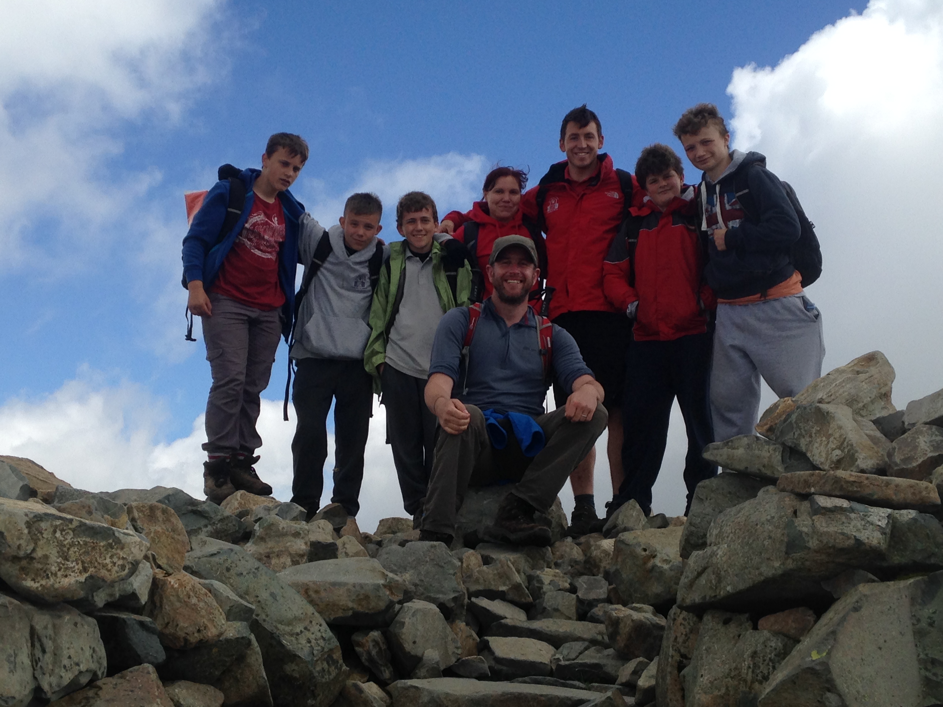
Walking with; Kallum, Josh, Jordan, Brad, George, Michelle and Mr Z!IMG_1207
IMG_1221


As part of their challenge week five students and two members of staff from Sincil Sports College in Lincoln decided they would like to attempt an ascent of Scafell Pike, England’s highest mountain, and Come walk with me UK were more than happy to help them achieve this fantastic goal! The weather the day before had been horrendous and when I’d ventured on to the fells to do a bit of a reccy, visibility had been little more than five metres and the rain torrential, so it was with some trepidation I crawled out of my tent on Thursday morning to see the tops of the big peaks covered in cloud.
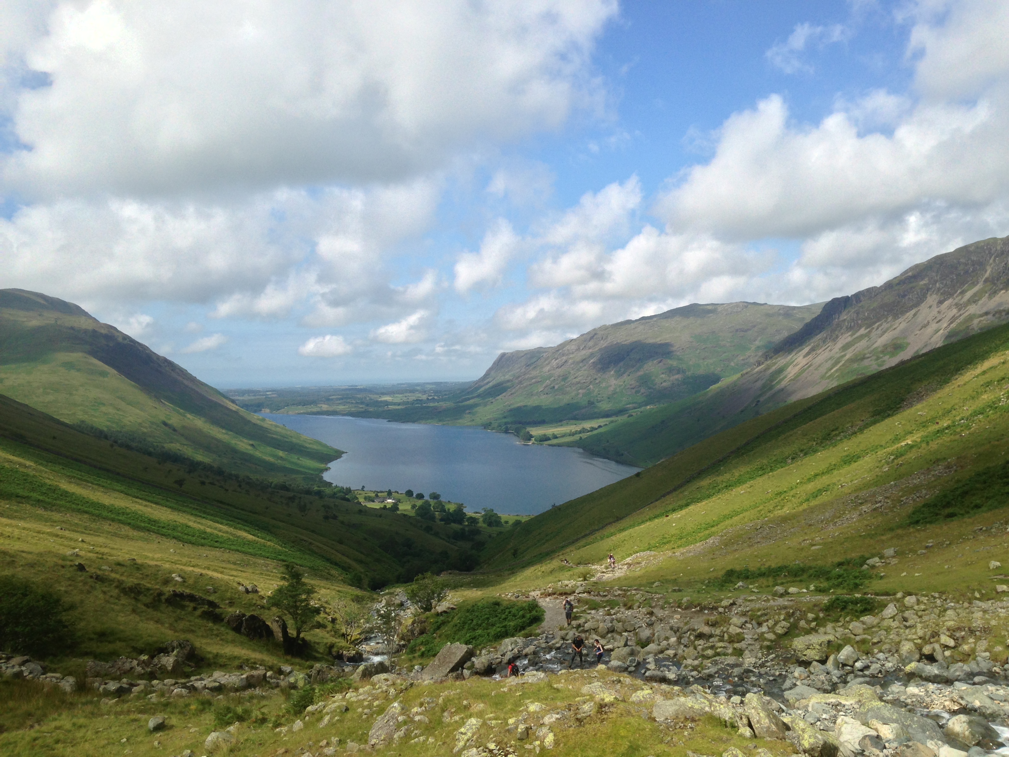
I met the guys at the NT campsite where they were busy dismantling their camp and after a quick kit check we set off along the banks of Longmell Gill and were soon climbing towards the now fully visible Scafell Pike, stopping for fantastic views of Wastwater, Yewbarrow, Ill Gill Head, Great Gable and Kirk Fell. After our stream crossing we carried on up the steep steps on Brown Tongue and onto the Hollow Stones. It was a popular day for walking and the same faces ebbed and flowed as we walked, admired the views and took the odd breather, but the peak continued to grow ever closer. We finally made the summit and the whole team were really proud of the effort it had taken to get to the top of England.
The descent was a bit easier and the views down to Styhead Tarn were fantastic. It was hot work and hard on the legs as we made our way back down to Wastwater, stopping for a cooling dip in the Gill en route. Although all the team would agree that it had been hard work, I think we would all agree it was well worth the effort and a true challenge! So, Congratulations to Team Sincil and I hope to see you again for another challenge soon!

Tuesday, May 27, 2014

Day and night navigation on Loughrigg and a wander up Caudale Moor

21.5.14
Walking with; Graham


  I've mentioned before that Loughrigg Fell is particularly well suited to practicing navigation on. It attains no great height, but it is easily accessible and covered in lumps, bumps, gullies, tarns, streams and wiggly contours of the most perplexing type. So ideal really as I make my last push towards ML readiness! The sun had bought out the masses and Ambleside (where I stayed at the excellent YHA) was heaving with people, but once I got out of the car and wandered down the back road to Under Loughrigg it wasn't long before the masses melted away and I found myself climbing up onto the fell in contemplative silence. I spent a couple of hours around Lanty Scar and Fox Hill. I was using the 1:50000 scale which I still find tricker for fine nav, but it was a reasonably successful outing enhanced by the bluebells, which I think have been better this year than in a long while. There were views to Grasmere, Rydal Water and Windermere and the cotton wool Cumulus drifted by as I sat drinking it all in. After a pleasant evening sitting in the sun outside the hostel, I wandered down to Rothay Park to meet Graham http://www.beardedmountainman.com/ who despite a full schedule of D of E work had been kind enough to spend a good few nights wandering round the fells with me in order to try and prepare me for assessment. It was a beautiful, clear night and another couple of hours passed as we navigated our way around the fell under a spectacularly starry sky.
   The next morning that spectacular sky had been buried under heavy, bruised clouds and as I chugged up "The Struggle"(which I still think is one of the best named roads in the world...."Where do you live?", "No 4 The Struggle....") the rain began to fall. Mine was the only car in the carpark opposite "The Kirkstone Pass Inn" and the inn itself soon disappeared in the clag below me as I ascended to Raven Crag. In the poor visibility I worked my way from point to point before reaching the Mark Atkinson monument. The monument remembers a landlord of the inn who died in 1930 and wished to be remembered in site of his life's work. His son is also remembered on a plaque. From there I attained the two tops named as Caudale Moor and Stony Cove Pike and then made my way down in deteriorating conditions back to the car. This was my last outing before my final ML assessment and the conditions were ideal for practicing navigation, now it is crunch time, but I feel as well prepared as I can be!

To view the full album please click on the link below;
https://www.facebook.com/media/set/?set=a.891122890903666.1073741866.597048676977757&type=1 

Friday, May 9, 2014

A week of walking in the Lake District

26.4-2.5/2014
Walking with; Ruthy, Jay and Iona


It's not often that one is afforded the luxury of a whole week in Cumbria and the Lakes, but a cottage had been booked, time off taken and a week of hill related fun was planned. As a prospective ML it was a good challenge organising a schedule of walks that would fit the diverse needs and abilities of the group and it meant a chance to try out a few new fells as well as returning to a couple of old favourites.
   Our cottage was in the hamlet of Dean about five miles from Cockermouth and just outside the boundaries of the National Park so we decided to focus on walks in this particular corner. Our first outing saw us setting off from Maggie's Bridge just outside Loweswater and making our way past High Nook Farm to the tarn where we encountered a very garrulous flock of Greylag Geese. Leaving them to their squabbles we followed the steep line of ascent of the Gill before popping out at the head of the stream and tramping across the marshy, tussocky ground to Gavel Fell itself. Gavel Fell proved a great spot for lunch with views West towards the coast and inland looking over to Mellbreak and Grasmoor not to mention Fleetwith Pike. We continued on to Blake Fell where we caught brief glimpses of the views to Cogra Moss before we were enveloped in cloud. With the view disappearing we meandered our way back down the grassy slopes towards High Nook Farm accompanied by an ever changing cast of Wheatears and Meadow Pippits.
  On the Tuesday we spent the morning on the Via Ferrata at Honister. I'd been on it shortly after it opened but the "extreme" version has added a little more exposure and the Burma Bridge which stretches across a canyon 2000 feet above the valley floor. After a morning of adrenalin pumping we chose a slightly more sedate afternoon and under beautifully blue skies we slowly ascended Rannerdale Knotts. Whilst it is only a comparative tiddler at 355 metres the views over Crummock Water and across to Whiteless Pike were superb. Rannerdale was immortalised in the book "The Secret Valley" written by Nicholas Size in 1930, according to the author, the valley held out for over 50 years after the Norman invasion of England in 1066. It is generally accepted there is little historical evidence to support this thesis but the valley is certainly a prime spot for an ambush. Unfortunately the Bluebells seem to be late this year and whilst there were plenty they hadn't quite reached their full magnificence.
  For our last group walk Ruthy had decided she wanted to revisit Catbells one of her favourite hills and the first Lakeland peak we did together. It's a cracking wee hill and even though it was hazy the views over Derwentwater were worth the initial grunt up the slopes. Amongst it's many claims to fame, the hill is supposed to be where Beatrix Potter's Hedgehog heroine Mrs Tiggywinkle had a burrow, but we saw no sign of the spiky washerwoman on our travels. We carried on up to Bull Crag and then across Maiden and Narrow Moor before making the hair raising descent down the screes of Nitting Haw. It's a tough descent but the girls and I all felt exhilarated to have scrambled, slipped and slid our way down the intimidating slopes.
  I spent my last morning doing some extended navigation practice on the rough ground between Muncaster and Devoke Water. It's a world away from the tweeness of the central lakes, this is rough marsh and tussock grass where you can find yourself up to your knee in gloop even on a dry day. It must be a hell of a place to make a living on  wind blasted, snowy December and I had the feeling that the Hound of the Baskervilles was just biding his time and waiting for me to step into one of the infernal bogs where upon he'd come for me!
  In addition to the walking I feel I can heartily recommend the following; "The Royal Yew" in Dean http://www.royalyew.co.uk/ for excellent food and a warm welcome from the lovely staff. "The Castle Bar" in Cockermouth http://www.cockermouth.org.uk/castlebar/ for a wide range of locally brewed real ales. The incredibly cute aquarium in Maryport http://www.coastaquarium.co.uk/ which whilst being small is perfectly formed and staffed by enthusiastic and passionate staff. The Via Ferrata at Honister http://www.honister-slate-mine.co.uk/via_ferrata_at_honister.asp which is great fun. Finally, Muncaster Castle http://www.muncaster.co.uk/ where we spent a fantastic afternoon admiring the castle and the beautiful grounds, not to mention the amazing World Owl Centre where we viewed everything from Little Owls to monsters from the Kazakh steppes who would probably have little difficulty polishing off a small child! Highly recommended.

To view the full album please click on the link below;
https://www.facebook.com/media/set/?set=a.879559215393367.1073741862.597048676977757&type=1 
Friday, March 28, 2014

Lingmoor Fell, Tilberthwaite and Wetherlam

26/27.03.14
Walking with; Graham


As I continue to work towards my ML I find myself spending a lot of time on lumpy, bumpy fells where micro-navigation can be practiced. Whilst they may not always have the height of some of the more well known Lakeland peaks they often afford great views of their loftier neighbours as well as providing a challengin training ground for me to practice my skills.
Lingmoor Fell is an excellent example of such a hill and sits prettily between Great and Little Langdale. I arrived just before 12 and set off from Elterwater which I think maybe my favourite village in the whole of the lakes, it certainly has one of the best pubs in The Britannia Inn! I followed the rough track that skirts Sawrey's Wood and then climbed gradually up on to Lingmoor admiring the views of Little Langdale Tarn and the snow capped peaks beyond. Little Langdale has a timeless feel, I imagine the basics of it have changed little over the centuries and it has a pleasingly timeless feel. Lingmoor is dotted with the remains of quarries and I picked my way through them to the summit at Brown How. The views over Lingmoor Tarn to the snow capped Langdale Pikes were truly spectacular. I spent an enjoyable afternoon wandering from tarn to abandoned hut, taking in contour features and random rocks and eventually worked my round to the crags above Fell Foot Farm where I practiced my rope work for half an hour or so making the most of the late afternoon sunshine. I dropped on to the path that contours round the bottom of the fell and made my way slowly back to Elterwater.
  Having pitched my tent on the flat, accommodating front lawn of Coniston Holly How YHA,I grabbed a bit of tea and headed off to Tilberthwaite where I was to meet Graham (http://www.beardedmountainman.com/) for another night nav. Navigating in the dark brings a fresh set of challenges, bearings and distance become of great importance and trusting them over instinct can be a struggle but invariably pays dividends. We headed up through the quarry workings and spent three hours navving around the Great Intake area, being hit by the odd snow flurry and admiring the distant lights of Ambleside and the coast. I got back to my tent just after 11pm and crawled into my sleeping bag falling asleep to the gentle patter of rain.
  It had cleared by the morning and I headed back to Tilberthwaite to have a go at Wetherlam. My last time on this hill had been fairly unpleasant http://www.comewalkwithmeuk.co.uk/2013/05/four-seasons-in-one-trip.html and I was hoping for better on this occasion. I climbed away from Tilberthwaite following the steep sided gill and made my way round Birk Fell before hitting the foot of Wetherlam Edge. There was a lot of snow and ice on the ascent and it was slow, careful work but the summit was well worth it. I've never had much of a view from the Coniston Fells before but this time it was breathtaking, snow, rock and sunshine, a perfect combination. I followed the edge South to Hole Rake and from there it was a gentle stroll back down to Tilberthwaite passing some old quarries en route. So,another night in the tent, more time in the hills, more navigation practice, the odd error but plenty of good stuff too! What will next week bring?

To view the full album please click on the link below; https://www.facebook.com/media/set/?set=a.853968714619084.1073741857.597048676977757&type=1

Friday, March 7, 2014

A long walk, a short walk and a night walk in the Lakes

5/6.3.14
Walking with; Graham


I have a tee shirt somewhere that bears the motto "Better a rainy day on the hill than a sunny one in the office" and it is a philosophy that I have strongly adhered to over the last few years, taking everything Mother Nature can throw at me and still smiling! However, there are the odd few occasions when it can be a bit of a struggle to feel the love, even with the alternative being the suit and tie 9-5.....
Day one got off to a niggly start when United Utilities had the temerity to charge me £7 to park on the muddied patch of waste ground at Steel End, to be frank, it's a bloody cheek. None-the-less it was a decent day and as I followed the path along Wyth Burn away from the road I eased into the walk enjoying the steady climb toward the snow capped Greenup Edge. I was using a 1:50000 scale map as I am trying out the different scales as part of my ML training and the lack of fine detail was noticeable as I followed a deep ghyll up towards Ullscarf. On the map there were only two streams shown whereas on the ground it was more than twice that.....still I made the summit of Ullscarf and crunched through the untrodden snow along the ridge line. I descended across more untouched snow fields to Standing Crag and then followed the seemingly unending fence line that whilst not appearing on my map appeared to run parallel to the marked right of way. The path junction I'd identified as a tick feature never appeared and pretty soon I was scanning the featureless, bleak, boggy marsh for a fix on where I was, eventually I decided that rise ahead of me was High Tove and that the fence line had effectively become a path in it's own right, albeit one unmarked on the larger scale map. It was unpleasant underfoot, each step sinking deep into the mire and sapping the energy and as soon as I made the trig at High Seat I decided I had had enough. I headed off the top and across more unforgiving marsh before making the knee crunching descent down Middlesteads Gill to the Thirlmere shore path from where it was a good 40min stroll back to the car and then onto the Windermere YHA, confusingly not in Windermere, but warm, friendly and serving Jenning's ale.....
"Put Wednesday behind you and move on I told myself....." Thursday was grim, proper low cloud, relentless drizzle that soaked through everything and negligible visibility. I made my way up Wansfell Pike, played around with my rope, bit of abseiling, belaying my rucksack etc, before the greyness became too oppressive and I made my way back down to Ambleside for coffee and warmth. It wasn't over yet.......I'd arranged via Facebook to meet Graham ( who goes by the web name Bearded Mountain. Man http://www.beardedmountainman.com/) for a night nav. If I wasn't an aspiring ML there'd be no way on earth you'd have dragged me out of The Golden Rule or The Mortal Man on a night like this with little to see and clothes starting to smell like a damp Retriever....but there you are, Loughrigg it was. Three hours of splashing through bogs seeking out ring contours, stream junctions and tiny tarns and sharing experiences of ML training and assessment meant the drizzle and gusty winds went almost unnoticed. Social media has been a very useful tool as I pursue my goal of becoming an ML and generous people like Graham who are willing to share their time and experience represent all of what is good about the outdoors community!

To view the full album please click on the link below;
https://www.facebook.com/media/set/?set=a.842344012448221.1073741853.597048676977757&type=1

Wednesday, February 5, 2014

Grasmere to Langdale in the snow!

31.1.14/1.2.14
Walking with; Gareth and Lawrence


Gareth and Lawrence had travelled up from the balmy South to see what Winter weather the Lakes could throw at them and, luckily, the weekend didn't disappoint. We rolled into Grasmere about 7pm and headed out straightaway  on a night nav. In spite of the cloud cover the snow was reflecting the ambient light which made things a bit easier as we picked our way around Wray Gill and the edge of Brigstone Moss. Even with the snow it was warm work and by the time we headed back to the YHA Lawrence was stripped down to his t-shirt!
YHA Grasmere has the best staff in the Lakes and buoyed by a good night's kip and a solid breakfast we kitted up and headed down Easedale taking in the snowy views that had been denied us the night before. It was slippery underfoot but we followed Blindtarn Gill up towards Swinescar Pike and skirted Lang How to the three tarns area where the snow really hit. We were looking down into Langdale but the snow was blowing upwards and we were being blown about pretty severely as we traversed across the slopes before slip-sliding our way down to the valley floor. In Langdale the snow turned to a steady drizzle and the Pikes themselves winked in and out of the clouds as we followed the Cumbria Way through Baysbrown. Once "The Wainwrights Inn" http://www.langdale.co.uk/dine/wainwrights/ loomed into view it was a no brainer and we took shelter, dried out a bit of kit in front of the fire and made the most of a restorative pint!
Fortified by this we carried on along Great Langdale Beck before cutting across Walthwaite Bottom and skirting Huntingstile Crag on our way to Loughrigg Terrace. As we started the ascent of Loughrigg we met a couple of walkers who'd decided the wind was too strong and had turned back but undeterred we pressed onwards. When the wind did hit it hit hard, given we were at little more than 300 metres at that stage I can't imagine what it must have been like on the tops....we took the buffeting for a little while before dropping down towards Rydal Water and Grasmere and meandering back along the shoreline with great views of Goosander and Tufted Ducks. A night in "Tweedie's bar" http://www.langdale.co.uk/dine/wainwrights/ consisted of great food, a log fire, live music and plenty of good beer, just what the Doctor ordered after a Wintery day on the hill!

To view the full album please click on the link below; https://www.facebook.com/media/set/?set=a.818191788196777.1073741848.597048676977757&type=1

Tuesday, January 28, 2014

Three Lake District walks

21/22/23.1.14
Walking with; Rob


So far, this Winter, south of the border at least, has been characterised by a disappointing lack of the white stuff on the ground. January walks in the Lake District should be about blue skies and crisp ground underfoot, not grey skies and swampy conditions, none the less, three days of back to back walking was just too good an opportunity to pass up.
For the first of my three walks I wanted to try somewhere different, somewhere I was unlikely to bump into many others, somewhere off the beaten track...Lorton Fells fitted the bill admirably, even more so when it was revealed to me that the Whinlatter Pass was closed reducing access only to those determined enough to take the lengthy detour via Cockermouth. The area is heavily forested but it didn't take long to get above the treeline and make my way onto the blowy top of Lord's Seat. Although it only stands at 552m the views belie the relative lack of height. Skiddaw, head in the clouds loomed to the East, Keswick and Derwentwater sat to the South and across the Solway Firth Scotland was visible in the distance. I dropped down onto the delightfully named Barf where the views of Bassenthwaite opened out even further before contouring round below Lord's Seat and continuing along the fine ridge to Broom Fell and lunching in the stone shelter below the impressive cairn. The ridge then drops gradually to the Darling How Plantation and from there it was a short scramble to the top of Graystones where the strong winds were joined by not inconsiderable rain. A quick detour onto the top of Kirk Fell and then it was down the perilously steep slope to Scawgill Bridge and a gentle wander through the trees to Spout Force which (thanks to the incessant rain) was looking truly impressive. With the rain now thoroughly persisting it down, the logical decision was back to Keswick and the sweet, beery embrace of "The Dog and Gun".
   After a night of purgatorial wakefulness thanks to the "World's Loudest Snorer" who had holed up in the same dorm as me at the Keswick YHA, Rob picked me up and we headed off towards Catbells, another fell that punches well above it's weight in the effort to view ratio. We took the path leading up to the summit over Skelgill Bank and then carried on to Bull Crag and across Maiden Moor. Apparently the Beatrix Potter character Mrs Tiggywinkle lived in a burrow somewhere on the fells, but we saw no sign of hedgehogs, just a couple of Ravens and a Kestrel sitting in the wind. Last time I'd been on High Spy I was barely able to stand http://www.comewalkwithmeuk.co.uk/2013/04/a-wet-wild-and-windy-lakeland-trip.html , and whilst it wasn't exactly sunbathing weather, it was a little more benign this time around. Tongue Gill was in full spate as we made our knee crunching descent before following the path back past Castle Crag to our starting point.
  Unable to face another night with the king of the snorers, I'd changed hostel (Ambleside) and pub (The Unicorn) and spent a far better night. Stockghyll Force was looking as impressive as Spout Force had a few days before as I climbed out of Ambleside and up onto Wansfell Pike. The summit is well won from the West and it was a steep climb made a little easier by the views to the snowy tops of the Kentmere Fells and Red Screes. Attaining the top I followed the ridge North East and then crossed the boggy fields below Idle Hill to eventually reach "The Kirkstone Pass Inn" just as the snow started to fall. Records for this venerable building date back to 1496 and it was a welcome sight as Red Screes disappeared from view in a flurry of falling snow. After stretching out a coffee and comparing notes with another sheltering soul I decided against my original plan of scrambling the snowy gullies of Red Screes and made my way back down to Ambleside via High Grove. The abandoned building at High Grove looked like something out of a horror film with a smashed up caravan and the depressing detritus of an uncared for, semi-abandoned farm building. About a mile before the town, I was hit by a broadside of vicious sleet and hail which had me scrambling for the nearby shelter of a jerrybuilt stone wall, but by the time I made the bottom of the hill there was sunshine over the Kirkstone pass once more!

To view the full album, please click on the link below;
https://www.facebook.com/media/set/?set=a.814428701906419.1073741846.597048676977757&type=1 

Monday, January 20, 2014

Manflu

Manflu and post-birthday hangover both banished to distant memory, back to the Lakes tomorrow. Happy Days!

Thursday, January 9, 2014

Lake District's UNESCO status bid


I'm watching a news item as I write this about the bid to get the Lake District listed on the UNESCO World Heritage register. The main driving force behind this seems to be the perceived economic benefits that the listing will bring with particular reference to tourists from China, India and Russia. The current number of visitors to the park, is, according to this feature, 15 million a year and I am speculating that very many of these current visitors will be annual/regular and will continue their visits which leads me to ask, do we need to actively promote the Lake District or by doing so do we run the risk of completely destroying any remaining vestiges of what makes/made it so attractive in the first place?
The process of this application will take four years and no doubt a substantial amount of money. Mass tourism almost never has a positive effect on the environment, the money that will no doubt be generated by mass package tourism of the sort common in the Chinese and Russian travel industries will be concentrated in the hands of the few (probably not locally owned) hotels that will be willing to cut deals with the operators. The majority of the operators will not be British and I am sceptical of the trickle down effect of mass tourism to those on the periphery of the core business. It's not only Bowness, Ambleside and Grasmere that will feel the effect as the more crowded and less appealing they become, the more people will try and seek out the authentic UNESCO certified landscape they've been promised....
I am surprised that the Lake District isn't already listed but that doesn't mean I think listing it is necessarily a positive thing. Ultimately in this time of public sector decimation, every body is scrambling for money wherever it can get it and I'm sure lots of clever people with clipboards and calculators have decided this is a positive step, but I genuinely hope that this isn't merely a case of sending a Golden Goose to the slaughter, motivated by short termism and a desire for the few to cash in at the expense of the many. What do other people think?

Thursday, December 12, 2013

More walks in and around Grasmere

4/5.12.13
Walking with; Nobody


I'd only been in Grasmere a couple of weeks earlier, but the great deals the YHA are currently offering on accommodation meant I could get a room to myself for roughly the price of a dorm bed. Butharlyp House (Butterlip is the pronunciation apparently) is an excellent hostel, well appointed, attractive and staffed by cheerful and helpful team members, an ideal location for a couple of nights. Since I'd read Hunter Davies's excellent "A walk around the Lakes" I felt better educated about the life of Wordsworth and, even in early December, there were still tour buses disgorging Japanese tourists outside the "Sarah Nelson Gingerbread shop" and "Dove Cottage". "Tweedies" is far and away the best option for a post walk pint by the fire, a choice of eight real ales and plenty of other options and some impressive looking food, I stuck to the beer on this occasion!
Anyway, enough of the tourist information. Loughrigg is exactly the kind of lumpy, bumpy, path criss-crossed, tarn dotted fell that I imagine has ML assessors salivating. I decided to head up mid-afternoon and play around for a bit before making my way back via the light of my head torch. I scrambled up stream beds, located tarns and trickles, watched Jackdaws playing on the thermals and listened to the insistent "cronk" of the Ravens. I found my way to Scartufts and as I ploughed through the boggy mire the light dropped and the headlights of the cars below skirted Rydal Water. In the darkness I located Lanty Scar, dropped down into Loughrigg Holme and ended up handrailing the wall above the slightly smutty sounding Rough Intake until I found myself back safe and sound in Rydal. I find Night Nav on my own can still be a bit intimidating but as my confidence and ability slowly increases I feel the immense satisfaction that comes from a skill being honed.
The forecast for the next day was apocalyptic and I as readied myself I could feel the glances upon me and the implicit, "You're going out in this.....?" Twenty minutes into my ascent to Alcock Tarn I wondered why I hadn't listened. The rain was torrential and unrelenting, trees bucked and bent in the wind and even the hardy Herdwicks huddled in the lee of stone walls and chewed the grass in miserable silence. A couple of gusts nearly had me off my feet but I continued to climb bent into the wind until I reached the beautifully appointed tarn on the lower slopes of Heron Pike with views of Grasmere and beyond. Rain turned to stinging sleet, the wind continued to blow and I trudged towards the village, then the wind continued to blow, the clouds scudded by and I ascended smiling to Stone Arthur under blue skies! I had a sandwich sheltering between two rocks out of the teeth of the gale and then contoured round below Great Rigg to reach Grizedale Tarn, one of Lakeland's best. Last time I'd been here was on my C2C route and the false summit as you climb up Great Tongue had crushed me, this time I at least knew what to expect.....I saw the only two other walkers of the day at the Tarn and then slipped and clambered up the screey slope of Seat Sandal affording spectacular views down Patterdale to Ullswater. The unusual name is, apparently, a derivation of the old Norse for "Sandulf's Hill Pasture", but it's a rare, old spot with views to match. Leaving the summit it was a knee crunching descent down the Southern slopes before following Great Tongue back down to "Tweedies" and a welcome pint by the fire! Sometimes the inclemency of the weather is the only way to get some of the more popular fells to yourself!

To view the full album, please click on the link below;
https://www.facebook.com/media/set/?set=a.785652168117406.1073741841.597048676977757&type=1 
Monday, November 25, 2013

A night walk and a day walk from Borrowdale YHA

23/24.11.13
Walking with; Rob


I only ever seem to visit Borrowdale in the cold. Last year I had one of my best, if snowiest walks, there http://www.comewalkwithmeuk.co.uk/2012/12/borrowdaleand-snow.html and when I arrived this weekend, full of fish and chips from "The Old Keswickian" I could see a dusting of snow across some of the higher tops. I had decided that the time had come to bite the bullet and set out on some night navs on my own, it is hard to finding people who are brave/daft/amenable enough to come out stumbling around the Peaks or the Lakes in the dark, and yet, it is one of the key challenges I will face on my ML assessment, so I gave it a go! I left the hostel and meandered through the Autumnal woodland following the crystal clear waters of the river I'd decided to make my way up to the fells, wait for darkness to fall and then micro-nav my way down from point to point. It seemed a little counter intuitive to be heading out as most people were heading back to the twinkling lights of Borrowdale, but it also seemed adventurous. As darkness fell I took a deep breath and reminded myself that I didn't believe in "ghosties or ghoulies or long legged beasties or things that go bump in the night" and set off using as many different techniques as I could usefully remember.
I'd given myself the fairly unmissable "handrail" of the stream so bumped up and down the slope from point to point, trying to identify ring contours and near invisible re-entrants, seeing the beam of my Petzl reflected in the eyes of the local Herdwicks and, at one stage, seeing another fellow night wanderer somewhere on the slopes of Thorneythwaite Crag! It wasn't the toughest route, but it was a start and as I wandered back along the abandoned lanes to Longthwaite I felt a, probably disproportionate, sense of pride and felt the three pints of "Cumberland" at the hostel bar, better earned than on many previous occasions.
I was joined by Rob the next morning. Once a colleague at Lose Hill YHA, the lucky sod has moved to the Lakes and now lives down in Levens. We set off along the river bank before aiming up and steadily ascending the Honister pass until we reached the slate mines and Honister Hause hostel. Circumventing my "Face of Fatigue" hell http://www.comewalkwithmeuk.co.uk/2012/12/borrowdaleand-snow.html , we headed up the steady ascent along the side of the fell which opened up some spectacular views over Buttermere and Crummock Water. It was chilly on the tops and as we made our way up the slopes of Green Gable I found myself walking in snow for the first time this Winter. The cloud dropped lower and lower and by the time we reached the summit we were restricted to a view of little more than one another! We headed down to Windy Gap and then slipped and scree slithered our way down to Styhead Tarn, one of my favourite spots in the whole Lake District. The path from here was a straightforward descent and then a stroll along the valley floor to Seathwaite and eventually back to Borrowdale. It was great to catch up with Rob again and, as a fell runner, he enjoyed the more sedate pace that I explore the fells at. Looking forward to some more snowy days out in the Lakes in the not too distant future!

To view the full album, please click on the link below;
https://www.facebook.com/media/set/?set=a.775527165796573.1073741838.597048676977757&type=1 

Thursday, November 14, 2013

Easedale Tarn and Helm Crag from Grasmere

13.11.13
Walking with; Al


After the sultry Caribbean heat of Cuba, a chilly Wednesday in November was just the short of re-introduction to the Lake District I needed....(honestly...). Al was finally free of weddings, honeymoons and DIY and we got an early start and arrived in Grasmere before 9am. In fact, we were too early, I spied a previously unnoticed snapped lace and we had to knock on the door of the not yet open "Mountain Warehouse" to obtain a new one, so big thanks to them!
We left Grasmere, heading out into Easedale and following the steady, pleasant ascent alongside Sourmilk Gill until we reached Easedale Tarn. Helm Crag and the valley below were painted with Autumnal rust and we passed few other walkers. Apparently in the 19th Century this was such a popular spot that a refreshment kiosk was established there, much as a warming cup of coffee might have taken the edge of the wind, I think I prefer it in the natural state in which we found it. We followed the steepish path up to Eagle Crag before meandering back and forth across the tops and eventually making our way up to Sergeant Man for magnificent views down to Stickle Tarn and Pavey Ark, the first time I'd seen these two Lakeland icons from this angle. We could see the ever darkening clouds scudding towards us so hotfooted it across to Birks and then onto Brownrigg Moss before making our way along the ridge towards Helm Crag. The cloud stayed pretty high but as we reached Gibson Knott the rain hit and it was increasingly hard to imagine that only ten days before I'd been in the Sierra Maestra gently melting under a tropical sun! Not sure which I preferred more though, there's something life affirming about the smack in the face of gale driven rain :-)
We picked our way down from Helm Crag and followed Easedale back towards the village for a stop in at the Gingerbread shop and a welcome, warming brew. It felt really good to be out in the Lakes again after a brief hiatus and I now feel broken in for a good Winter of walking in the many and varied conditions the Lakes can throw at us!

To view the full album please click on the link below;
 https://www.facebook.com/media/set/?set=a.766713403344616.1073741837.597048676977757&type=1

Tuesday, November 12, 2013

A walk around the Lakes by Hunter Davies


Despite being born in Scotland Hunter Davies is a Lakeland man through and through, he moved to Carlisle at the age of 11 and in addition to this wide ranging view of the Lake District he has also written a biography of the one and only Alfred Wainwright. He has a Summer home near Loweswater and the affection he feels for the area and it's history is clear in this enjoyably written study.
I initially confused the unusually monikered Hunter, with shouty TV comedy army sort, Windsor, (they both have impressive mustaches), and even once I had been alerted to the fact they were not one and the same the vein of humour running through the book is distinctly agreeable. Davies takes an unusual approach interspersing self deprecating tales of his own adventures through all the major Lakes locations; Windermere, Hawkshead, Coniston, Langdale, Grasmere et al with a literary history focusing predominantly on the poetry of Wordsworth, Southey and Coleridge. In addition to these poetic titans further tales are told of Beatrix Potter, John Peel, Thomas de Quincy (a frightful gossip by all accounts), John Ruskin and the redoubtable Canon Rawnsley, all of whom played a significant part in creating what is the modern Lake District.
In spite of his eccentric habits, he decides to walk only in wellington boots or Green Flash plimsols, Davies is an energetic and enthusiastic walker with a nice eye for the absurd and a storyteller's natural flair and rhythm. He gets lost not infrequently, mixes with Earls and commoners alike and has a knack for getting people to talk to him as a conversation rather than an interview.
Written in 1979 it is inevitable that much has changed since this book was first published and it is interesting to relate my experiences of Lakeland walking 25 years on with Davies's, particularly in areas like Ennerdale where the re-wilding project has had such an impact taking over from the heavy forestry so despised by Wainwright. None-the-less for a firm grounding in Lakeland literary history coupled with a profusion of walker's anecdotes this book is well worth digging out.

Wednesday, October 2, 2013

Night Nav, three Dodds and Britain's lowest Marilyn!


25-27.9.13


Walking with; Nathan

One of the most intimidating aspects of the ML training is the night navigation, it is also one that in order to practice effectively it's good to have more than one of you. However I have found it tricky to find volunteers to clamber up onto a hillside in the dark and spent four hours bashing through wet bracken in the pursuit of ever smaller and more obscure features. Luckily Nathan is also a ML trainee and one who conveniently lives at the foot of High Rigg, a low, but suitably bumpy fell just outside Keswick. After an hour or two padding a canoe around Derwentwater with excellent views of Catbells and a stop on Herbert's Island named for a 7th Century Christian hermit, we donned headtorches and headed out onto the hill. Night nav requires a set of different skills with bearings, timing and pacing being the key and we spent four productive hours refining our techniques with varying degrees of success!
  The next morning with Nathan heading off to work I made my way over to St John's in the Vale and set off along the traverse of Wanthwaite Bank that led me under Threkeld Knotts and out onto the moorland below Clough Head. Apart from a farmer and sheepdog on a Quadbike, it was pretty quiet and I made my way to Calfhow Pike for beautiful views over Thirlmere and stretching across the Western Fells. High Rigg sat below me in the sunshine, looking a very different proposition in daylight! I climbed up to Great Dodd and then continued along the ridge to Watson's Dodd and Stybarrow Dodd with the sky blue above me and the sun on my face. The descent of Sticks Pass is a tough one on the knees but eventually aching and creaking I hit the valley floor and picked up the track that runs through the woodlands that skirt High Rigg before eventually I arrived at the church of St John's itself before making my way back to my car at Hill Top Farm.
  I spent the night at the YHA at Arnside, a magnificent old, rambling building that the YHA has sadly put up for sale. There was a beer festival at The Albion Inn in town and beautiful views across the deadly sands of the Estuary which were peppered with Herons, Curlews, Gulls and other waders. The next day a gentle dander along the promenade towards the woods of Arnside Knott provided more ornithological diversions and the woods themselves served up a couple of Nuthatches and some magnificent fungi. I eventually made it to the top of the Knott for fantastic vistas of the Lakeland peaks and the estuary, truly, truly stunning views! A small sign at the foot of the climb informed that the Knott is Britain's smallest Marilyn at 159m, a tick for a rather obscure box but an enjoyable way to complete a couple of days of varying walking!