8/9/10.7.13
Walking with; Nathan and Tim
What better to way to break another illness enforced lay off than a three day/two night wild camping expedition in the heart of Snowdonia. The scorching forecast proved to be accurate and there was plenty of blood, sweat and tears, but, more importantly, some stunning views, fewer than expected people for the majority of the walk, a couple of lovely campsites,some very necessary swimming and the odd bit of gorgeous wildlife.
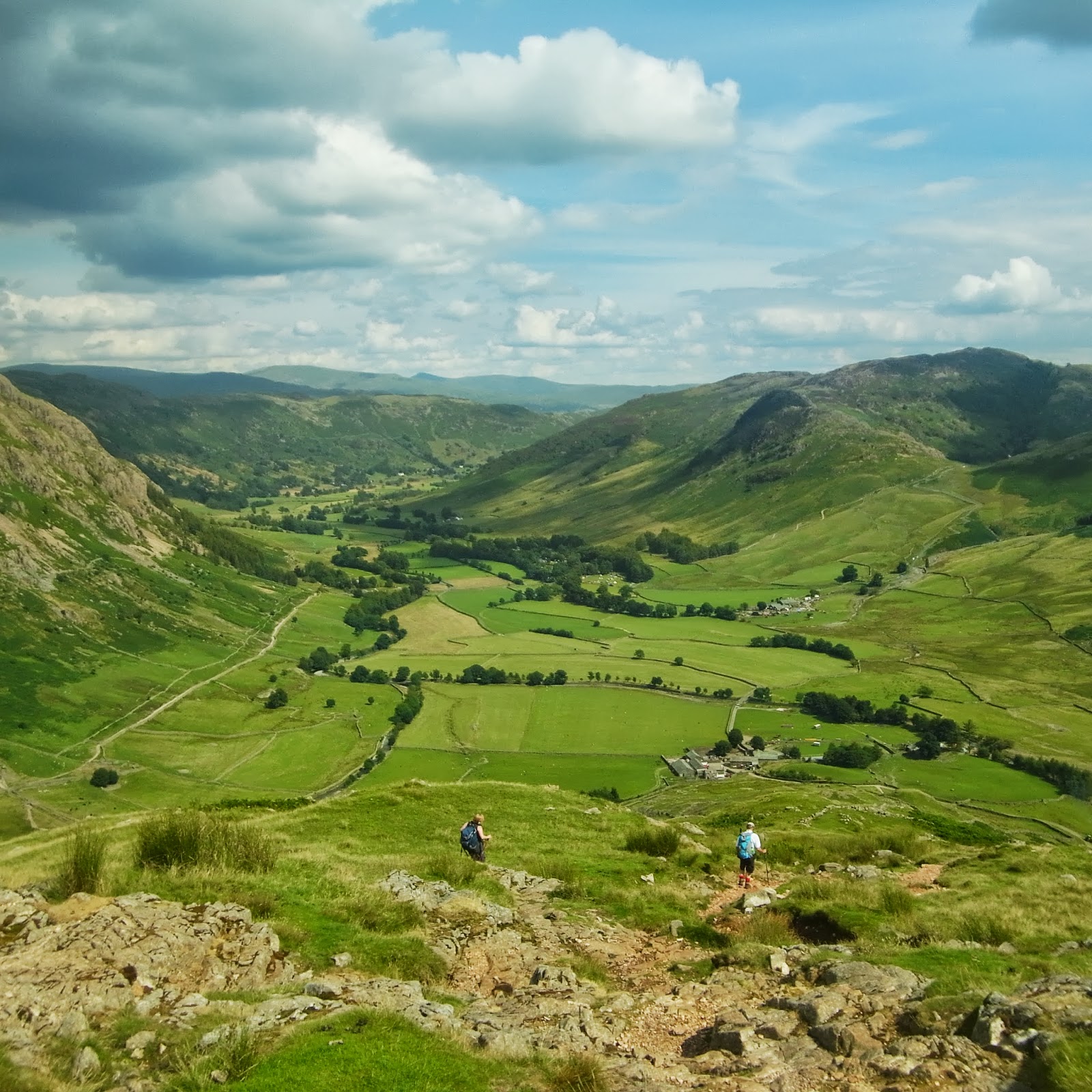
Nathan and Tim were heading down from the Lakes and I was coming up from Manchester to rendezvous in Rhyd Ddu, the inevitable traffic delays meant we didn't get going til noon, but you know what they say about mad dogs and Englishmen.......It's been a long time since I did a full pack walk and setting off up the steep, slippery slopes of Y Garn with temperatures in the high 20s reminded me that it can be substantially more challenging than a short dander with a lightly loaded daypack. The views back towards the Snowdon range were outstanding, there was not a cloud in the sky and by the time we hit the top for lunch we were already feeling it in our legs. The coastal views and the flapjacks provided by Tim's Mum revived us though and soon we were scrambling up the Nantlle Ridge and watching the landscape open up below us. Ravens soared on the thermals, Swifts and Swallows displayed their aerobatic skills and in the distance Moel Hebog sat imperious waiting for us on Day 2. I'd walked the ridge once before (
http://www.comewalkwithmeuk.co.uk/2012/01/nantlle-ridge.html) in very different conditions and had sat next to the Obelisk on Tal-Y-Mignedd with my hands freezing to my cup of soup, this time we were battling to squeeze into the shade cask by this enigmatic landmark. It was seriously hot and so after watching the Rescue chopper hovering above Drws-Y-Coed we decided to descend into Cwm Pennant where we'd identified a tempting looking reservoir (no longer used) in the shadow of Moel Lefn. We descended the steep slope, through the remains of an abandoned mining village and found a superb pitch on the marshy flats below the mine buildings and above the reservoir. A waterfall tumbled down the rocks behind us, we swam in the "bracing" waters of the pool, watched a couple of climbers on Bwlch Sais, got examined by a very inquisitive Buzzard and cooked up a storm on our gas stoves, "What bliss it was to be alive......."
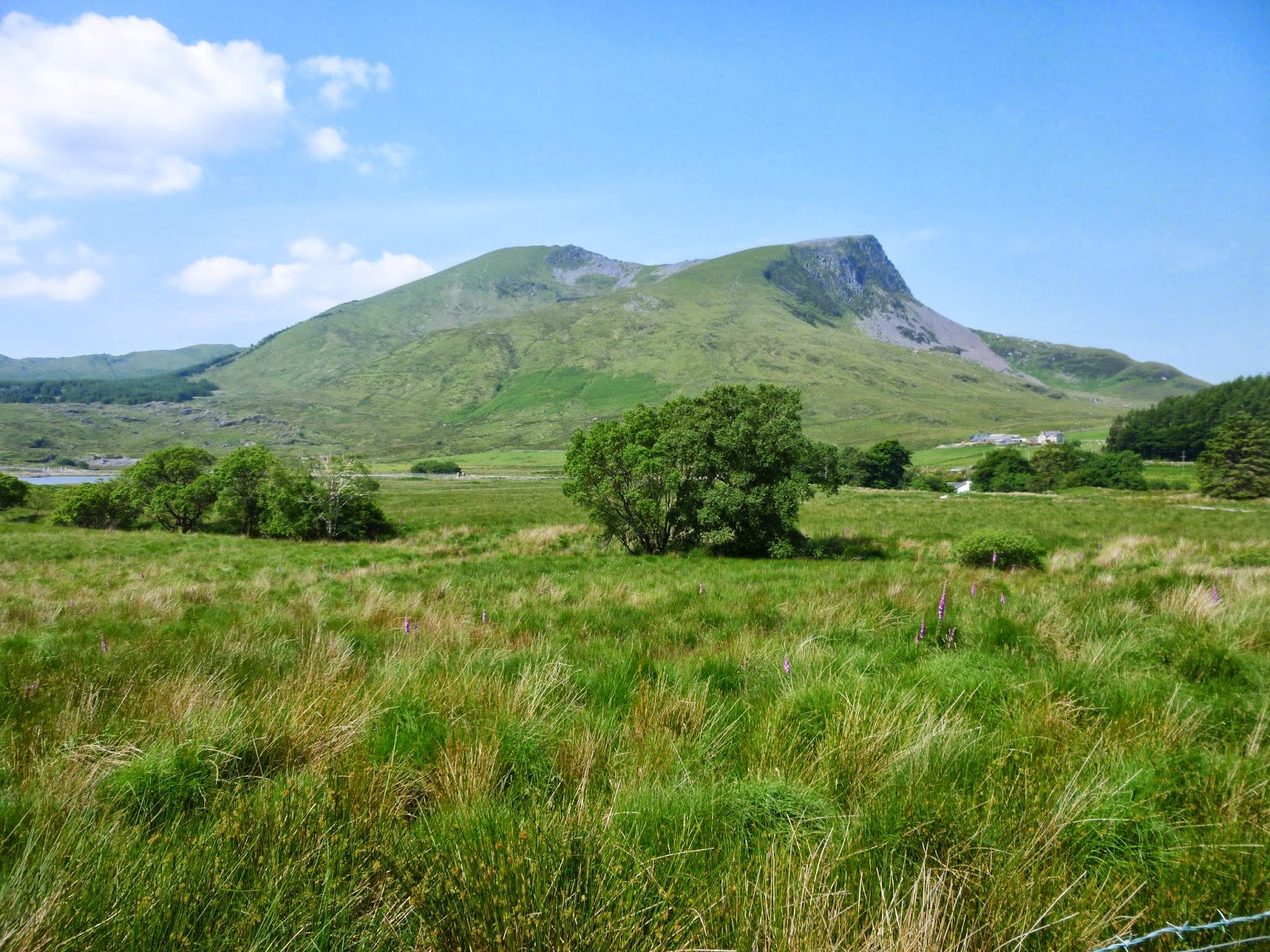
We'd decided on an early start to try an get some mileage and height under our belts before the worst of the sun and after breaking camp we followed the climber's path up onto the scrubby lower slopes of Moel Lefn. It was rough walking for a while, rocky underfoot and we plodded up the steep, heathery ground acquiring a collection of nicks and scratches for good measure. We followed the edge of the Beddgelert forest around Moel Lefn, trying to hug the shady margins and enjoying the occasional patches of cool air found in the mouths of the multiple caves and mine entrances that dotted the hillside. After another hour or so we struck up the slopes onto the breezy ridge and followed into up onto the summit of Moel Yr Ogof where a fruitless search for the cave of Owain Glyndwr, last of the great Welsh warrior princes, detained us....as did the views, the cool breeze and the thought of the slog up Hebog still to come! We stopped at a beautiful pool between the two mountains, Cotton grass dotted the valley and we watched Newts swimming in the peaty waters of the pool, but Hebog awaited us still. I'd been up it only a few weeks before from the other side (
http://www.comewalkwithmeuk.co.uk/2013/06/a-snowdonian-overnighter.html) but, even so, the views from the top were still breathtaking and worth every ounce of effort it took us to get to the top. After a day and a half of near solitude our descent into Beddgelert was littered with sweating, red faced walkers struggling their way to the top! Eventually we reached the village where we took advantage of refrigerated drinks and killed another superheated hour swimming in the River Glaslyn. Our plan for the night was to camp in the lumpy, bumpy area above the village and after the odd navigational blip and some interesting industrial heritage rusting in the wilds we eventually located the small lake we'd planned to camp at. Unfortunately the swathes of Cotton grass and Spagnum Moss told us that the whole valley bowl was saturated. Exhausted, heather scratched and sweaty this was not good news.....Nathan scrambled up a steep slope however and found a gem of a site on a saddle with some protection from the wind (what little there was) and stunning views in all directions! Eventually the nesting Ravens on a neighbouring crag took the hint and stopped "Cronking" and after eating a Chicken curry with views all the way to the coast and a couple of hands of cards we retreated from the midges into our tents.
Day 3 dawned and although we were on the move by shortly after 8am, it was already seriously warm! The path marked on the map didn't seem to be marked on the ground so we tramped, slithered and slid through marsh, bracken and heather before emerging on the tiny lane that led us towards Nantgwynan and the foot of The Watkin Path up Snowdon. Road walking is rarely my favourite activity but as we passed the odd farmhouse and a few fields of cows and sheep it was nice to get some easy miles underfoot. Eventually we hit civilisation once more and after wandering up the first section of The Watkin Path past the National Trust work on their new Hydro-Electric programme we angled off towards the pass back towards Rhyd Ddu. It was our final ascent and the cloud (for the first time in three days) did us the favour of gently drifting across the sun. We reached the pass and began the gentle descent through substantial slate workings back down to Rhyd Ddu where a much needed ice cream from the tiny tea room provided a fitting end to a thoroughly excellent trip!
It was a truly exhilarating three days of proper adventure and shows just how wonderful and wild Snowdonia can be as soon as you take even one or two steps off the most beaten tracks.....It was also the first outing from my new Wild Country Hoolie tent and I am pleased to report initial impressions are very positive. It's spacious and easy to put together although it didn't really have to deal with any challenging conditions, still, so far so good!
To view the full album please click on the link below;
https://www.facebook.com/media/set/?set=oa.413408638778047&type=1


