19.2.14
Walking with; Nobody
Saddleworth Moor and the area around will, unfortunately, be forever connected with the Moors murders. The deeds of Ian Brady and Myra Hindley have cast a dark shadow over this area and the impression lingers that these are wild places where bad things happen and bodies and dark secrets are buried. The moorland in this area does have a dark and sometimes forboding feel to it, but as a place to find solitude and feel far removed from the urban jungle of Greater Manchester it represents an excellent option.
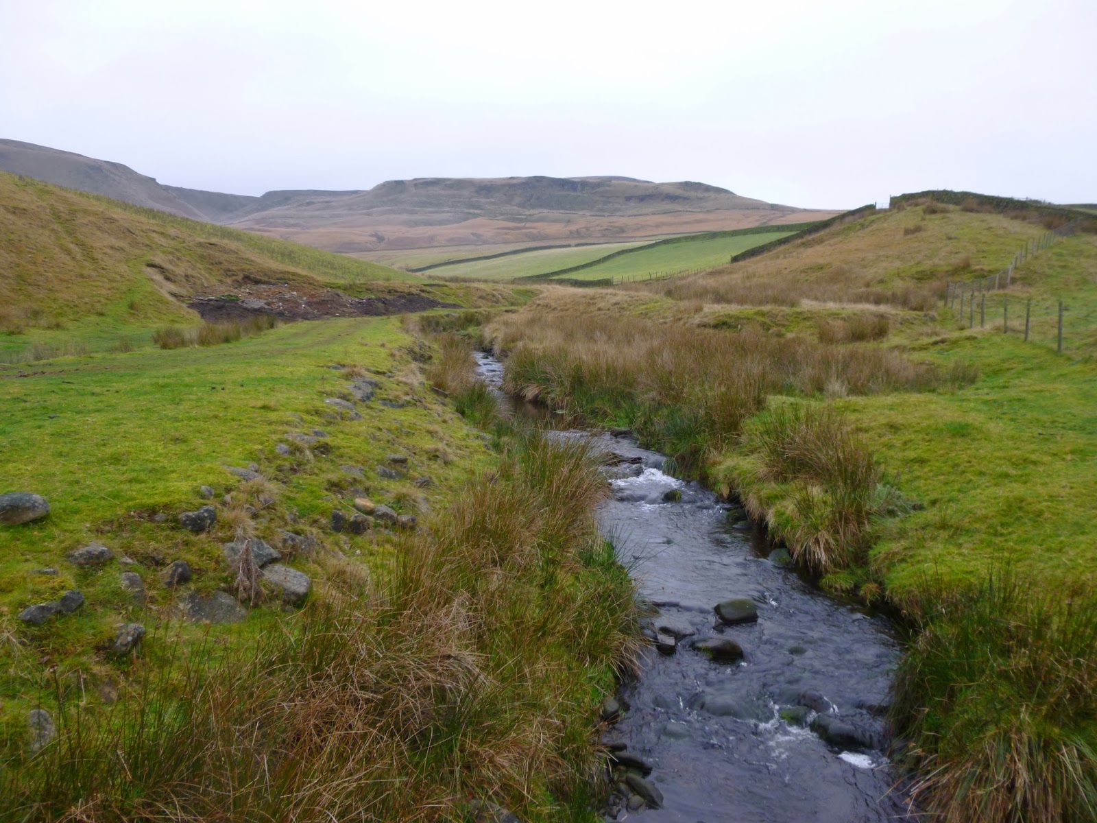
I parked in the layby at the site of what was once "The Isle of Sky Inn", Black Hill lay shrouded in low cloud and the car park at Featherbed Moss had been almost invisible beneath the thick blanket of fog. I set off onto The Pennine Way making my way between enormous bags of Heather Brash which was being helicoptered onto the moors and spread by hand to help prevent the worst excesses of erosion. I carried on down past Wessenden Head reservoir to Wessenden Reservoir and Lodge. The Lodge used to serve "rich repasts" in Victorian times, even in Wainwright's day food was provided, but apparently the last tenant farmer moved out some years ago and the place is now being run as a small scale deer farm. It is certainly a picturesque spot to be situated.
I followed the Pennine Way up Blakely Clough before striking off onto Black Moss and locating an overgrown Grouse butt to lunch in with views of the Butterly Hills and beyond. The helicopters had started ferrying the huge bags of brash out on to Broadhead Moss and the whirring of their rotors accompanied for the remainder of the day. There were plenty of Grouse around as I tramped through the peaty bog making my way up to the tiny pool sitting atop Birk Moss. The cloud had lifted by this point and there were grand views across to the Black Hill and the transmitter mast. I cut down to Shiny Brook in the sunshine thoughts of ghosts and bad deeds far from my mind and followed the line of the stream down to the reservoir where The Pennine Way led me back towards my car. As I reached the gates at the entrance a small sign caught my eye and gave me a sombre reminder of why this area is best known, it provided a website link to a campaign set up to try and ascertain the whereabouts of the body of Keith Bennett who is presumed to still be buried out on the wild moors.
To view the full album please click on the link below; https://www.facebook.com/media/set/?set=a.828687837147172.1073741851.597048676977757&type=1
Come walk with me aims to help you enjoy, and be inspired by, the magnificent British countryside
Total Pageviews
Showing posts with label Pennine Way. Show all posts
Thursday, February 20, 2014
Friday, November 29, 2013
Walking on Bleaklow
28.11.13
Walking with; Nobody
Bleaklow can be an intimidating hill, a vast expanse of peat, groughs, bogs and moorland often enveloped in low cloud, it's the kind of place where an overactive imagination could conjure up all manner of ghostly encounters. There are rumoured to be spirits of Roman legionnaires haunting the Pennine Way and the very real wreckage of many planes in the area can give a walk on this Peak District classic a sombre air. There are also, however, Mountain Hares, Grouse, a selection of intriguing stone formations and a sense of wilderness that can be hard to find in Britain's most visited National Park. Navigation can be a challenge especially in bad weather, but this just adds to the sense of remoteness which can be found on this bog trotters paradise!
I set off from Old Glossop along Doctor's Gate, a bridleway that follows the route of an old Roman road (possibly the one taken by the ghostly legionnaires....?) before cutting off above Shelf Benches and following the rough route of Wigan Clough up onto the tops. At this stage visibility was pretty good and as I wandered along the edge towards the Shelf Stones there were great views over the Dark Peak, plenty of Mountain Hares and very little in the way of human company. I made the Trig point and then bog trotted my way, compass in hand, in and out of groughs, across boot sucking patches of moor and into increasingly thick and low cloud until I located the weirdly sculpted formations of the Hern Stones where I stopped for a well deserved Chicken and coleslaw roll! The cloud was very low now and I moved onto the Wain Stones where another figure loomed out of the mist, proving to be a flesh and blood type of walker rather than a ghostly Roman. It was satisfying to gain the flagstones of The Pennine Way which led me along the beautiful Wildboar Grain and around Torside Castle. There is considerable conjecture about this site, for many years it was thought to be a Bronze Age hill fort or Prehistoric earthworks, although more recently the consensus has been towards it being a natural formation. I must confess that to my eye it looked as if it might be man made, but it's a striking feature none-the-less. There are tales of mysterious, ghostly lights dancing on the summit at certain times of the year, but I passed it in the clag with no supernatural experiences.
I left the Way somewhere above Torside Clough and cut in land, heather bashing and startling the odd Grouse. I eventually located the deep grough of Small Clough and handrailed it all the way down to the scatologically named Shittern Clough which was full of stunning Autumnal woodland and dense stands of Rhododendron. Popping back onto Doctor's Gate the path menadered back to Old Glossop and my car. Bleaklow will never be my favourite hill, it is rough and scruffy and not the prettiest, but it has a genuine feeling of wilderness and is certainly not a hill to be underestimated.
To view the full album please click on the link below;
https://www.facebook.com/media/set/?set=a.777797895569500.1073741839.597048676977757&type=1
Walking with; Nobody
Bleaklow can be an intimidating hill, a vast expanse of peat, groughs, bogs and moorland often enveloped in low cloud, it's the kind of place where an overactive imagination could conjure up all manner of ghostly encounters. There are rumoured to be spirits of Roman legionnaires haunting the Pennine Way and the very real wreckage of many planes in the area can give a walk on this Peak District classic a sombre air. There are also, however, Mountain Hares, Grouse, a selection of intriguing stone formations and a sense of wilderness that can be hard to find in Britain's most visited National Park. Navigation can be a challenge especially in bad weather, but this just adds to the sense of remoteness which can be found on this bog trotters paradise!
I set off from Old Glossop along Doctor's Gate, a bridleway that follows the route of an old Roman road (possibly the one taken by the ghostly legionnaires....?) before cutting off above Shelf Benches and following the rough route of Wigan Clough up onto the tops. At this stage visibility was pretty good and as I wandered along the edge towards the Shelf Stones there were great views over the Dark Peak, plenty of Mountain Hares and very little in the way of human company. I made the Trig point and then bog trotted my way, compass in hand, in and out of groughs, across boot sucking patches of moor and into increasingly thick and low cloud until I located the weirdly sculpted formations of the Hern Stones where I stopped for a well deserved Chicken and coleslaw roll! The cloud was very low now and I moved onto the Wain Stones where another figure loomed out of the mist, proving to be a flesh and blood type of walker rather than a ghostly Roman. It was satisfying to gain the flagstones of The Pennine Way which led me along the beautiful Wildboar Grain and around Torside Castle. There is considerable conjecture about this site, for many years it was thought to be a Bronze Age hill fort or Prehistoric earthworks, although more recently the consensus has been towards it being a natural formation. I must confess that to my eye it looked as if it might be man made, but it's a striking feature none-the-less. There are tales of mysterious, ghostly lights dancing on the summit at certain times of the year, but I passed it in the clag with no supernatural experiences.
I left the Way somewhere above Torside Clough and cut in land, heather bashing and startling the odd Grouse. I eventually located the deep grough of Small Clough and handrailed it all the way down to the scatologically named Shittern Clough which was full of stunning Autumnal woodland and dense stands of Rhododendron. Popping back onto Doctor's Gate the path menadered back to Old Glossop and my car. Bleaklow will never be my favourite hill, it is rough and scruffy and not the prettiest, but it has a genuine feeling of wilderness and is certainly not a hill to be underestimated.
To view the full album please click on the link below;
https://www.facebook.com/media/set/?set=a.777797895569500.1073741839.597048676977757&type=1
Labels:
Bleaklow,
bleaklow walk,
Come walk with me,
Dark Peak,
Doctor's Gate,
Hern stones,
Mountain Hares,
Peak District,
peat bogs,
Pennine Way,
Shittern Clough,
Torside castle,
Wain stones,
Wildboar grain
Sunday, September 22, 2013
Walking home by Simon Armitage
Simon Armitage is a poet born in the village of Marsden on the Pennine Way, reckoned to be one of the tougher long distance paths in Great Britain. For the purposes of this book Armitage decided to walk the way and perform poetry each evening to see if he could be financially self sufficient (hence the sub-title Travels with a Troubador). This book simply tells the story of his walk and the recitals that were integral to it.
Armitage is not a natural walker and I suspect that many more experienced in the gentle art of plodding may find some of his descriptions a little overwrought or dramatic, none-the-less there can be few walkers who haven't felt the familiar tendrils of dread enveloping us once the cloud descends on a rain soaked moor! As both a performer and narrator he is self effacing and the gentle vein of humour that runs through the book takes the edge of what can be, occasionally, the necessarily repetitious nature of a fortnight or so walking and then reading poems. In style it reminded me a little of Bill Bryson although I think the latter has a sharper observational eye for the absurd.
Our narrator does not walk alone. He actively encourages a safety blanket of knowing locals, Pennine Way Rangers and any of the odds and sods attending his readings that he can persuade (after a pint or two) that a day on the Way was better than their previously planned alternative. The characters travel writers meet in books always seem to have decidedly more eccentricities than those I come cross but they add colour to the pages and the affection Armitage feels for them is clear in his prose and the reported snippets of conversation.
Walking home is not a literary masterpiece, it won't be edging it's way onto the shelves populated by Patrick Leigh Fermor, Robert MacFarlane or Norman Lewis, but it is a good paperback read. I can see myself sitting by a log burner in a hostel with my socks gently steaming dry and turning over a page or two as I pass an undemanding evening. The book made me feel as if I wanted to get back out there and, even more meaningfully, get back out there on a long distance path......The twist at the end of the story disappointed and perplexed me but it didn't detract from the fact that the time i had spent getting their had been very agreeable indeed.
Friday, February 1, 2013
Crowden
Walking with; Nobody
28.01.13
When I think of the Dark Peak, I tend to think about the "Big three", Kinder, Bleaklow and Crowden/Black Hill, but I do seem to neglect the latter. It doesn't have the mystery of Bleaklow with it's low hanging fog and aircraft wrecks (although it does have a few up there) or the history of Kinder and the tresspass, but it does have the Great and Little Brooks, Laddow Rocks (where the original members of The Rucksack club climbed and put in place the foundations of the modern Mountain rescue service) and miles of barren moorland. I wanted a bit more navigation work and figured miles of barren moorland met that criteria so away I went, passing the YHA before crossing Crowden Brook and making my way up to The Pennine Way. There were Pheasant and Grouse about and I heard Ravens at least twice on my walk. I ascended slowly until I reached Oakenclough Brook tumbling down off Rakes Moss,then instead of re-treading the next section of the Way, I decided to follow a narrow track contouring along the valley and below Laddow Rocks before emerging back onto the Way opposite the magnificent rock formations known as Castles.
The path crisscrossed the brook before the distinctive paving slabs showed me the way towards the distant Black Hill. I'm always struck at how vast the expanse of moorland is up there, miles of nothingness giving the lone walker the occasional chill down the spine especially when the mist starts to drift in.......Visibility remianed pretty good though so I struck off in an easterly direction, locating the pond at Sliddens Moss before continuing on the rough, broken up, tussocky ground in the direction of the ever visible Holme Moss Transmitting Station. The groughs were still full of snow and I set off a Mountain Hare in it's beautiful white coat, he made my progress across the moor look decidedly clumsy and he bounced and bounded away from me. I eventually made my way up on to Tooleyshaw Moss and searched for the remains of the original route that the Pennine Way took. The wind had gotten up by this point and the dark clouds that had hovered over Bleaklow began to scud in my general direction incentivising me to pick up my pace as I slip slid through the peaty bogs and mossy marshes from White Low and across Westend Moss. The squall when it hit did so with the kind of malevolence a disgruntled Nordic God might have used to show his power over mere humans and I was soaked before I'd even got my waterproofs out of my rucksack......luckily it was over as quickly as it started and I wandered the remaining path back to the hamlet of Crowden (the most Northerly settlement in Derbyshire) without further downpour.
To visit the full photo album for this walk please click on the link below;
https://www.facebook.com/#!/media/set/?set=oa.332787893506789&type=1
28.01.13
When I think of the Dark Peak, I tend to think about the "Big three", Kinder, Bleaklow and Crowden/Black Hill, but I do seem to neglect the latter. It doesn't have the mystery of Bleaklow with it's low hanging fog and aircraft wrecks (although it does have a few up there) or the history of Kinder and the tresspass, but it does have the Great and Little Brooks, Laddow Rocks (where the original members of The Rucksack club climbed and put in place the foundations of the modern Mountain rescue service) and miles of barren moorland. I wanted a bit more navigation work and figured miles of barren moorland met that criteria so away I went, passing the YHA before crossing Crowden Brook and making my way up to The Pennine Way. There were Pheasant and Grouse about and I heard Ravens at least twice on my walk. I ascended slowly until I reached Oakenclough Brook tumbling down off Rakes Moss,then instead of re-treading the next section of the Way, I decided to follow a narrow track contouring along the valley and below Laddow Rocks before emerging back onto the Way opposite the magnificent rock formations known as Castles.
The path crisscrossed the brook before the distinctive paving slabs showed me the way towards the distant Black Hill. I'm always struck at how vast the expanse of moorland is up there, miles of nothingness giving the lone walker the occasional chill down the spine especially when the mist starts to drift in.......Visibility remianed pretty good though so I struck off in an easterly direction, locating the pond at Sliddens Moss before continuing on the rough, broken up, tussocky ground in the direction of the ever visible Holme Moss Transmitting Station. The groughs were still full of snow and I set off a Mountain Hare in it's beautiful white coat, he made my progress across the moor look decidedly clumsy and he bounced and bounded away from me. I eventually made my way up on to Tooleyshaw Moss and searched for the remains of the original route that the Pennine Way took. The wind had gotten up by this point and the dark clouds that had hovered over Bleaklow began to scud in my general direction incentivising me to pick up my pace as I slip slid through the peaty bogs and mossy marshes from White Low and across Westend Moss. The squall when it hit did so with the kind of malevolence a disgruntled Nordic God might have used to show his power over mere humans and I was soaked before I'd even got my waterproofs out of my rucksack......luckily it was over as quickly as it started and I wandered the remaining path back to the hamlet of Crowden (the most Northerly settlement in Derbyshire) without further downpour.
To visit the full photo album for this walk please click on the link below;
https://www.facebook.com/#!/media/set/?set=oa.332787893506789&type=1
Labels:
birds,
Come walk with me,
Crowden,
Dark Peak,
Derbyshire walks,
groughs,
grouse,
hike,
Laddow Rocks,
moorland,
Mountain Hares,
Oakenclough Brook,
Peak District,
Pennine Way,
Sliddens Moss
Wednesday, January 16, 2013
A Snowy Peak District Double
14/15.01.13
Walking with; Nobody
Tomorrow is my 40th birthday and I'd hoped to fit something special in as a prelude to this momentous landmark, luckily the weather seemed to be on my side and I had two fantastic days in the Peak District with snow lying thick on the ground and barely a soul to be seen. My plan for the Monday was to head over to Edale and up Kinder via Grindsbrook but as I drove along Rushup Edge the snow was already coating the raod pretty thickly and I decided to stop at Mam Tor and have a dander from there.
Mam Tor is one of my favourites, the "bang for your bucks" vista, the Great Ridge stretching out in front of you, the Bronze and Iron Age history and hill fort remnants and the broken road destroyed by the 1979 land slip. It's accessibility, however, means the top is generally busy......not today. I stood alone in glorious solitude on the "mother mountain" in a complete whiteout, barely able to see two foot in front of me! It was too chilly to hang around so I continued along the ridge, dropping out of the cloud until I reached Hollin's Cross. A toss of the coin took me down towards Castleton rather than Edale and as my footprints disturbed the untouched snow on Hollowford Road I passed Candle House and into the village for a cup of coffee and some respite from the falling flakes. Buoyed by caffeine and warm again I passed the colourfully named "Devil's Arse" cavern and after crossing the bottom of Winnat's Pass headed across the narrow, slippery path traversing the face of Treak Cliff to the Blue John Cavern. Blue John is indelibly linked to Castleton, a form of flourite it is found only in this area and has been mined since the 18th Century mainly for the production of decorative pieces. The caverns are closed at this time of year, but well worth a visit on a rainy day in the Summer. I had lunch back at my car before deciding to utilise the white out conditions to practice my navigation work. I headed down towards the Limestone Trail and has I reached it, the cloud broke giving fantastic views to a snow capped Win Hill in the distance. Red faced and chap cheeked I headed back to the car for another restorative coffee.
Snow was falling again (though lightly) as I parked up near Bowden Bridge, the site from where Benny Rothman led his group of ramblers on the Kinder Trespass of 1932. This site should be a mecca for all hill walkers, marking, as it does, the site of a formative event in challenging the restrictive access laws of the time. The trespass went up William Clough but I headed for Coldwell and Oaken Cloughs (where I spotted a Grey Heron and a beautiful Wren) and followed them up past the snowline to the Edale Cross. The views back to South Head and Mount Famine were stunning and the whole hill had that unique, sound muffled quality that snow tends to bring. The only noises disturbing me as I headed across Swine's Back in beautiful sunshine, were the occasional Grouse and the crunch of snow and ice underfoot. I headed out to the cairn at Kinderlow Head before doubling back towards the Trig Point all the while using the snow covered terrain as navigational practice (this will be a big theme for the year as I work towards my Mountain Leader qualification). With blue skies and great views I worked across to Noe's Stool before yomping through sometimes knee deep snow across the plateau to Red Brook and The Pennine Way. I followed the Way as it hugged the edge of the plateau over the Downfall with views to the Reservoir and Mermaid's Pool before descending down William Clough,where the route once taken by Benny Rothwell and his band of protestors switched back and forth across an icy stream. The last mile was a gentle stroll along the reservoir and back down to Bowden Bridge. This was to be the last walk I took in my thirties and it's fitting it was on one of my "local" and favourite hills, I was even luckier that the snow fell and sun shone. Roll on the next ten years!
To view the full album please click on the link below;
https://www.facebook.com/media/set/?set=oa.320909411361304&type=1
Walking with; Nobody
Tomorrow is my 40th birthday and I'd hoped to fit something special in as a prelude to this momentous landmark, luckily the weather seemed to be on my side and I had two fantastic days in the Peak District with snow lying thick on the ground and barely a soul to be seen. My plan for the Monday was to head over to Edale and up Kinder via Grindsbrook but as I drove along Rushup Edge the snow was already coating the raod pretty thickly and I decided to stop at Mam Tor and have a dander from there.
Mam Tor is one of my favourites, the "bang for your bucks" vista, the Great Ridge stretching out in front of you, the Bronze and Iron Age history and hill fort remnants and the broken road destroyed by the 1979 land slip. It's accessibility, however, means the top is generally busy......not today. I stood alone in glorious solitude on the "mother mountain" in a complete whiteout, barely able to see two foot in front of me! It was too chilly to hang around so I continued along the ridge, dropping out of the cloud until I reached Hollin's Cross. A toss of the coin took me down towards Castleton rather than Edale and as my footprints disturbed the untouched snow on Hollowford Road I passed Candle House and into the village for a cup of coffee and some respite from the falling flakes. Buoyed by caffeine and warm again I passed the colourfully named "Devil's Arse" cavern and after crossing the bottom of Winnat's Pass headed across the narrow, slippery path traversing the face of Treak Cliff to the Blue John Cavern. Blue John is indelibly linked to Castleton, a form of flourite it is found only in this area and has been mined since the 18th Century mainly for the production of decorative pieces. The caverns are closed at this time of year, but well worth a visit on a rainy day in the Summer. I had lunch back at my car before deciding to utilise the white out conditions to practice my navigation work. I headed down towards the Limestone Trail and has I reached it, the cloud broke giving fantastic views to a snow capped Win Hill in the distance. Red faced and chap cheeked I headed back to the car for another restorative coffee.
Snow was falling again (though lightly) as I parked up near Bowden Bridge, the site from where Benny Rothman led his group of ramblers on the Kinder Trespass of 1932. This site should be a mecca for all hill walkers, marking, as it does, the site of a formative event in challenging the restrictive access laws of the time. The trespass went up William Clough but I headed for Coldwell and Oaken Cloughs (where I spotted a Grey Heron and a beautiful Wren) and followed them up past the snowline to the Edale Cross. The views back to South Head and Mount Famine were stunning and the whole hill had that unique, sound muffled quality that snow tends to bring. The only noises disturbing me as I headed across Swine's Back in beautiful sunshine, were the occasional Grouse and the crunch of snow and ice underfoot. I headed out to the cairn at Kinderlow Head before doubling back towards the Trig Point all the while using the snow covered terrain as navigational practice (this will be a big theme for the year as I work towards my Mountain Leader qualification). With blue skies and great views I worked across to Noe's Stool before yomping through sometimes knee deep snow across the plateau to Red Brook and The Pennine Way. I followed the Way as it hugged the edge of the plateau over the Downfall with views to the Reservoir and Mermaid's Pool before descending down William Clough,where the route once taken by Benny Rothwell and his band of protestors switched back and forth across an icy stream. The last mile was a gentle stroll along the reservoir and back down to Bowden Bridge. This was to be the last walk I took in my thirties and it's fitting it was on one of my "local" and favourite hills, I was even luckier that the snow fell and sun shone. Roll on the next ten years!
To view the full album please click on the link below;
https://www.facebook.com/media/set/?set=oa.320909411361304&type=1
Monday, October 1, 2012
The Todmorden Centenary Way
28.9.12
Walking with; Nobody
The good folk of Yorkshire must have done something to upset the almighty given the almost Biblical deluge that they'd been on the end of over the last week, none-the-less that was where I headed last week with the express intention of getting a few miles in my legs. I stayed in the Mankinholes YHA, a cosy hostel set in a 16th Century manor house http://www.yha.org.uk/hostel/mankinholes and a mere five minute walk from the excellent Top Brink Inn http://topbrink.com/ where photos of hardy looking Yorkshire farmers and horse brasses adorn the walls. Lumbutts, the neighbouring hamlet, has a magnificent Methodist chapel and John Wesley was once a regular visitor to the area where he preached to the locals.
The Todmorden Centenary Way is a 20 mile footpath created to commemorate the granting of Borough status to the area. With the walk in and out from Mankinholes and the occasional, ahem, detour, I reckon I ended the day with 23 miles under my belt which I think is probably my longest day of walking......there or thereabouts anyway! The walk up to Stoodley Pike set the tone for the rest of the day, muddy and wet underfoot and grey and squally overhead, yuck! I climbed up to Stoodley Pike and admired the view of cloud, cloud and a little more cloud! The monument on the Pike was completed in 1856 to commemorate the end of the Crimean War. It was designed by James Green and replaced a previous monument that was destroyed by lightening. It is certainly a spectacular spot and with the cloud and mist swirling around had a distinctly ghostly feel. I continued along The Pennine Way squelching through the puddles and moving in and out of cloud until I reached the vast expanse of Warland Reservoir where the rain set in.......so far, so good! Walking off the moor into Warland, I crossed the A6033 and past the Steanor Bottom Toll House before heading up the abandoned Calderbrook Road. The road had a kind of post-apocalyptic air to it as nature had taken hold and there were rabbits, squirrels and kestrels not to mention plenty of blackberries and wild roses.
The landscape round here is wild but man's stamp is very clear. Everywhere there is evidence of old mine workings, abandoned buildings, the inexorable column of electricity pylons and in the distance wind turbines slowly turning and dominating the landscape. None-the-less, the moorlands feel wild, exposed, barren and untamed and in 23 miles of walking I only met two other people, not something you could often say in the Lake District! I passed the Allescholes farms and headed up to the ruined farm at Ramsden at the South West end of Carberry Dam. The moors past here grew wilder and more mine workings and ruined buildings gave a real feeling of desolation. The wildlife clearly flourishes here and I saw Kestrels, Meadow Pippits and a flock of the very rare Twite, a real bonus! More moorland walking took me into Cornholme (the only place on the route with a pub as far as I could see) before another ascent led me over the Whirlaw Stones and opened up great views back across the valley to Stoodley Pike.
The last section of the walk took me down through Beech woodland and along the Rochdale canal before climbing through the woodland of Stoodley Glen and back to the villages of Harvelin Park and Stoodley. As I climbed back onto the Pennine Bridleway for the last mile back to Mankinholes the heavens opened for the last time and I arrived back at the hostel bedraggled, footsore but feeling very satisfied at the completion of a job well done.
To see the full photo album, please click on the link below;
https://www.facebook.com/#!/media/set/?set=oa.277191782399734&type=1
Walking with; Nobody
The good folk of Yorkshire must have done something to upset the almighty given the almost Biblical deluge that they'd been on the end of over the last week, none-the-less that was where I headed last week with the express intention of getting a few miles in my legs. I stayed in the Mankinholes YHA, a cosy hostel set in a 16th Century manor house http://www.yha.org.uk/hostel/mankinholes and a mere five minute walk from the excellent Top Brink Inn http://topbrink.com/ where photos of hardy looking Yorkshire farmers and horse brasses adorn the walls. Lumbutts, the neighbouring hamlet, has a magnificent Methodist chapel and John Wesley was once a regular visitor to the area where he preached to the locals.
The Todmorden Centenary Way is a 20 mile footpath created to commemorate the granting of Borough status to the area. With the walk in and out from Mankinholes and the occasional, ahem, detour, I reckon I ended the day with 23 miles under my belt which I think is probably my longest day of walking......there or thereabouts anyway! The walk up to Stoodley Pike set the tone for the rest of the day, muddy and wet underfoot and grey and squally overhead, yuck! I climbed up to Stoodley Pike and admired the view of cloud, cloud and a little more cloud! The monument on the Pike was completed in 1856 to commemorate the end of the Crimean War. It was designed by James Green and replaced a previous monument that was destroyed by lightening. It is certainly a spectacular spot and with the cloud and mist swirling around had a distinctly ghostly feel. I continued along The Pennine Way squelching through the puddles and moving in and out of cloud until I reached the vast expanse of Warland Reservoir where the rain set in.......so far, so good! Walking off the moor into Warland, I crossed the A6033 and past the Steanor Bottom Toll House before heading up the abandoned Calderbrook Road. The road had a kind of post-apocalyptic air to it as nature had taken hold and there were rabbits, squirrels and kestrels not to mention plenty of blackberries and wild roses.
The landscape round here is wild but man's stamp is very clear. Everywhere there is evidence of old mine workings, abandoned buildings, the inexorable column of electricity pylons and in the distance wind turbines slowly turning and dominating the landscape. None-the-less, the moorlands feel wild, exposed, barren and untamed and in 23 miles of walking I only met two other people, not something you could often say in the Lake District! I passed the Allescholes farms and headed up to the ruined farm at Ramsden at the South West end of Carberry Dam. The moors past here grew wilder and more mine workings and ruined buildings gave a real feeling of desolation. The wildlife clearly flourishes here and I saw Kestrels, Meadow Pippits and a flock of the very rare Twite, a real bonus! More moorland walking took me into Cornholme (the only place on the route with a pub as far as I could see) before another ascent led me over the Whirlaw Stones and opened up great views back across the valley to Stoodley Pike.
The last section of the walk took me down through Beech woodland and along the Rochdale canal before climbing through the woodland of Stoodley Glen and back to the villages of Harvelin Park and Stoodley. As I climbed back onto the Pennine Bridleway for the last mile back to Mankinholes the heavens opened for the last time and I arrived back at the hostel bedraggled, footsore but feeling very satisfied at the completion of a job well done.
To see the full photo album, please click on the link below;
https://www.facebook.com/#!/media/set/?set=oa.277191782399734&type=1
Wednesday, August 22, 2012
Black Hill via Holme Clough
22.8.12
Walking with; Nobody
I like paths. When I am on a path I know it is taking me somewhere and even on the odd occasion when that somewhere isn't exactly where I think it might be, I know it's going to end up in a defined place! However, there are times when I want a bit more adventure in my life. Maybe it's the fact that my Mum's family lived in Africa for much of their early life, maybe it's a yearning for the carefree days of childhood when everything felt like an adventure, but just occasionally going "off piste" seems like the way to go! Now, I am not comparing the Peak District with the velds of South Africa or plains of Tanzania, but an off path adventure on the bleak moors around Black Hill can still feel pretty wild.
The start of today's walk was by no means adventurous, a gentle stroll along the shores of Dove Stone, Yeoman Hey and Greenfield Reservoirs. The footpaths were busy with bikers and walkers, both of the dog and power varieties. Reservoirs have been, and can be, relatively contentious, think of Ladybower, beneath the waters of which lie the remains of the villages of Derwent and Ashopton and Mardale now sitting underneath the water of Haweswater.However, I like them, these three provide havens for wildlife and sit picturesquely below the crags of Ashway Hey and the delightfully named Raven Stones Brow. Leaving the reservoirs behind I climbed along the banks of Greenfield Brook before striking out (off path) along Holme Clough. Holme Clough is a beautiful but tough walk/scramble. The stream winds it's way towards the open moorland, tumbling over waterfalls and cutting a deep, steep sided gorge through the landscape. The walking was not easy, tussock grass, mossy bogs and slippery rocks all provided impediments but, more satisfyingly, just the right degree of challenge to make it feel vaguely adventurous, a feeling heightened by the lack of any other walkers. The Heather on the slopes was magnificent, turning the slopes purple and I came across a couple of patches of Match Head Lichen, beautiful and unusual, and a good indicator of the air quality in this part of the world. Eventually Black Hill hoved into view, I was only separated from it by (yet another) patch of marshy bog, (deep sigh.......)
I struck off East, heading for the path that had come from Black Moss Reservoir and after another foot soaking, located it and made my way upto a perfectly situated stone shelter where I paused for lunch. The moorlands of the Dark Peak do not have the scale and splendour of Snowdonia but the vast expanse of barren wilderness is impressive in a completely different way and still made a memorable vista for a chicken sarnie! From here I ascended to the summit (582m), informally known as Soldier's Lump after the Army surveying team who were the first to erect a Trig Point on the boggy top. Apparently in the past, reaching the trig meant wading knee deep through bog, today it was wet but my descent was made much easier as I located the flag stones of The Pennine Way as it headed towards Crowden. As the route climbed above Great Crowden Brook it narrowed to not much more than a sheep track and passed above Laddow Rocks (previously mentioned in my blog as an important site in the establishment of Mountain Rescue). Leaving The Pennine Trail I headed across to Chew Reservoir before following the service road back to Dove Stone Reservoir which buy now was busy with families, picknickers and even more dogwalkers. One side of the reservoir is given over to a woodland with the trees planted in commemoration of deceased loved ones and it struck me that a Rowan Tree in a wood on the shores of such a beautifully situated body of water might not make a bad reminder for myself some day,hopefully, a long time in the future!!
To view the full album please click on the link below;
https://www.facebook.com/media/set/?id=718985691&tid=136991043086476&skipClustering=true&qn=1345621147&success=2&failure=0&set=oa.262198243899088#!/media/set/?set=oa.262198243899088&type=1
Walking with; Nobody
I like paths. When I am on a path I know it is taking me somewhere and even on the odd occasion when that somewhere isn't exactly where I think it might be, I know it's going to end up in a defined place! However, there are times when I want a bit more adventure in my life. Maybe it's the fact that my Mum's family lived in Africa for much of their early life, maybe it's a yearning for the carefree days of childhood when everything felt like an adventure, but just occasionally going "off piste" seems like the way to go! Now, I am not comparing the Peak District with the velds of South Africa or plains of Tanzania, but an off path adventure on the bleak moors around Black Hill can still feel pretty wild.
The start of today's walk was by no means adventurous, a gentle stroll along the shores of Dove Stone, Yeoman Hey and Greenfield Reservoirs. The footpaths were busy with bikers and walkers, both of the dog and power varieties. Reservoirs have been, and can be, relatively contentious, think of Ladybower, beneath the waters of which lie the remains of the villages of Derwent and Ashopton and Mardale now sitting underneath the water of Haweswater.However, I like them, these three provide havens for wildlife and sit picturesquely below the crags of Ashway Hey and the delightfully named Raven Stones Brow. Leaving the reservoirs behind I climbed along the banks of Greenfield Brook before striking out (off path) along Holme Clough. Holme Clough is a beautiful but tough walk/scramble. The stream winds it's way towards the open moorland, tumbling over waterfalls and cutting a deep, steep sided gorge through the landscape. The walking was not easy, tussock grass, mossy bogs and slippery rocks all provided impediments but, more satisfyingly, just the right degree of challenge to make it feel vaguely adventurous, a feeling heightened by the lack of any other walkers. The Heather on the slopes was magnificent, turning the slopes purple and I came across a couple of patches of Match Head Lichen, beautiful and unusual, and a good indicator of the air quality in this part of the world. Eventually Black Hill hoved into view, I was only separated from it by (yet another) patch of marshy bog, (deep sigh.......)
I struck off East, heading for the path that had come from Black Moss Reservoir and after another foot soaking, located it and made my way upto a perfectly situated stone shelter where I paused for lunch. The moorlands of the Dark Peak do not have the scale and splendour of Snowdonia but the vast expanse of barren wilderness is impressive in a completely different way and still made a memorable vista for a chicken sarnie! From here I ascended to the summit (582m), informally known as Soldier's Lump after the Army surveying team who were the first to erect a Trig Point on the boggy top. Apparently in the past, reaching the trig meant wading knee deep through bog, today it was wet but my descent was made much easier as I located the flag stones of The Pennine Way as it headed towards Crowden. As the route climbed above Great Crowden Brook it narrowed to not much more than a sheep track and passed above Laddow Rocks (previously mentioned in my blog as an important site in the establishment of Mountain Rescue). Leaving The Pennine Trail I headed across to Chew Reservoir before following the service road back to Dove Stone Reservoir which buy now was busy with families, picknickers and even more dogwalkers. One side of the reservoir is given over to a woodland with the trees planted in commemoration of deceased loved ones and it struck me that a Rowan Tree in a wood on the shores of such a beautifully situated body of water might not make a bad reminder for myself some day,hopefully, a long time in the future!!
To view the full album please click on the link below;
https://www.facebook.com/media/set/?id=718985691&tid=136991043086476&skipClustering=true&qn=1345621147&success=2&failure=0&set=oa.262198243899088#!/media/set/?set=oa.262198243899088&type=1
Wednesday, July 25, 2012
Two down, one to go
22.6.12
Walking with; Ruthy
A couple of years ago Ruthy and I visited the Yorkshire Dales staying at the fantastic "Game Cock Inn" in Austwick (http://www.gamecockinn.co.uk/), fuelled by French food and Yorkshire bitter we ascended Ingleborough in the snow and sleet and I decided that she was the girl for me. Later on, with another pint in front of the fire I asked her to marry me! Last weekend was our first Wedding anniversary and we stayed once again in this fantastic pub and decided to try and conquer another of the Yorkshire Three Peaks, Pen-Y-Ghent this time. Whilst Pen-Y-Ghent is the lowest of the three, it is an impressive looking lump of rock when viewed from the tables outside the legendary cafe in Horton in Ribblesdale. The Celtic sounding name appears to be a bit of mystery with some people ascribing it to ancient Cumbric whilst others back a Welsh interpretation meaning "Hill of the Winds", given the conditions on the top I am prepared to favour the latter!
We decided to take the anti-clockwise route gradually climbing from Brackenbottom Farm until we reached Brackenbottom Scar where the full imposing splendour of the hill really became evident.We continued to ascend with spectacular clear views to Ingleborough and Whernside and of lonely windswept farms perched on the moorland below. The scramble to the summit was made a little trickier by the buffeting wind but it seemed to be those coming down who were finding the route more difficult and we were soon walking over the brow to the Trig Point on the summit which was pretty busy with people enjoying the rare day of sunshine.
The descent follows The Pennine Way and drops down quite steeply through moorland with views of Hull Pot (a gaping hole in the earth), flocks of Jackdaws and the rare Purple Saxifrage that is found in abundance on the slopes of this hill. As the path levelled out, we admired the views back to Pen-Y-Ghent and watched a waterfall crashing down in another limestone scar. It wasn't long before we were making our way back into Horton with two Yorkshire Peaks under our belt and making the decision to schedule in another trip to Austwick and give us a crack at the third and final one of the challenge!
To view the full album please click on the link below;
https://www.facebook.com/media/set/?id=718985691&tid=136991043086476&skipClustering=false&qn=1343292443&success=16&failure=0&set=oa.252632414855671
Walking with; Ruthy
A couple of years ago Ruthy and I visited the Yorkshire Dales staying at the fantastic "Game Cock Inn" in Austwick (http://www.gamecockinn.co.uk/), fuelled by French food and Yorkshire bitter we ascended Ingleborough in the snow and sleet and I decided that she was the girl for me. Later on, with another pint in front of the fire I asked her to marry me! Last weekend was our first Wedding anniversary and we stayed once again in this fantastic pub and decided to try and conquer another of the Yorkshire Three Peaks, Pen-Y-Ghent this time. Whilst Pen-Y-Ghent is the lowest of the three, it is an impressive looking lump of rock when viewed from the tables outside the legendary cafe in Horton in Ribblesdale. The Celtic sounding name appears to be a bit of mystery with some people ascribing it to ancient Cumbric whilst others back a Welsh interpretation meaning "Hill of the Winds", given the conditions on the top I am prepared to favour the latter!
We decided to take the anti-clockwise route gradually climbing from Brackenbottom Farm until we reached Brackenbottom Scar where the full imposing splendour of the hill really became evident.We continued to ascend with spectacular clear views to Ingleborough and Whernside and of lonely windswept farms perched on the moorland below. The scramble to the summit was made a little trickier by the buffeting wind but it seemed to be those coming down who were finding the route more difficult and we were soon walking over the brow to the Trig Point on the summit which was pretty busy with people enjoying the rare day of sunshine.
The descent follows The Pennine Way and drops down quite steeply through moorland with views of Hull Pot (a gaping hole in the earth), flocks of Jackdaws and the rare Purple Saxifrage that is found in abundance on the slopes of this hill. As the path levelled out, we admired the views back to Pen-Y-Ghent and watched a waterfall crashing down in another limestone scar. It wasn't long before we were making our way back into Horton with two Yorkshire Peaks under our belt and making the decision to schedule in another trip to Austwick and give us a crack at the third and final one of the challenge!
To view the full album please click on the link below;
https://www.facebook.com/media/set/?id=718985691&tid=136991043086476&skipClustering=false&qn=1343292443&success=16&failure=0&set=oa.252632414855671
Sunday, June 3, 2012
Kinder Scout and Redbrook followed by Castleton Garland Day
29.5.12
Walking with; Nobody
Ewan MacColl's Manchester Rambler claimed to have "sunbathed on Kinder and been burned to a cinder", but given that my last two trips up there had involved zero visibility and blizzard like conditions I had my doubts. None-the-less I can now confirm that it is eminently possible to be fried on and around Kinder!
I set off from Edale and headed out past "The Nag's Head" and the start/end of The Pennine Way towards Grindsbrook. I've ascended up Grindsbrook Clough before and it's a stern but cracking route, but today I decided to take the shorter but steeper path leading up to The Nab. It was a short, sharp shock but I quickly passed Heardman's Plantation and found myself scrambling up onto Ringing Roger for some stunning views across the Vale of Edale to Rushup Edge, Mam Tor, Win Hill and beyond. The air was incredibly clear and it made the Peak District appear genuinely mountainous. After a chat with a German backpacker who was after a bit of local knowledge I continued up to the edge and headed along above Grindsbrook Clough passing Nether and Upper Tor before reaching the head of the Clough. From here the path pretty much follows the edge until Crowden Clough where I left the handrail of the cliff and headed into the featurless, moorland interior. I clambered and scrambled through groughs and peat cuttings and bog before losing the path altogether, sweaty and hot I headed off on a bearing West until I picked up the dry bed of Redbrook and followed it along to the edge where I stopped for a shady lunch and, despite being harassed by hungry sheep, enjoyed stunning views over the Kinder Reservoir and down towards Hayfield. I had originally planned to carry on round to William Clough, but Redbrook appealed and I decided to descend to the Reservoir via the (initially) dried up stream bed. It was a great descent, hopping from boulder to boulder in the sun, before crossing the brook and following the waters through a beautifully preserved patch of woodland towards the reservoir.
Not far shy of the water, the features on the ground no longer matched the features on my OS map and using my finely honed instinct I detoured above Kinder Head and decided to strike up the slope below The Three Knolls to make my way back to The Pennine Way. I had thought very steep but short would be better than flat but much longer, however by the time I had sweated, slipped and slid my way to the top I was no longer convinced by the wisdom of that particular decision. None-the-less I had made it and continued on past the Trig point to descend via Jacob's Ladder back into the Vale of Edale. The last mile and a quarter passed through farmland before a shaded lane led me back into Edale, pink, sweaty and knackered but very content.
Having completed my walk I headed over to Castleton for a restorative pint and the Garland Day celebrations. Garland Day is celebrated on May 29th which is known as Oak Apple Day, a commemoration of Charles the Second regaining the English throne. The Garland King and his consort parade around the village (conveniently visiting each of the pubs) before the garland is hauled up onto the church tower. The link below gives a lot more detail on the history of the occasion.
http://www.visitcastleton.co.uk/garland-day-c19.html
To see the full album for this walk please click on the link below;
https://www.facebook.com/#!/media/set/?set=oa.225834857535427&type=1
Walking with; Nobody
Ewan MacColl's Manchester Rambler claimed to have "sunbathed on Kinder and been burned to a cinder", but given that my last two trips up there had involved zero visibility and blizzard like conditions I had my doubts. None-the-less I can now confirm that it is eminently possible to be fried on and around Kinder!
I set off from Edale and headed out past "The Nag's Head" and the start/end of The Pennine Way towards Grindsbrook. I've ascended up Grindsbrook Clough before and it's a stern but cracking route, but today I decided to take the shorter but steeper path leading up to The Nab. It was a short, sharp shock but I quickly passed Heardman's Plantation and found myself scrambling up onto Ringing Roger for some stunning views across the Vale of Edale to Rushup Edge, Mam Tor, Win Hill and beyond. The air was incredibly clear and it made the Peak District appear genuinely mountainous. After a chat with a German backpacker who was after a bit of local knowledge I continued up to the edge and headed along above Grindsbrook Clough passing Nether and Upper Tor before reaching the head of the Clough. From here the path pretty much follows the edge until Crowden Clough where I left the handrail of the cliff and headed into the featurless, moorland interior. I clambered and scrambled through groughs and peat cuttings and bog before losing the path altogether, sweaty and hot I headed off on a bearing West until I picked up the dry bed of Redbrook and followed it along to the edge where I stopped for a shady lunch and, despite being harassed by hungry sheep, enjoyed stunning views over the Kinder Reservoir and down towards Hayfield. I had originally planned to carry on round to William Clough, but Redbrook appealed and I decided to descend to the Reservoir via the (initially) dried up stream bed. It was a great descent, hopping from boulder to boulder in the sun, before crossing the brook and following the waters through a beautifully preserved patch of woodland towards the reservoir.
Not far shy of the water, the features on the ground no longer matched the features on my OS map and using my finely honed instinct I detoured above Kinder Head and decided to strike up the slope below The Three Knolls to make my way back to The Pennine Way. I had thought very steep but short would be better than flat but much longer, however by the time I had sweated, slipped and slid my way to the top I was no longer convinced by the wisdom of that particular decision. None-the-less I had made it and continued on past the Trig point to descend via Jacob's Ladder back into the Vale of Edale. The last mile and a quarter passed through farmland before a shaded lane led me back into Edale, pink, sweaty and knackered but very content.
Having completed my walk I headed over to Castleton for a restorative pint and the Garland Day celebrations. Garland Day is celebrated on May 29th which is known as Oak Apple Day, a commemoration of Charles the Second regaining the English throne. The Garland King and his consort parade around the village (conveniently visiting each of the pubs) before the garland is hauled up onto the church tower. The link below gives a lot more detail on the history of the occasion.
http://www.visitcastleton.co.uk/garland-day-c19.html
To see the full album for this walk please click on the link below;
https://www.facebook.com/#!/media/set/?set=oa.225834857535427&type=1
Wednesday, May 9, 2012
Malham Tarn
7.5.12
Walking with; Ruthy
Malham is a tiny hamlet at the Southern end of the Yorkshire Dales, but it has a big reputation and attracts a lot of visitors. There has been a settlement on the site for over one thousand years and it is named in the Domesday Book as Malgun. It's main claim to fame are the limestone formations in the area, the notable limestone pavements and the magnificent curving amphitheatre of Malham Cove. The village also found cinematic fame when it was used as one of the filming locations for Harry Potter and the Deathly Hallows Part One. We were heading towards a well known but slightly less popular sight, about three miles from the village down ever narrowing lanes, Malham Tarn, the highest lake in England at 377 metres above sea level and a site of Special Scientific Interest. The limestone has made the lake very akaline and this has led to an unusual habitat. It is said that the Tarn was the inspiration for Charles Kingsley when he wrote "The Water Babies" and it certainly has a certain mystical quality to it.
After parking up near the Tarn we headed across to Malham Moor and across the rough, tussocky access land to the Smelt Mill Chimney, a restored reminder of the industrial past of the area and a notable local landmark that made for an easy target. The chimney was used to remove poisonous fumes from the smelting of lead, copper and zinc carbonate, but the bitter wind blowing off the moor was a lot purer today! We carried on along the ridge with views of the Tarn before dropping down across Dean Moor and crossing the road at Water Sinks onto The Pennine Way. The Way loops round the lake and we had good views of a Curlew sheltering in the lee of more impressive limestone cliffs. The path led through some woodland (helping to provide a little protection from the rain) to the Tarn House which is now used as a centre for Field Studies. The house was originally a hunting lodge for the Lister family. In 1852 it was bought by James Morrison, a prominent MP, and then five years later inherited by his son, Walter. Walter loved the house and spent a lot of time there and extended the building considerably to something approaching the current form (http://www.kirkbymalham.info/KMI/malhammoor/tarnhouse.html). We headed down from the house and after a brief, but fruitless, stop at the bird hide we pressed on to the newly constructed boardwalk winding for nearly a mile over the top of a boggy moorland liberally sprinkled with Marsh Marigolds, the occasional Early Purple Orchid and home to a couple of beautiful Pheasant. By this time the rain was coming down pretty hard and we were glad to make the sanctuary of our car. We drove back through the throngs in Malham and away damp but content and en route to "The White Bull" in Gisburn for an excellent fish and chips.
To view the full album for this walk, please click on the link below;
https://www.facebook.com/#!/media/set/?set=oa.212633265522253&type=1
Walking with; Ruthy
Malham is a tiny hamlet at the Southern end of the Yorkshire Dales, but it has a big reputation and attracts a lot of visitors. There has been a settlement on the site for over one thousand years and it is named in the Domesday Book as Malgun. It's main claim to fame are the limestone formations in the area, the notable limestone pavements and the magnificent curving amphitheatre of Malham Cove. The village also found cinematic fame when it was used as one of the filming locations for Harry Potter and the Deathly Hallows Part One. We were heading towards a well known but slightly less popular sight, about three miles from the village down ever narrowing lanes, Malham Tarn, the highest lake in England at 377 metres above sea level and a site of Special Scientific Interest. The limestone has made the lake very akaline and this has led to an unusual habitat. It is said that the Tarn was the inspiration for Charles Kingsley when he wrote "The Water Babies" and it certainly has a certain mystical quality to it.
After parking up near the Tarn we headed across to Malham Moor and across the rough, tussocky access land to the Smelt Mill Chimney, a restored reminder of the industrial past of the area and a notable local landmark that made for an easy target. The chimney was used to remove poisonous fumes from the smelting of lead, copper and zinc carbonate, but the bitter wind blowing off the moor was a lot purer today! We carried on along the ridge with views of the Tarn before dropping down across Dean Moor and crossing the road at Water Sinks onto The Pennine Way. The Way loops round the lake and we had good views of a Curlew sheltering in the lee of more impressive limestone cliffs. The path led through some woodland (helping to provide a little protection from the rain) to the Tarn House which is now used as a centre for Field Studies. The house was originally a hunting lodge for the Lister family. In 1852 it was bought by James Morrison, a prominent MP, and then five years later inherited by his son, Walter. Walter loved the house and spent a lot of time there and extended the building considerably to something approaching the current form (http://www.kirkbymalham.info/KMI/malhammoor/tarnhouse.html). We headed down from the house and after a brief, but fruitless, stop at the bird hide we pressed on to the newly constructed boardwalk winding for nearly a mile over the top of a boggy moorland liberally sprinkled with Marsh Marigolds, the occasional Early Purple Orchid and home to a couple of beautiful Pheasant. By this time the rain was coming down pretty hard and we were glad to make the sanctuary of our car. We drove back through the throngs in Malham and away damp but content and en route to "The White Bull" in Gisburn for an excellent fish and chips.
To view the full album for this walk, please click on the link below;
https://www.facebook.com/#!/media/set/?set=oa.212633265522253&type=1
Monday, April 2, 2012
Crowden Great Brook to Crowden Castles and back via The Pennine Way


01.04.2012
Walking with; Cath and Brian from the Rangers
Another stunning day out in the Dark Peak on my third pre-visit with the Ranger service, one more and I'll be eligible for an interview for the training scheme. The Langdendale Ranger Station is based in Tintwistle and sits above the Bottoms Reservoir, one of five that run up the valley and which were used by the Luftwaffe in World War Two to help guide their bombers into Manchester. We were heading out onto Crowden today under blue skies and I was looking forward to my first excursion on this classic peak and the chance to get some views back over to Bleaklow where I'd been on Wednesday.
Leaving the campsite and YHA behind we began by following the Crowden Great Brook. Initially a path runs along the brook but soon the path disappears and it became an exercise in scrambling and carefully picking our way along the banks. Cath told me that they do get Peregrines nesting in the valley, but in spite of seeing evidence of a couple of kills, we didn't see anything bigger than a Kestrel in the air or a Weasel on the ground! After scrambling up a couple of waterfalls, the rock formations known as the Castles came into view and we headed away from the river and up the very steep, calf tightening climb to our lunch spot. It was breezy on the tops but the views as far as Kinder made the climb worthwhile and we were able to watch a few people picking their way along the "new" Pennine Way. Refuelled we struck out North East onto Siddens where we came across evidence of yet another plane wreck on the top, there are over 200 wrecks spread across the Peak District and whilst the majority date from World War Two, the most recent was in 2008! There were great views across to Black Hill, but we had a path survey to complete and so had to save it for another day. We headed west from Siddens over some rough moorland before dropping down to The Pennine Way at Red Ratcher. The path climbed steadily out of the valley and cut across the hill on the opposite side of the brook we'd ascended in the morning. Once we reached Laddow Rocks we dropped down off the path to the "cave", an overhanging bivvy spot closely linked to the foundation of The Rucksack Club and latterly the Mountain Rescue Teams. The Rucksack Club was founded in 1902 "To facilitate walking tours and mountaineering expeditions, both in the British Isles and elsewhere, and to particularly to initiate members into the science of rock climbing and snowcraft", Laddow Rocks was one of the favourite sites for the early members to climb on, but difficulties in rescuing an injured participant led to the formation of the "Stretcher sub-committee" which eventually led to the formation of the Mountain Rescue teams.
http://www.original.rucksackclub.org/index.php. There were a couple of climbers but we left them and continued along The Pennine Way which was surprisingly quiet given the conditions. We crossed Oakenclough Brook and headed down with the Reservoirs in our sights all the way back down to the campsite and a welcome sit down for a brew!
To view the full album please click on the link below:
Thursday, March 15, 2012
Ashton Clough and the Shelf Stones on Bleaklow
14.03.12
Walking with; Nobody
I fancied something a little more challenging today and a spot of navigation practice, so where better than Bleaklow and the peat bogs atop it? Bleaklow is a classic example of peat covered gritstone moorland riven with Groughs and in poor visibility very hard to find your way around. It has two peaks above 2000 feet and today I was aiming for the Trig Point at Higher Shelf Stones which sits at 2037 feet.
The initial route along Shelf Brook was a pleasant meander along the valley floor with Pheasant and Curlew plentiful and good views towards Bleaklow and James's Thorn. The path is known as Doctor's Gate and is reputed to be a Roman route linking the forts of Ardotalia in Glossop and Navio in the Hope Valley. The track is supposed to be named after Doctor John Talbot who had a family seat in Sheffield and needed to link it to his parish in Glossop, either way it is a pleasant introduction ahead of the tougher work required to ascend Bleaklow. Shortly after the Edwin Ambler memorial footbridge I left the path and followed the Brook along to the foot of Ashton Clough, a perfect spot for a coffee before tackling the climb. One of the great advantages of Open Access Land is how easy it makes it to find yourself some real solitude. Sat down by the water with Grouse scudding by and Curlews calling I felt as if I could have been the only person in the hills......
The climb up Ashton Clough involved a little scrambling and the stream bed made footing a little uncertain from time to time but it was exhilarating stuff and as I climbed the views back down towards the valley were worth the effort. I passed some wreckage from a June 1945 plane crash and when I sent a hail of stones tumbling behind me I disturbed a Mountain Hare, still in his Winter coat which now made him stand out starkly against the non-snowy background. By the time I'd reached the top the clouds had dropped pretty low and visibility was not fantastic so I skirted the edge and headed across to Lower Shelf Stones where I thought I might sit it out with a tuna sarnie and a book until the cloud lifted. It didn't take long and refreshed I headed over to the high point of the walk at Higher Shelf Stones Trig point. This whole area is crisscrossed with deep groughs and peat bogs and has a real rugged beauty to it, it also has the most spectacular plane wreck on the moors. In November 1948 , a Boeing RB-29A American Airforce reconaissance plane with 13 crew members on board crashed in heavy cloud killing all crew members and the wreckage is still strewn across a wide area (for more information on this visit http://www.peakdistrictaircrashes.co.uk/pages/peakdistrict/peakdistrict44-61999.htm). The whole site still has a very eerie air to it which was exacerbated today by cloud blowing across it.
I headed East towards the Pennine Way but decided to take the path running parallel to the edge of the beautiful and spectacular Crooked Clough. Another Hare broke cover up here and I put up numerous Grouse en route as I followed the Clough back down to Doctor's Gate which led me gently back down to Shelf Brook and my starting point on the outskirts of Glossop.
To see the full photo album please click on the link below;
Tuesday, March 6, 2012
Kinder with the Rangers
4.3.12
Walking with; Simon Huddlestone from The Peak District Rangers
I was back at Kinder this weekend for the first of my "pre-walks" as part of my bid to become a Peak District Ranger. I am starting to see why people love what I'd always considered a big, ugly lump quite so much. We set off from the Briefing Centre at Bowden Bridge after visiting the plaque that immortalises the Kinder trespassers. We headed back the way I'd come on Wednesday, along the Sett valley and up Coldwell Clough, even at this stage we could see the snow dusting the tops and Simon warned me that conditions might be pretty bad on Kinder. Walking with a Ranger of 30 years standing was informative and Simon told me a lot about the industrial history of the area and how Hayfield used to be famous for printworks due to the quality of the water in the local rivers. We climbed up to the Edale Cross with a bitter wind driving the snow into our faces and decided that we'd head for the relative shelter of Edale Rocks for some lunch.
On Wednesday I'd followed The Pennine Way but today we headed along the brilliantly named Swine's Back tramping through the virgin snow and following a tumbledown wall to the Rocks where we wedged ourselves into a sheltered-ish spot and considered our options. Although the visibility was poor, it was better than in the fog on Wednesday so we continued on to the Kinder Cairn and head down, battling into the wind, we carried on towards Red Brook. Red Brook was running fast and although the snow was still falling we'd come across a few other walkers and so decided to press on towards the Kinder Downfall and aim for a descent at William Clough. We spotted a couple of hardy Grouse by the Downfall and the views from the edge down towards Broad Clough and the Kinder Reservoir were fantastic. We decided to drop down into the valley just before William Clough and although the conditions underfoot were very slippery we made our way down towards the Reservoir and a welcome brew in the shelter of the valley. Simon told me a few more tales about the area, including the fact that before the Kinder reservoir Hayfield wasn't connected to the sewerage system and as a reward for the inconvenience that building the reservoir caused the village was finally connected to mains drainage. We headed back along the reservoir watching a flock of 14 Curlews before the Kinder Road took us back in the shade of Kinder Bank Wood to our starting point, cold, wet but exhilarated!
To view the full album please cut and paste the link below into the search bar;
https://www.facebook.com/#!/media/set/?set=oa.169098926542354&type=1
Subscribe to:
Posts (Atom)