12 and 14.5.14
Walking with; Graham
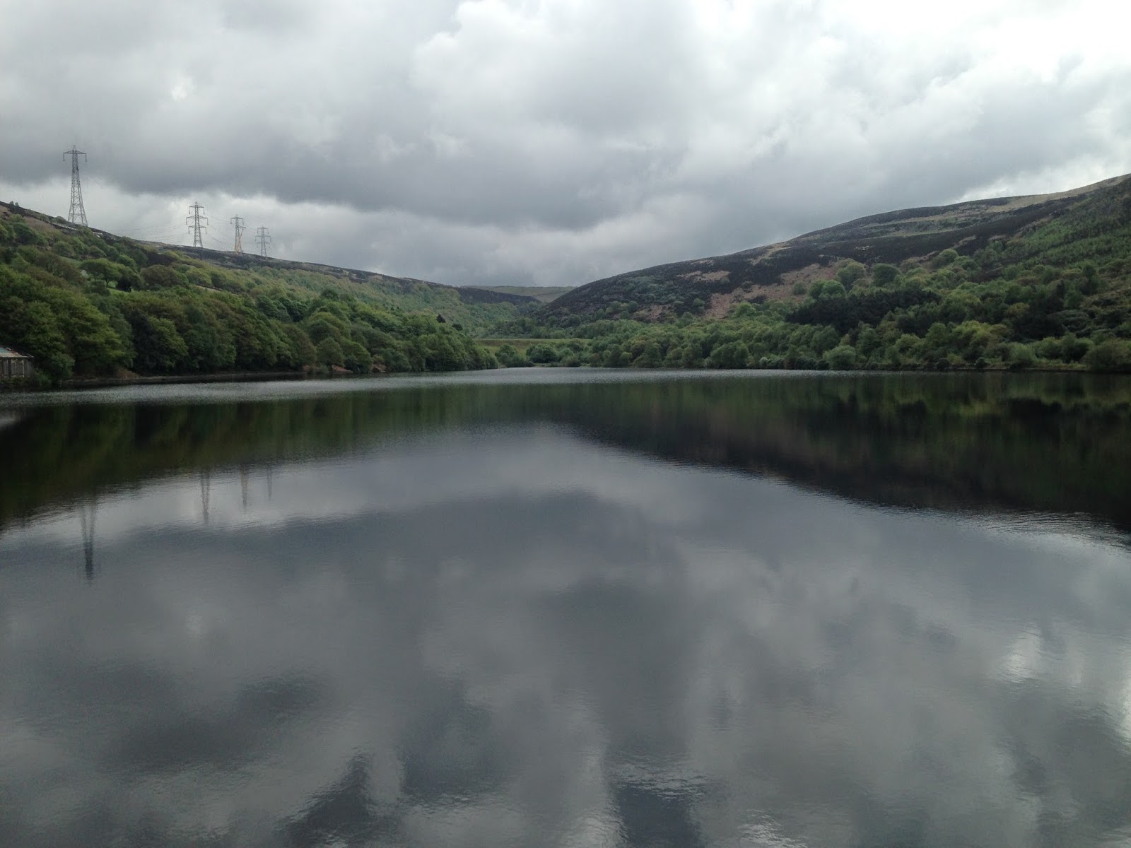
In spite of the beautiful weather we have been having of late I've not managed to get out as much as I would have liked, it's been a combination of factors ranging from a general ennui through to family get togethers, none-the-less I managed a couple of outings last week.
I headed off to Stalybridge Country Park on the Monday morning, a new area for me although I am reasonably familiar with the town. I parked at the foot of the Walkerwood Reservoir and before long was cutting through the Rhododendrons of Cock Wood. I carried onto Brushes Reservoir and then cut through the flower studded woodland and onto the main track. I climbed slowly but surely in the shadows of the men working on the new electricity pylons, this is a serious bit of engineering and (unfortunately) I suspect this area will be blighted by this project for some time to come. Having reached the twin Swineside Reservoirs (which I had previously visited from Tintwistle http://www.comewalkwithmeuk.co.uk/2013/05/another-weekly-wander-or-two.html) I then cut off into the peaty moorland for a bit of navigation practice. I gradually made my way up on to Harridge Pike where there were some excellent views towards Manchester. The rain clouds started to roll in at this point and I aimed off towards The Pennine Bridleway which I followed back round to the reservoirs after a short detour bought about by the work on the powerlines.
A couple of days later it was up to the Lake District. I pitched my tent at the fantastic Baysbrown campsite with wonderful views of the Langdale Pikes before heading into Ambleside where I met Graham for another night navigation. Great as it is to have the long Summer evenings it does make for late starts when night navving. We set off up onto Wansfell Pike at about 10pm and after nearly four hours of picking our way round the Troutbeck side of the hill finally headed back down about 2am. There is a lot of satisfaction in night navigation tiring as it is and mine was greatly enhanced this time by my new Black Diamond head torch which performed fantastically and has an amazing range. Breakfast the next morning at Bilbo's cafe in Ambleside comes very highly recommended. Two very different experiences, two enjoyable rambles and more navigation practice under my belt!
To view the full album please click on the link below;
https://www.facebook.com/media/set/?set=a.886120598070562.1073741864.597048676977757&type=1
Come walk with me aims to help you enjoy, and be inspired by, the magnificent British countryside
Total Pageviews
Showing posts with label Wansfell Pike. Show all posts
Monday, May 19, 2014
Friday, March 7, 2014
A long walk, a short walk and a night walk in the Lakes
5/6.3.14
Walking with; Graham
I have a tee shirt somewhere that bears the motto "Better a rainy day on the hill than a sunny one in the office" and it is a philosophy that I have strongly adhered to over the last few years, taking everything Mother Nature can throw at me and still smiling! However, there are the odd few occasions when it can be a bit of a struggle to feel the love, even with the alternative being the suit and tie 9-5.....
Day one got off to a niggly start when United Utilities had the temerity to charge me £7 to park on the muddied patch of waste ground at Steel End, to be frank, it's a bloody cheek. None-the-less it was a decent day and as I followed the path along Wyth Burn away from the road I eased into the walk enjoying the steady climb toward the snow capped Greenup Edge. I was using a 1:50000 scale map as I am trying out the different scales as part of my ML training and the lack of fine detail was noticeable as I followed a deep ghyll up towards Ullscarf. On the map there were only two streams shown whereas on the ground it was more than twice that.....still I made the summit of Ullscarf and crunched through the untrodden snow along the ridge line. I descended across more untouched snow fields to Standing Crag and then followed the seemingly unending fence line that whilst not appearing on my map appeared to run parallel to the marked right of way. The path junction I'd identified as a tick feature never appeared and pretty soon I was scanning the featureless, bleak, boggy marsh for a fix on where I was, eventually I decided that rise ahead of me was High Tove and that the fence line had effectively become a path in it's own right, albeit one unmarked on the larger scale map. It was unpleasant underfoot, each step sinking deep into the mire and sapping the energy and as soon as I made the trig at High Seat I decided I had had enough. I headed off the top and across more unforgiving marsh before making the knee crunching descent down Middlesteads Gill to the Thirlmere shore path from where it was a good 40min stroll back to the car and then onto the Windermere YHA, confusingly not in Windermere, but warm, friendly and serving Jenning's ale.....
"Put Wednesday behind you and move on I told myself....." Thursday was grim, proper low cloud, relentless drizzle that soaked through everything and negligible visibility. I made my way up Wansfell Pike, played around with my rope, bit of abseiling, belaying my rucksack etc, before the greyness became too oppressive and I made my way back down to Ambleside for coffee and warmth. It wasn't over yet.......I'd arranged via Facebook to meet Graham ( who goes by the web name Bearded Mountain. Man http://www.beardedmountainman.com/) for a night nav. If I wasn't an aspiring ML there'd be no way on earth you'd have dragged me out of The Golden Rule or The Mortal Man on a night like this with little to see and clothes starting to smell like a damp Retriever....but there you are, Loughrigg it was. Three hours of splashing through bogs seeking out ring contours, stream junctions and tiny tarns and sharing experiences of ML training and assessment meant the drizzle and gusty winds went almost unnoticed. Social media has been a very useful tool as I pursue my goal of becoming an ML and generous people like Graham who are willing to share their time and experience represent all of what is good about the outdoors community!
To view the full album please click on the link below;
https://www.facebook.com/media/set/?set=a.842344012448221.1073741853.597048676977757&type=1
Walking with; Graham
I have a tee shirt somewhere that bears the motto "Better a rainy day on the hill than a sunny one in the office" and it is a philosophy that I have strongly adhered to over the last few years, taking everything Mother Nature can throw at me and still smiling! However, there are the odd few occasions when it can be a bit of a struggle to feel the love, even with the alternative being the suit and tie 9-5.....
Day one got off to a niggly start when United Utilities had the temerity to charge me £7 to park on the muddied patch of waste ground at Steel End, to be frank, it's a bloody cheek. None-the-less it was a decent day and as I followed the path along Wyth Burn away from the road I eased into the walk enjoying the steady climb toward the snow capped Greenup Edge. I was using a 1:50000 scale map as I am trying out the different scales as part of my ML training and the lack of fine detail was noticeable as I followed a deep ghyll up towards Ullscarf. On the map there were only two streams shown whereas on the ground it was more than twice that.....still I made the summit of Ullscarf and crunched through the untrodden snow along the ridge line. I descended across more untouched snow fields to Standing Crag and then followed the seemingly unending fence line that whilst not appearing on my map appeared to run parallel to the marked right of way. The path junction I'd identified as a tick feature never appeared and pretty soon I was scanning the featureless, bleak, boggy marsh for a fix on where I was, eventually I decided that rise ahead of me was High Tove and that the fence line had effectively become a path in it's own right, albeit one unmarked on the larger scale map. It was unpleasant underfoot, each step sinking deep into the mire and sapping the energy and as soon as I made the trig at High Seat I decided I had had enough. I headed off the top and across more unforgiving marsh before making the knee crunching descent down Middlesteads Gill to the Thirlmere shore path from where it was a good 40min stroll back to the car and then onto the Windermere YHA, confusingly not in Windermere, but warm, friendly and serving Jenning's ale.....
"Put Wednesday behind you and move on I told myself....." Thursday was grim, proper low cloud, relentless drizzle that soaked through everything and negligible visibility. I made my way up Wansfell Pike, played around with my rope, bit of abseiling, belaying my rucksack etc, before the greyness became too oppressive and I made my way back down to Ambleside for coffee and warmth. It wasn't over yet.......I'd arranged via Facebook to meet Graham ( who goes by the web name Bearded Mountain. Man http://www.beardedmountainman.com/) for a night nav. If I wasn't an aspiring ML there'd be no way on earth you'd have dragged me out of The Golden Rule or The Mortal Man on a night like this with little to see and clothes starting to smell like a damp Retriever....but there you are, Loughrigg it was. Three hours of splashing through bogs seeking out ring contours, stream junctions and tiny tarns and sharing experiences of ML training and assessment meant the drizzle and gusty winds went almost unnoticed. Social media has been a very useful tool as I pursue my goal of becoming an ML and generous people like Graham who are willing to share their time and experience represent all of what is good about the outdoors community!
To view the full album please click on the link below;
https://www.facebook.com/media/set/?set=a.842344012448221.1073741853.597048676977757&type=1
Labels:
Bearded mountain man,
Blea Tarn,
Come walk with me,
High Seat,
High Tove,
Lake District,
Lake district walks,
Loughrigg,
ML training,
moorland,
Night Nav,
Thirlmere,
Ullscarf,
Wansfell Pike,
Windermere YHA
Tuesday, January 28, 2014
Three Lake District walks
21/22/23.1.14
Walking with; Rob
So far, this Winter, south of the border at least, has been characterised by a disappointing lack of the white stuff on the ground. January walks in the Lake District should be about blue skies and crisp ground underfoot, not grey skies and swampy conditions, none the less, three days of back to back walking was just too good an opportunity to pass up.
For the first of my three walks I wanted to try somewhere different, somewhere I was unlikely to bump into many others, somewhere off the beaten track...Lorton Fells fitted the bill admirably, even more so when it was revealed to me that the Whinlatter Pass was closed reducing access only to those determined enough to take the lengthy detour via Cockermouth. The area is heavily forested but it didn't take long to get above the treeline and make my way onto the blowy top of Lord's Seat. Although it only stands at 552m the views belie the relative lack of height. Skiddaw, head in the clouds loomed to the East, Keswick and Derwentwater sat to the South and across the Solway Firth Scotland was visible in the distance. I dropped down onto the delightfully named Barf where the views of Bassenthwaite opened out even further before contouring round below Lord's Seat and continuing along the fine ridge to Broom Fell and lunching in the stone shelter below the impressive cairn. The ridge then drops gradually to the Darling How Plantation and from there it was a short scramble to the top of Graystones where the strong winds were joined by not inconsiderable rain. A quick detour onto the top of Kirk Fell and then it was down the perilously steep slope to Scawgill Bridge and a gentle wander through the trees to Spout Force which (thanks to the incessant rain) was looking truly impressive. With the rain now thoroughly persisting it down, the logical decision was back to Keswick and the sweet, beery embrace of "The Dog and Gun".
After a night of purgatorial wakefulness thanks to the "World's Loudest Snorer" who had holed up in the same dorm as me at the Keswick YHA, Rob picked me up and we headed off towards Catbells, another fell that punches well above it's weight in the effort to view ratio. We took the path leading up to the summit over Skelgill Bank and then carried on to Bull Crag and across Maiden Moor. Apparently the Beatrix Potter character Mrs Tiggywinkle lived in a burrow somewhere on the fells, but we saw no sign of hedgehogs, just a couple of Ravens and a Kestrel sitting in the wind. Last time I'd been on High Spy I was barely able to stand http://www.comewalkwithmeuk.co.uk/2013/04/a-wet-wild-and-windy-lakeland-trip.html , and whilst it wasn't exactly sunbathing weather, it was a little more benign this time around. Tongue Gill was in full spate as we made our knee crunching descent before following the path back past Castle Crag to our starting point.
Unable to face another night with the king of the snorers, I'd changed hostel (Ambleside) and pub (The Unicorn) and spent a far better night. Stockghyll Force was looking as impressive as Spout Force had a few days before as I climbed out of Ambleside and up onto Wansfell Pike. The summit is well won from the West and it was a steep climb made a little easier by the views to the snowy tops of the Kentmere Fells and Red Screes. Attaining the top I followed the ridge North East and then crossed the boggy fields below Idle Hill to eventually reach "The Kirkstone Pass Inn" just as the snow started to fall. Records for this venerable building date back to 1496 and it was a welcome sight as Red Screes disappeared from view in a flurry of falling snow. After stretching out a coffee and comparing notes with another sheltering soul I decided against my original plan of scrambling the snowy gullies of Red Screes and made my way back down to Ambleside via High Grove. The abandoned building at High Grove looked like something out of a horror film with a smashed up caravan and the depressing detritus of an uncared for, semi-abandoned farm building. About a mile before the town, I was hit by a broadside of vicious sleet and hail which had me scrambling for the nearby shelter of a jerrybuilt stone wall, but by the time I made the bottom of the hill there was sunshine over the Kirkstone pass once more!
To view the full album, please click on the link below;
https://www.facebook.com/media/set/?set=a.814428701906419.1073741846.597048676977757&type=1
Walking with; Rob
So far, this Winter, south of the border at least, has been characterised by a disappointing lack of the white stuff on the ground. January walks in the Lake District should be about blue skies and crisp ground underfoot, not grey skies and swampy conditions, none the less, three days of back to back walking was just too good an opportunity to pass up.
For the first of my three walks I wanted to try somewhere different, somewhere I was unlikely to bump into many others, somewhere off the beaten track...Lorton Fells fitted the bill admirably, even more so when it was revealed to me that the Whinlatter Pass was closed reducing access only to those determined enough to take the lengthy detour via Cockermouth. The area is heavily forested but it didn't take long to get above the treeline and make my way onto the blowy top of Lord's Seat. Although it only stands at 552m the views belie the relative lack of height. Skiddaw, head in the clouds loomed to the East, Keswick and Derwentwater sat to the South and across the Solway Firth Scotland was visible in the distance. I dropped down onto the delightfully named Barf where the views of Bassenthwaite opened out even further before contouring round below Lord's Seat and continuing along the fine ridge to Broom Fell and lunching in the stone shelter below the impressive cairn. The ridge then drops gradually to the Darling How Plantation and from there it was a short scramble to the top of Graystones where the strong winds were joined by not inconsiderable rain. A quick detour onto the top of Kirk Fell and then it was down the perilously steep slope to Scawgill Bridge and a gentle wander through the trees to Spout Force which (thanks to the incessant rain) was looking truly impressive. With the rain now thoroughly persisting it down, the logical decision was back to Keswick and the sweet, beery embrace of "The Dog and Gun".
After a night of purgatorial wakefulness thanks to the "World's Loudest Snorer" who had holed up in the same dorm as me at the Keswick YHA, Rob picked me up and we headed off towards Catbells, another fell that punches well above it's weight in the effort to view ratio. We took the path leading up to the summit over Skelgill Bank and then carried on to Bull Crag and across Maiden Moor. Apparently the Beatrix Potter character Mrs Tiggywinkle lived in a burrow somewhere on the fells, but we saw no sign of hedgehogs, just a couple of Ravens and a Kestrel sitting in the wind. Last time I'd been on High Spy I was barely able to stand http://www.comewalkwithmeuk.co.uk/2013/04/a-wet-wild-and-windy-lakeland-trip.html , and whilst it wasn't exactly sunbathing weather, it was a little more benign this time around. Tongue Gill was in full spate as we made our knee crunching descent before following the path back past Castle Crag to our starting point.
Unable to face another night with the king of the snorers, I'd changed hostel (Ambleside) and pub (The Unicorn) and spent a far better night. Stockghyll Force was looking as impressive as Spout Force had a few days before as I climbed out of Ambleside and up onto Wansfell Pike. The summit is well won from the West and it was a steep climb made a little easier by the views to the snowy tops of the Kentmere Fells and Red Screes. Attaining the top I followed the ridge North East and then crossed the boggy fields below Idle Hill to eventually reach "The Kirkstone Pass Inn" just as the snow started to fall. Records for this venerable building date back to 1496 and it was a welcome sight as Red Screes disappeared from view in a flurry of falling snow. After stretching out a coffee and comparing notes with another sheltering soul I decided against my original plan of scrambling the snowy gullies of Red Screes and made my way back down to Ambleside via High Grove. The abandoned building at High Grove looked like something out of a horror film with a smashed up caravan and the depressing detritus of an uncared for, semi-abandoned farm building. About a mile before the town, I was hit by a broadside of vicious sleet and hail which had me scrambling for the nearby shelter of a jerrybuilt stone wall, but by the time I made the bottom of the hill there was sunshine over the Kirkstone pass once more!
To view the full album, please click on the link below;
https://www.facebook.com/media/set/?set=a.814428701906419.1073741846.597048676977757&type=1
Monday, February 11, 2013
First Lakeland trip of 2013
6/7.2.13
Walking with; Nobody
The Lake District in the snow is just about the best place to be in England so after a Monday snowfall I decided to head up there for an overnight trip staying at the Windermere YHA on the Troutbeck Road (http://www.yha.org.uk/hostel/windermere) . I got up there not long before lunch on the Wednesday and having parked up just outside Troutbeck set off up Robin Lane towards the snow sprinkled top of Wansfell Pike. As the path slowly climbed, the views across Windermere to the snow capped peaks beyond became ever more impressive. I turned onto Hundreds Road and then was out in open moorland and admiring the views across to Yoke and Ill Bell. The path was pretty iced up as I ascended steadily towards the South Western summit. The name Wansfell is believed to have been derived from the Old Norse for Woden's Fell and with the wind whipping across the ridge reddening the face and making the eyes water it had a distinctly Scandanavian feel to it!
I began the descent down to Ambleside, the path remaining slippery underfoot, and after meeting a few people struggling up the slope I arrived in the park around Stockghyll Force. Stock Ghyll is a tributary of the River Rothay and the falls tumble 70 feet towards the town through a pretty wooded vale. After browsing a few of the plethora of outdoor shops I settled on a pint at "The Royal Oak" and worked out my route back. Leaving Ambleside via Skelghyll Woods, the path passed the remote farm at High Skelghyll before leading back round towards Robin Lane. The sun was still shining though and I wasn't quite ready for home so added a loop via Wood Farm and Middlerigg Tarn (Goldeneyes, Pochard and Mute Swans) before heading back to the car and then the hostel via an hour of sitting in front of a crackling log fire at the fantastic "Mortal Man" pub (http://www.themortalman.co.uk/).
I was up early the next morning and parking my car in the layby next to Kentmere church just after 8am. Nowadays Kentmere is a tiny hamlet full of beautiful cottages but very remote, but it has an illustrious history and the fortified tower of Kentmere Hall is still a visible reminder of times past. The Gilpin family (who came over with William the Conquerer) owned the hall for 12 generations before all of it except the tower was destroyed by Cromwell's forces during the Civil War. The churchyard still contains the graves of the few hardy families who settled this area and there were a number of memorials to "Yeomans" (free man owning his own farm).
The Garburn Pass was slippery underfoot but as I set off I saw a herd of deer on the skyline which buoyed my spirits and by the time I was trudging through the snow towards the summit of Yoke the sun was peeking out through the clouds and a couple of other hardy walkers could be seen in the distance. The ridge walk from Yoke over Ill Bell and Froswick to Bleathwaite Crags was awesome......stunning scenery, deep snow making for challenging walking and almost complete silence. The route to Mardale Ill Bell was through even deeper snow and by the time I reached Nan Bield Pass I was both exhausted and felt I'd been genuinely challenged! I clambered up the steep slope onto Harter Fell with it's distinctive cairn spiked with metal and then continued across the exposed moorland through more deep snow to Kentmere Pike my final summit of the day. A little off piste descending scared both myself and the odd sheep before I finally made my way back to the edge of Kentmere and wound my way through the hamlet back to my car and a very welcome cup of coffee.
The Kentmere Round is a genuinely stunning walk and I would highly recommend it. It was challenging in winter conditions and it wouldn't be a place to be out if you were underequipped, but the views from Windermere to Haweswater are more than ample reward!
To view the full album please click on the link below;
https://www.facebook.com/#!/media/set/?set=oa.337197503065828&type=1
Walking with; Nobody
The Lake District in the snow is just about the best place to be in England so after a Monday snowfall I decided to head up there for an overnight trip staying at the Windermere YHA on the Troutbeck Road (http://www.yha.org.uk/hostel/windermere) . I got up there not long before lunch on the Wednesday and having parked up just outside Troutbeck set off up Robin Lane towards the snow sprinkled top of Wansfell Pike. As the path slowly climbed, the views across Windermere to the snow capped peaks beyond became ever more impressive. I turned onto Hundreds Road and then was out in open moorland and admiring the views across to Yoke and Ill Bell. The path was pretty iced up as I ascended steadily towards the South Western summit. The name Wansfell is believed to have been derived from the Old Norse for Woden's Fell and with the wind whipping across the ridge reddening the face and making the eyes water it had a distinctly Scandanavian feel to it!
I began the descent down to Ambleside, the path remaining slippery underfoot, and after meeting a few people struggling up the slope I arrived in the park around Stockghyll Force. Stock Ghyll is a tributary of the River Rothay and the falls tumble 70 feet towards the town through a pretty wooded vale. After browsing a few of the plethora of outdoor shops I settled on a pint at "The Royal Oak" and worked out my route back. Leaving Ambleside via Skelghyll Woods, the path passed the remote farm at High Skelghyll before leading back round towards Robin Lane. The sun was still shining though and I wasn't quite ready for home so added a loop via Wood Farm and Middlerigg Tarn (Goldeneyes, Pochard and Mute Swans) before heading back to the car and then the hostel via an hour of sitting in front of a crackling log fire at the fantastic "Mortal Man" pub (http://www.themortalman.co.uk/).
I was up early the next morning and parking my car in the layby next to Kentmere church just after 8am. Nowadays Kentmere is a tiny hamlet full of beautiful cottages but very remote, but it has an illustrious history and the fortified tower of Kentmere Hall is still a visible reminder of times past. The Gilpin family (who came over with William the Conquerer) owned the hall for 12 generations before all of it except the tower was destroyed by Cromwell's forces during the Civil War. The churchyard still contains the graves of the few hardy families who settled this area and there were a number of memorials to "Yeomans" (free man owning his own farm).
The Garburn Pass was slippery underfoot but as I set off I saw a herd of deer on the skyline which buoyed my spirits and by the time I was trudging through the snow towards the summit of Yoke the sun was peeking out through the clouds and a couple of other hardy walkers could be seen in the distance. The ridge walk from Yoke over Ill Bell and Froswick to Bleathwaite Crags was awesome......stunning scenery, deep snow making for challenging walking and almost complete silence. The route to Mardale Ill Bell was through even deeper snow and by the time I reached Nan Bield Pass I was both exhausted and felt I'd been genuinely challenged! I clambered up the steep slope onto Harter Fell with it's distinctive cairn spiked with metal and then continued across the exposed moorland through more deep snow to Kentmere Pike my final summit of the day. A little off piste descending scared both myself and the odd sheep before I finally made my way back to the edge of Kentmere and wound my way through the hamlet back to my car and a very welcome cup of coffee.
The Kentmere Round is a genuinely stunning walk and I would highly recommend it. It was challenging in winter conditions and it wouldn't be a place to be out if you were underequipped, but the views from Windermere to Haweswater are more than ample reward!
To view the full album please click on the link below;
https://www.facebook.com/#!/media/set/?set=oa.337197503065828&type=1
Labels:
Ambleside,
Come walk with me,
Garburn Pass,
Harter Fell,
Ill Bell,
Kentmere Round,
Lake District,
Nan Bield Pass,
National park,
Stockghyll force,
Troutbeck,
Wainwright,
Wansfell Pike,
Yoke
Subscribe to:
Posts (Atom)