Total Pageviews

Showing posts with label Langdale. Show all posts

Wednesday, February 5, 2014

Grasmere to Langdale in the snow!

31.1.14/1.2.14
Walking with; Gareth and Lawrence


Gareth and Lawrence had travelled up from the balmy South to see what Winter weather the Lakes could throw at them and, luckily, the weekend didn't disappoint. We rolled into Grasmere about 7pm and headed out straightaway  on a night nav. In spite of the cloud cover the snow was reflecting the ambient light which made things a bit easier as we picked our way around Wray Gill and the edge of Brigstone Moss. Even with the snow it was warm work and by the time we headed back to the YHA Lawrence was stripped down to his t-shirt!
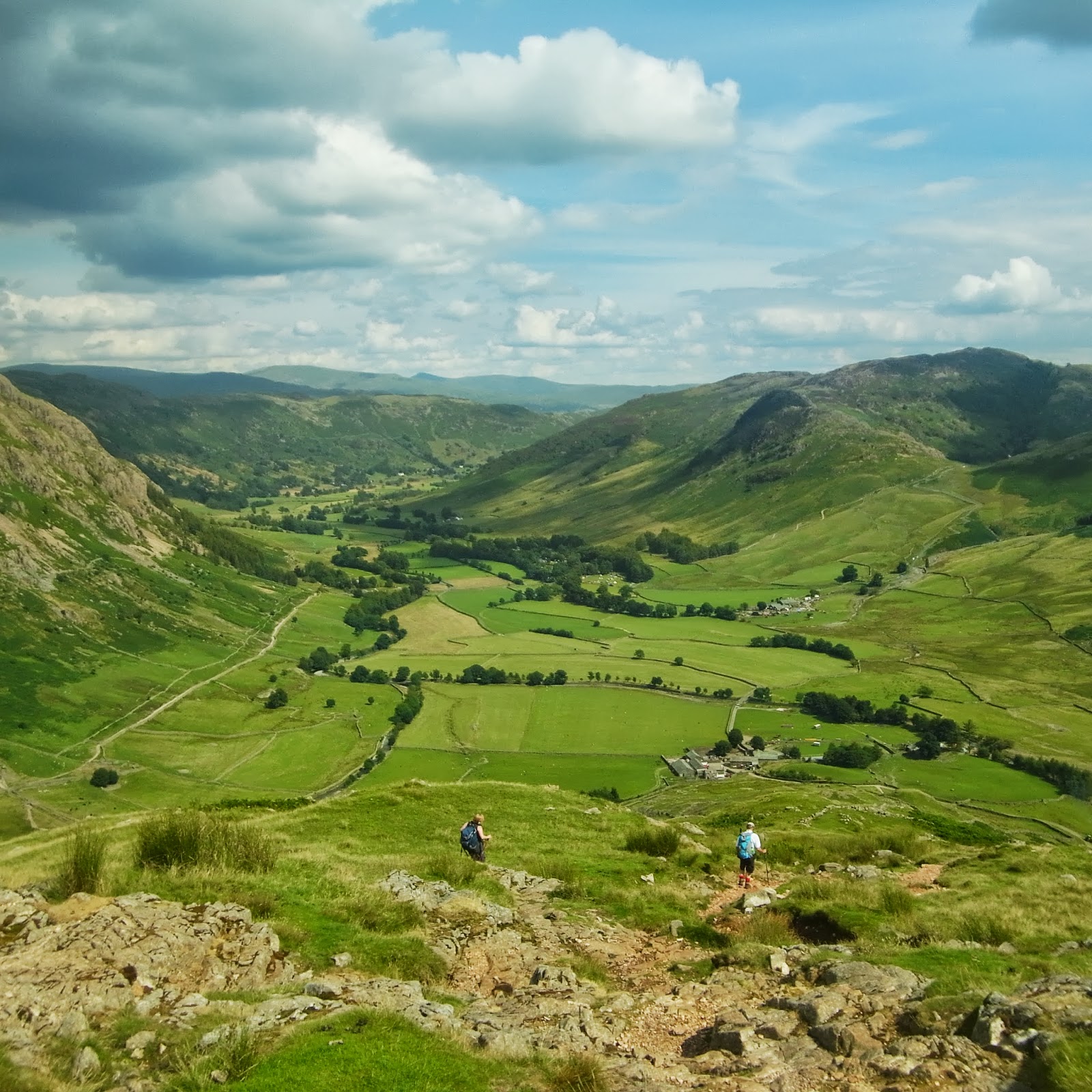
YHA Grasmere has the best staff in the Lakes and buoyed by a good night's kip and a solid breakfast we kitted up and headed down Easedale taking in the snowy views that had been denied us the night before. It was slippery underfoot but we followed Blindtarn Gill up towards Swinescar Pike and skirted Lang How to the three tarns area where the snow really hit. We were looking down into Langdale but the snow was blowing upwards and we were being blown about pretty severely as we traversed across the slopes before slip-sliding our way down to the valley floor. In Langdale the snow turned to a steady drizzle and the Pikes themselves winked in and out of the clouds as we followed the Cumbria Way through Baysbrown. Once "The Wainwrights Inn" http://www.langdale.co.uk/dine/wainwrights/ loomed into view it was a no brainer and we took shelter, dried out a bit of kit in front of the fire and made the most of a restorative pint!
Fortified by this we carried on along Great Langdale Beck before cutting across Walthwaite Bottom and skirting Huntingstile Crag on our way to Loughrigg Terrace. As we started the ascent of Loughrigg we met a couple of walkers who'd decided the wind was too strong and had turned back but undeterred we pressed onwards. When the wind did hit it hit hard, given we were at little more than 300 metres at that stage I can't imagine what it must have been like on the tops....we took the buffeting for a little while before dropping down towards Rydal Water and Grasmere and meandering back along the shoreline with great views of Goosander and Tufted Ducks. A night in "Tweedie's bar" http://www.langdale.co.uk/dine/wainwrights/ consisted of great food, a log fire, live music and plenty of good beer, just what the Doctor ordered after a Wintery day on the hill!

To view the full album please click on the link below; https://www.facebook.com/media/set/?set=a.818191788196777.1073741848.597048676977757&type=1

Saturday, August 10, 2013

Honister, Great Langdale and points in between

6-8/8/13
Walking with; Nobody/Nathan 


Not being in possession of either children or gainful employment I'd kind of forgotten how the Summer holidays affect the Lake District. There are hills best avoided under these conditions and yet I'd already planned a roughish selection of wanderings to occupy me over three days and I was loathe to stray too far from my prescribed ideas. Whilst it was considerably busier than usual I was fortunate that a little judicious route selection and some reasonably timed starts minimised the amount of contact I was required to have with the many hundreds thronging the fells!
Day one started at the prohibitively priced NT car park in Seatoller. I'd been a member once and when they tried to strong arm us into renewing the subscription they wanted £92 for a couple, the exorbitant fees are clearly the latest example of strong arming people into membership...Heading off up Thorneythwaite Fell (try saying that after a pint or three of Snecklifter) I was soon being treated to views of Derwentwater and the crags above Comb Gill. I was heading for Glaramara, a previous attempt had had to be aborted due to the depth of snow http://www.comewalkwithmeuk.co.uk/2012/12/borrowdaleand-snow.html, so I was keen to get it under my belt. The final gentle scramble onto the summit proved very rewarding, two hours in to my Lakeland August odyssey and still not a soul to be seen! I was experimenting with a 1:50000 scale OS in order to sharpen my identification of contours but my brain hadn't quite computed the full repercussions so the wander over to Allen Crags took me twice as long as I had convinced myself it would. Arriving at the Crags and with Great End and Esk Hause in clear view I discovered where all the Summer visitors had been, it was akin to Oxford Street in December, people (and dogs) here, there and everywhere! The path most being trodden appeared to be the one towards Scafell Pike but I dropped off it and headed over to Great End for magnificent views and some close inspection by a rescue chopper which circled the summit for some time. Leaving the tops I followed Ruddy Gill down to Seathwaite and then tramped along The Allerdale Ramble back to Seatoller from where I headed up to the YHA at Honister. Whilst it may be that the hostel could do with a lick of paint and a wee bit of TLC, the staff were friendly, the beer cold and the views spectacular all for the price of a good bottle of wine!
The next morning started with the steep haul up Grey Knotts where I snapped a sure fire winner for the "Trail magazine-Face of Fatigue". The top was reached and the vistas opened out in all directions, Borrowdale, Buttermere, Ennerdale, the heart of the Lakes. The walking over Brandreth and upto Green Gable was gentle and I slipped and slid my way down the Aaron Slack for a bite to eat at Styhead Tarn. Last time I'd been here the snow was knee deep and I'd had the place pretty much to myself, but by lunchtime on a Thursday in August there were already two tents pitched and a plethora of walkers milling about. I headed on up and before too long was escaping the bulk of the crowds once more and slowly ascending Esk Pike for more views back towards England's highest peak. I had one more peak in mind for the day, Bowfell, which I duly meandered up before the descent to the Three Tarns and then down the knee crunching The Band to arrive in Great Langdale with the sun shining and the lure of a good pint foremost in my mind. Tent pitched and chilli cooked it was time to head off to "The Old Dungeon Ghyll" and then "The Stickleback" to refresh myself with a couple of pints of Esthwaite Ale and Loweswater Gold!
Nathan had come across to join me for the Thursday. We headed off into Mickleden and began the brutal climb up Rossett Pike, this was made slightly less arduous for us by the sight of eight gents hefting their mountain bikes up and over the summit, respect due. We carried on to Angle Tarn and gradually ascended to Esk Hause where perched upon one of the shelter walls I found the Guinness cap that I had inadvertently left there the afternoon before! Honest bunch walkers? Or perhaps the sweat stained soiled and grubby cap hadn't proved enough of a prize for anyone to covet, who knows? We'd decided to do a traverse around Great Gable and stopped opposite Lingmell for a bit of rope work practice, still one of my bete noirs! The traverse was spectacular, crossing the screes with stunning views down Wasdale and we eventually ended up at Beck Head from where we made our way back towards Honister with some truly awesome views back down Ennerdale and towards Buttermere and Crummock Water.
Even in the height of Summer there are still plenty of spots where it's possible to find a little Lakeland solitude and the sunshine and the views made this three of my favourite days out so far this year! All that being said, roll on September and the hills to myself once more!

Monday, October 8, 2012

A Langdale Round involving lots of Pikes and Stickles

4.10.12
Walking with; Nobody


Definition of PIKE

dialect English
: a mountain or hill having a peaked summit —used especially in place names

Origin of PIKE

Middle English, perhaps of Scandinavian origin; akin to Norwegian dialect pīk pointed mountain
First Known Use: 13th century

As I sat in Windermere Youth Hostel trying to drown out the din of a school group involved in noisily debating the merits of their quiz answers, I poured myself a glass of Jennings fine Cockerhoop beer and fell to reading, as one does in these situations, an ancient back edition of "TGO" or "Trail". A feature caught my eye on the differing names for mountains in the different parts of the UK and I read on intrigued by the world of Fells, Pikes and Tors. It hardened my resolve to visit Langdale the next morning and take in a round including both the Pikes of Blisco and Stickle!
   I parked at Blea Tarn and managed to time my setting off to perfectly coincide with a shower, but the views back to the Pike of Stickle were already spectacular. Striking off towards the Wrynose Pass the ground was sodden and water was running off the mountain but as I climbed the road I emerged out of cloud as I started to ascend the back of Blisco. The cloud inversion was spectacular, one of the best I've ever seen (up there with Alp D'Huez and the Queen Charlotte Track in NZ) and once I was through it the Pike of Blisco sat bathed in sunlight. The wind on the top was strong and chill so after a brief consultation with the map I left my fellow summmit baggers and descended to Red Tarn and then down, down and still further down in the shadow of Great Knott to the valley floor where my screaming knees were finally rested. I proceded into Mickleden and began the long, slow ascent up Stake Pass where I stopped for refuelling with a great view of Blisco across the valley. I continued on to Martcrag Moor, defined by Wainwright as demarcating the edge of the Central Fells and, today (and I suspect everyday), very heavy underfoot. As I tramped ever forward I was met with more rain and then a rainbow as I climbed up towards the Pike of Stickle. The rain had left the rock very greasy and a few would-be summiters were turning back but I slid and scrambled and as much by luck as judgement ended up alone on the top with views of my whole route so far and onto Windermere in the distance.
 
 Harrison Stickle awaited and then onwards downhill, with more creaking knees, to Stickle Tarn, sat in the magnificent shadow of Pavey Arc. The path down Stickle Ghyll showcased a pair of Raven and some beautiful, vibrant Rowan berries but was very slippery and I was glad to reach Langdale and the Dungeon Ghylls once more. Tempted as I was by a pint in either of the esteemed hotels I pressed on below Side Pike and back along the atmospheric shores of the tarn. Post walk refreshment had to wait until "The Britannia Inn" in Elterwater, but the wait was very well worth it!

To view the full photo album please click on the link below;
https://www.facebook.com/groups/136991043086476/#!/media/set/?set=oa.279299808855598&type=1

Monday, July 16, 2012

Elterwater and Skelwith Force

14.7.12
Walking with; Ruthy


Two weeks since my hernia op and I felt it was about time that I got back out there, albeit in a gentle, non-strenuous manner. This undemanding perambulation in Langdale hit the spot and, in spite of the occasional shower, finished with a pint in the sunshine.....
The name Elterwater is believed to have derived from the Norse for Swan Lake and although we didn't see any swans until the next day in Coniston, the birdlife was good on the walk with plenty of Swallows, Grey Wagtails and a beautiful Redstart all popping up en route. There were also some magnificent Oak and Beech trees occupying some rare, undisturbed patches of English woodland. We set off from the village and left the Coniston Road before climbing up an increasingly rough track that led through the margin of Sawrey's Wood. The woodland opened out and we followed a path that skirted a well flowered hay meadow and allowed great views of the Coniston Fells down towards Little Langdale where the rain started to fall. We pressed onto Stang End Farm enjoying the views of the Brathay Valley and being glad we weren't buried in the thick cloud coating the Peaks that were visible through the drizzle. We continued to follow the river through woodland until the sound of crashing water alerted us to the fact we'd arrived at Colwith Force where the Brathay falls about 40 feet to the valley floor over a series of narrow cataracts.
We continued on along The Cumbria Way and down to Skelwith Bridge where we watched the Wagtails for a while before venturing through the yard of Kirkstone Slate Gallery to Skelwith Force. Whilst the falls here are much smaller than Colwith, the passage the water is forced through is very narrow and the river thunders through here throwing up clouds of spray, even the wettest Summer anyone can remember has some benefits !! From the falls the path meanders along the bank of the Brathay to Elterwater with stunning views of the Langdale Pikes, surely one of the most evocative of all Lakeland views. Leaving Elterwater behind we passed a very angry cow, admired the redstart as he stayed a couple of fenceposts ahead of us all the way to the carpark and then, just as the sunshine made a welcome reappearance, crossed to the excellent Britannia Inn for a pint of their eponymous bitter! http://lakedistrictinn.com/

To view the full album for this walk please follow the link below;
https://www.facebook.com/#!/media/set/?set=oa.249340331851546&type=1