13-15.5.13
Walking with; Nobody
Off to the Lakes again for comprehensive proof that in spite of last week's Bank Holiday sunshine in Wales, Britain seems reluctant to shake off Winter just yet. I spent the morning in Ambleside touring the gear shops in search of a new jacket, I eventually settled on the Montane Superfly which will be getting it's first outing next week as I am somewhat superstitious about throwing a new garment directly into the fray. Lunch done, I decided to drive up to Kirkstone Pass and have a go at Red Screes which I'd seen from the other side on my Fairfield Horseshoe route http://www.comewalkwithmeuk.co.uk/2012/10/the-fairfield-horseshoe.html. The ascent from the Kirkstone Pass Inn took on some of the eponymous screes and there was a fair amount of judicious route picking and minor scrambling all of which made the sudden appearance of the summit very satisfying. Wainwright claims that the cairn atop Red Screes is the largest of the Eastern Fells and it provided a degree of shelter from the wind which had started whipping hailstones across the tops somewhat lessening my enjoyment of the spectacular views back towards Windermere, across to Fairfield and down to Brothers Water. I decided that discretion might well be the better part of valour at this stage and headed (with the wind battering at my back) down the broad ridge of Middle Dodd before slipsliding my way down to Kirkstone Beck and with the hail now turned to a wet sleet I was very happy to see the ancient inn ahead of me as I crested the final slope. The pub is reckoned to date back to the Fifteenth Century and is listed as the third highest inn in England, it's certainly an attractive building and the fire was burning as I supped a restorative pint, very welcome. I spent the night at the Ambleside Backpackers which I can heartily recommend http://www.englishlakesbackpackers.co.uk/ after a few pints at The Gilded Lily!
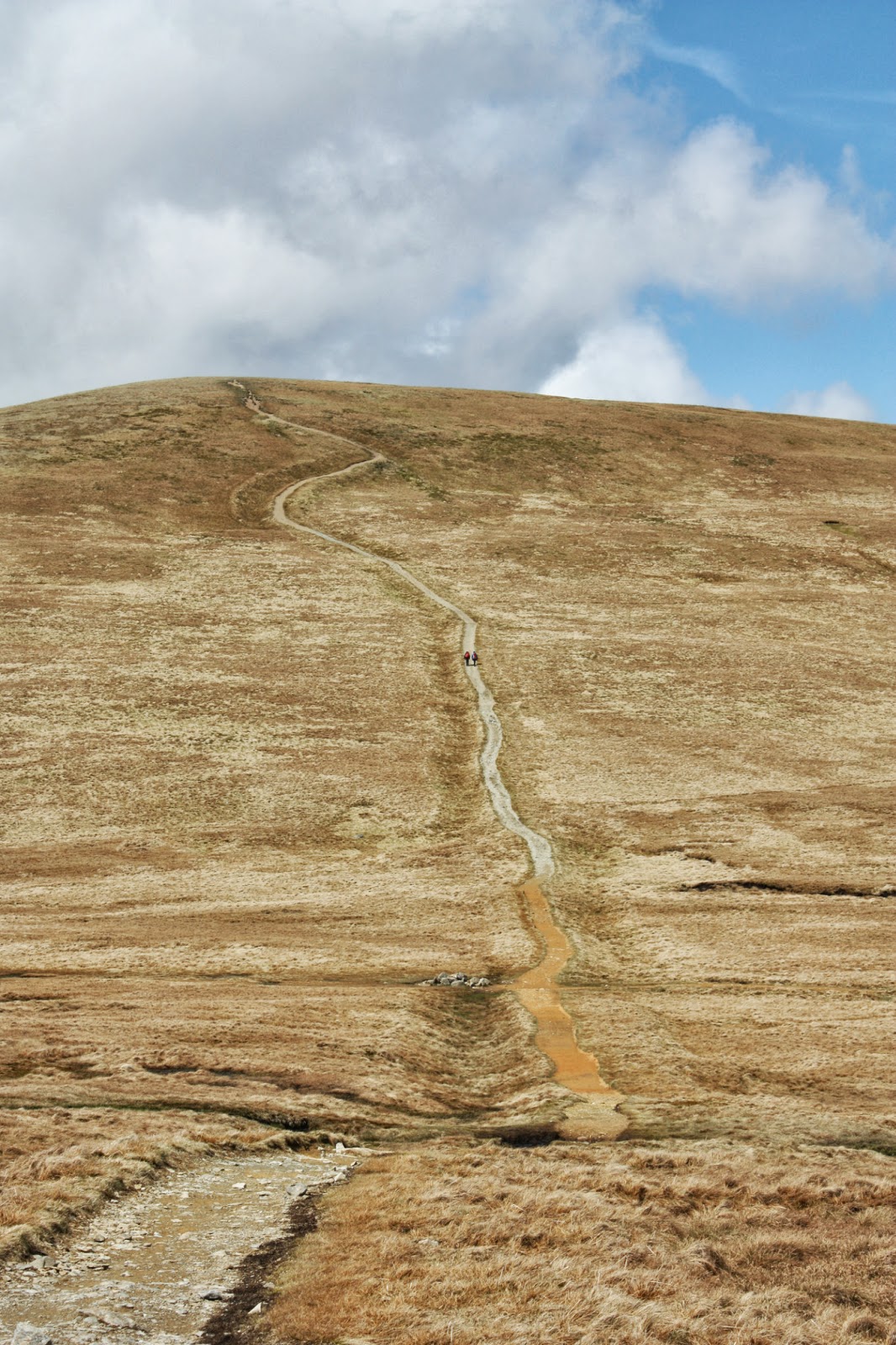
I have a few dirty little secrets; I like JLS and Bombay Bad Boy Pot Noodles, but, perhaps the worst of them was, that for someone describing themselves as a passionate hillwalker I had never climbed Helvellyn....well, that has at least been rectified! I decided to take the easy way up and parked at the exorbitantly expensive Wythburn car park next to the beautiful little church that served the community of Wythburn before it was drowned under the waters of Thirlmere. Coleridge and Wordsworth both mention the building and I found it a lovely, poignant spot. I followed the path running parallel to Comb Gill and then skirting below the peak of Nethermost Pike which afforded excellent views of Thirlmere and the Western Fells and then as the path levelled out there was Striding Edge with a couple of brave souls picking their way along it. There was fresh snow on the top and a bitter wind and the cross shaped shelter was well populated, the sky was clear though and the views to Ullswater and beyond were worth every ounce of effort. I followed the edge of the busy summit and headed down past Lower Man and along the ridge to White Side (for lunch) and then onto Raise. It was at this stage the sun came out and ......stayed out. I took off my jacket, smiled for a little while and then meandered onto Stybarrow Dodd for a wee spot of rest looking out of miles and miles of beautifully scenic countryside that yesterday would have been completely invisible! Time was ticking on so I headed down the increasingly sheer and stunningly beautiful Stanah Gill until reaching the path that ran parallel to the lakeside road, flitting in and out of the pine forest (spotting my first Chiffchaff of the year) until I reached the welcome sanctuary of my car! I spent the night at the YHA in Hawkshead http://www.yha.org.uk/hostel/hawkshead catching up with my friend Rob, whom I'd worked with at Castleton last year. He introduced me to the joys of Loweswater Gold at The King's Arms in the picturesque village for which I am very thankful!
Wednesday morning started grey and very quickly progressed to wet and by the time I was on my way up the Coniston Fells, Wetherlam my quarry for the day, wet and windy. The cloud got lower, the wind got higher and I got wetter.....and wetter....and (you guessed it) wetter......Summiting was satisfying, not pleasurable, so I abandoned plans to carry on to Swirl How, and with the wind doing it's very level best to lift me off my feet, I headed down Low Wether Crag, past Levers Water and back towards the Coppermines and a cup of something hot.
Three days, three different walks, and just about every kind of weather chucked at me......roll on next week!
To view the full album, please click on the link below;
https://www.facebook.com/#!/media/set/?set=oa.384532758332302&type=1
Come walk with me aims to help you enjoy, and be inspired by, the magnificent British countryside
Total Pageviews
Showing posts with label walk. Show all posts
Friday, May 17, 2013
Four seasons in one trip
Labels:
Comb Gill,
Come walk with me,
Coniston,
Hawkshead,
Helvellyn,
Kirkstone Pass,
Lake District,
Levers Water,
Middle Dodd,
Montane Superfly,
Raise,
Red Screes,
Stybarrow Dodd,
Thirlmere,
walk,
Weatherlam,
Wythburn,
YHA
Monday, February 4, 2013
Rushup Edge to Hayfield
3.2.13
Walking with; Ruth, Emily and Roz
Some of the more observant amongst you may have noticed that whilst the blog is called Come walk with me, for many of my wanderings, I tend to wander alone! This is partially as a result of me generally walking during the week when other people are working and partially because I enjoy walking on my own. However, I am in the process of trying to become a Mountain Leader and that, of course, requires leading people, so many thanks to Ruthy, Emily and Roz for being willing guinea pigs in this experiment!
We set off, in pretty miserable conditions from Rushup Edge and after slipping and sliding on the first iced up half mile of the Pennine Bridleway we disappeared into thick mist. It was muddy going underfoot and the Bridleway provides the additional hazard of avoiding hurtling hordes of mountain bikers, but early progress was predominantly "head down, hoods up and aim into the wind!". After crossing the wooded stream at Bolehill Clough we descended to Roych Clough where the cloud thinned and we paused for a sandwich ahead of the climb up to South Head. The slope up to South Head is brutal and the wind on the top was gale force, but the lure of getting to the top of the highest point on the main route was too good a chance to miss and with Roz leading the way we ascended to the summit for a good view of the clouds and all cobwebs to be very decisively blown away!
We slid (literally in Ruthy's case) back down to the Bridleway and continued a gradual descent out of the clouds circumventing Mount Famine (try as I might I have been unable to find out where this name comes from) and following the paths down towards Bowden Bridge where we found a magnificent herd of Highland Cattle grazing contentedly. From there we followed the River Sett down into Hayfield for a well deserved drink at The Pack Horse. I managed not to lose or kill anyone, hopefully even imparted a little bit of knowledge and the girls all seemed to have a good time, so everyone is a winner! First of many I hope.
To view the full album, please click on the link below;
https://www.facebook.com/media/set/?set=oa.335118956607016&type=1
Thursday, June 14, 2012
A stroll on the Middlewood Way
12.6.12
Walking with; Nobody
A good walk doesn't ALWAYS have to involve ascending something big, rocky and sticking out of the ground! A gentle ramble through the Cheshire countryside along an old railway line and, sticking to the theme of genteel transportation, back along the Macclesfield Canal can be just what the body needs on a lazy, sultry Tuesday morning.
The Middlewood Way is a self designated linear park running along the old railway line from Macclesfield and ending in Marple. The link below describes a little about the history of the railway
http://www.marple-uk.com/middlewood.htm. I parked in High Lane and descended the slope onto the Way and was immediately struck by the profusion of wild flowers, they were everywhere. There were rambling Dog Roses, some beautiful Foxgloves and the path was lined by Clover, Common Vetch, Forget-me-not and Cranesbill. There were bees and bumble bees darting in and out of the flowers and Dunnocks, Wrens, Swallows and Swifts swooping and flitting overhead and in the undergrowth. There were masses of thick Bramble patches and the Elder were starting to flower as they are in my back garden (nearly time to start harvesting for some elderflower champagne I think!). The path was reasonably well used with dog walkers and cyclists but in-between times, there was almost perfect peace and some gorgeous views of rural, agricultural Cheshire. There were horses running around the Buttercup meadows and sheep and lambs grazing quietly next to a thatched farmhouse. I meandered along to Marple where I fortified myself with a cup of coffee or two before deciding on a return along the canal. The route skirted the immaculately manicured fairways of Davenport golf course and avoiding flying balls I emerged on the canal and watched a couple of narrow boats puttering by and a mother Mallard gather her fluffy brood under her wings and eye me with a mistrustful expression. The walking on the footpath was easy and pleasant and I found my way back to High Lane in no time at all.
This was not a challenging or spectacular walk but it was a beautiful one and one anybody could manage. It was a welcome reminder that almost anywhere can be spectacular if you approach it with the right attitude!
Sunday, June 3, 2012
Kinder Scout and Redbrook followed by Castleton Garland Day
29.5.12
Walking with; Nobody
Ewan MacColl's Manchester Rambler claimed to have "sunbathed on Kinder and been burned to a cinder", but given that my last two trips up there had involved zero visibility and blizzard like conditions I had my doubts. None-the-less I can now confirm that it is eminently possible to be fried on and around Kinder!
I set off from Edale and headed out past "The Nag's Head" and the start/end of The Pennine Way towards Grindsbrook. I've ascended up Grindsbrook Clough before and it's a stern but cracking route, but today I decided to take the shorter but steeper path leading up to The Nab. It was a short, sharp shock but I quickly passed Heardman's Plantation and found myself scrambling up onto Ringing Roger for some stunning views across the Vale of Edale to Rushup Edge, Mam Tor, Win Hill and beyond. The air was incredibly clear and it made the Peak District appear genuinely mountainous. After a chat with a German backpacker who was after a bit of local knowledge I continued up to the edge and headed along above Grindsbrook Clough passing Nether and Upper Tor before reaching the head of the Clough. From here the path pretty much follows the edge until Crowden Clough where I left the handrail of the cliff and headed into the featurless, moorland interior. I clambered and scrambled through groughs and peat cuttings and bog before losing the path altogether, sweaty and hot I headed off on a bearing West until I picked up the dry bed of Redbrook and followed it along to the edge where I stopped for a shady lunch and, despite being harassed by hungry sheep, enjoyed stunning views over the Kinder Reservoir and down towards Hayfield. I had originally planned to carry on round to William Clough, but Redbrook appealed and I decided to descend to the Reservoir via the (initially) dried up stream bed. It was a great descent, hopping from boulder to boulder in the sun, before crossing the brook and following the waters through a beautifully preserved patch of woodland towards the reservoir.
Not far shy of the water, the features on the ground no longer matched the features on my OS map and using my finely honed instinct I detoured above Kinder Head and decided to strike up the slope below The Three Knolls to make my way back to The Pennine Way. I had thought very steep but short would be better than flat but much longer, however by the time I had sweated, slipped and slid my way to the top I was no longer convinced by the wisdom of that particular decision. None-the-less I had made it and continued on past the Trig point to descend via Jacob's Ladder back into the Vale of Edale. The last mile and a quarter passed through farmland before a shaded lane led me back into Edale, pink, sweaty and knackered but very content.
Having completed my walk I headed over to Castleton for a restorative pint and the Garland Day celebrations. Garland Day is celebrated on May 29th which is known as Oak Apple Day, a commemoration of Charles the Second regaining the English throne. The Garland King and his consort parade around the village (conveniently visiting each of the pubs) before the garland is hauled up onto the church tower. The link below gives a lot more detail on the history of the occasion.
http://www.visitcastleton.co.uk/garland-day-c19.html
To see the full album for this walk please click on the link below;
https://www.facebook.com/#!/media/set/?set=oa.225834857535427&type=1
Friday, January 13, 2012
Shutlingsloe-Macclesfield Forest-Tegg's Nose-Toot Hill-Clough Hall
10.1.12
Walking with; Nobody
A fantastic walking start to the year in the heart of the Cheshire countryside. I started out from Clough Hall and headed straight up Shutlingsloe, known in this part of the world as "The Cheshire Matterhorn" due to it's distinctive triangular profile. At 506m, it's a little smaller than it's famous namesake but it's a short, sharp shock at the start of a January walk and conditions underfoot were slippery. I made the top without seeing another soul and celebrated with a slice of coconut cake and some fantastic views out towards The Roaches and The Cat and Fiddle.
I continued on across the moors and into Macclesfield Forest, site of one of the ancient Royal forests and hunting reserves, though the majority of the trees are now Sitka Spruce and Japanese Larch farmed for timber by United Utilities. The path wound it's way through the forest although there were a number of trees down across the path after the recent high winds and emerged near the Ranger station before continuing alongside Ridgegate and Bottoms reservoirs. There were a few Goosander and a pair of Tufted Ducks on the latter and a large, restless flock of Black headed Gulls.
It was a slog up to Tegg's Nose, but the views more than compensated and after skirting the abandoned quarry works, I stopped for lunch and watched a Buzzard circle over the valley below, it was a bit early for any lamb carcasses and it eventually ended up alighting in a bare Hawthorn where it sat and watched me for a while, unimpressed with my sandwiches! I'd originally planned to continue via Hardingland, but headed back down the valley, crossing the brook on a set of stepping stones before following the road back to Ridgegate. The "Leather's Smithy" was doing a good trade and the temptation to pop in for one of their really good game dishes was strong, but Toot Hill awaited, and the thought of having to drag an extra Venison Wellington up it's steep slope drove me on towards St Stephen's, a Grade 2 sandstone church, better known as the Forest Chapel and sitting in a beautiful churchyard.
The final descent back towards Wildboarclough took me through fields of pregnant sheep and a flock of pheasants before following the winding lane back towards Clough Hall and the remains of my coffee.
To view full set of photos please click on link below
Labels:
Cheshire,
come,
district,
hiking,
Howells,
Macclesfield Forest,
nose,
peak,
reservoirs,
Shutlingsloe,
tegg's,
trekking,
walk,
walking,
with me
Subscribe to:
Posts (Atom)