Total Pageviews

Showing posts with label Snowdon. Show all posts

Friday, March 21, 2014

Scrambling and climbing around Crib Goch

18/19.3.14
Walking with; Nathan


Crib Goch is one of those evocative peaks that either have walkers/climbers grinning inanely and nodding wildly or shaking their heads and pursing their lips. It is an iconic route and with the feel of enough real danger to ensure that completing it produces the kind of buzz more normally associated with more extreme pastimes! The fact that the ridge line leads onto Wales's highest peak is an additional incentive for testing your head for heights and giving it a go. Snowdon can be climbed on a train, up the gentle "motorway" of the Llanberis pass, by the Pyg, by the Pyg and then Crib Goch or you can do what Nathan persuaded me to do and scramble your way from the bottom of the Pen-Y-Pass road onto Crib Goch and then battle your way through the cloud and wind to emerge wind reddened and grinning at the highest point in Wales!
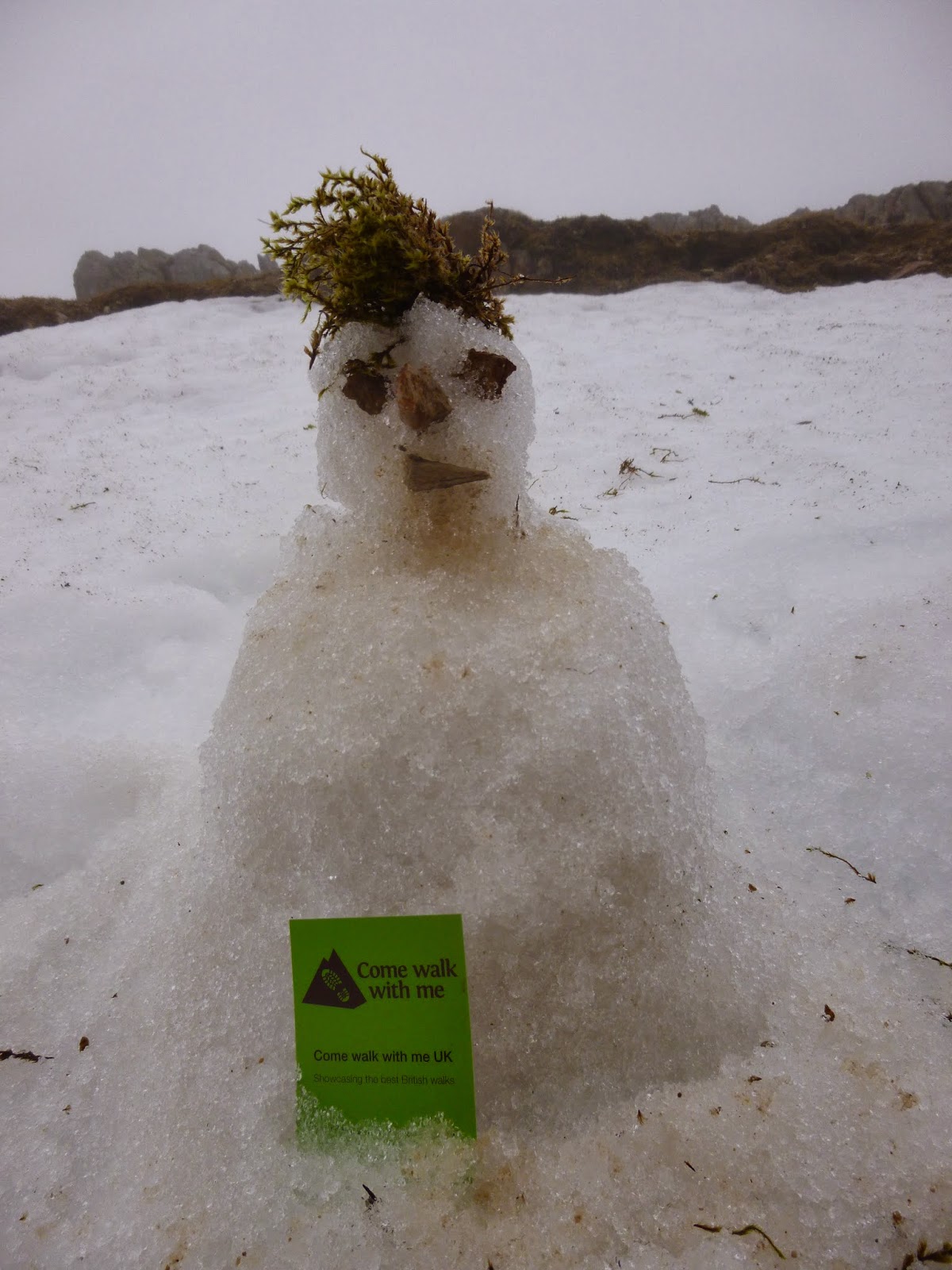
   I am still relatively new to scrambling and found our route up towards our goal the perfect blend of challenge and fun. At one stage we ascended a slippery gully only to find our escape route blocked by a chock stone, after a little exploration a hole was discovered between the stone and valley wall and I managed to squeeze through feeling grateful I'd restricted myself to only one bacon sandwich for breakfast. By the time we'd reached the ridge itself the clouds were low and the wind high, but we picked our way along the craggy route, climbing up, dropping down, ducking out of the wind and glancing at the sheer drop offs with a mixture of awe and trepidation! There were still plenty of slabby, wind blasted snow fields on the slopes on both sides and we were aware that a slip would be unlikely to end well! We could hear voices drifting up from the Pyg track and saw one other group of three on the ridge in the distance but for the majority of our route we had what "Trail" magazine recently called "the most climbed mountain in the world" (Snowdon) to ourselves. We eventually, and somewhat regretfully, reached the trig on Carnedd Ugain and after dropping off the very windy summit we suddenly entered a traffic jam of varyingly equipped walkers moving towards the Snowdon summit. There was still snow on the railway line but that hadn't prevented the summit from being littered with beer cans, crisp packets and other detritus left by inconsiderate scum too idle to carry their own crap off the hill. We descended via The Pyg Track before dropping off back down the slope and eventually reaching our car in driving rain.
   Wednesday dawned and Nathan was keen to have a climb. I nervously assented. Whilst I have been climbing indoors for a year or so I'd never climbed outside before and had only my walking boots, but felt confident that I was with an experienced climber. We parked up in the same spot and made our way towards the crags of Dinas Mot. Nathan led the climb with me seconding and we made our way up four pitches and around sixty metres of ascent. I wasn't sure how much I would enjoy it but aside from the occasional burst of debilitating adrenalin I found my confidence growing and by the time I was hauling myself ungracefully onto the grassy plateau at the top of the climb I think it's fair to say I was hooked. The route we took wasn't a pure rock face climb, we included traverses and grassy gullies, but it was a great experience for me getting me used to climbing roped up, removing gear from crags and dealing with exposure on small ledges. I can't wait for the next time :-)

To view the full album (and it's a good one!) please click on the link below;
https://www.facebook.com/media/set/?set=a.849622378387051.1073741856.597048676977757&type=1 

Monday, June 24, 2013

A Snowdonian overnighter

19/20.6.13
Walking with; Nobody


In my recent desire to get to know the Lake District better I have somewhat neglected Snowdonia but after a cracking two days in North Wales I am anxious to rectify this once more. The hostels in Snowdon were busy but I eventually found a bed at the Pen-Y-Pass YHA http://www.yha.org.uk/hostel/pen-y-pass  and so planned a couple of days around my base.
I arrived in Beddgelert in blazing sunshine (a sentence not often written I suspect) and after a brief refreshment stop headed out along the pretty banks of the River Glaslyn to Gelert's grave. Gelert, a hunting hound, was the pet of Prince Llewelyn, one day the Prince went hunting without Gelert and on his return found his son's crib overturned and the room in disarray, there was blood on Gelert's muzzle and the Prince, jumping to conclusions slew him. As he did this a baby cried and the Prince found his son alive under the crib and a huge Wolf, killed by the faithful hound, lay dead next to him. The Prince was heartbroken and supposedly never smiled again! Leaving the grave I followed "The Fisherman's Path" which became ever rockier as the river became wilder, before emerging on the Aberglaslyn bridge. The path then zigzagged up through woodland before emerging onto boggy moorland near the ruins of the farm at Oerddwr-uchaf. Even in the sunshine the ruins had a slightly "The Hills have eyes" feel to them and I was glad to be past them and tramping through the Cotton grass towards my first target for the day Moel Ddu. I watched a Red Kite playing on the thermals, soaring gracefully up and up before dropping down again, and then repeating the process, and as I started up the painfully steep lower slopes of Moel Ddu my grunts of exertion were accompanied by the familiar "cronk" of a number of the local Ravens.It was a short, very steep slog, but the summit views were possibly some of the finest in Wales. As I sat sandwich in hand, whichever direction I looked it was magnificent. The Moel range loomed large, Snowdon herself sat proud and cloudless in the distance, the Llyn Peninsula stretched out into the sea and Porthmadog sat perched on the estuary offering the promise of fish and chips and ice cream....I'd have killed for an ice cream at this stage. Apart from the occasional "cronk" and the whistle of the steam train from down in the valley, it was blissfully peaceful and still.
Ahead of me I could see Moel Hebog and Banog, two more sharp climbs still lay ahead so, refuelled, I moved on. The climb up Banog was another where frequent "view" stops broke up the gradient and from there it was a last slog up the scree onto the summit of Moel Hebog where I met a squirrel hanging around the cairn on the scrounge and saw the only other walkers I met all day, seven hours close to one of Snowdonia's tourist honeypots and barely a soul to be seen. The path zig zagged back down to the valley where I saw a couple of Wheatears before coming to rest in the Tanronnen Inn for a restorative pint and a perusal of the photos of local history adorning the walls.
Snowdon is not just a mountain, it is a tourist attraction, a destination in it's own right, and my second ascent of it was a very different experience from the day before. I'd been up it once before, in a hurry, in the cloud at the end of a Three Peaks challenge, so this time I wanted to take my time and enjoy it. I left the friendly staff at the hostel behind and they agreed I could save myself a tenner by leaving my car in their layby rather than in the exorbitantly priced car park across the road. I'd previously followed the Miner's Track so this time I set off up the Pyg, a far more scenic path that climbs up to the foot of Crib Goch. It was still sunny at this stage but the forecast was poor so I'd decided to skip the ridge and concentrate on getting to the top in one piece. The paths were all busy but by varying my pace I managed to not get caught up in any traffic jams and the views remained pretty impressive until about ten minutes from the top when the cloud dropped a little further and things became a bit hazy. None-the-less I did have views from the summit, even if they had to be shared with a train load of 50 odd European tourists who timed their arrival to perfectly coincide with mine! Snowdon is not a mountain for peace and solitude! I dropped back down the Miner's enjoying the relatively flat return and almost making it back to Pen-Y-Pass before the rain started!
On the return leg I came across a number of groups of people who were very clearly (to my mind) under prepared and/or inappropriately equipped. I am the first to accept that I sometimes overdo it, but a full pack gives me a feeling of security and a better workout, and if the worst comes to the worst I am confident in my ability to deal with most things a mountain can throw at me. I am sure all regular walkers have come across this on occasions, once on the Half Dome Trail in Yosemite I came across a (for want of a better description) "stoner dude" in cut off denims and no shirt who had attempted the 15 odd mile round trek with a 350ml bottle of water and by the time we found him was suffering from heat stroke......an extreme example but it raises the question, what responsibility do we, as experienced and able hill walkers, have to people we see heading out into potentially perilous situations? My natural reserve makes me inclined to say little, but last month after I'd descended in full waterproof kit from Wetherlam due to the ferocity of the conditions on the top I felt compelled to say to three teenage Americans who were about to try and ascend the Old Man of Coniston in shorts and t-shirt that I didn't think it would be sensible for them to continue.....they ignored me, but at least I felt I done the right thing.....What do other people think?

To view the full album, plase click on the link below;
 https://www.facebook.com/media/set/?set=oa.403018443150400&type=1

Monday, June 17, 2013

Snowdonian suggestions

I am heading off to Snowdonia this week (staying at Pen-Y-Pass) and was looking for any suggestions for a couple of good, day walks in the area......anything considered as it isn't an area I know well. I've have done Snowdon via the Miner's previously.......Thanks in advance!

Thursday, November 8, 2012

Tryfan and the Glyders

29.10.12
Walking with; Al


A last warm up walk before heading off on my Mountain Leader Training course and what a cracking day it proved to be. Tryfan is one of those iconic mountains that really look the part, the Matterhornesque summit of the type that kids sketch when asked to draw a mountain. Tryfan is the fifteenth highest mountain in Wales at 915 metres and is topped by the twin rocks of Adam and Eve, neither Al nor I nor any of the other sumiteers whilst we were there attempted the leap between these two biblically named pillars and I tip my hat in salute to those of you brave enough to have done this.
We set off from Llyn Idwal and soon began the climb/scramble up the North face. Whilst there is theoretically a path it wasn't long before we had given up following it and as we picked our way through the rocks and gulleys it was easy to see how in poor visibility it could prove to be tricky. We found the Cannon Stone and posed for an obligatory photo although the rock is now worn smooth and there isn't a lot of grip left, so instead of noble "yonder, the Ogwen valley" shots, mine looks like a drowning man clinging to a life raft! We continued to pick our way through gullies, scree slopes and up the odd body contorting scramble until we reached the top, Adam and Eve and some spectacular 360 degree views to enjoy with a coffee and flapjack!
Looking across to Glyder Fach the unpromising scree slopes threatened an arduous, strength sapping ascent, but as we dropped into Bwlch Tryfan a fellow walker suggested Bristly Ridge as a more interesting route. Wow!! One of the highlights of this busy year in the hills and mountains. Www.ukscrambles.co.uk describes Bristly Ridge as "an absolute classic scramble, the best Grade 1 in Wales without any doubt", and who am I to disagree........It was a truly exhilirating half hour or so, nerve racking, exciting, challenging and fun and I emerged onto the wind blasted summit of Glyder Fach grinning like an overdosed adrenalin addict. The name Glyder is believed to be derived from the Welsh word gludair meaning heap of stones and the exposed summit is strewn with rocks not least the Cantilever Stone (another essential photo stop) and the spectacular formation of Castell Y Gwynt or the Castle of the Winds, both these features were used in the Disney film "Dragonslayer" and certainly the place has a fantastical feel to it. Circumventing the Castle we headed onto Glyder Fawr, our highest peak of the day which our map told us was an agonising 999 metres, however in late 2010 it was resurveyed and is now believed to top out at 1000.8 metres! http://www.bbc.co.uk/news/uk-wales-north-west-wales-11375937. Either way it is the fifth highest peak in Wales and whilst not as pretty as it's sister still affords incredible views across to Angelsey.
Our descent from here was hard on the knees, skidding down the scree towards Llyn Y Cwn and then taking The Devil's Kitchen path down towards Llyn Idwal. By the time we got to the bottom the clouds were scudding across the top of Tryfan and it was fantastic to be able to trace our whole route behind us. Definitely one of the best days our of the year so far!!!!

To view the full album please click on the link below;
https://www.facebook.com/#!/media/set/?set=oa.292351124217133&type=1

Tuesday, March 6, 2012

Kinder with the Rangers


4.3.12
Walking with; Simon Huddlestone from The Peak District Rangers


I was back at Kinder this weekend for the first of my "pre-walks" as part of my bid to become a Peak District Ranger. I am starting to see why people love what I'd always considered a big, ugly lump quite so much. We set off from the Briefing Centre at Bowden Bridge after visiting the plaque that immortalises the Kinder trespassers. We headed back the way I'd come on Wednesday, along the Sett valley and up Coldwell Clough, even at this stage we could see the snow dusting the tops and Simon warned me that conditions might be pretty bad on Kinder. Walking with a Ranger of 30 years standing was informative and Simon told me a lot about the industrial history of the area and how Hayfield used to be famous for printworks due to the quality of the water in the local rivers. We climbed up to the Edale Cross with a bitter wind driving the snow into our faces and decided that we'd head for the relative shelter of Edale Rocks for some lunch.
On Wednesday I'd followed The Pennine Way but today we headed along the brilliantly named Swine's Back tramping through the virgin snow and following a tumbledown wall to the Rocks where we wedged ourselves into a sheltered-ish spot and considered our options. Although the visibility was poor, it was better than in the fog on Wednesday so we continued on to the Kinder Cairn and head down, battling into the wind, we carried on towards Red Brook. Red Brook was running fast and although the snow was still falling we'd come across a few other walkers and so decided to press on towards the Kinder Downfall and aim for a descent at William Clough. We spotted a couple of hardy Grouse by the Downfall and the views from the edge down towards Broad Clough and the Kinder Reservoir were fantastic. We decided to drop down into the valley just before William Clough and although the conditions underfoot were very slippery we made our way down towards the Reservoir and a welcome brew in the shelter of the valley. Simon told me a few more tales about the area, including the fact that before the Kinder reservoir Hayfield wasn't connected to the sewerage system and as a reward for the inconvenience that building the reservoir caused the village was finally connected to mains drainage. We headed back along the reservoir watching a flock of 14 Curlews before the Kinder Road took us back in the shade of Kinder Bank Wood to our starting point, cold, wet but exhilarated!
To view the full album please cut and paste the link below into the search bar;
https://www.facebook.com/#!/media/set/?set=oa.169098926542354&type=1

Tuesday, February 14, 2012

Bempton Cliffs


12.2.12
Walking with;Ruth
I thought the perfect walk for a rehabilitating knee would be a nice gentle stroll along an East Yorkshire coastal path with the chance to observe a few early season seabirds as a decent bonus. A walk was necessary after nearly a month of inactivity not to mention some superb Haddock and Chips in Bridlington and a Mixed Grill at The Ship Inn in Dunstall that would have stopped a lion in its track such was the ferocious amount of meat piled high on my plate. The only fly in the ointment for this plan was that snowfall during the week, coupled with Arctic winds whistling in off the North Sea had covered the path with a freezing, slushy mess, none-the-less we pressed on undeterred.
Bempton Cliffs is a flagship RSPB reserve and between April and August over 200,000 seabirds including Puffins, Guillemots, Razorbills, Gannets and Fulmars nest on the cliff faces of this spectacular headland. We were a little early in the year,but there were numerous Gannets flying in squadrons of four or more, and plenty of fulmars surfing the freezing thermals (if that's not a contradiction in terms)! The walking was good, the path wound along the cliff top very close to the edge and with conditions underfoot slippy, concentration was required.
On the other side from the cliff edge the ruins of RAF Bempton stood stark against the skyline and provided a moody and atmospheric backdrop for our expedition. RAF Bempton was first set up during World War Two as a GCI station and soldiered on in various different forms until it was eventually closed in 1972. Whilst the area is sealed off it looked well worth an exploration and had a distinctly "ghost townish" feel about it.
Anyway, the knee survived in spite of a few skids and slips and will hopefully be ready for some more adventurous walks over the next week or two. Come Walk with Me is back on track!
To view the full album please click on the link below;

Monday, January 16, 2012

Nantlle Ridge


12.1.12
Walking with; Al
A beautiful, wild, windy day out in Snowdonia without another walker in sight. We parked up at the very picturesque Rhyd Ddu railway station, scenically set with Snowdon (hidden by cloud) as a spectacular backdrop.
We set out across very swampy land, before passing Drwyscoed Uchaf farm and starting the lengthy ascent towards the summit of Y Garn. Slippery conditions underfoot made it hard going, but the "view stops" looking back over the valley towards Snowdon provided welcome respite. The summit was blowy, but the vistas opening up with spectacular views towards the coast and Caernarfon Harbour made the initial ascent worthwhile. Looking West from the hilltop, the ridge lay before us, the clouds were scudding across the pass, but the wind kept them moving and we pressed on.
Following an excellent stone wall along the ridge with an exposed edge on one side, the wind hit us hard and with the rocks slippery from the frost and dew, the scramble up to the second peak of Mynydd Drws Y Coed was hair raising, but just the right side of exciting. The cloud was getting lower now in spite of the wind and after a third short ascent we hit the grassy plateau of Trum Y Ddysgl and assessed our onward/downward options. We'd initially planned to descend along the ridge to Bwlch-Y-ddwy-elor, a pass on the ancient route between Rhyd Ddu and Cwm Pennat, but in the distance the obelisk atop Mynydd-Tal-Y-Mignedd just proved too intruiging. The obelisk was reached via a narrow ridge with drop off views on both sides and a short, steep climb, sheltering in it's lee, we had lunch with magnificent views back to the coast and across the Snowdon range.
With frozen fingers and wind bitten cheeks we headed away from the obelisk and descended a very steep sheep path into the Afon Dwyfor valley (Valley of the Big Holy River) where we made our way through the abandoned, and by know quite ruined, copper mine workings before the steep ascent following sheep tracks up the marshy slopes with only circling ravens and the spectacular, sunlit views down the valley as distractions. Finally reaching the Bwlch-Y-ddwy-elor pass we headed down into the dense pine of the Beddgelert Forest where a sole mountain biker proved we were moving back towards civilisation. The path wound through the forest and spat us out back on the A4085 where we followed the railway line back to our parking spot enjoying magnificent views of the Llyn y Gader lake nestled in the shadows of Y Garn.
To view the full photo album please visit the link below