6-8/8/13
Walking with; Nobody/Nathan
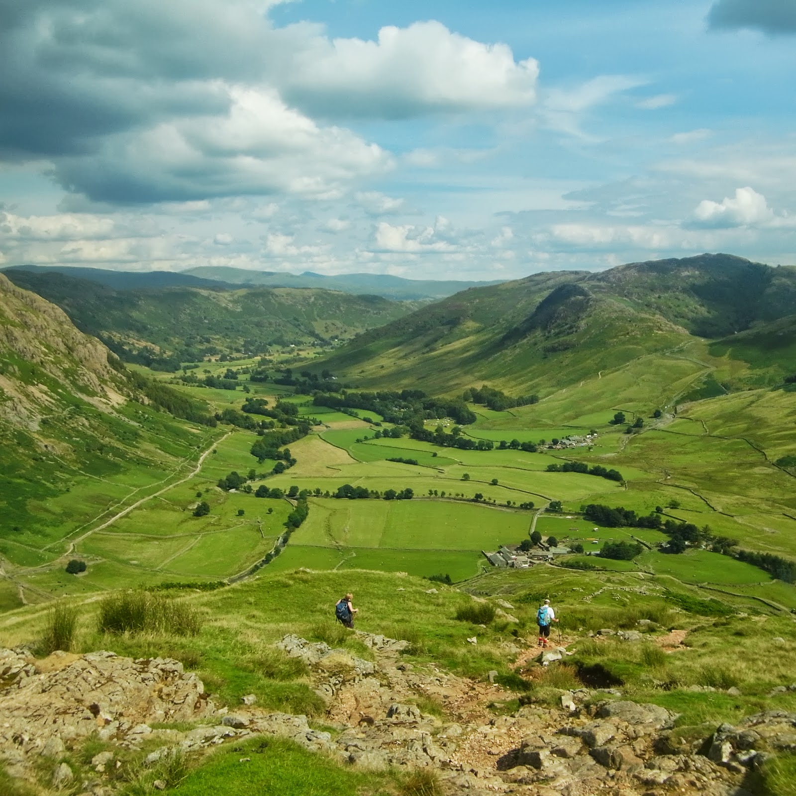
Not being in possession of either children or gainful employment I'd kind of forgotten how the Summer holidays affect the Lake District. There are hills best avoided under these conditions and yet I'd already planned a roughish selection of wanderings to occupy me over three days and I was loathe to stray too far from my prescribed ideas. Whilst it was considerably busier than usual I was fortunate that a little judicious route selection and some reasonably timed starts minimised the amount of contact I was required to have with the many hundreds thronging the fells!
Day one started at the prohibitively priced NT car park in Seatoller. I'd been a member once and when they tried to strong arm us into renewing the subscription they wanted £92 for a couple, the exorbitant fees are clearly the latest example of strong arming people into membership...Heading off up Thorneythwaite Fell (try saying that after a pint or three of Snecklifter) I was soon being treated to views of Derwentwater and the crags above Comb Gill. I was heading for Glaramara, a previous attempt had had to be aborted due to the depth of snow http://www.comewalkwithmeuk.co.uk/2012/12/borrowdaleand-snow.html, so I was keen to get it under my belt. The final gentle scramble onto the summit proved very rewarding, two hours in to my Lakeland August odyssey and still not a soul to be seen! I was experimenting with a 1:50000 scale OS in order to sharpen my identification of contours but my brain hadn't quite computed the full repercussions so the wander over to Allen Crags took me twice as long as I had convinced myself it would. Arriving at the Crags and with Great End and Esk Hause in clear view I discovered where all the Summer visitors had been, it was akin to Oxford Street in December, people (and dogs) here, there and everywhere! The path most being trodden appeared to be the one towards Scafell Pike but I dropped off it and headed over to Great End for magnificent views and some close inspection by a rescue chopper which circled the summit for some time. Leaving the tops I followed Ruddy Gill down to Seathwaite and then tramped along The Allerdale Ramble back to Seatoller from where I headed up to the YHA at Honister. Whilst it may be that the hostel could do with a lick of paint and a wee bit of TLC, the staff were friendly, the beer cold and the views spectacular all for the price of a good bottle of wine!
The next morning started with the steep haul up Grey Knotts where I snapped a sure fire winner for the "Trail magazine-Face of Fatigue". The top was reached and the vistas opened out in all directions, Borrowdale, Buttermere, Ennerdale, the heart of the Lakes. The walking over Brandreth and upto Green Gable was gentle and I slipped and slid my way down the Aaron Slack for a bite to eat at Styhead Tarn. Last time I'd been here the snow was knee deep and I'd had the place pretty much to myself, but by lunchtime on a Thursday in August there were already two tents pitched and a plethora of walkers milling about. I headed on up and before too long was escaping the bulk of the crowds once more and slowly ascending Esk Pike for more views back towards England's highest peak. I had one more peak in mind for the day, Bowfell, which I duly meandered up before the descent to the Three Tarns and then down the knee crunching The Band to arrive in Great Langdale with the sun shining and the lure of a good pint foremost in my mind. Tent pitched and chilli cooked it was time to head off to "The Old Dungeon Ghyll" and then "The Stickleback" to refresh myself with a couple of pints of Esthwaite Ale and Loweswater Gold!
Nathan had come across to join me for the Thursday. We headed off into Mickleden and began the brutal climb up Rossett Pike, this was made slightly less arduous for us by the sight of eight gents hefting their mountain bikes up and over the summit, respect due. We carried on to Angle Tarn and gradually ascended to Esk Hause where perched upon one of the shelter walls I found the Guinness cap that I had inadvertently left there the afternoon before! Honest bunch walkers? Or perhaps the sweat stained soiled and grubby cap hadn't proved enough of a prize for anyone to covet, who knows? We'd decided to do a traverse around Great Gable and stopped opposite Lingmell for a bit of rope work practice, still one of my bete noirs! The traverse was spectacular, crossing the screes with stunning views down Wasdale and we eventually ended up at Beck Head from where we made our way back towards Honister with some truly awesome views back down Ennerdale and towards Buttermere and Crummock Water.
Even in the height of Summer there are still plenty of spots where it's possible to find a little Lakeland solitude and the sunshine and the views made this three of my favourite days out so far this year! All that being said, roll on September and the hills to myself once more!
Come walk with me aims to help you enjoy, and be inspired by, the magnificent British countryside
Total Pageviews
Showing posts with label Trek. Show all posts
Saturday, August 10, 2013
Thursday, June 27, 2013
Skills in the sunshine above Elterwater
27.6.13
Walking with; Nathan
Ever since I completed my initial Mountain Leader training I have been living in fear! It is one of the most ambitious and intimidating things I have undertaken in my adult life and involved a number of aspects that would lift me well clear of my hill walking comfort zone. However, my jaw is set and my mind is made up and I am determined that this is something I want to do, with that in mind, a few weeks ago I put a post on a walking forum to find people in the same situation as me with whom I might be able to practice a wider range of skills than the standard day on the hill stuff.
So it was that I found myself waiting in the free carpark just outside Elterwater for Nathan, a fellow ML trainee employed for the Summer season at Whinlatter Go Ape, and with a good working knowledge of the knobbly bits of the Lakeland that might prove ideal for some ropework and micro-navigation. We climbed out of the valley bashing our way through the bracken and exchanging tips on the local flora or fauna before finding a suitable crag to practice some rope work. In spite of my recent Indoor climbing course this was the first time since my training I'd used a rope "in situ" as it were and it took a bit of getting used to! An hour or so later and I was feeling much more confident and we coiled the rope away and, enjoying the magnificent views down to Baysbrown campsite and the Langdales continued on our way upwards. After a bit of lunch by a small, cotton grass covered tarn we moved onto some micro-navigation on the numerous lumps and bumps of Silver Howe. It was the kind of terrain and practice that's hard to replicate during a normal hill day and really useful for all that, it gave me some helpful pointers for areas that I still need to work on! We were also treated to some spectacular views out over Grasmere, Rydal Water and Loughrigg, made a welcome change after a couple of hours of nose to compass and nose to map!
We finished with another batch of rope work, hopefully ingraining some of the skills we'd been working on earlier, before descending down through yet more bracken to Elterwater. It was a very different kind of day, but immensely useful and I shall definitely be incorporating plenty more of these into the mix before I take the final, dreaded exam!
To view the full album please click on the link below;
https://www.facebook.com/media/set/?set=oa.404518436333734&type=1
Walking with; Nathan
Ever since I completed my initial Mountain Leader training I have been living in fear! It is one of the most ambitious and intimidating things I have undertaken in my adult life and involved a number of aspects that would lift me well clear of my hill walking comfort zone. However, my jaw is set and my mind is made up and I am determined that this is something I want to do, with that in mind, a few weeks ago I put a post on a walking forum to find people in the same situation as me with whom I might be able to practice a wider range of skills than the standard day on the hill stuff.
So it was that I found myself waiting in the free carpark just outside Elterwater for Nathan, a fellow ML trainee employed for the Summer season at Whinlatter Go Ape, and with a good working knowledge of the knobbly bits of the Lakeland that might prove ideal for some ropework and micro-navigation. We climbed out of the valley bashing our way through the bracken and exchanging tips on the local flora or fauna before finding a suitable crag to practice some rope work. In spite of my recent Indoor climbing course this was the first time since my training I'd used a rope "in situ" as it were and it took a bit of getting used to! An hour or so later and I was feeling much more confident and we coiled the rope away and, enjoying the magnificent views down to Baysbrown campsite and the Langdales continued on our way upwards. After a bit of lunch by a small, cotton grass covered tarn we moved onto some micro-navigation on the numerous lumps and bumps of Silver Howe. It was the kind of terrain and practice that's hard to replicate during a normal hill day and really useful for all that, it gave me some helpful pointers for areas that I still need to work on! We were also treated to some spectacular views out over Grasmere, Rydal Water and Loughrigg, made a welcome change after a couple of hours of nose to compass and nose to map!
We finished with another batch of rope work, hopefully ingraining some of the skills we'd been working on earlier, before descending down through yet more bracken to Elterwater. It was a very different kind of day, but immensely useful and I shall definitely be incorporating plenty more of these into the mix before I take the final, dreaded exam!
To view the full album please click on the link below;
https://www.facebook.com/media/set/?set=oa.404518436333734&type=1
Friday, May 10, 2013
South Wales wanderings
7/8.5.13
Walking with; Ruthy
Some of my earliest walking memories are of family outings to the Brecon Beacons where my Grandparents lived (and Grandmother still does). The names are evocative to me; The Sugar Loaf, The Table Mountain, The Blorenge and in my mind they have grown into epic mountain days, and so it was, that with Ruth having to visit Abergavenny for work the Wednesday after a Bank Holiday we thought we could stay with Granny in Crickhowell and I could relive a few childhood memories.
Tuesday felt as if Summer had arrived. We rolled into Hay-on-Wye in glorious sunshine, there was blossom on the trees, primroses and daffodils were still in flower and the fields were full of young lambs. Hay is the self proclaimed book capital of the world and with 30+ shops covering every conceivable specialism, it was easy to wile away a couple of hours and head back to the car with a bootfull of new reads. We headed out of Hay and onto the Offa's Dyke Path (which I am still hoping to do this year, time permitting) and had soon left the town behind for a world of forget-me-nots, celandines, goosegrass and primroses. We crossed the Dulas Brook, back into England, and the tiny hamlet of Cusop which found notoriety as the home of Herbert Rowse Armstrong, the only English solicitor ever to be hanged for murder! More country lanes lined with Cow Parsley and early bluebells took us back into Hay still bathed in beautiful sunshine.
Wednesday morning and the sunshine of the previous day had disappeared. The cloud hung low and drizzle was in the air as I emerged replete from another Full English at The Kings Arms in Abergavenny. Undaunted I made my way through the narrow lanes and past the Sugar Loaf vineyards to the car park at Mynydd Llanwenarth where the cloud was lifting to provide spectacular views. I headed off North West and dropped into a valley below the Western ridge where I heard, and then saw, my first Cuckoo of the year. The climb up the ridge was long and blowy but undemanding and the views of the Beacons and surrounding countryside were spectacular. I now have longer legs than I did on my first ascent so it wasn't quite such an arduous adventure, but the 360 degree views from the summit are well earned and well worth the effort. It was a gentle descent back to the car park drinking in the views and skirting the edge of St Mary's Vale and once I was back I looked back at the cone like summit through the same eyes I did 30 years before and felt as if I'd had a proper adventure once more!
Walking with; Ruthy
Some of my earliest walking memories are of family outings to the Brecon Beacons where my Grandparents lived (and Grandmother still does). The names are evocative to me; The Sugar Loaf, The Table Mountain, The Blorenge and in my mind they have grown into epic mountain days, and so it was, that with Ruth having to visit Abergavenny for work the Wednesday after a Bank Holiday we thought we could stay with Granny in Crickhowell and I could relive a few childhood memories.
Tuesday felt as if Summer had arrived. We rolled into Hay-on-Wye in glorious sunshine, there was blossom on the trees, primroses and daffodils were still in flower and the fields were full of young lambs. Hay is the self proclaimed book capital of the world and with 30+ shops covering every conceivable specialism, it was easy to wile away a couple of hours and head back to the car with a bootfull of new reads. We headed out of Hay and onto the Offa's Dyke Path (which I am still hoping to do this year, time permitting) and had soon left the town behind for a world of forget-me-nots, celandines, goosegrass and primroses. We crossed the Dulas Brook, back into England, and the tiny hamlet of Cusop which found notoriety as the home of Herbert Rowse Armstrong, the only English solicitor ever to be hanged for murder! More country lanes lined with Cow Parsley and early bluebells took us back into Hay still bathed in beautiful sunshine.
Wednesday morning and the sunshine of the previous day had disappeared. The cloud hung low and drizzle was in the air as I emerged replete from another Full English at The Kings Arms in Abergavenny. Undaunted I made my way through the narrow lanes and past the Sugar Loaf vineyards to the car park at Mynydd Llanwenarth where the cloud was lifting to provide spectacular views. I headed off North West and dropped into a valley below the Western ridge where I heard, and then saw, my first Cuckoo of the year. The climb up the ridge was long and blowy but undemanding and the views of the Beacons and surrounding countryside were spectacular. I now have longer legs than I did on my first ascent so it wasn't quite such an arduous adventure, but the 360 degree views from the summit are well earned and well worth the effort. It was a gentle descent back to the car park drinking in the views and skirting the edge of St Mary's Vale and once I was back I looked back at the cone like summit through the same eyes I did 30 years before and felt as if I'd had a proper adventure once more!
Tuesday, April 2, 2013
Aira Force and Dockray
31.3.13
Walking with; Rich
After a couple of weeks of indolence as a result of a rugby obtained knee injury it felt good to be out and about even on the gentlest of ambles. I was in the Lakes on a stag do staying at the fantastically appointed Blencathra Centre, in the shadow of the eponymous hill and with magnificent vistas of snow capped peaks. The stag and less injured parties were off scrambling in ghylls and via ferrata-ing, so it was left to me and Rich (hobbled by a hip injury) to enjoy a perambulation of a less demanding sort.
Wordsworth writes in his poem "The Somnambulist", "Wild stream of Aira, hold thy course" and the falls are mentioned in two further works of his. They are certainly a popular spot and easily accessible from the Ullswater road. The name is believed to come from the Nordic "eyrara" meaning "gravel-bank stream" with the word force (or sometimes foss) being a commonly used term for waterfall. The land is now owned by the National Trust but was developed as a pleasure garden by the Howard family in the eighteenth century who landscaped the area around their hunting lodge. The two bridges are dedicated to members of the Spring-Rice family and are popular photo spots.
Our car park provided good views of Ullswater and the snowy hills beyond and we descended the gentle path through the pine arboretum before crossing the stream and climbing slowly up the other side of the valley. The view of the falls from below is spectacular and was enhanced by the icicles and frozen spray decorating the surrounding rocks. We continued, following the river, until we eventually reached the tiny hamlet of Dockray for a pint of "hair of the dog" in the very attractive "Royal Hotel". It was a simple matter of following the road back to the car then and whilst four ambled miles might not represent my most challenging walk, it felt could to be back out in the countryside once more, and even more pleasingly, the knee held up pretty well!
To view the full album please click on the link below;
https://www.facebook.com/media/set/?set=oa.364297450355833&type=1
Walking with; Rich
After a couple of weeks of indolence as a result of a rugby obtained knee injury it felt good to be out and about even on the gentlest of ambles. I was in the Lakes on a stag do staying at the fantastically appointed Blencathra Centre, in the shadow of the eponymous hill and with magnificent vistas of snow capped peaks. The stag and less injured parties were off scrambling in ghylls and via ferrata-ing, so it was left to me and Rich (hobbled by a hip injury) to enjoy a perambulation of a less demanding sort.
Wordsworth writes in his poem "The Somnambulist", "Wild stream of Aira, hold thy course" and the falls are mentioned in two further works of his. They are certainly a popular spot and easily accessible from the Ullswater road. The name is believed to come from the Nordic "eyrara" meaning "gravel-bank stream" with the word force (or sometimes foss) being a commonly used term for waterfall. The land is now owned by the National Trust but was developed as a pleasure garden by the Howard family in the eighteenth century who landscaped the area around their hunting lodge. The two bridges are dedicated to members of the Spring-Rice family and are popular photo spots.
Our car park provided good views of Ullswater and the snowy hills beyond and we descended the gentle path through the pine arboretum before crossing the stream and climbing slowly up the other side of the valley. The view of the falls from below is spectacular and was enhanced by the icicles and frozen spray decorating the surrounding rocks. We continued, following the river, until we eventually reached the tiny hamlet of Dockray for a pint of "hair of the dog" in the very attractive "Royal Hotel". It was a simple matter of following the road back to the car then and whilst four ambled miles might not represent my most challenging walk, it felt could to be back out in the countryside once more, and even more pleasingly, the knee held up pretty well!
To view the full album please click on the link below;
https://www.facebook.com/media/set/?set=oa.364297450355833&type=1
Monday, February 4, 2013
Rushup Edge to Hayfield
3.2.13
Walking with; Ruth, Emily and Roz
Some of the more observant amongst you may have noticed that whilst the blog is called Come walk with me, for many of my wanderings, I tend to wander alone! This is partially as a result of me generally walking during the week when other people are working and partially because I enjoy walking on my own. However, I am in the process of trying to become a Mountain Leader and that, of course, requires leading people, so many thanks to Ruthy, Emily and Roz for being willing guinea pigs in this experiment!
We set off, in pretty miserable conditions from Rushup Edge and after slipping and sliding on the first iced up half mile of the Pennine Bridleway we disappeared into thick mist. It was muddy going underfoot and the Bridleway provides the additional hazard of avoiding hurtling hordes of mountain bikers, but early progress was predominantly "head down, hoods up and aim into the wind!". After crossing the wooded stream at Bolehill Clough we descended to Roych Clough where the cloud thinned and we paused for a sandwich ahead of the climb up to South Head. The slope up to South Head is brutal and the wind on the top was gale force, but the lure of getting to the top of the highest point on the main route was too good a chance to miss and with Roz leading the way we ascended to the summit for a good view of the clouds and all cobwebs to be very decisively blown away!
We slid (literally in Ruthy's case) back down to the Bridleway and continued a gradual descent out of the clouds circumventing Mount Famine (try as I might I have been unable to find out where this name comes from) and following the paths down towards Bowden Bridge where we found a magnificent herd of Highland Cattle grazing contentedly. From there we followed the River Sett down into Hayfield for a well deserved drink at The Pack Horse. I managed not to lose or kill anyone, hopefully even imparted a little bit of knowledge and the girls all seemed to have a good time, so everyone is a winner! First of many I hope.
To view the full album, please click on the link below;
https://www.facebook.com/media/set/?set=oa.335118956607016&type=1
Walking with; Ruth, Emily and Roz
Some of the more observant amongst you may have noticed that whilst the blog is called Come walk with me, for many of my wanderings, I tend to wander alone! This is partially as a result of me generally walking during the week when other people are working and partially because I enjoy walking on my own. However, I am in the process of trying to become a Mountain Leader and that, of course, requires leading people, so many thanks to Ruthy, Emily and Roz for being willing guinea pigs in this experiment!
We set off, in pretty miserable conditions from Rushup Edge and after slipping and sliding on the first iced up half mile of the Pennine Bridleway we disappeared into thick mist. It was muddy going underfoot and the Bridleway provides the additional hazard of avoiding hurtling hordes of mountain bikers, but early progress was predominantly "head down, hoods up and aim into the wind!". After crossing the wooded stream at Bolehill Clough we descended to Roych Clough where the cloud thinned and we paused for a sandwich ahead of the climb up to South Head. The slope up to South Head is brutal and the wind on the top was gale force, but the lure of getting to the top of the highest point on the main route was too good a chance to miss and with Roz leading the way we ascended to the summit for a good view of the clouds and all cobwebs to be very decisively blown away!
We slid (literally in Ruthy's case) back down to the Bridleway and continued a gradual descent out of the clouds circumventing Mount Famine (try as I might I have been unable to find out where this name comes from) and following the paths down towards Bowden Bridge where we found a magnificent herd of Highland Cattle grazing contentedly. From there we followed the River Sett down into Hayfield for a well deserved drink at The Pack Horse. I managed not to lose or kill anyone, hopefully even imparted a little bit of knowledge and the girls all seemed to have a good time, so everyone is a winner! First of many I hope.
To view the full album, please click on the link below;
https://www.facebook.com/media/set/?set=oa.335118956607016&type=1
Wednesday, January 23, 2013
Fernilee Reservoir
22.01.13
Walking with; Nobody
Snow seems to divide the nation, one half turning into big kids and the other into whingers and moaners, perhaps the divide is based on whether you have to go to work in it, because spending a day wandering through the Peak District in the snow is, quite frankly, one of the best things I can think of doing! It's a while since I have found a completely new walk in the Peaks so I pulled my well thumbed "Pub Walks in the Peak District" out of the bookcase and on John Morrison's advice decided to try a variant on his stroll around Fernilee.
Fernilee is a hamlet, a mile or so South of Whalley Bridge and consists of "The Shady Oak" pub, a few farms and not a lot more. However a short stroll down the Goyt Valley there are the twin reservoirs of Fernilee and Errwood built in 1938 by the Stockport Water Corporation. I followed the footpath through Folds Lane Farm and down the pristine slopes to the River Goyt itself which I crossed before following a path that seemed better suited to cross country skiing than walking to the head of the Fernilee Reservoir. Walking with the crunch of snow under boot, the sky blue and cloudless and a chill wind reddening your cheeks is hard to beat and my meander was further cheered by a friendly Robin accompanying me en route......no bird looks better against a backdrop of snow and holly. The next section took me through a fir plantation giving the walk a distinctly Scandanavian flavour before a path dropped down to the shore and I followed this to the dam separating the two reservoirs. It was being utilised by some kamikaze sledders who I watched in awe before lunching on top of the dam and spending ten minutes chatting to a gent who'd come down from the Cat and Fiddle.
I circumvented Bunsal Cob before taking the Midshires Way and heading through some seriously deep, drifted snow to the roadside viewpoint of Long Hill with views back towards the reservoir and across to Ladbitch Wood and Taxal Moor. The slog across the thigh deep drifts made me feel like Titus Oates, except with a little less immediate peril. Crossing the access land North of the A5004 I headed through more deep snow up to the Old Road which led me past the very lonely and remote farm at Wythen Lache and back through a true Winter wonderland to the lane down to the pub which sadly had just closed thus depriving me of a well needed pint and opportunity to thaw out in front of a fire......ah well, there's always next time!
All this snow has seriously whetted my appetite for our ski trip, one month from today, so fingers crossed it continues in this vein!
To view the full album, please click on the link below;
https://www.facebook.com/#!/media/set/?set=oa.325422667576645&type=1
Walking with; Nobody
Snow seems to divide the nation, one half turning into big kids and the other into whingers and moaners, perhaps the divide is based on whether you have to go to work in it, because spending a day wandering through the Peak District in the snow is, quite frankly, one of the best things I can think of doing! It's a while since I have found a completely new walk in the Peaks so I pulled my well thumbed "Pub Walks in the Peak District" out of the bookcase and on John Morrison's advice decided to try a variant on his stroll around Fernilee.
Fernilee is a hamlet, a mile or so South of Whalley Bridge and consists of "The Shady Oak" pub, a few farms and not a lot more. However a short stroll down the Goyt Valley there are the twin reservoirs of Fernilee and Errwood built in 1938 by the Stockport Water Corporation. I followed the footpath through Folds Lane Farm and down the pristine slopes to the River Goyt itself which I crossed before following a path that seemed better suited to cross country skiing than walking to the head of the Fernilee Reservoir. Walking with the crunch of snow under boot, the sky blue and cloudless and a chill wind reddening your cheeks is hard to beat and my meander was further cheered by a friendly Robin accompanying me en route......no bird looks better against a backdrop of snow and holly. The next section took me through a fir plantation giving the walk a distinctly Scandanavian flavour before a path dropped down to the shore and I followed this to the dam separating the two reservoirs. It was being utilised by some kamikaze sledders who I watched in awe before lunching on top of the dam and spending ten minutes chatting to a gent who'd come down from the Cat and Fiddle.
I circumvented Bunsal Cob before taking the Midshires Way and heading through some seriously deep, drifted snow to the roadside viewpoint of Long Hill with views back towards the reservoir and across to Ladbitch Wood and Taxal Moor. The slog across the thigh deep drifts made me feel like Titus Oates, except with a little less immediate peril. Crossing the access land North of the A5004 I headed through more deep snow up to the Old Road which led me past the very lonely and remote farm at Wythen Lache and back through a true Winter wonderland to the lane down to the pub which sadly had just closed thus depriving me of a well needed pint and opportunity to thaw out in front of a fire......ah well, there's always next time!
All this snow has seriously whetted my appetite for our ski trip, one month from today, so fingers crossed it continues in this vein!
To view the full album, please click on the link below;
https://www.facebook.com/#!/media/set/?set=oa.325422667576645&type=1
Labels:
Bunsal Cob,
Come walk with me,
Derbyshire walks,
Errwood,
Fernilee,
forest walks,
hike,
John Morrison,
Midshires way,
Peak District,
Pub walks,
reservoir walk,
robin,
Snow,
The Shady Oak,
Trek,
winter walks
Monday, January 21, 2013
Wednesday, October 10, 2012
The Fairfield Horseshoe
5.10.12
Walking with; Nobody
After a night at Elterwater YHA (great staff and breakfast) I headed over to Ambleside and parked up before following the A591 along to Rydal. The path climbed out of the village and past Rydal Mount, the historic home of Lakeland poet William Wordsworth. The walk up to Nab Scar zig zagged across the hillside but as I gained height the views across to Windermere began to open out and I knew I was going to be in for a cracking day. The route essentially follows a long ridge that sits high above the valleys on either side and from Nab Scar the path took me along to Heron Pike. At this stage the sun was still shining and though Fairfield itself remained in the cloud the rest of the horseshoe opened up in glorious sunshine. The views took in Rydal Beck,Windermere, Rydal Water, Grasmere (where Wordsworth is buried) and endless miles of rolling hills, tarns and rivers, not to mention the incredible dry stone walls on the slopes of Low and High Pike on the opposite side. The last few weeks have proved to me that the Lake District is the equal of anywhere in the world, I have sat and gazed at spectacular vistas in Yosemite, the Dolomites, the Sourhern Alps and the Pyrenees but when the Lakes gets it right, it can hold a candle to any of them.
I pressed onwards onto Great Rigg and as I descended ahead of the last slog onto Fairfield's cloud hidden summit the rain hit. It was the kind of wind driven rain that stings the cheeks and the gusts blowing across the ridge made for a wearying final few hundred metres. The summit was completely enveloped in cloud and could be quite disorientating without a compass, none the less I made the top and sought a little shelter from the wind behind a pile of rocks where I met a Scottish lady doing much the same thing! Heading East off the summit and ontowards Dove Crag the clouds cleared a little. The rest of the route follows an incredible dry stone wall for at least three miles, this helps with navigation but also acts as a reminder of the long standing nature of farming in the area that has shaped the landscape we see from this spectacular route. There were equally impressive examples on the steep solpes of Red Screes as the rocky path continued downhill through various peat bogs on it's long, slow way back to Ambleside. Eventually you emerge on the campus of the University of Cumbria before popping out almost opposite the excellent "The Golden Rule" pub http://goldenrule-ambleside.co.uk/ for a well earned pint of Robinson's Double Hop.
This route truly is a lakeland classic and combines sensational views with a satisfying amount of challenge. It also includes eight Wainwrights so is a good one for peak baggers/collectors!
To view the full album, please click on the link below;
https://www.facebook.com/#!/media/set/?id=718985691&tid=136991043086476&skipClustering=true&qn=556dfb3460222186986800a0059df563&success=17&failure=0&set=oa.281001475352098
Walking with; Nobody
After a night at Elterwater YHA (great staff and breakfast) I headed over to Ambleside and parked up before following the A591 along to Rydal. The path climbed out of the village and past Rydal Mount, the historic home of Lakeland poet William Wordsworth. The walk up to Nab Scar zig zagged across the hillside but as I gained height the views across to Windermere began to open out and I knew I was going to be in for a cracking day. The route essentially follows a long ridge that sits high above the valleys on either side and from Nab Scar the path took me along to Heron Pike. At this stage the sun was still shining and though Fairfield itself remained in the cloud the rest of the horseshoe opened up in glorious sunshine. The views took in Rydal Beck,Windermere, Rydal Water, Grasmere (where Wordsworth is buried) and endless miles of rolling hills, tarns and rivers, not to mention the incredible dry stone walls on the slopes of Low and High Pike on the opposite side. The last few weeks have proved to me that the Lake District is the equal of anywhere in the world, I have sat and gazed at spectacular vistas in Yosemite, the Dolomites, the Sourhern Alps and the Pyrenees but when the Lakes gets it right, it can hold a candle to any of them.
I pressed onwards onto Great Rigg and as I descended ahead of the last slog onto Fairfield's cloud hidden summit the rain hit. It was the kind of wind driven rain that stings the cheeks and the gusts blowing across the ridge made for a wearying final few hundred metres. The summit was completely enveloped in cloud and could be quite disorientating without a compass, none the less I made the top and sought a little shelter from the wind behind a pile of rocks where I met a Scottish lady doing much the same thing! Heading East off the summit and ontowards Dove Crag the clouds cleared a little. The rest of the route follows an incredible dry stone wall for at least three miles, this helps with navigation but also acts as a reminder of the long standing nature of farming in the area that has shaped the landscape we see from this spectacular route. There were equally impressive examples on the steep solpes of Red Screes as the rocky path continued downhill through various peat bogs on it's long, slow way back to Ambleside. Eventually you emerge on the campus of the University of Cumbria before popping out almost opposite the excellent "The Golden Rule" pub http://goldenrule-ambleside.co.uk/ for a well earned pint of Robinson's Double Hop.
This route truly is a lakeland classic and combines sensational views with a satisfying amount of challenge. It also includes eight Wainwrights so is a good one for peak baggers/collectors!
To view the full album, please click on the link below;
https://www.facebook.com/#!/media/set/?id=718985691&tid=136991043086476&skipClustering=true&qn=556dfb3460222186986800a0059df563&success=17&failure=0&set=oa.281001475352098
Labels:
Ambleside,
Buttermere,
cloud,
Come walk with me,
dry stone wall,
Fairfield Horseshoe,
Heron Pike,
hike,
Lake District,
Lakes,
ridge walk,
Rydal,
Trek,
Wainwright,
Windermere,
Wordsworth
Monday, October 8, 2012
A Langdale Round involving lots of Pikes and Stickles
4.10.12
Walking with; Nobody
As I sat in Windermere Youth Hostel trying to drown out the din of a school group involved in noisily debating the merits of their quiz answers, I poured myself a glass of Jennings fine Cockerhoop beer and fell to reading, as one does in these situations, an ancient back edition of "TGO" or "Trail". A feature caught my eye on the differing names for mountains in the different parts of the UK and I read on intrigued by the world of Fells, Pikes and Tors. It hardened my resolve to visit Langdale the next morning and take in a round including both the Pikes of Blisco and Stickle!
I parked at Blea Tarn and managed to time my setting off to perfectly coincide with a shower, but the views back to the Pike of Stickle were already spectacular. Striking off towards the Wrynose Pass the ground was sodden and water was running off the mountain but as I climbed the road I emerged out of cloud as I started to ascend the back of Blisco. The cloud inversion was spectacular, one of the best I've ever seen (up there with Alp D'Huez and the Queen Charlotte Track in NZ) and once I was through it the Pike of Blisco sat bathed in sunlight. The wind on the top was strong and chill so after a brief consultation with the map I left my fellow summmit baggers and descended to Red Tarn and then down, down and still further down in the shadow of Great Knott to the valley floor where my screaming knees were finally rested. I proceded into Mickleden and began the long, slow ascent up Stake Pass where I stopped for refuelling with a great view of Blisco across the valley. I continued on to Martcrag Moor, defined by Wainwright as demarcating the edge of the Central Fells and, today (and I suspect everyday), very heavy underfoot. As I tramped ever forward I was met with more rain and then a rainbow as I climbed up towards the Pike of Stickle. The rain had left the rock very greasy and a few would-be summiters were turning back but I slid and scrambled and as much by luck as judgement ended up alone on the top with views of my whole route so far and onto Windermere in the distance.
Harrison Stickle awaited and then onwards downhill, with more creaking knees, to Stickle Tarn, sat in the magnificent shadow of Pavey Arc. The path down Stickle Ghyll showcased a pair of Raven and some beautiful, vibrant Rowan berries but was very slippery and I was glad to reach Langdale and the Dungeon Ghylls once more. Tempted as I was by a pint in either of the esteemed hotels I pressed on below Side Pike and back along the atmospheric shores of the tarn. Post walk refreshment had to wait until "The Britannia Inn" in Elterwater, but the wait was very well worth it!
To view the full photo album please click on the link below;
https://www.facebook.com/groups/136991043086476/#!/media/set/?set=oa.279299808855598&type=1
Walking with; Nobody
Definition of PIKE
dialect English
: a mountain or hill having a peaked summit —used especially in place names
Origin of PIKE
Middle English, perhaps of Scandinavian origin; akin to Norwegian dialect pīk pointed mountain
First Known Use: 13th century
As I sat in Windermere Youth Hostel trying to drown out the din of a school group involved in noisily debating the merits of their quiz answers, I poured myself a glass of Jennings fine Cockerhoop beer and fell to reading, as one does in these situations, an ancient back edition of "TGO" or "Trail". A feature caught my eye on the differing names for mountains in the different parts of the UK and I read on intrigued by the world of Fells, Pikes and Tors. It hardened my resolve to visit Langdale the next morning and take in a round including both the Pikes of Blisco and Stickle!
I parked at Blea Tarn and managed to time my setting off to perfectly coincide with a shower, but the views back to the Pike of Stickle were already spectacular. Striking off towards the Wrynose Pass the ground was sodden and water was running off the mountain but as I climbed the road I emerged out of cloud as I started to ascend the back of Blisco. The cloud inversion was spectacular, one of the best I've ever seen (up there with Alp D'Huez and the Queen Charlotte Track in NZ) and once I was through it the Pike of Blisco sat bathed in sunlight. The wind on the top was strong and chill so after a brief consultation with the map I left my fellow summmit baggers and descended to Red Tarn and then down, down and still further down in the shadow of Great Knott to the valley floor where my screaming knees were finally rested. I proceded into Mickleden and began the long, slow ascent up Stake Pass where I stopped for refuelling with a great view of Blisco across the valley. I continued on to Martcrag Moor, defined by Wainwright as demarcating the edge of the Central Fells and, today (and I suspect everyday), very heavy underfoot. As I tramped ever forward I was met with more rain and then a rainbow as I climbed up towards the Pike of Stickle. The rain had left the rock very greasy and a few would-be summiters were turning back but I slid and scrambled and as much by luck as judgement ended up alone on the top with views of my whole route so far and onto Windermere in the distance.
Harrison Stickle awaited and then onwards downhill, with more creaking knees, to Stickle Tarn, sat in the magnificent shadow of Pavey Arc. The path down Stickle Ghyll showcased a pair of Raven and some beautiful, vibrant Rowan berries but was very slippery and I was glad to reach Langdale and the Dungeon Ghylls once more. Tempted as I was by a pint in either of the esteemed hotels I pressed on below Side Pike and back along the atmospheric shores of the tarn. Post walk refreshment had to wait until "The Britannia Inn" in Elterwater, but the wait was very well worth it!
To view the full photo album please click on the link below;
https://www.facebook.com/groups/136991043086476/#!/media/set/?set=oa.279299808855598&type=1
Labels:
Blea Tarn,
cloud inversion,
Come walk with me,
Harrison Stickle,
hike,
Lake District,
Lakes,
Langdale,
Langdale Pikes,
Martcrag Moor,
Pike of Blisco,
Pike of Stickle,
Side Pike,
Tarn,
Trek,
Wainwright,
Wrynose
Wednesday, September 5, 2012
The Four Reservoirs Walk
4.9.12
Walking with; The Pendle Walking Festival
Walking Festival walking is of a very different kind from lonesome wandering. Whilst the freedom to stop at will and change direction on a whim is restricted, there is no need to constantly refer to a map or to worry about pacing, the walk leaders can generally provide useful local information and there is the opportunity to talk to other like minded souls. Pendle claims to be the UK's largest free walking festival and there are certainly events to suit all interests and abilities (see link for details)http://www.visitpendle.com/countryside/walking-festival.
As I have previously mentioned Pendle's main claim to fame is the Witch Trials that took place 400 years ago in 1612 where 12 alledged witches were tried and 10 executed. The region trades heavily on these events and part of the walk today followed The Pendle Witches Trail. We were seen off on our walk by the Lord Mayor of Pendle, not an everyday occurence, and one which made me wish I'd cleaned my boots! We set off along the banks of Pendle Water and headed through cow-tread boggy farmland (which made me glad I'd not bothered to clean my boots) with Old Pendle looming large in the distance. The appeal of Pendle is the way it rises from the flat valleys and troughs and dominates the surrounding landscape, a huge expanse of rock that just demands to be ascended! We passed between the Black Moss reservoirs where a number of fly fishermen were chancing their arms without any noticeable success that I could see. Conversations was batted back and forth within the group, "Where are you from?", "Where have you walked?" etc and tales of the witches were told as well as modern day tales of angry farmers tearing down 2012 witch memorials on the hill!
The sun came out for the ascent, a blessing or a curse? It made the climb pretty tough but the views from the top were fantastic, stretching out across the Lancashire countryside. A breeze cooled lunch, most of which I spent evading sandwhich scavenging sheep, provided beautiful views of Swallows and House Martins wheeling and swooping and keeping the midges down! We crossed the marshy tops, scruffy heather and black peat, on a fine flagstone path that very much reminded me of last weeks wander down The Pennine Way from Black Hill. At the foot of the hill, the vast expanse of moorland on top remains invisible, but once on top the summit spreads for miles and we crossed it to the head of Ogden Clough and began to folow the Clough towards Barley. Ogden Clough is not uninteresting but nor does it change much from top to bottom and the narrow goat path we followed ensured that eyes were directed firmly towards where feet were put rather than the scrubby surrounds. The clough ends in two more reservoirs and the path from there descends into the picturesque village of Barley where our numbers fraternally co-mingled with a group of French hikers, including a very fine gentleman with feathered beret!
Barley is a pretty spot with a fine cafe. United Utilities during excavations uncovered an almost complete 17th Century cottage complete with cat skeleton which it has been suggested may have belonged to one of the accused Pendle witches......The route from Barley back to Barrowford is a low level meander partially following Pendle Water and with fantastic views back to Pendle Hill. I saw a nodding, twitching Dipper and a pair of Grey Wagtails, before we were spat back out into Barrowford and urbanity and made our way back to our cars. Barrowford is home to the Pendle Heritage Centre, a beautifully maintained park and "The White Bear" pub where (before it was a pub) Methodist preacher and reformer John Wesley was forced to take shelter from an angry mob. All of these deserve a return and further exploration.
Whilst the walk was conducted in the glorious sun of an Indian Summer, there were some distinctly Autumnal hints. The rose hips and rowan berries are out, leaves are starting to turn and as we came through Barley, schoolchildren were emerging from the local Primary for the first time for many of them!
Walking with; The Pendle Walking Festival
Walking Festival walking is of a very different kind from lonesome wandering. Whilst the freedom to stop at will and change direction on a whim is restricted, there is no need to constantly refer to a map or to worry about pacing, the walk leaders can generally provide useful local information and there is the opportunity to talk to other like minded souls. Pendle claims to be the UK's largest free walking festival and there are certainly events to suit all interests and abilities (see link for details)http://www.visitpendle.com/countryside/walking-festival.
As I have previously mentioned Pendle's main claim to fame is the Witch Trials that took place 400 years ago in 1612 where 12 alledged witches were tried and 10 executed. The region trades heavily on these events and part of the walk today followed The Pendle Witches Trail. We were seen off on our walk by the Lord Mayor of Pendle, not an everyday occurence, and one which made me wish I'd cleaned my boots! We set off along the banks of Pendle Water and headed through cow-tread boggy farmland (which made me glad I'd not bothered to clean my boots) with Old Pendle looming large in the distance. The appeal of Pendle is the way it rises from the flat valleys and troughs and dominates the surrounding landscape, a huge expanse of rock that just demands to be ascended! We passed between the Black Moss reservoirs where a number of fly fishermen were chancing their arms without any noticeable success that I could see. Conversations was batted back and forth within the group, "Where are you from?", "Where have you walked?" etc and tales of the witches were told as well as modern day tales of angry farmers tearing down 2012 witch memorials on the hill!
The sun came out for the ascent, a blessing or a curse? It made the climb pretty tough but the views from the top were fantastic, stretching out across the Lancashire countryside. A breeze cooled lunch, most of which I spent evading sandwhich scavenging sheep, provided beautiful views of Swallows and House Martins wheeling and swooping and keeping the midges down! We crossed the marshy tops, scruffy heather and black peat, on a fine flagstone path that very much reminded me of last weeks wander down The Pennine Way from Black Hill. At the foot of the hill, the vast expanse of moorland on top remains invisible, but once on top the summit spreads for miles and we crossed it to the head of Ogden Clough and began to folow the Clough towards Barley. Ogden Clough is not uninteresting but nor does it change much from top to bottom and the narrow goat path we followed ensured that eyes were directed firmly towards where feet were put rather than the scrubby surrounds. The clough ends in two more reservoirs and the path from there descends into the picturesque village of Barley where our numbers fraternally co-mingled with a group of French hikers, including a very fine gentleman with feathered beret!
Barley is a pretty spot with a fine cafe. United Utilities during excavations uncovered an almost complete 17th Century cottage complete with cat skeleton which it has been suggested may have belonged to one of the accused Pendle witches......The route from Barley back to Barrowford is a low level meander partially following Pendle Water and with fantastic views back to Pendle Hill. I saw a nodding, twitching Dipper and a pair of Grey Wagtails, before we were spat back out into Barrowford and urbanity and made our way back to our cars. Barrowford is home to the Pendle Heritage Centre, a beautifully maintained park and "The White Bear" pub where (before it was a pub) Methodist preacher and reformer John Wesley was forced to take shelter from an angry mob. All of these deserve a return and further exploration.
Whilst the walk was conducted in the glorious sun of an Indian Summer, there were some distinctly Autumnal hints. The rose hips and rowan berries are out, leaves are starting to turn and as we came through Barley, schoolchildren were emerging from the local Primary for the first time for many of them!
Labels:
Barrowford,
Black Moss,
Come walk with me,
dipper,
group walks,
hike,
Lancashire walks,
mayor of pendle,
moorland,
Ogden Clough,
Pendle Hill,
Pendle Water,
reservoirs,
Trek,
Walking festival,
witches
Wednesday, August 22, 2012
Black Hill via Holme Clough
22.8.12
Walking with; Nobody
I like paths. When I am on a path I know it is taking me somewhere and even on the odd occasion when that somewhere isn't exactly where I think it might be, I know it's going to end up in a defined place! However, there are times when I want a bit more adventure in my life. Maybe it's the fact that my Mum's family lived in Africa for much of their early life, maybe it's a yearning for the carefree days of childhood when everything felt like an adventure, but just occasionally going "off piste" seems like the way to go! Now, I am not comparing the Peak District with the velds of South Africa or plains of Tanzania, but an off path adventure on the bleak moors around Black Hill can still feel pretty wild.
The start of today's walk was by no means adventurous, a gentle stroll along the shores of Dove Stone, Yeoman Hey and Greenfield Reservoirs. The footpaths were busy with bikers and walkers, both of the dog and power varieties. Reservoirs have been, and can be, relatively contentious, think of Ladybower, beneath the waters of which lie the remains of the villages of Derwent and Ashopton and Mardale now sitting underneath the water of Haweswater.However, I like them, these three provide havens for wildlife and sit picturesquely below the crags of Ashway Hey and the delightfully named Raven Stones Brow. Leaving the reservoirs behind I climbed along the banks of Greenfield Brook before striking out (off path) along Holme Clough. Holme Clough is a beautiful but tough walk/scramble. The stream winds it's way towards the open moorland, tumbling over waterfalls and cutting a deep, steep sided gorge through the landscape. The walking was not easy, tussock grass, mossy bogs and slippery rocks all provided impediments but, more satisfyingly, just the right degree of challenge to make it feel vaguely adventurous, a feeling heightened by the lack of any other walkers. The Heather on the slopes was magnificent, turning the slopes purple and I came across a couple of patches of Match Head Lichen, beautiful and unusual, and a good indicator of the air quality in this part of the world. Eventually Black Hill hoved into view, I was only separated from it by (yet another) patch of marshy bog, (deep sigh.......)
I struck off East, heading for the path that had come from Black Moss Reservoir and after another foot soaking, located it and made my way upto a perfectly situated stone shelter where I paused for lunch. The moorlands of the Dark Peak do not have the scale and splendour of Snowdonia but the vast expanse of barren wilderness is impressive in a completely different way and still made a memorable vista for a chicken sarnie! From here I ascended to the summit (582m), informally known as Soldier's Lump after the Army surveying team who were the first to erect a Trig Point on the boggy top. Apparently in the past, reaching the trig meant wading knee deep through bog, today it was wet but my descent was made much easier as I located the flag stones of The Pennine Way as it headed towards Crowden. As the route climbed above Great Crowden Brook it narrowed to not much more than a sheep track and passed above Laddow Rocks (previously mentioned in my blog as an important site in the establishment of Mountain Rescue). Leaving The Pennine Trail I headed across to Chew Reservoir before following the service road back to Dove Stone Reservoir which buy now was busy with families, picknickers and even more dogwalkers. One side of the reservoir is given over to a woodland with the trees planted in commemoration of deceased loved ones and it struck me that a Rowan Tree in a wood on the shores of such a beautifully situated body of water might not make a bad reminder for myself some day,hopefully, a long time in the future!!
To view the full album please click on the link below;
https://www.facebook.com/media/set/?id=718985691&tid=136991043086476&skipClustering=true&qn=1345621147&success=2&failure=0&set=oa.262198243899088#!/media/set/?set=oa.262198243899088&type=1
Walking with; Nobody
I like paths. When I am on a path I know it is taking me somewhere and even on the odd occasion when that somewhere isn't exactly where I think it might be, I know it's going to end up in a defined place! However, there are times when I want a bit more adventure in my life. Maybe it's the fact that my Mum's family lived in Africa for much of their early life, maybe it's a yearning for the carefree days of childhood when everything felt like an adventure, but just occasionally going "off piste" seems like the way to go! Now, I am not comparing the Peak District with the velds of South Africa or plains of Tanzania, but an off path adventure on the bleak moors around Black Hill can still feel pretty wild.
The start of today's walk was by no means adventurous, a gentle stroll along the shores of Dove Stone, Yeoman Hey and Greenfield Reservoirs. The footpaths were busy with bikers and walkers, both of the dog and power varieties. Reservoirs have been, and can be, relatively contentious, think of Ladybower, beneath the waters of which lie the remains of the villages of Derwent and Ashopton and Mardale now sitting underneath the water of Haweswater.However, I like them, these three provide havens for wildlife and sit picturesquely below the crags of Ashway Hey and the delightfully named Raven Stones Brow. Leaving the reservoirs behind I climbed along the banks of Greenfield Brook before striking out (off path) along Holme Clough. Holme Clough is a beautiful but tough walk/scramble. The stream winds it's way towards the open moorland, tumbling over waterfalls and cutting a deep, steep sided gorge through the landscape. The walking was not easy, tussock grass, mossy bogs and slippery rocks all provided impediments but, more satisfyingly, just the right degree of challenge to make it feel vaguely adventurous, a feeling heightened by the lack of any other walkers. The Heather on the slopes was magnificent, turning the slopes purple and I came across a couple of patches of Match Head Lichen, beautiful and unusual, and a good indicator of the air quality in this part of the world. Eventually Black Hill hoved into view, I was only separated from it by (yet another) patch of marshy bog, (deep sigh.......)
I struck off East, heading for the path that had come from Black Moss Reservoir and after another foot soaking, located it and made my way upto a perfectly situated stone shelter where I paused for lunch. The moorlands of the Dark Peak do not have the scale and splendour of Snowdonia but the vast expanse of barren wilderness is impressive in a completely different way and still made a memorable vista for a chicken sarnie! From here I ascended to the summit (582m), informally known as Soldier's Lump after the Army surveying team who were the first to erect a Trig Point on the boggy top. Apparently in the past, reaching the trig meant wading knee deep through bog, today it was wet but my descent was made much easier as I located the flag stones of The Pennine Way as it headed towards Crowden. As the route climbed above Great Crowden Brook it narrowed to not much more than a sheep track and passed above Laddow Rocks (previously mentioned in my blog as an important site in the establishment of Mountain Rescue). Leaving The Pennine Trail I headed across to Chew Reservoir before following the service road back to Dove Stone Reservoir which buy now was busy with families, picknickers and even more dogwalkers. One side of the reservoir is given over to a woodland with the trees planted in commemoration of deceased loved ones and it struck me that a Rowan Tree in a wood on the shores of such a beautifully situated body of water might not make a bad reminder for myself some day,hopefully, a long time in the future!!
To view the full album please click on the link below;
https://www.facebook.com/media/set/?id=718985691&tid=136991043086476&skipClustering=true&qn=1345621147&success=2&failure=0&set=oa.262198243899088#!/media/set/?set=oa.262198243899088&type=1
Wednesday, August 8, 2012
Ennerdale
6/7.8.12
Walking with; Nobody
The Lake District in Summer can be a pretty horrendous place, Bowness can be akin to Blackpool and on my drive up both Ambleside and Keswick were too hectic to even consider stopping. I eventually found a spot of lunch in Cockermouth and can heartily recommend "Main Street Fisheries" for an excellent portion of fish and chips. Ennerdale however remains a relatively tranquil oasis, it's remoteness means it gets considerably less visitors than many of the other lakes and apart from a trickle of Coast to Coasters I had the place to myself for the majority of the walking.
I arrived on the Monday afternoon and parked my car outside the picturesque YHA http://www.yha.org.uk/hostel/ennerdale which is housed in an old foresters cottage a couple of miles along a dirt track and has it's own hydro-electric power supply, an excellent selection of cakes and scones and no mobile phone, reception, internet or television....all adding to the tranquility. It also has a superb view of Pillar from the breakfast room. On Day one, I contented myself with a gentle stroll along the forestry track taking in the views of Pillar, Crag Fell, Anglers Crag and Ennerdale Water. I watched a couple of Peregrines playing above the forest, snacked on billberries in the woods and listened to the distinctive "cronk" of a Raven. I found a bench to sit on and watched the shadows of the clouds flit across the hills and generally revelled in doing nothing, hearing nothing and seeing nobody........Back to the hostel for a few pints of "Snecklifter" and a good nights sleep ahead of a slightly tougher Tuesday.
Fuelled by a cooked breakfast I set off on Tuesday morning and was soon climbing out above Ennerdale following the path of Gillflinter Beck onto the slopes of Red Pike. It was wet underfoot and there had been a number of landslides across the path so I ended up scrambling through the scree to reach White Pike before heading across the tops to Red Pike and some spectacular views over Crummock Water and a good twenty miles of visibility in all directions. The ridge stretched out ahead of me and I was soon continuing high above Bleaberry Tarn to the next peak, High Stile, where I sat and looked out over Buttermere and away in the distance to the Derwent Fells. I watched another Raven circling and chatted to a couple of girls backpacking their way over to Scafell Pike. Reluctantly leaving the view behind I struck out East along the well defined ridge to High Crag where I stopped for a sarnie with beautiful views down the valley to Ennerdale Water and watched as the clouds started to swirl around Pillar and minutes later the rain started to fall. Descending the steep flank of High Crag I was aware, for the first time today, of multi-coloured dots ascending the slopes ahead of me, it was Haystacks, beloved by Wainwright and, if Tuesday is anything to go by, large numbers of others. Wainwright wrote of Haystacks, "for beauty, variety and interesting detail, for sheer fascination and unique individuality, the summit area of Haystacks is supreme. This is in fact the best fell-top of all..", high praise indeed and whilst I might not find myself in total agreement, it is certainly a pretty spot and accessible at only 597 metres. Having made it this far I decided to carry on to Innominate Tarn where Wainwright had his ashes scattered, a site of proper pilgrimage for fans of Lakeland walking. I skirted the tarn and then made my way down a steep sheep track on Haystack's flank to Scarth Gap sandwiched between Seat and Haystacks where I followed the path down to the valley floor and watched a group of walkers working their way up to the Black Sail Hut, sitting remote at the head of the valley. The last four miles were a military yomp along the forestry track back to the YHA. The Ennerdale re-wilding project is working http://www.wildennerdale.co.uk/ and the valley floor reminds me of wild Scotland or even the South island of New Zealand with the Liza running down the middle and the lack of farming until Gillerthwaite is reached. Ennerdale is still home to Red Squirrels and Pine Martens and is a fantastic spot to get away from the hubbub of the Southern Lakes and enjoy some real solitude.
To view the full album, please click on the link below;
https://www.facebook.com/#!/media/set/?set=oa.257203821065197&type=1
Walking with; Nobody
The Lake District in Summer can be a pretty horrendous place, Bowness can be akin to Blackpool and on my drive up both Ambleside and Keswick were too hectic to even consider stopping. I eventually found a spot of lunch in Cockermouth and can heartily recommend "Main Street Fisheries" for an excellent portion of fish and chips. Ennerdale however remains a relatively tranquil oasis, it's remoteness means it gets considerably less visitors than many of the other lakes and apart from a trickle of Coast to Coasters I had the place to myself for the majority of the walking.
I arrived on the Monday afternoon and parked my car outside the picturesque YHA http://www.yha.org.uk/hostel/ennerdale which is housed in an old foresters cottage a couple of miles along a dirt track and has it's own hydro-electric power supply, an excellent selection of cakes and scones and no mobile phone, reception, internet or television....all adding to the tranquility. It also has a superb view of Pillar from the breakfast room. On Day one, I contented myself with a gentle stroll along the forestry track taking in the views of Pillar, Crag Fell, Anglers Crag and Ennerdale Water. I watched a couple of Peregrines playing above the forest, snacked on billberries in the woods and listened to the distinctive "cronk" of a Raven. I found a bench to sit on and watched the shadows of the clouds flit across the hills and generally revelled in doing nothing, hearing nothing and seeing nobody........Back to the hostel for a few pints of "Snecklifter" and a good nights sleep ahead of a slightly tougher Tuesday.
Fuelled by a cooked breakfast I set off on Tuesday morning and was soon climbing out above Ennerdale following the path of Gillflinter Beck onto the slopes of Red Pike. It was wet underfoot and there had been a number of landslides across the path so I ended up scrambling through the scree to reach White Pike before heading across the tops to Red Pike and some spectacular views over Crummock Water and a good twenty miles of visibility in all directions. The ridge stretched out ahead of me and I was soon continuing high above Bleaberry Tarn to the next peak, High Stile, where I sat and looked out over Buttermere and away in the distance to the Derwent Fells. I watched another Raven circling and chatted to a couple of girls backpacking their way over to Scafell Pike. Reluctantly leaving the view behind I struck out East along the well defined ridge to High Crag where I stopped for a sarnie with beautiful views down the valley to Ennerdale Water and watched as the clouds started to swirl around Pillar and minutes later the rain started to fall. Descending the steep flank of High Crag I was aware, for the first time today, of multi-coloured dots ascending the slopes ahead of me, it was Haystacks, beloved by Wainwright and, if Tuesday is anything to go by, large numbers of others. Wainwright wrote of Haystacks, "for beauty, variety and interesting detail, for sheer fascination and unique individuality, the summit area of Haystacks is supreme. This is in fact the best fell-top of all..", high praise indeed and whilst I might not find myself in total agreement, it is certainly a pretty spot and accessible at only 597 metres. Having made it this far I decided to carry on to Innominate Tarn where Wainwright had his ashes scattered, a site of proper pilgrimage for fans of Lakeland walking. I skirted the tarn and then made my way down a steep sheep track on Haystack's flank to Scarth Gap sandwiched between Seat and Haystacks where I followed the path down to the valley floor and watched a group of walkers working their way up to the Black Sail Hut, sitting remote at the head of the valley. The last four miles were a military yomp along the forestry track back to the YHA. The Ennerdale re-wilding project is working http://www.wildennerdale.co.uk/ and the valley floor reminds me of wild Scotland or even the South island of New Zealand with the Liza running down the middle and the lack of farming until Gillerthwaite is reached. Ennerdale is still home to Red Squirrels and Pine Martens and is a fantastic spot to get away from the hubbub of the Southern Lakes and enjoy some real solitude.
To view the full album, please click on the link below;
https://www.facebook.com/#!/media/set/?set=oa.257203821065197&type=1
Labels:
Black Sail,
Come walk with me,
Crummock Water,
Ennerdale,
Ennerdale Water,
Haystacks,
High Crag,
High Stile,
Innominate Tarn,
Lake District,
Lakes,
National park,
Peregrines,
Red Pike,
Trek,
Wainwright,
wild,
YHA
Monday, July 30, 2012
Ridgegate Reservoir-Higher Sutton-Sutton Common-Fox Bank-Ridgegate Reservoir
25.7.12
Walking with; Nobody
The bucolic pastoral landscape of Cheshire farming country seemed like it might be the place to stretch the legs on a lazy Wednesday with the sun shining and not much else going on and so I headed off to beautiful Ridgegate Reservoir sitting in the shadow of Tegg's Nose. There were a lot of wildfowl on the water, Tufted Ducks, Great Crested Grebe, Canada Geese and just before I arrived a deer crossed the road at some speed in front of me! I decided to strike out along a section of The Gritstone Trail and it got me thinking. A couple of years ago I walked the Wainwright's Coast to Coast, it took two weeks with tent and all kit on my back and it was one of the most satisfying challenges I've undertaken. It was much more satisfying though for being completed in one go and made me identify much more strongly with Munro baggers and their ilk whom I'd previously not really understood. Now I have walked most sections of The Gritstone but I would never consider myself to have completed it unless I did it in one go.......Still, I digress........
Walking through the countryside I found myself thinking that, as on previous occasions, in this part of the world there seems to be a very real difficulty in accommodating the needs of walkers and those of farmers. The track was already quite overgrown, but in a number of places the path had been chewed to pieces by dairy herds and in damper conditions would probably have been impassable. It's a tricky issue and not one I have a ready answer for but it seems particularly prevalent in this part of the world (http://howellseycomewalkwithme.blogspot.co.uk/2012/03/mud-mud-not-so-glorious-mud-round.html.) Passing through a couple of hamlets I diverted from The Gritstone onto the bridleway along Rossen Clough which was beautifuly lit in sunshine and flanked by wild flowers. Looming in the distance I could see the huge radio tower at Lingerds Farm, which whilst not exactly a beauty spot certainly ensured it was hard to get lost. As I climbed up towards the mast the views back to Tegg's Nose, Shutlingsloe and Macclesfield Forest were more than compensation for the sweat! Regaining The Gritstone I followed it along the ridge through more fields of cattle before dropping down Fox Bank. I passed over the road and headed up through hay fields where the mowing sent up clouds of insects and where I bumped into a family of Partridge fleeing ahead of the tractor, not to mention a couple of redstarts and a goldfinch! The last half mile or so took me past the magnificent (not to mention eccentric) pile at Meg Lane End and then a huge Canada Geese nursery (or goslingery) behind Mosslee Farm.
I may not have completed The Gritstone Track (as of yet) but it does provide good and varied walking and helps to showcase the diversity of the Cheshire countryside!
To view the full album, please click on the link below;
https://www.facebook.com/#!/media/set/?set=oa.254114044707508&type=1
Walking with; Nobody
The bucolic pastoral landscape of Cheshire farming country seemed like it might be the place to stretch the legs on a lazy Wednesday with the sun shining and not much else going on and so I headed off to beautiful Ridgegate Reservoir sitting in the shadow of Tegg's Nose. There were a lot of wildfowl on the water, Tufted Ducks, Great Crested Grebe, Canada Geese and just before I arrived a deer crossed the road at some speed in front of me! I decided to strike out along a section of The Gritstone Trail and it got me thinking. A couple of years ago I walked the Wainwright's Coast to Coast, it took two weeks with tent and all kit on my back and it was one of the most satisfying challenges I've undertaken. It was much more satisfying though for being completed in one go and made me identify much more strongly with Munro baggers and their ilk whom I'd previously not really understood. Now I have walked most sections of The Gritstone but I would never consider myself to have completed it unless I did it in one go.......Still, I digress........
Walking through the countryside I found myself thinking that, as on previous occasions, in this part of the world there seems to be a very real difficulty in accommodating the needs of walkers and those of farmers. The track was already quite overgrown, but in a number of places the path had been chewed to pieces by dairy herds and in damper conditions would probably have been impassable. It's a tricky issue and not one I have a ready answer for but it seems particularly prevalent in this part of the world (http://howellseycomewalkwithme.blogspot.co.uk/2012/03/mud-mud-not-so-glorious-mud-round.html.) Passing through a couple of hamlets I diverted from The Gritstone onto the bridleway along Rossen Clough which was beautifuly lit in sunshine and flanked by wild flowers. Looming in the distance I could see the huge radio tower at Lingerds Farm, which whilst not exactly a beauty spot certainly ensured it was hard to get lost. As I climbed up towards the mast the views back to Tegg's Nose, Shutlingsloe and Macclesfield Forest were more than compensation for the sweat! Regaining The Gritstone I followed it along the ridge through more fields of cattle before dropping down Fox Bank. I passed over the road and headed up through hay fields where the mowing sent up clouds of insects and where I bumped into a family of Partridge fleeing ahead of the tractor, not to mention a couple of redstarts and a goldfinch! The last half mile or so took me past the magnificent (not to mention eccentric) pile at Meg Lane End and then a huge Canada Geese nursery (or goslingery) behind Mosslee Farm.
I may not have completed The Gritstone Track (as of yet) but it does provide good and varied walking and helps to showcase the diversity of the Cheshire countryside!
To view the full album, please click on the link below;
https://www.facebook.com/#!/media/set/?set=oa.254114044707508&type=1
Wednesday, July 25, 2012
Two down, one to go
22.6.12
Walking with; Ruthy
A couple of years ago Ruthy and I visited the Yorkshire Dales staying at the fantastic "Game Cock Inn" in Austwick (http://www.gamecockinn.co.uk/), fuelled by French food and Yorkshire bitter we ascended Ingleborough in the snow and sleet and I decided that she was the girl for me. Later on, with another pint in front of the fire I asked her to marry me! Last weekend was our first Wedding anniversary and we stayed once again in this fantastic pub and decided to try and conquer another of the Yorkshire Three Peaks, Pen-Y-Ghent this time. Whilst Pen-Y-Ghent is the lowest of the three, it is an impressive looking lump of rock when viewed from the tables outside the legendary cafe in Horton in Ribblesdale. The Celtic sounding name appears to be a bit of mystery with some people ascribing it to ancient Cumbric whilst others back a Welsh interpretation meaning "Hill of the Winds", given the conditions on the top I am prepared to favour the latter!
We decided to take the anti-clockwise route gradually climbing from Brackenbottom Farm until we reached Brackenbottom Scar where the full imposing splendour of the hill really became evident.We continued to ascend with spectacular clear views to Ingleborough and Whernside and of lonely windswept farms perched on the moorland below. The scramble to the summit was made a little trickier by the buffeting wind but it seemed to be those coming down who were finding the route more difficult and we were soon walking over the brow to the Trig Point on the summit which was pretty busy with people enjoying the rare day of sunshine.
The descent follows The Pennine Way and drops down quite steeply through moorland with views of Hull Pot (a gaping hole in the earth), flocks of Jackdaws and the rare Purple Saxifrage that is found in abundance on the slopes of this hill. As the path levelled out, we admired the views back to Pen-Y-Ghent and watched a waterfall crashing down in another limestone scar. It wasn't long before we were making our way back into Horton with two Yorkshire Peaks under our belt and making the decision to schedule in another trip to Austwick and give us a crack at the third and final one of the challenge!
To view the full album please click on the link below;
https://www.facebook.com/media/set/?id=718985691&tid=136991043086476&skipClustering=false&qn=1343292443&success=16&failure=0&set=oa.252632414855671
Walking with; Ruthy
A couple of years ago Ruthy and I visited the Yorkshire Dales staying at the fantastic "Game Cock Inn" in Austwick (http://www.gamecockinn.co.uk/), fuelled by French food and Yorkshire bitter we ascended Ingleborough in the snow and sleet and I decided that she was the girl for me. Later on, with another pint in front of the fire I asked her to marry me! Last weekend was our first Wedding anniversary and we stayed once again in this fantastic pub and decided to try and conquer another of the Yorkshire Three Peaks, Pen-Y-Ghent this time. Whilst Pen-Y-Ghent is the lowest of the three, it is an impressive looking lump of rock when viewed from the tables outside the legendary cafe in Horton in Ribblesdale. The Celtic sounding name appears to be a bit of mystery with some people ascribing it to ancient Cumbric whilst others back a Welsh interpretation meaning "Hill of the Winds", given the conditions on the top I am prepared to favour the latter!
We decided to take the anti-clockwise route gradually climbing from Brackenbottom Farm until we reached Brackenbottom Scar where the full imposing splendour of the hill really became evident.We continued to ascend with spectacular clear views to Ingleborough and Whernside and of lonely windswept farms perched on the moorland below. The scramble to the summit was made a little trickier by the buffeting wind but it seemed to be those coming down who were finding the route more difficult and we were soon walking over the brow to the Trig Point on the summit which was pretty busy with people enjoying the rare day of sunshine.
The descent follows The Pennine Way and drops down quite steeply through moorland with views of Hull Pot (a gaping hole in the earth), flocks of Jackdaws and the rare Purple Saxifrage that is found in abundance on the slopes of this hill. As the path levelled out, we admired the views back to Pen-Y-Ghent and watched a waterfall crashing down in another limestone scar. It wasn't long before we were making our way back into Horton with two Yorkshire Peaks under our belt and making the decision to schedule in another trip to Austwick and give us a crack at the third and final one of the challenge!
To view the full album please click on the link below;
https://www.facebook.com/media/set/?id=718985691&tid=136991043086476&skipClustering=false&qn=1343292443&success=16&failure=0&set=oa.252632414855671
Thursday, June 21, 2012
A Wasdale Weekender
18/19.6.12
Walking with; Greg
Working on Saturdays and Sundays mean my weekends are now Mondays and Tuesdays and with an operation looming at the tail end of next week I was determined to make the most of my last week of freedom and full health. I'd decided to try a wild camp on the Monday night and then meet Greg on Tuesday for an ascent of Scafell Pike as a prelude to his attempt on the Three Peaks in a couple of weeks time (http://www.justgiving.com/Greg-Price0).
I parked up at the Wasdale Head carpark after the fantastic drive along the shores of Wastwater, England's deepest lake. With the sun shining and barely any clouds in the sky it was easy to see why ITV viewers voted Wastwater "Britain's Favourite view". Walking away from the lake I turned in the opposite direction to the group heading towards England's highest mountain and climbed the bridleway above Wasdale Head Hall and soon hit the boggy moorland between Illgill Head and Hard Rigg. Ahead of me sat Burnmoor Tarn with the forboding (and reputedly haunted) lodge standing sentinel above it. The Lodge was built for hunting by Lord Leconfield in the latter half of the Nineteenth century and it looks pretty dilapidated and forboding nowadays! Whilst it looked like a reasonable spot for a wild camp I thought it might be a bit busy so after lunch at the foot of Hardrigg Gill, watching swallows dipping and swooping over the moor, I headed up behind the Lodge onto Boat How for some fantastic views back towards the Scafell Massif, down Miterdale and across to Eel Tarn. Deciding Eel Tarn looked like a decent camping spot I struck off across the marsh and tussock grass which made for slow progress before fording Whillan Beck and making slow, sweaty progress up to the Tarn. The name is apparently nothing to do with what might dwell in the waters but rather a bastardisation of "Evil Tarn" which apparently comes from the ancient Norse name. There were Black Headed Gulls nesting near the shore and Canada Geese and goslings on the water, not to mention Skylarks and numerous Bog Bean plants poking up above the surface. It is sandwiched between the beautifully named, Peelplace Noddle and Great Barrow which I eventually decided would be where I pitched my Vango Banshee for the night.
After brewing up and cooking tea on my trangia, I spent a very pleasant evening sitting in the sunshine reading my book (Last Orders by Graham Swift-recommended) and enjoying the views down to Eskdale and across to Harter Fell.
In spite of the beautifully sunny evening, about 4am I was woken up by the pitter patter of rain that rapidly increased in tempo and volume. I pulled my sleeping bag up over my head and hoped it would go away, but a couple of hours later I was taking down my tent in the rain with views of very little but cloud and a few disgruntled sheep! I headed down into Eskdale and followed the road which ran alongside the Eskdale-Ravenglass Railway, through the picturesque hamlet of Boot before reaching Eskdale Green where Greg was going to pick me up. A few delays here and there gave me time to peruse the village shop and the display of local history in St.Bega's church including the remarkable photos of Mary Fair. By the time Greg arrived the sky was blue and the clouds were scudding into the distance and the world felt like a good place to be! We crossed Lingmell Gill and began the climb, sweating and puffing our way up Brown Tongue and through the Hollow Stones under the stern gaze of Scafell Pike and the marginally smaller Scafell. There was a lot of traffic on the path but we eventually made the summit and were rewarded with a cooling breeze and 360 degree views taking in Buttermere, Styhead Tarn and Great Gable and away on the coast the hulking shape of Sellafield loomed large. The descent was quicker with more wonderful views of Wastwater, a buzzard circling overhead and as we got towards the bottom some welcome shade and splashes of cooling water from Lingmell Beck. Job done and "Good Luck" to all the 3 Peakers in two weeks time!
To see the full album please click on the link below;
https://www.facebook.com/media/set/?id=718985691&tid=136991043086476&skipClustering=true&qn=1340308460&success=32&failure=0&set=oa.238573972928182#!/media/set/?set=oa.238573972928182&type=1
Walking with; Greg
Working on Saturdays and Sundays mean my weekends are now Mondays and Tuesdays and with an operation looming at the tail end of next week I was determined to make the most of my last week of freedom and full health. I'd decided to try a wild camp on the Monday night and then meet Greg on Tuesday for an ascent of Scafell Pike as a prelude to his attempt on the Three Peaks in a couple of weeks time (http://www.justgiving.com/Greg-Price0).
I parked up at the Wasdale Head carpark after the fantastic drive along the shores of Wastwater, England's deepest lake. With the sun shining and barely any clouds in the sky it was easy to see why ITV viewers voted Wastwater "Britain's Favourite view". Walking away from the lake I turned in the opposite direction to the group heading towards England's highest mountain and climbed the bridleway above Wasdale Head Hall and soon hit the boggy moorland between Illgill Head and Hard Rigg. Ahead of me sat Burnmoor Tarn with the forboding (and reputedly haunted) lodge standing sentinel above it. The Lodge was built for hunting by Lord Leconfield in the latter half of the Nineteenth century and it looks pretty dilapidated and forboding nowadays! Whilst it looked like a reasonable spot for a wild camp I thought it might be a bit busy so after lunch at the foot of Hardrigg Gill, watching swallows dipping and swooping over the moor, I headed up behind the Lodge onto Boat How for some fantastic views back towards the Scafell Massif, down Miterdale and across to Eel Tarn. Deciding Eel Tarn looked like a decent camping spot I struck off across the marsh and tussock grass which made for slow progress before fording Whillan Beck and making slow, sweaty progress up to the Tarn. The name is apparently nothing to do with what might dwell in the waters but rather a bastardisation of "Evil Tarn" which apparently comes from the ancient Norse name. There were Black Headed Gulls nesting near the shore and Canada Geese and goslings on the water, not to mention Skylarks and numerous Bog Bean plants poking up above the surface. It is sandwiched between the beautifully named, Peelplace Noddle and Great Barrow which I eventually decided would be where I pitched my Vango Banshee for the night.
After brewing up and cooking tea on my trangia, I spent a very pleasant evening sitting in the sunshine reading my book (Last Orders by Graham Swift-recommended) and enjoying the views down to Eskdale and across to Harter Fell.
In spite of the beautifully sunny evening, about 4am I was woken up by the pitter patter of rain that rapidly increased in tempo and volume. I pulled my sleeping bag up over my head and hoped it would go away, but a couple of hours later I was taking down my tent in the rain with views of very little but cloud and a few disgruntled sheep! I headed down into Eskdale and followed the road which ran alongside the Eskdale-Ravenglass Railway, through the picturesque hamlet of Boot before reaching Eskdale Green where Greg was going to pick me up. A few delays here and there gave me time to peruse the village shop and the display of local history in St.Bega's church including the remarkable photos of Mary Fair. By the time Greg arrived the sky was blue and the clouds were scudding into the distance and the world felt like a good place to be! We crossed Lingmell Gill and began the climb, sweating and puffing our way up Brown Tongue and through the Hollow Stones under the stern gaze of Scafell Pike and the marginally smaller Scafell. There was a lot of traffic on the path but we eventually made the summit and were rewarded with a cooling breeze and 360 degree views taking in Buttermere, Styhead Tarn and Great Gable and away on the coast the hulking shape of Sellafield loomed large. The descent was quicker with more wonderful views of Wastwater, a buzzard circling overhead and as we got towards the bottom some welcome shade and splashes of cooling water from Lingmell Beck. Job done and "Good Luck" to all the 3 Peakers in two weeks time!
To see the full album please click on the link below;
https://www.facebook.com/media/set/?id=718985691&tid=136991043086476&skipClustering=true&qn=1340308460&success=32&failure=0&set=oa.238573972928182#!/media/set/?set=oa.238573972928182&type=1
Labels:
Boot,
Britain's favourite view,
Burnmoor,
Come walk with me,
Eel tarn,
Eskdale,
hike,
Lake District,
Scafell Pike,
Sunshine,
Tarn,
trangia,
Trek,
vango banshee,
Wainwright,
Wasdale Head,
Wastwater,
Wild camping
Monday, May 28, 2012
Pendle Hill from Downham
21.05.12
Walking with; Nobody
Pendle, old Pendle, thou standest alone.
Twixt Burnley and Clitheroe, Whalley and Colne,
Where Hodder and Ribble's fair waters do meet
With Barley and Downham content at thy feet
Pendle Hill truly does stand alone, an imposing monolith towering over the impossibly picturesque village of Downham. For all the associations with witches and the supernatural (http://www.pendlewitches.co.uk/), in the bright and glorious sunshine of an unseasonably warm May morning Pendle Hill sat like a benign giant and off I set. The path from Downham took me across farmland passing wooded glades filled with Bluebells and Wild Garlic. Passing under Worsaw Hill I followed a brook along as far as Worston where there were some beautiful cottages and plenty more Wild Garlic and Cow Parsley. I followed the narrow lane, encountering no traffic and plenty more wildflowers including Forget-me-not and Rose Bay Willowherb, before striking off onto the lower slopes of Pendle Moor and climbing very steeply (and sweatily) to a fine vantage (and resting) point. Pendle Moor acts as a plateau and after following a stream for a while the path climbed steeply again towards a cairn on the edge of the broad, fairly featureless summit. Pendle Hill is well known for difficult navigation in tricky conditions but today with not a cloud in the sky, the whole summit plateau spread out before me, as did spectacular, if slightly hazy, views back into the Ribble Valley. I passed the Scout Cairn and continued on across moorland with not a soul in sight until I reached the stone wind shelter and decided that it offered a modicum of shade and would make a decent spot for lunch accompanied by Skylark, Curlew and Meadow Pippit.
Fuelled by cheese and my Granny's excellent Green Tomato chutney I crossed the boggy plateau and headed to the summit. The summit, on the Barley side, was much busier with a couple of groups enjoying the views over the Black Moss reservoirs, so I didn't stay long but retraced my steps back towards the open land before striking off on a descending track above Downham Moor. It was easy, but warm, walking and as I crossed the moor there were plenty of lambs and sheep but not many people even on such a spectacular day. The path continued down through farmland before following the stream back into Downham passing many more beautiful cottages.
Downham is part of the estate of the Assheton family and is reckoned by many to be the prettiest village in Lancashire with no phone lines, electrical lines or satellite dishes, giving it a olde world charm that the pub and tea rooms trade on (and judging by their business do very well from......). The Assheton family have owned the manor since 1588 and have a small private chapel in St Leonard's Church as well as several stained glass windows dedicated to various of their clan. It's unspoilt nature makes it popular with TV and film crews and "Whistle Down the Wind" was mostly shot in the area, as well as, more recently, the TV series Born and Bred. After a wander round the church and graveyard I refreshed myself with a coffee in the sunshine and basked not only in the sun, but in the reflected glory of conquering Old Pendle!
Walking with; Nobody
Pendle, old Pendle, thou standest alone.
Twixt Burnley and Clitheroe, Whalley and Colne,
Where Hodder and Ribble's fair waters do meet
With Barley and Downham content at thy feet
Pendle Hill truly does stand alone, an imposing monolith towering over the impossibly picturesque village of Downham. For all the associations with witches and the supernatural (http://www.pendlewitches.co.uk/), in the bright and glorious sunshine of an unseasonably warm May morning Pendle Hill sat like a benign giant and off I set. The path from Downham took me across farmland passing wooded glades filled with Bluebells and Wild Garlic. Passing under Worsaw Hill I followed a brook along as far as Worston where there were some beautiful cottages and plenty more Wild Garlic and Cow Parsley. I followed the narrow lane, encountering no traffic and plenty more wildflowers including Forget-me-not and Rose Bay Willowherb, before striking off onto the lower slopes of Pendle Moor and climbing very steeply (and sweatily) to a fine vantage (and resting) point. Pendle Moor acts as a plateau and after following a stream for a while the path climbed steeply again towards a cairn on the edge of the broad, fairly featureless summit. Pendle Hill is well known for difficult navigation in tricky conditions but today with not a cloud in the sky, the whole summit plateau spread out before me, as did spectacular, if slightly hazy, views back into the Ribble Valley. I passed the Scout Cairn and continued on across moorland with not a soul in sight until I reached the stone wind shelter and decided that it offered a modicum of shade and would make a decent spot for lunch accompanied by Skylark, Curlew and Meadow Pippit.
Fuelled by cheese and my Granny's excellent Green Tomato chutney I crossed the boggy plateau and headed to the summit. The summit, on the Barley side, was much busier with a couple of groups enjoying the views over the Black Moss reservoirs, so I didn't stay long but retraced my steps back towards the open land before striking off on a descending track above Downham Moor. It was easy, but warm, walking and as I crossed the moor there were plenty of lambs and sheep but not many people even on such a spectacular day. The path continued down through farmland before following the stream back into Downham passing many more beautiful cottages.
Downham is part of the estate of the Assheton family and is reckoned by many to be the prettiest village in Lancashire with no phone lines, electrical lines or satellite dishes, giving it a olde world charm that the pub and tea rooms trade on (and judging by their business do very well from......). The Assheton family have owned the manor since 1588 and have a small private chapel in St Leonard's Church as well as several stained glass windows dedicated to various of their clan. It's unspoilt nature makes it popular with TV and film crews and "Whistle Down the Wind" was mostly shot in the area, as well as, more recently, the TV series Born and Bred. After a wander round the church and graveyard I refreshed myself with a coffee in the sunshine and basked not only in the sun, but in the reflected glory of conquering Old Pendle!
Labels:
Assheton,
climb,
Clitheroe,
Come walk with me,
curlew,
Downham,
hiking,
Lancashire,
moorland,
Old Pendle,
Pendle Hill,
reservoirs,
Skylark,
Steep,
Summit,
Sunshine,
Trek,
witches
Subscribe to:
Posts (Atom)