28.11.13
Walking with; Nobody
Bleaklow can be an intimidating hill, a vast expanse of peat, groughs, bogs and moorland often enveloped in low cloud, it's the kind of place where an overactive imagination could conjure up all manner of ghostly encounters. There are rumoured to be spirits of Roman legionnaires haunting the Pennine Way and the very real wreckage of many planes in the area can give a walk on this Peak District classic a sombre air. There are also, however, Mountain Hares, Grouse, a selection of intriguing stone formations and a sense of wilderness that can be hard to find in Britain's most visited National Park. Navigation can be a challenge especially in bad weather, but this just adds to the sense of remoteness which can be found on this bog trotters paradise!
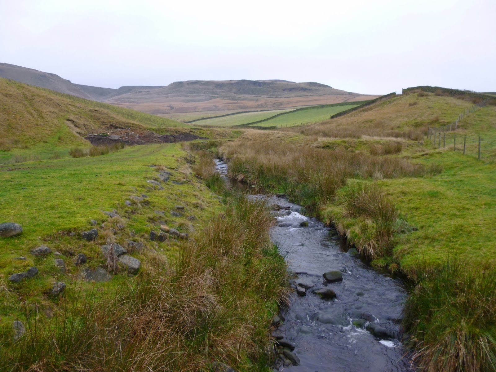
I set off from Old Glossop along Doctor's Gate, a bridleway that follows the route of an old Roman road (possibly the one taken by the ghostly legionnaires....?) before cutting off above Shelf Benches and following the rough route of Wigan Clough up onto the tops. At this stage visibility was pretty good and as I wandered along the edge towards the Shelf Stones there were great views over the Dark Peak, plenty of Mountain Hares and very little in the way of human company. I made the Trig point and then bog trotted my way, compass in hand, in and out of groughs, across boot sucking patches of moor and into increasingly thick and low cloud until I located the weirdly sculpted formations of the Hern Stones where I stopped for a well deserved Chicken and coleslaw roll! The cloud was very low now and I moved onto the Wain Stones where another figure loomed out of the mist, proving to be a flesh and blood type of walker rather than a ghostly Roman. It was satisfying to gain the flagstones of The Pennine Way which led me along the beautiful Wildboar Grain and around Torside Castle. There is considerable conjecture about this site, for many years it was thought to be a Bronze Age hill fort or Prehistoric earthworks, although more recently the consensus has been towards it being a natural formation. I must confess that to my eye it looked as if it might be man made, but it's a striking feature none-the-less. There are tales of mysterious, ghostly lights dancing on the summit at certain times of the year, but I passed it in the clag with no supernatural experiences.
I left the Way somewhere above Torside Clough and cut in land, heather bashing and startling the odd Grouse. I eventually located the deep grough of Small Clough and handrailed it all the way down to the scatologically named Shittern Clough which was full of stunning Autumnal woodland and dense stands of Rhododendron. Popping back onto Doctor's Gate the path menadered back to Old Glossop and my car. Bleaklow will never be my favourite hill, it is rough and scruffy and not the prettiest, but it has a genuine feeling of wilderness and is certainly not a hill to be underestimated.
To view the full album please click on the link below;
https://www.facebook.com/media/set/?set=a.777797895569500.1073741839.597048676977757&type=1
Come walk with me aims to help you enjoy, and be inspired by, the magnificent British countryside
Total Pageviews
Showing posts with label peat bogs. Show all posts
Friday, November 29, 2013
Wednesday, August 22, 2012
Black Hill via Holme Clough
22.8.12
Walking with; Nobody
I like paths. When I am on a path I know it is taking me somewhere and even on the odd occasion when that somewhere isn't exactly where I think it might be, I know it's going to end up in a defined place! However, there are times when I want a bit more adventure in my life. Maybe it's the fact that my Mum's family lived in Africa for much of their early life, maybe it's a yearning for the carefree days of childhood when everything felt like an adventure, but just occasionally going "off piste" seems like the way to go! Now, I am not comparing the Peak District with the velds of South Africa or plains of Tanzania, but an off path adventure on the bleak moors around Black Hill can still feel pretty wild.
The start of today's walk was by no means adventurous, a gentle stroll along the shores of Dove Stone, Yeoman Hey and Greenfield Reservoirs. The footpaths were busy with bikers and walkers, both of the dog and power varieties. Reservoirs have been, and can be, relatively contentious, think of Ladybower, beneath the waters of which lie the remains of the villages of Derwent and Ashopton and Mardale now sitting underneath the water of Haweswater.However, I like them, these three provide havens for wildlife and sit picturesquely below the crags of Ashway Hey and the delightfully named Raven Stones Brow. Leaving the reservoirs behind I climbed along the banks of Greenfield Brook before striking out (off path) along Holme Clough. Holme Clough is a beautiful but tough walk/scramble. The stream winds it's way towards the open moorland, tumbling over waterfalls and cutting a deep, steep sided gorge through the landscape. The walking was not easy, tussock grass, mossy bogs and slippery rocks all provided impediments but, more satisfyingly, just the right degree of challenge to make it feel vaguely adventurous, a feeling heightened by the lack of any other walkers. The Heather on the slopes was magnificent, turning the slopes purple and I came across a couple of patches of Match Head Lichen, beautiful and unusual, and a good indicator of the air quality in this part of the world. Eventually Black Hill hoved into view, I was only separated from it by (yet another) patch of marshy bog, (deep sigh.......)
I struck off East, heading for the path that had come from Black Moss Reservoir and after another foot soaking, located it and made my way upto a perfectly situated stone shelter where I paused for lunch. The moorlands of the Dark Peak do not have the scale and splendour of Snowdonia but the vast expanse of barren wilderness is impressive in a completely different way and still made a memorable vista for a chicken sarnie! From here I ascended to the summit (582m), informally known as Soldier's Lump after the Army surveying team who were the first to erect a Trig Point on the boggy top. Apparently in the past, reaching the trig meant wading knee deep through bog, today it was wet but my descent was made much easier as I located the flag stones of The Pennine Way as it headed towards Crowden. As the route climbed above Great Crowden Brook it narrowed to not much more than a sheep track and passed above Laddow Rocks (previously mentioned in my blog as an important site in the establishment of Mountain Rescue). Leaving The Pennine Trail I headed across to Chew Reservoir before following the service road back to Dove Stone Reservoir which buy now was busy with families, picknickers and even more dogwalkers. One side of the reservoir is given over to a woodland with the trees planted in commemoration of deceased loved ones and it struck me that a Rowan Tree in a wood on the shores of such a beautifully situated body of water might not make a bad reminder for myself some day,hopefully, a long time in the future!!
To view the full album please click on the link below;
https://www.facebook.com/media/set/?id=718985691&tid=136991043086476&skipClustering=true&qn=1345621147&success=2&failure=0&set=oa.262198243899088#!/media/set/?set=oa.262198243899088&type=1
Thursday, March 29, 2012
Back of Bleaklow in the sunshine
28.03.12
Walking with; Nobody
A tough but beautiful day climbing up from the Woodhead Pass and with the sun beating down and tremendous views. As soon as I got out of the car and crossed the bridge over the River Etherow I saw a Dipper bobbing up and down on a small rock by the far bank and the wildlife was a constant over the whole walk. This is Grouse shooting country and the moorland in this area has been very much shaped by the demands of the shoot. The path up Far Black Clough is a cracker, it winds it's way up the very narrow clough, dipping in and out of the sunshine and ascending steadily, eventually it becomes a little too narrow and steep and a tiring scramble up the bank to the rough Landrover track used by the shooters is necessary. I followed a narrow path along the clough edge before following a large, sandy grough Eastward onto the path from Howden Edge. I followed this path for about half a mile putting up quite a few Red Grouse and a number of Mountain Hares in various shades of colour from pure white to dirty brown. Visibility was excellent so I could see my goal, Barrow Stones, and struck off across the moors to reach them, negotiating a few deep groughs and peat bogs before arriving at the stones for an early lunch and a bit of shade from the strong sun. I'd not seen another soul and the only sign of human activity thus far had been a helicopter which looked like it was distributing fertiliser or feed over the moors.
Refreshed by a chicken sandwich I headed across to the Grinah stones where I met a landscape photographer who was taking advantage of the fantastic weather and spectacular views over Ridgewalk Moor and over the River Westend. The rocks are eroded into fantastic shapes and the vista was amazing. I spotted a Common Lizard catching a few rays as well before leaving the stones and heading through some waist high heather South East towards Round Hill. In spite of the weather it was still pretty boggy underfoot and at one stage I found myself thigh deep in peat bog, this is not a walk I'd fancy in mid-January! After a while I met a deep landrover track linking the Ronksley Moor bothy with the Grouse butts. I wandered down to a viewpoint over the River Westend before returning along the path and down to the beautifully sighted bothy at the top of Lower Small Clough. It's pretty basic and is, I think, mainly used for shooters, but there is a poem tacked to the wall singing the praises of the shelter provided on a wild, snowy afternoon!
Lower Small Clough runs down across the heather (including a patch very recently burned) and past many well established Grouse butts to a beautiful spot where the clough meets the River Derwent, where I cooled down by sticking my head into the running waters! (Bliss!)
The path along the Derwent is beautiful and the landscape a little more lush than on the tops, but I soon had to leave the river and ascend the steep, brackeny slopes of Hoar Clough to the Shepherds Meeting Stones. Featherbed Moss is a pretty featureless expanse and it took me a while to locate the path that led back to the Howden Edge path, but locate it I eventually did and followed it due West until cutting off back to Far Black Clough where I followed the path all the way back to my car, sweaty, peaty but thoroughly satisfied by a great day.
One of the real highlights of today was the solitude. The number of other walkers I saw today can eb counted on the fingers of one hand, once I'd got away from the A628, there were no roads, houses, pylons etc and the tracks and butts were well hidden. It is remarkable to get a feeling of such wilderness and isolation so close to Manchester, Barnsley and Sheffield, and there is something magnificent about the utter bleakness of the expanses of moorland!
To see the full album for this walk please click on the link below;
Subscribe to:
Posts (Atom)